


Watch this video to learn about tornadoes! Click here to download this video (1920x1080, 139 MB, video/mp4).
Download a poster version of this video!
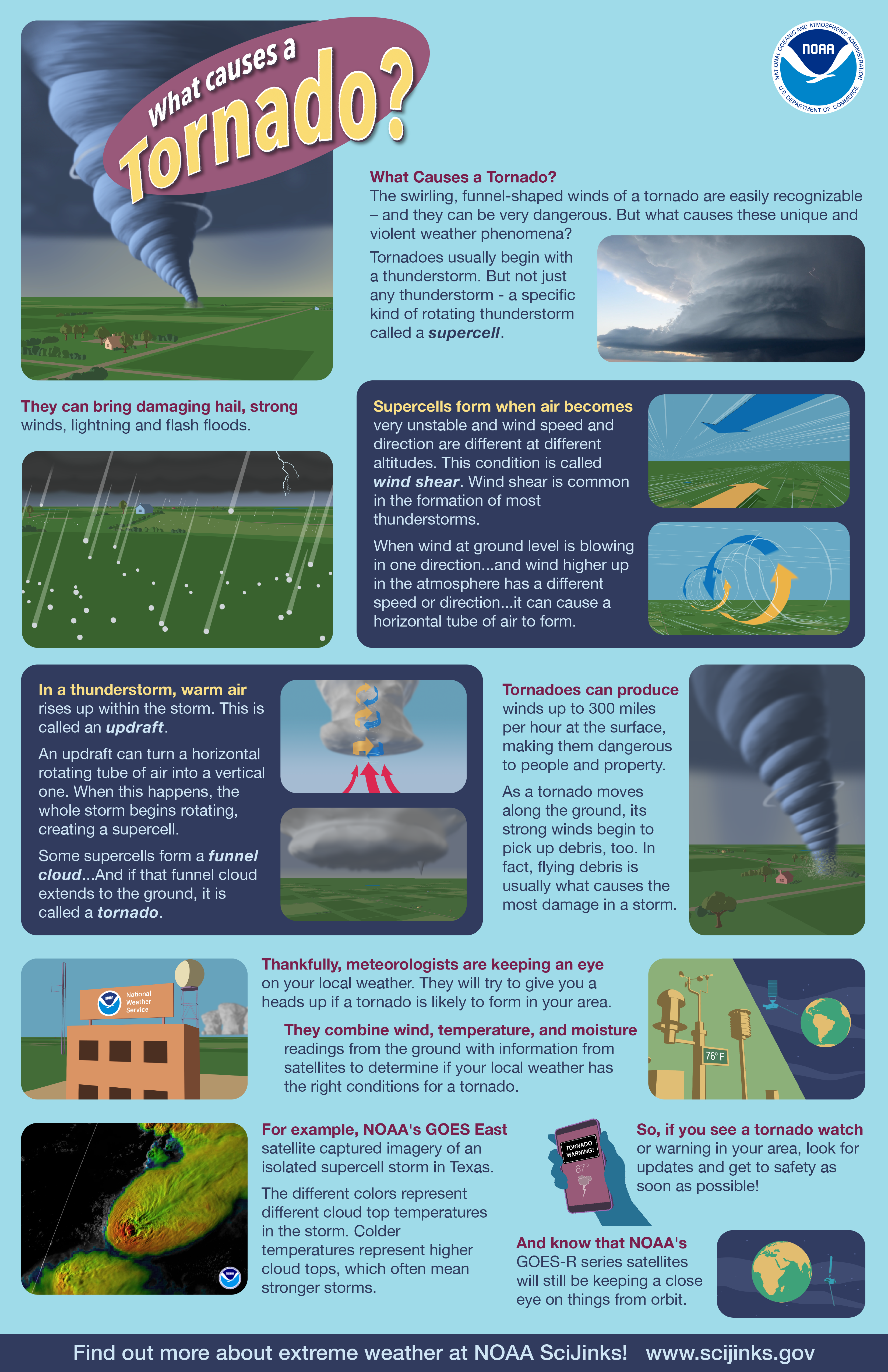
Click the above image to download.
Video transcript
What Causes a Tornado?
The swirling, funnel-shaped winds of a tornado are easily recognizable—and they can be very dangerous.
But what causes these unique and violent weather phenomena?
Tornados usually begin with a thunderstorm. But not just any thunderstorm—a specific kind of rotating thunderstorm called a supercell.
They can bring damaging hail, strong winds, lightning and flash floods.
Supercells form when air becomes very unstable and wind speed and direction are different at different altitudes. This condition is called wind shear.
Wind shear is common in the formation of most thunderstorms.
But when wind at ground level is blowing in one direction and wind higher up in the atmosphere blows in a different direction it can cause a horizontal tube of air to form.
In a thunderstorm, warm air rises up within the storm. This is called an updraft.
An updraft can turn a horizontal rotating tube of air into a vertical one. When this happens, the whole storm begins rotating, creating a supercell.
Some supercells form a funnel cloud.
And if that funnel cloud extends to the ground, it is called a tornado.
Tornados can produce winds up to 300 miles per hour at the surface, making them dangerous to people and property.
As a tornado moves along the ground, its strong winds begin to pick up debris, too. In fact, flying debris is usually what causes the most damage in a storm.
Thankfully, meteorologists are keeping an eye on your local weather. They will try to give you a heads up if a tornado is likely to form in your area.
They combine wind and temperature readings form the ground with information from satellites to determine if your local weather has the right conditions for a tornado.
For example, NOAA’s GOES-East satellite captures this video of an isolated supercell storm in Texas.
The different colors represent different cloud top temperatures in the storm. Colder temperatures represent higher cloud tops, which often mean stronger storms.
So, if you see a tornado watch or warning in your area, look for updates and get to safety as soon as possible.
And know that NOAA's GOES-R series satellites will still be keeping a close eye on things from orbit.
Find out more about extreme weather at NOAA SciJinks!