


- Tropical
- Dry
- Temperate
- Continental
- Polar
Climate is the average weather conditions in a place over a long period of time—30 years or more. And as you probably already know, there are lots of different types of climates on Earth.
For example, hot regions are normally closest to the equator. The climate is hotter there because the Sun’s light is most directly overhead at the equator. And the North and South Poles are cold because the Sun’s light and heat are least direct there.
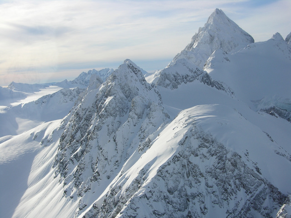
The snow-covered peaks of the Chigmit Range during winter. Credit: NPS/M. Cahill 2015
Using this information, in the late 1800s and early 1900s a German climate scientist named Wladimir Koppen divided the world's climates into categories. His categories were based on the temperature, the amount of precipitation, and the times of year when precipitation occurs. The categories were also influenced by a region’s latitude—the imaginary lines used to measure our Earth from north to south from the equator.
Today, climate scientists split the Earth into approximately five main types of climates. They are:
A: Tropical. In this hot and humid zone, the average temperatures are greater than 64°F (18°C) year-round and there is more than 59 inches of precipitation each year.
B: Dry. These climate zones are so dry because moisture is rapidly evaporated from the air and there is very little precipitation.
C: Temperate. In this zone, there are typically warm and humid summers with thunderstorms and mild winters.
D. Continental. These regions have warm to cool summers and very cold winters. In the winter, this zone can experience snowstorms, strong winds, and very cold temperatures—sometimes falling below -22°F (-30°C)!
E: Polar. In the polar climate zones, it’s extremely cold. Even in summer, the temperatures here never go higher than 50°F (10°C)!
This is roughly where those climate zones appear on a globe:
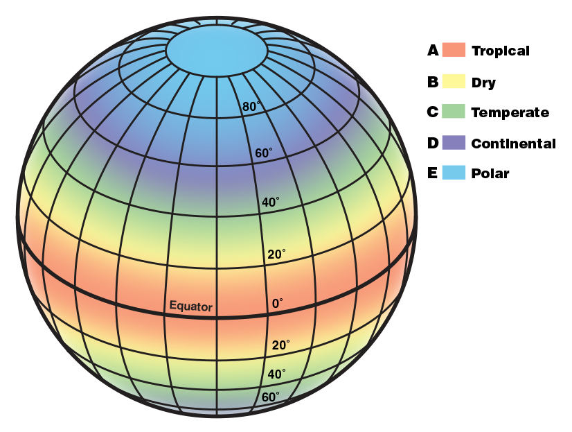
Credit: NOAA/JPL-Caltech
What does a map of climate zones really look like?
Distance to the equator is only one part of an area’s climate. Things like the movement of the oceans and Earth’s tilt and rotation also affect how weather patterns move around the globe.
If you classify the United States into climate zones using all of this information, it actually looks something like this:
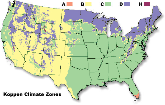
This is an illustration of the climate zones within the United States. The extra climate zone, labeled "H" on this map, is a special zone called the highlands. The highlands climate zone is characterized by weather that differs from the surrounding area because of mountains. Credit: NOAA (modified)
How can information about climate zones be used?
Climate zones can be useful for gardening and farming. Plants grow best in the climate conditions that are found in their native ecosystem. For example, if you want to plant an apple orchard in your backyard, you should first check to see which varieties of apples are a good match for your region’s climate.
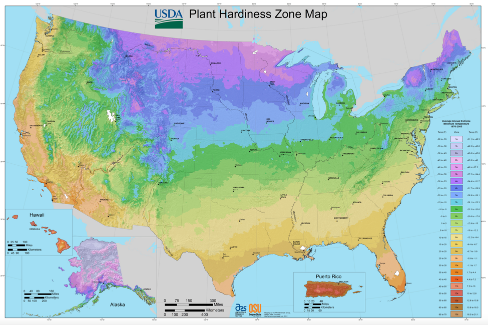
This is called a Plant Hardiness Zone map. It’s a specific type of climate zone map that can help you figure out what kinds of plants will survive in your back yard. Image credit: USDA/Agricultural Research Service/Oregon State University
How do weather satellites play a role?
Weather satellites mostly help with tracking conditions that are happening right now and forecasting weather in the near future. However, they also collect information that helps us monitor a region’s climate over time.
For example, satellites in the GOES-R series—short for Geostationary Operational Environmental Satellite-R—can monitor the sea surface temperature and the Gulf Stream, a powerful current in the Atlantic Ocean. Both of these things can influence a region’s climate.
In addition, the temperature of the land becomes cooler at night, and there are changes in the amount of clouds. The GOES-R series satellites monitor cloudiness and land surface temperature—information that helps scientists to understand how the differences between day and night can affect a region’s climate.
Satellites in the Joint Polar Satellite System (JPSS) can also provide information on differences between day and night. For example, JPSS orbits Earth twice a day in what’s called an afternoon orbit. As the satellite orbits from North Pole to South Pole, it captures observations in the afternoon on one side of Earth and observations of the early morning on the other side of the planet.
While JPSS orbits, the satellites provide global observations of many other variables that influence climate such as atmospheric temperature and water vapor, snow and ice cover, vegetation, sea and land surface temperature, precipitation and more. These add important information to our records of regional differences in Earth’s climate.