


Watch this video to learn about the different types of clouds! Click here to download this video (1920x1080, 319 MB, video/mp4).
All clouds are made up of basically the same thing: water droplets or ice crystals that float in the sky. But all clouds look a little bit different from one another, and sometimes these differences can help us predict a change in the weather.
Here’s a list of some of the most common cloud types you might spot in the sky:
High Clouds (16,500-45,000 feet)
Cirrus
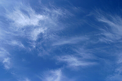
Cirrus clouds are delicate, feathery clouds that are made mostly of ice crystals. Their wispy shape comes from wind currents which twist and spread the ice crystals into strands.
Weather prediction: A change is on its way!
Credit: NOAA
Cirrostratus
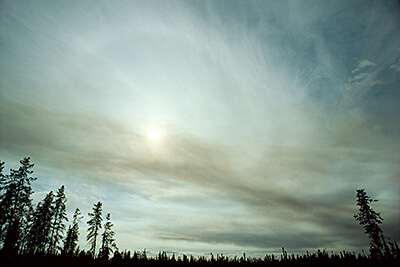
Cirrostratus clouds are thin, white clouds that cover the whole sky like a veil. These clouds are most commonly seen in the winter, and can cause the appearance of a halo around the sun or the moon.
Weather prediction: Rain or snow will arrive within 24 hours!
Credit: NOAA
Cirrocumulus
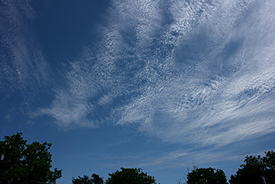
Cirrocumulus clouds are thin, sometimes patchy, sheet-like clouds. They sometimes look like they’re full of ripples or are made of small grains.
Weather prediction: Fair, but cold. However, if you live in a tropical region, these clouds could be a sign of an approaching hurricane!
Credit: NOAA
Mid-level Clouds (6,500-23,000 feet)
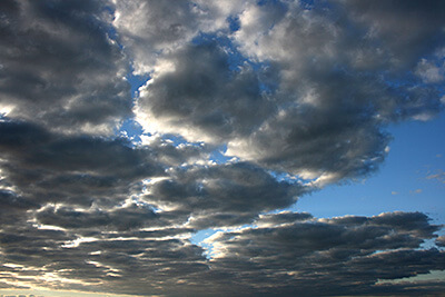
Altocumulus
Altocumulus clouds have several patchy white or gray layers, and seem to be made up of many small rows of fluffy ripples. They are lower than cirrus clouds, but still quite high. They are made of liquid water, but they don’t often produce rain.
Weather prediction: Fair
Credit: NOAA
Altostratus
Altostratus clouds are gray or blue-gray mid-level clouds composed of ice crystals and water droplets. The clouds usually cover the entire sky.
Weather prediction: Be prepared for continuous rain or snow!
Credit: NOAA
Nimbostratus
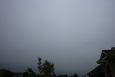
Nimbostratus clouds are dark, gray clouds that seem to fade into falling rain or snow. They are so thick that they often blot out the sunlight.
Weather prediction: Gloomy with continuous rain or snow
Credit: NOAA
Low Clouds (less than 6,500 feet)
Cumulus
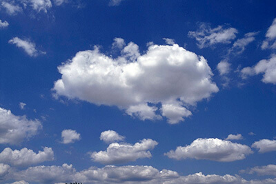
Cumulus clouds look like fluffy, white cotton balls in the sky. They are beautiful in sunsets, and their varying sizes and shapes can make them fun to observe!
Weather prediction: Fair
Credit: NOAA
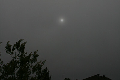
Stratus
Stratus cloud often look like thin, white sheets covering the whole sky. Since they are so thin, they seldom produce much rain or snow. Sometimes, in the mountains or hills, these clouds appear to be fog.
Weather prediction: Fair, but gloomy
Credit: NOAA
Cumulonimbus
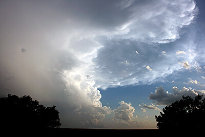
Cumulonimbus clouds grow on hot days when warm, wet air rises very high into the sky. From far away, they look like huge mountains or towers.
Weather prediction: Look out for rain, hail, and tornadoes!
Credit: NOAA
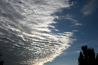
Stratocumulus
Stratocumulus clouds are patchy gray or white clouds that often have a dark honeycomb-like appearance.
Weather prediction: Fair weather for now, but a storm might be on its way.
Credit: NOAA
Special Clouds
Contrails
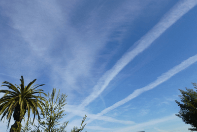
Contrails are made by high-flying jet airplanes. They are still clouds, though, because they are made of water droplets condensed from the water vapor in the exhaust of the jet engines.
Click here to test out making contrails in our simulator!
Weather prediction: Contrails can provide information about the layers of moisture in the sky.
Credit: NOAA
Mammatus clouds
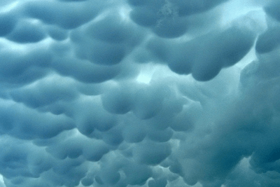
Mammatus clouds are actually altocumulus, cirrus, cumulonimbus, or other types of clouds that have these pouch-like shapes hanging out of the bottom. The pouches are created when cold air within the cloud sinks down toward the Earth.
Weather prediction: Severe weather might be on its way!
Credit: NOAA
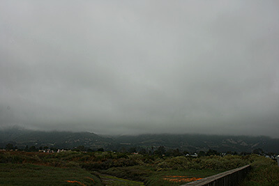
Orographic clouds

Orographic clouds get their shape from mountains or hills that force the air to move over or around them. They can also be formed by sea breezes and often appear as lines where two air masses meet.
Weather prediction: An early sign that the conditions might be right to form afternoon thunderstorms!
Credit: NOAA
Lenticular clouds
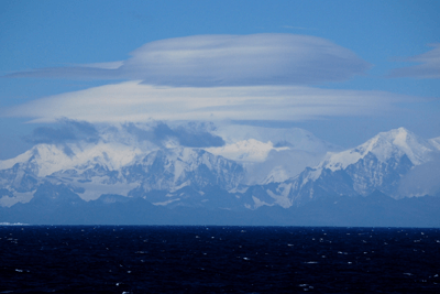
Lenticular clouds are shaped like lenses or almonds or...flying saucers! They may get their shape from hilly terrain or just the way the air is rising over flat terrain.
Weather prediction: None!
Credit: NOAA
The GOES-R (Geostationary Operational Environmental Satellite-R) Series satellites can watch clouds with an instrument called the Advanced Baseline Imager, or ABI for short. Scientists have found that rapid growth and cooling at the tops of clouds are indicators of the potential for severe weather. The ABI can show more detailed changes in cloud-top features, helping scientists assess the potential size and severity of a storm even before it reaches its peak!
Test Your Knowledge!
See how well you understood this subject!