


You've probably heard the term nor'easter in movies and on television, but what exactly does it mean? A nor'easter is a type of storm that forms along the East Coast of North America. Nor'easters are named after the direction from which the strongest winds typically blow over the northeast states, including New England and the Mid-Atlantic states. The storms can bring wind, snow, rain and flooding to these regions.
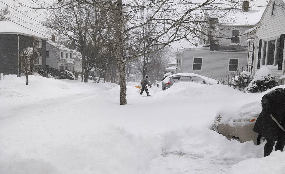
Snowfall from a January 2015 nor'easter in Watertown, Massachusetts. Credit: Wikimedia Commons Aria1561 CC BY-SA 3.0
How do Nor'easters form?
Nor'easters begin to form within 100 miles of the coast that stretches between New Jersey and Georgia. This area is a perfect spot for the formation of storms. The polar jet stream blows cold air southward out of Canada and eastward toward the ocean. The Atlantic Ocean is warm, thanks to the Gulf Stream–a warm ocean current.
Where the cold air and warm water meet, a low pressure system forms. The low pressure system causes clouds to form and a storm to develop.
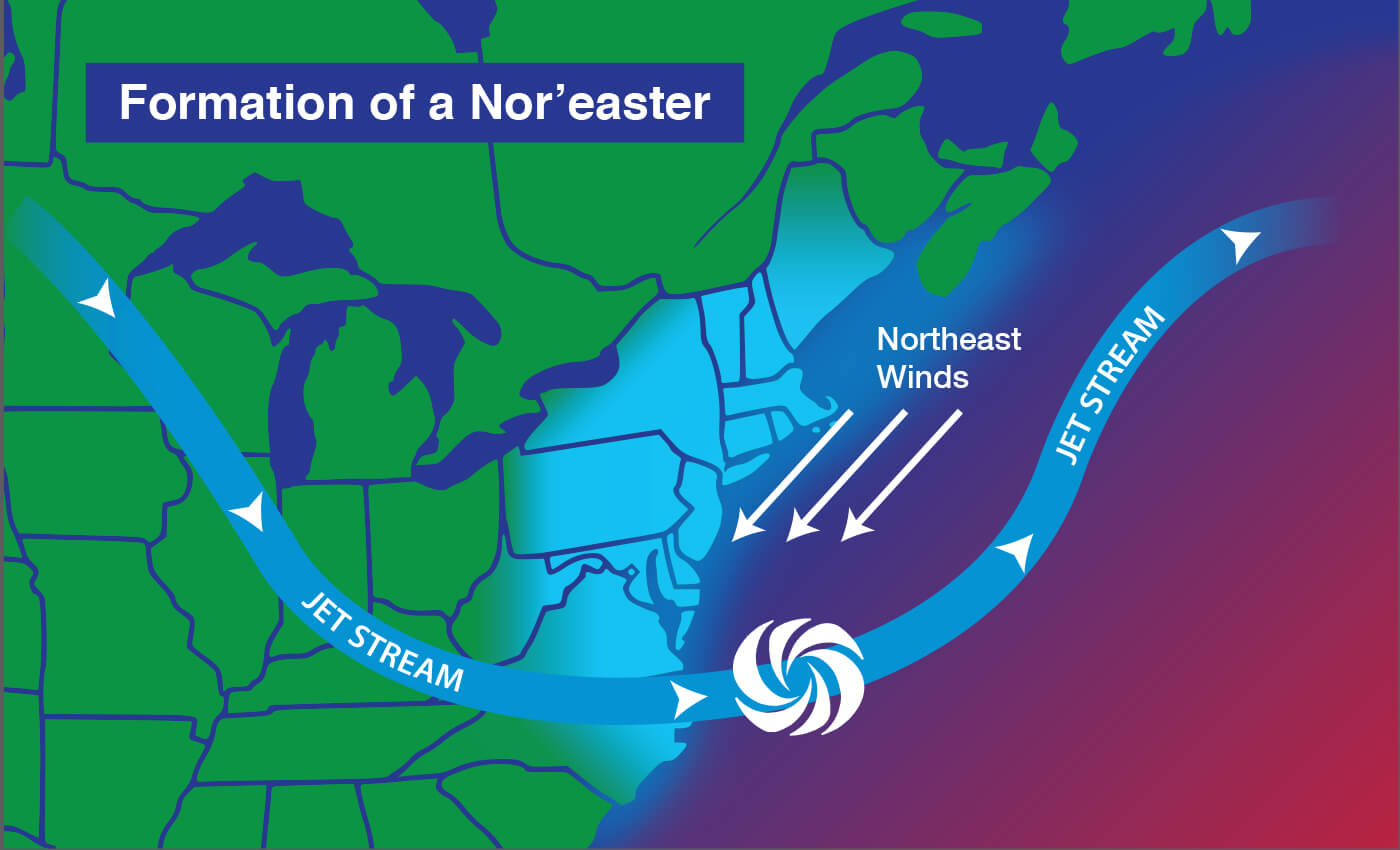
A nor'easter forms when cold air often originating in Canada blows over the warm Atlantic Ocean off the coast of the eastern United States.
What's the difference between a nor'easter and a hurricane?
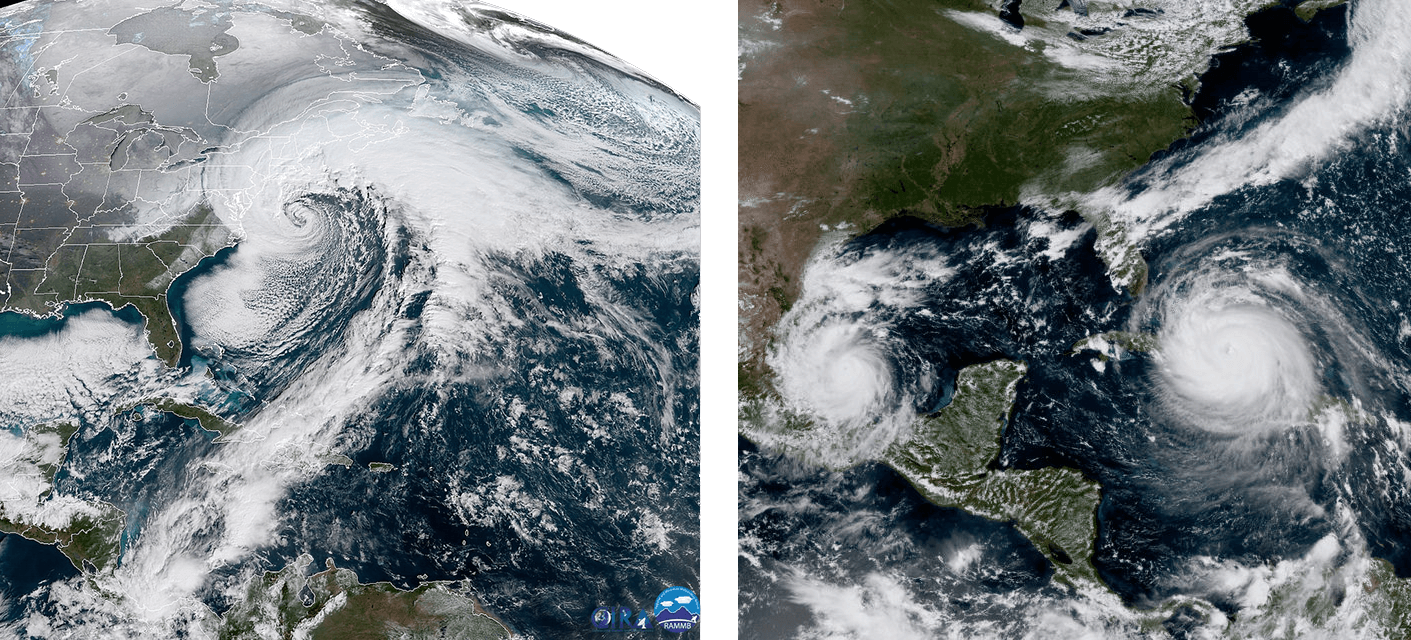
On the left, a nor'easter hits the East Coast on January 4, 2017. On the right, Hurricane Katia makes landfall in Mexico and Hurricane Irma passes between Cuba and the Bahamas on September 8, 2017. Both images are from NOAA's GOES-16 satellite. Credits: NOAA/CIRA (left) and CIRA (right)
Upon first glance, the satellite images above might look very similar. However, if you look closely, you'll realize the spiraling storms in the photo on the right are much further south than the spiraling storm in the photo on the left.
Nor'easters and hurricanes both form over the Atlantic Ocean. They're both also types of cyclones–a storm that has winds spiraling around a central low pressure zone.
There are some key differences between the two storms. For example, hurricanes originate over the warm waters of the tropics–the region near the equator. Nor'easters originate further north, near the eastern coast of the United States. Also, nor'easters thrive and pick up strength from cold air in the atmosphere, while hurricanes thrive on warm air.
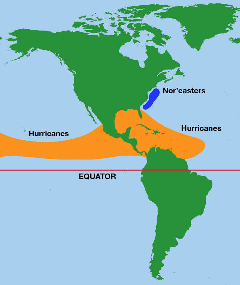
Nor'easters form off the eastern coast of the United States (blue), while hurricanes are most likely to form in the tropics (orange).
When do nor'easters happen?
Nor'easters can happen any time of year, but they are most common between September and April. They are most severe in the winter months.
What kinds of weather do nor'easters bring?
If you hear that a nor'easter is headed your way, prepare for very bad weather. Nor'easters can produce heavy snow and blizzards, rain and flooding, and huge crashing waves. These waves can cause erosion to the beach and severe damage to nearby buildings and structures. Nor'easters can also produce wind gusts that are even stronger than hurricane-force winds.
How do we watch nor'easters from space?
Satellites keep a constant eye on Earth's weather, so they can take detailed images and measurements when severe storms strike. GOES-16, operating as NOAA's GOES-East, has a great view of the eastern U.S. Because GOES-East watches this region continuously, it can provide minute-by-minute updates of a Nor'easter's progress.
GOES-16 captured this video of a nor'easter traveling up the East Coast on January 4, 2018, producing strong winds and heavy snow. Credit: NOAA
Polar orbiting satellites, like NOAA-20-part of the JPSS system-provide a different view of the storm. NOAA-20 doesn't watch the same region of Earth continuously-it only passes over the U.S. East Coast twice per day.
However, NOAA-20 can use one of its instruments to detect the thermal emissions (heat) from clouds and the surface of the sea. These measurements can help meteorologists detect particular features of a storm, such as cloud top temperature. In general, the coldest cloud tops in a storm are often associated with areas of greater storm intensity.
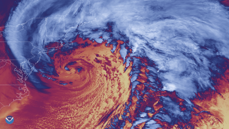
This image of a January 2018 nor'easter was created by NOAA-20's VIIRS instrument, which is sensitive to changes in atmospheric temperature. In this thermal infrared image, blue and white indicate cold cloud tops, while the red and yellow shades indicate lower clouds and clear sky over ocean. Credit: NOAA