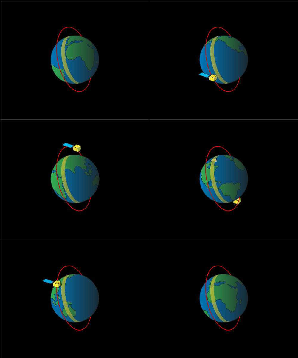
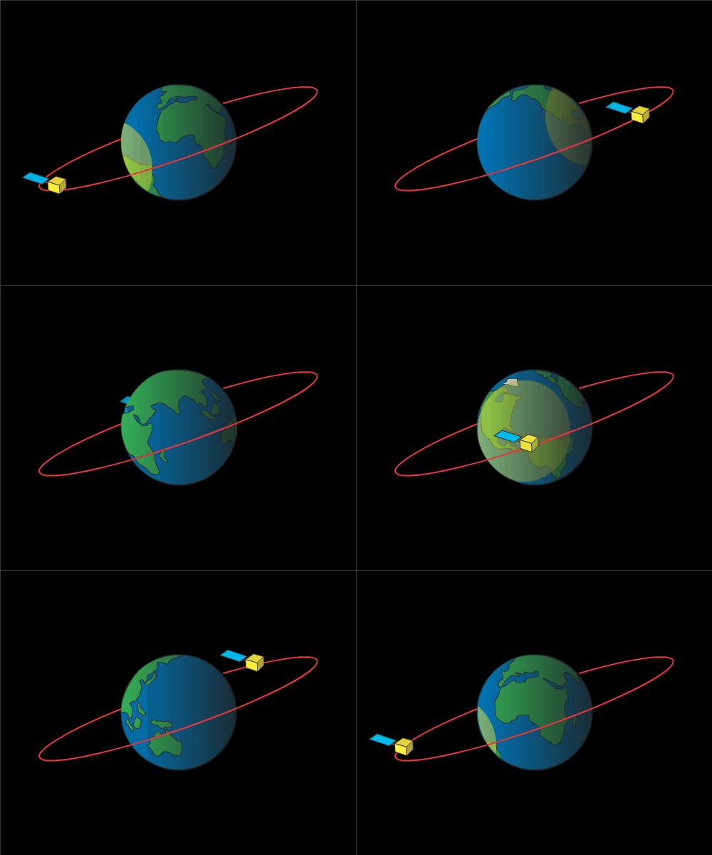
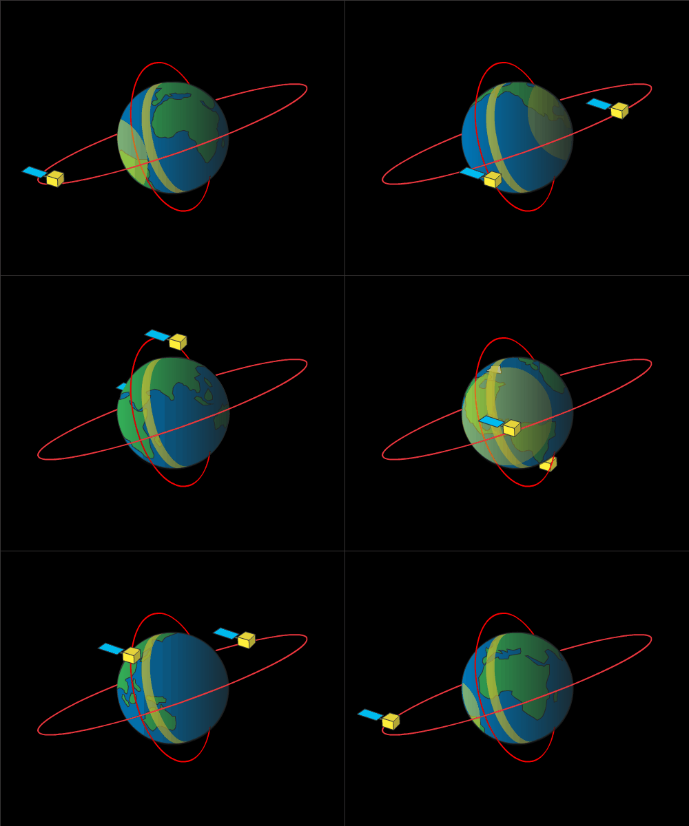
Video showing the difference between a geostationary orbit and a polar orbit. The yellow areas shows what part of Earth each satellite 'sees' during its orbit. Credit: NOAA/JPL-Caltech
Imagine two satellites. One orbits the Earth at the same speed that the Earth rotates. It is high in the sky—tens of thousands of miles from the ground. The other orbits the Earth quickly and passes over each of the poles many times in one day. This satellite is only a couple hundred miles from the ground.
What could these two satellites possibly have in common?
The answer: they both can be used to monitor weather, climate, and the environment.
In late 2016, NOAA and NASA launched the first satellite in the Geostationary Operational Environmental Satellite - R Series. The GOES-R series satellites can face the Earth and turn with it as it rotates. Another group, the Joint Polar Satellite System (JPSS), will orbit between both poles.
Why the different types of orbits?
It all has to do with what each satellite is designed to accomplish. The goal of the GOES-R series is to keep a continual watch on one area of the world—the western hemisphere. By orbiting at the same speed the Earth rotates, it stays over one place. This is called a geosynchronous orbit. Satellites need to be very far away from earth and above the equator to rotate in this kind of orbit. This orbit allows the GOES-R series satellites to constantly scan the earth for severe weather as it develops while also monitoring the sun.
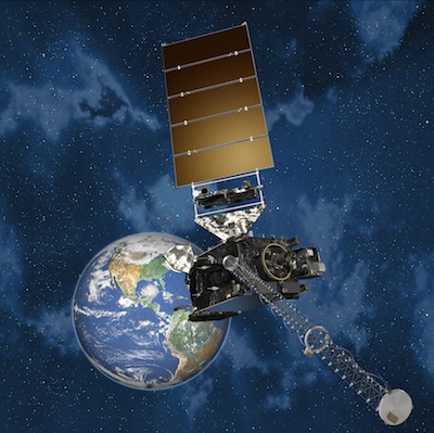
A GOES-R series satellite. Credit: Lockheed Martin Space Systems Corporation.
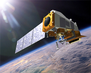
JPSS-1. Credit: NOAA/Ball Aerospace & Technologies Corporation.
But what if you want to see as much of the world as possible? That’s where polar orbiting satellites, like the JPSS satellites, come in handy. These satellites let Earth do the hard work. Earth rotates under these satellites as they move from pole to pole. These satellites have very low orbits, allowing them to travel around the world very quickly—sometimes as fast as once every hour and a half! The combination of the fast speed and the rotating Earth will make it possible for JPSS satellites to see the weather around our planet every day.
Both satellites will provide us with important information that can be used to predict weather and monitor changes in Earth's environment.


