-

Safety is important when traveling in foggy conditions. How can weather satellites help? Check out this poster and learn how!
-
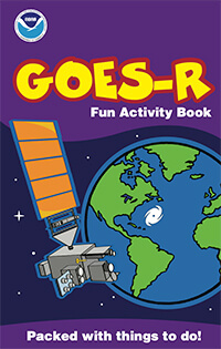
Have fun learning about GOES-R with this activity book!
-
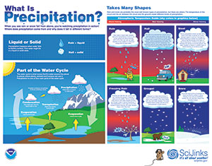
When you see rain or snow fall from above, you’re watching precipitation in action! Where does precipitation come from and why does it fall in different forms? This poster explains what precipitation is, how it fits into the water cycle, and what conditions determine whether water falling from the sky will become rain or snow.
-
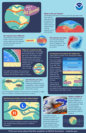
Jet streams are bands of strong wind that generally blow from west to east all across the globe. They impact weather, air travel and many other things that take place in our atmosphere. This poster explains more about the jet stream.
-
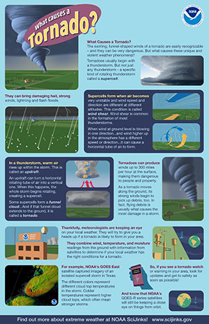
The swirling, funnel-shaped winds of a tornado are easily recognizable—and they can be very dangerous. But what causes these unique and violent weather phenomena? This poster explains what causes a tornado.
-
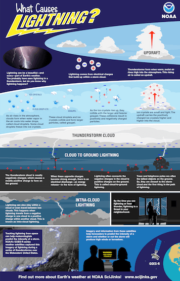
Lightning can be a beautiful—and scary—part of Earth’s weather. You probably have seen lightning in a thunderstorm, but do you know why lightning happens? This poster explains what causes lightning.
-
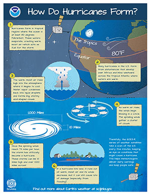
Hurricanes are the most violent storms on Earth. They form near the equator over warm ocean waters. Actually, the term hurricane is used only for the large storms that form over the Atlantic Ocean or eastern Pacific Ocean. This poster explains how hurricanes form.
-
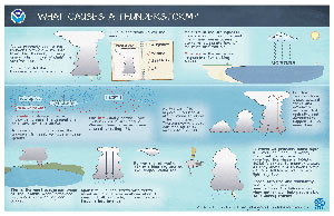
You’ve probably seen a big thunderstorm cloud roll into town. The thunder, lightning, heavy rain, and gusty winds are hard to miss! But where did that thunderstorm come from? This poster explains what causes a thunderstorm.
-
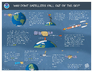
Why Don't Satellites Fall Out of the Sky?
A satellite is a type of machine that orbits Earth, taking pictures and collecting information. There are thousands of satellites orbiting Earth right now. How do they all stay up there—and why don’t they just fall out of the sky? This poster explains why satellites don't fall out of the sky.
-
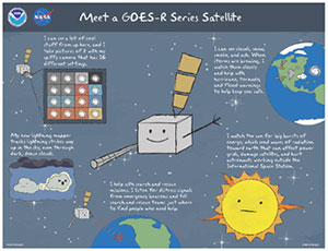
Meet a GOES-R Series Satellite
This poster explains some fun facts about a GOES-R series satellite.
-
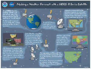
Making a Weather Forecast with a GOES-R Series Weather Satellite
This poster explains how a weather forecast is made with a GOES-R series satellite.
-
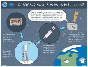
A GOES-R Series Satellite Gets Launched
This poster explains how a GOES-R series satellite gets launched.
-
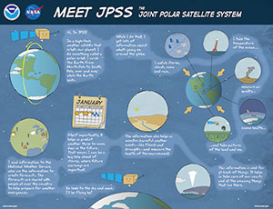
This poster explains some fun facts about JPSS.
-
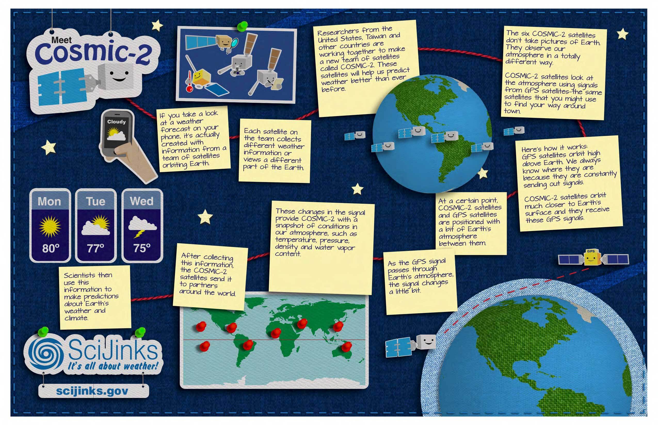
This poster explains some fun facts about Cosmic-2.
-
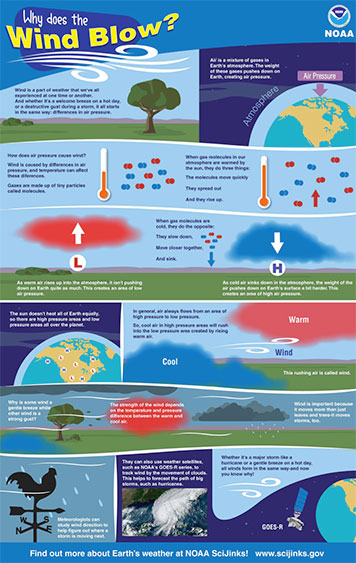
Wind is a part of weather we experience all the time, but why does it actually happen? This poster explains why the wind blows.
-
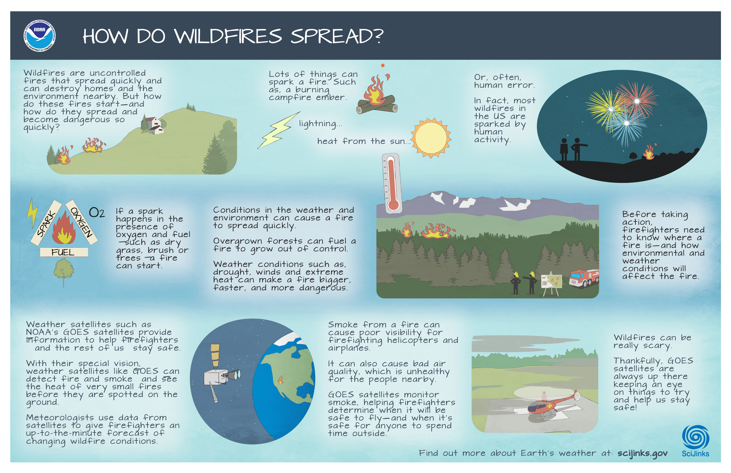
Wildfires are uncontrolled fires that spread quickly and can destroy homes and the environment nearby. This poster explains how wildfires spread.
-
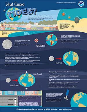
High and low tides are caused by the moon. The moon's gravitational pull generates something called the tidal force. The tidal force causes Earth—and its water—to bulge out on the side closest to the moon and the side farthest from the moon. These bulges of water are high tides. This poster explains what causes tides.
Click here to download the .png of the poster (11x17 inches)!
Click here to download the .png of the poster (8.5x11 inches)!
-
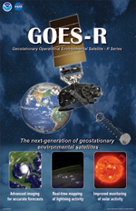
GOES-R series: The next generation of geostationary environmental satellites.
The poster features a detailed rendering of a GOES-R series satellite, with brief descriptions of what these satellites can do.
-
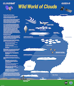
Poster front illustrates and describes types of high-, low-, and mid-altitude clouds. Poster back explains Earth's water cycle and the role of clouds in maintaining it and providing fresh (non-salty) water to land plants and animals. A crossword puzzle and cloud identification quiz reinforce the concepts.
-
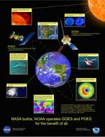
Poster front illustrates both the Geostationary Operational Environment Satellites (GOES) and the Polar-orbiting Operational Environmental Satellites (POES), and their functions and accomplishments. Back material includes two articles and activities on many of the different parameters meteorologists measure and terms they define in order to describe and predict the weather.
-
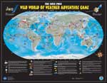
GOES/POES Wild World of Weather Adventure Game.
Download question cards here. A self-contained board game about all kinds of weather and the places it occurs. Besides the game instructions, includes two articles and activities on many of the different parameters meteorologists measure and terms they define in order to describe and predict the weather.
-
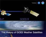
History of GOES Weather Satellites
Explains why we need weather satellites, what they measure and how, and how the technologies have improved since the first generation of Geostationary Operational Environmental Satellites (GOES), thus imparting more benefits to society. Poster is formatted as a horizontal timeline, 42" wide x 11" high.
-
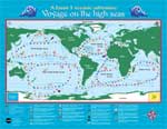
Voyage on the High Seas: A Jason 1 Ocean Adventure
Self-contained board game about the oceans. Download game cards here, if needed. Also included on the poster back are articles on mapping the oceans using altimetry, how winds drive ocean currents (also an activity), an explanation of El Niño, and an ocean-related crossword puzzle.
-
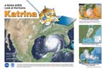
Poster shows Hurricane Katrina as it looked from space just as it rammed into the Gulf Coast. Other images and captions show how the hurricane was tracked and its path predicted.