Watch this video to learn about what causes a thunderstorm! Click here to download this video (1920x1080, 94 MB, video/mp4).
Download a poster version of this video!

Click the above image to download.
Video transcript
What causes a thunderstorm?
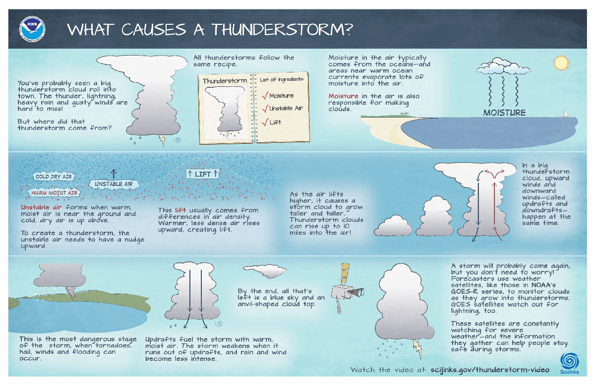
You’ve probably seen a big thunderstorm cloud roll into town. The thunder, lightning, heavy rain, and gusty winds are hard to miss!
But where did that thunderstorm come from?
All thunderstorms follow the same recipe. To form, these storms require three basic ingredients:
Moisture, unstable air and lift.
Moisture in the air typically comes from the oceans—and areas near warm ocean currents evaporate lots of moisture into the air.
Moisture in the air is also responsible for making clouds.
Unstable air forms when warm, moist air is near the ground and cold, dry air is up above.
To create a thunderstorm, the unstable air needs to have a nudge upward.
This lift usually comes from differences in air density. Warmer, less dense air rises upward, creating lift.
As the air lifts higher and higher, it causes a storm cloud to grow taller and taller. Thunderstorm clouds can rise up to 10 miles into the air!
In a big thunderstorm cloud, there are now strong upward winds and downward winds happening at the same time. These are called updrafts and downdrafts.
This is the most dangerous stage of the storm, when tornadoes, hail, winds and flooding can happen.
Updrafts continue to fuel the storm with warm, moist air. But, once a storm runs out of updrafts, it starts to weaken.
As a storm begins to slow down, the rain and wind become less intense.
And by the end, all that’s left is a blue sky and an anvil-shaped cloud top.
Phew! Glad that’s over!
Sure, a storm will probably come again, but you don’t need to worry! Forecasters can use weather satellites, like those in NOAA’s GOES-R series, to monitor clouds as they grow into thunderstorms. GOES satellites watch out for lightning, too.
These satellites are constantly watching for severe weather—and the information they gather can help people stay safe during storms.


