Why do we need to keep an eye on volcanic ash?
You don’t have to fall into a volcano or be engulfed in molten lava to experience its dangers.
A volcano’s ash plume can be as dangerous as a sky full of razor blades.

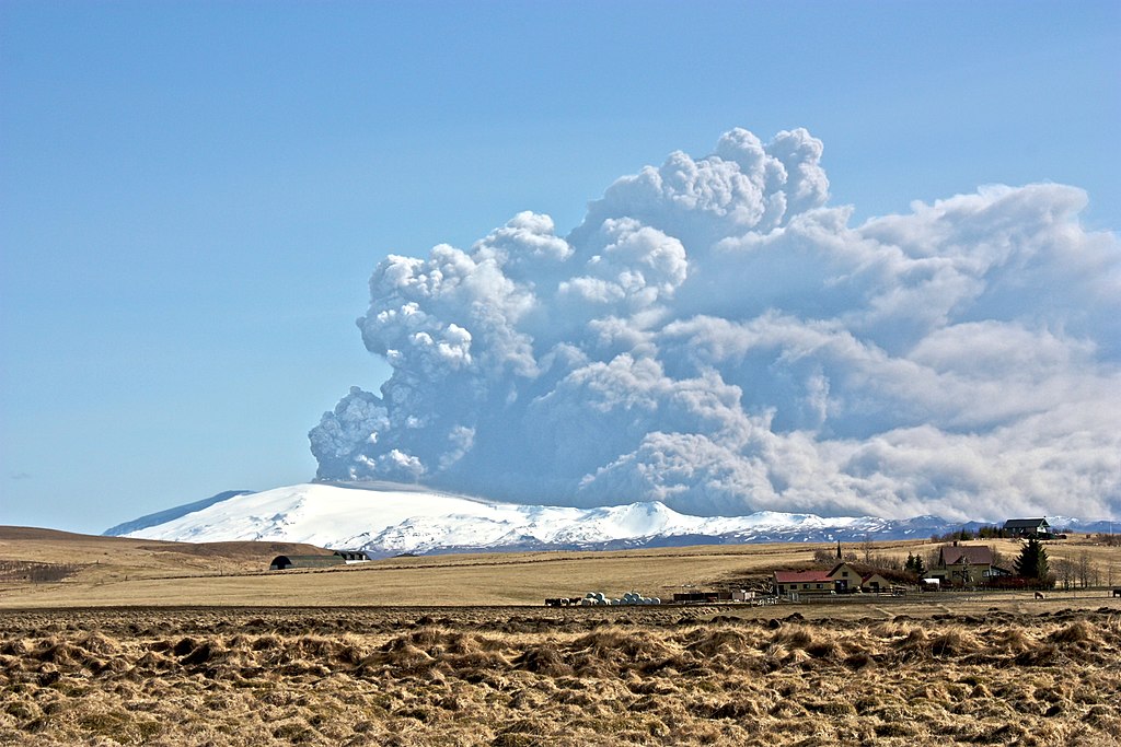
Ash plume of the Eyjafjallajokull Glacier volcano in Iceland in April 2010. Credit: Bjarki Sigursveinsson, Wikimedia Commons. (Creative Commons Attribution-Share Alike 3.0).
The 2010 eruption of the Eyjafjallajokull Glacier volcano in Iceland sent ash plumes high into the atmosphere. When the plume drifted over the United Kingdom and Europe, airline flights were cancelled.
Why?

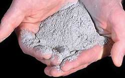
Volcanic ash, like this ash from the 1980 eruption of Mount St. Helens, can be as fine as baby powder. Credit: USGS/D.E. Wieprecht
Jet engines on airplanes don’t like ash any more than your lungs do. The powdery ashes are like tiny shards of broken glass. The particles are very sharp, rough and abrasive to any surface they encounter, especially at high speed. Jet engine turbine blades are definitely in that category.
Besides the abrasion problem, the inside of the jet engine is hot enough to melt the glassy particles, clogging up parts of the engine. Flying through a thick plume of volcanic ash is a sure way to shut down a jet engine pronto.
Much better, in this case, to keep the planes on the ground—or figure out exactly where the plume is and avoid it. Even if a plume is too thin and spread out to see, it could still have enough ash particles to pose a hazard.

Scanning electron microscope images of volcanic ash particles. Credit: (left) Pavel Izbekov and Jill Shipman, Alaska Volcano Observatory / University of Alaska Fairbanks, Geophysical Institute. (right) U.S. Geological Survey.
So how can airplane operators find the plume so they know where to not send the planes?
Like clouds, the ash plume moves with the wind currents. Weather forecasters have computer models to help predict where the plume will go next. But they still need to be able to monitor it and make sure it is really going where the computers say it is going. They also need to be able to evaluate how thick and dangerous the plume really is.
The GOES satellites gather images at different wavelengths of light that can be processed to show where the ash plume is. However, the image doesn’t really say much about the particle concentrations or sizes, important information for aviation.
NOAA's GOES-16 captured the eruption of Mexico's most active volcano, Popocatépetl, on November 23, 2017. The eruption sent a dramatic plume of ash 1,800 meters (5,900 feet) into the sky. Credit: NOAA Satellites YouTube Channel
Currently, the Advanced Satellite Products Branch and the Cooperative Institute for Meteorological Satellite studies at the University of Wisconsin at Madison as well as the Cooperative Institute for Research in the Atmosphere (CIRA) in Fort Collins, Colorado, together with the NOAA/NESDIS RAMM Branch develops and distributes the volcanic ash data products.
The Advanced Baseline Imager on the GOES-R series of satellites gathers data from different wavelengths of light so that a detailed picture of the ash plume can be made, including its extent, height, mass, and particle size. This information can be used to improve computer models that predict where the ash plume will go and where the ash will fall.
The GOES-R series can give aviators the information they need to fly through or around volcanic plumes safely, and those on the ground advance warning of when to go inside and hold their breath!
More About Volcanic Ash and Jet Engines
Jet engines with volcanic ash damage are super bad news!
Volcanic ash can cause damage to jet engines. Ash can melt and fuse to the turbine engine stator vanes. These are non-rotating airflow directing vanes in the "hot section" of the engine.
This is very BAD!
This kind of build-up can occur slowly over weeks of travel through light ash or within minutes if the plane flies through a heavy ash cloud. The stator blades in the engine have lots of little holes for the cooling air to flow out of the engine. Damage from volcanic ash can cover these holes. Also, the surface shape of the engine can change, disrupting the smooth airflow needed for the engine to function properly. An engine damaged in this way would give poor performance with warnings to the crew.


