


Watch this video to learn about what causes lightning! Click here to download this video (1920x1080, 102 MB, video/mp4).
Download a poster version of this video!
Click the above image to download.
Video transcript
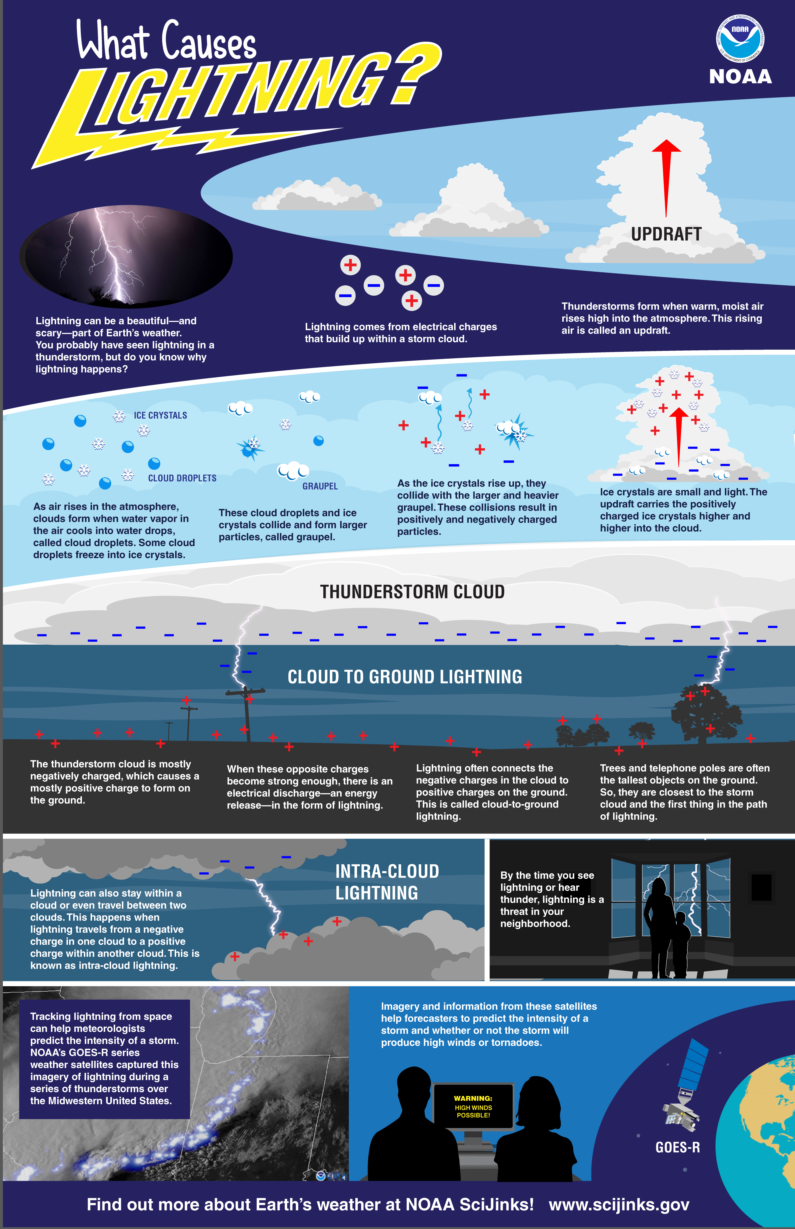
What Causes Lightning?
Lightning can be a beautiful—and scary—part of Earth’s weather.
You probably have seen lightning in a thunderstorm, but do you know why lightning happens?
Lightning comes from electrical charges that build up within a storm cloud.
Thunderstorms form when warm, moist air rises high into the atmosphere. This rising air is called an updraft.
As air rises in the atmosphere, clouds form when water vapor in the air cools into water drops, called cloud droplets. Some cloud droplets freeze into ice crystals.
These cloud droplets and ice crystals collide and form larger particles, called graupel.
As the ice crystals rise up, they collide with the larger and heavier graupel.
These collisions result in positively and negatively charged particles.
Ice crystals are small and light. The updraft carries the positively charged ice crystals higher and higher into the cloud.
The thunderstorm cloud is mostly negatively charged, which causes a mostly positive charge to form on the ground.
When these opposite charges become strong enough, there is an electrical discharge—an energy release—in the form of lightning.
Lightning often connects the negative charges in the cloud to positive charges on the ground. This is called cloud-to-ground lightning.
Why does lightning often hit trees, telephone poles, or other tall structures first?
Trees and telephone poles are often tallest objects on the ground. So, they are closest to the storm cloud and the first thing in the path of lightning.
Lightning can also stay within a cloud or even travel between two clouds.
This happens when lightning travels from a negative charge in one cloud to a positive charge within another cloud. This is known as intra-cloud lightning.
By the time you see lightning in the sky, a storm is probably already underway in your neighborhood.
But tracking lightning from space can help meteorologists predict the intensity of a storm.
NOAA’s GOES-R series weather satellites captured this imagery of lightning during a series of thunderstorms over the Midwestern United States.
Imagery and information from these satellites help forecasters to predict the intensity of a storm and whether or not the storm will produce high winds or tornadoes.
Find out more about Earth’s weather at NOAA SciJinks!