Watch this video to learn about jet streams! Click here to download this video (1920x1080, 59 MB, video/mp4). Also, click here to download an 11x17 inch poster version of video!
Jet streams are narrow bands of strong wind that generally blow from west to east all across the globe. Earth has four primary jet streams: two polar jet streams, near the north and south poles, and two subtropical jet streams closer to the equator.
What Causes Jet Streams?
Jet streams form when warm air masses meet cold air masses in the atmosphere.
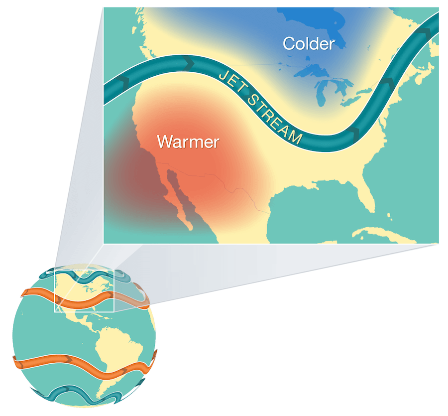
On Earth there are four main jet streams: two polar jet streams and two subtropical jet streams. They form in the atmosphere where warm air masses meet cool air masses. Credit: NOAA/JPL-Caltech
The Sun doesn’t heat the whole Earth evenly. That’s why areas near the equator are hot and areas near the poles are cold.
So when Earth’s warmer air masses meet cooler air masses, the warmer air rises up higher in the atmosphere while cooler air sinks down to replace the warm air. This movement creates an air current, or wind. A jet stream is a type of air current that forms high in the atmosphere.
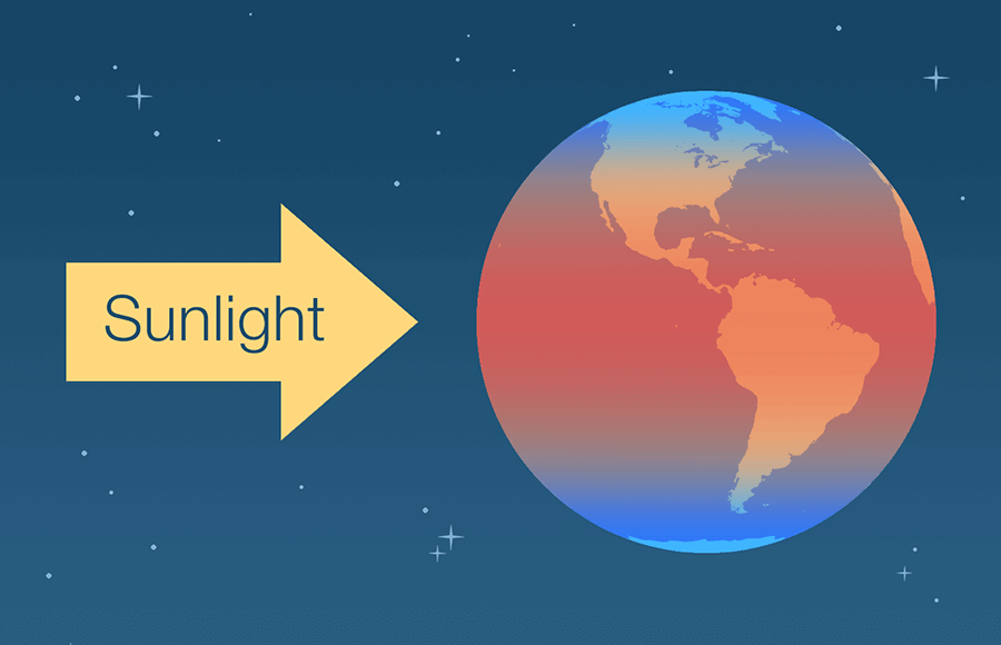
The Sun heats Earth unevenly, creating masses of colder air near the poles and warmer air near the equator. Credit: NOAA/JPL-Caltech
On average, jet streams move at about 110 miles per hour. But dramatic temperature differences between the warm and cool air masses can cause jet streams to move at much higher speeds — 250 miles per hour or faster. Speeds this high usually happen in polar jet streams in the winter time.
How Do Jet Streams Affect Air Travel?
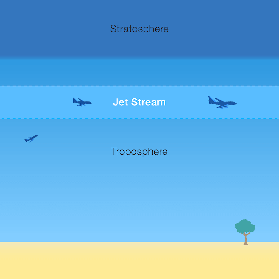
The jet stream exists in the mid to upper troposphere — the layer of Earth’s atmosphere where we live and breathe. Airplanes can fly in the jet stream. When they’re both headed in the same direction, airplanes can get a boost in speed from this fast moving air current. Credit: NASA/JPL-Caltech
Jet streams are located about five to nine miles above Earth’s surface in the mid to upper troposphere — the layer of Earth’s atmosphere where we live and breathe.
Airplanes also fly in the mid to upper troposphere. So, if an airplane flies in a powerful jet stream and they are traveling in the same direction, the airplane can get a boost. That’s why an airplane flying a route from west to east can generally make the trip faster than an airplane traveling the same route east to west.
How Do Jet Streams Affect Weather?
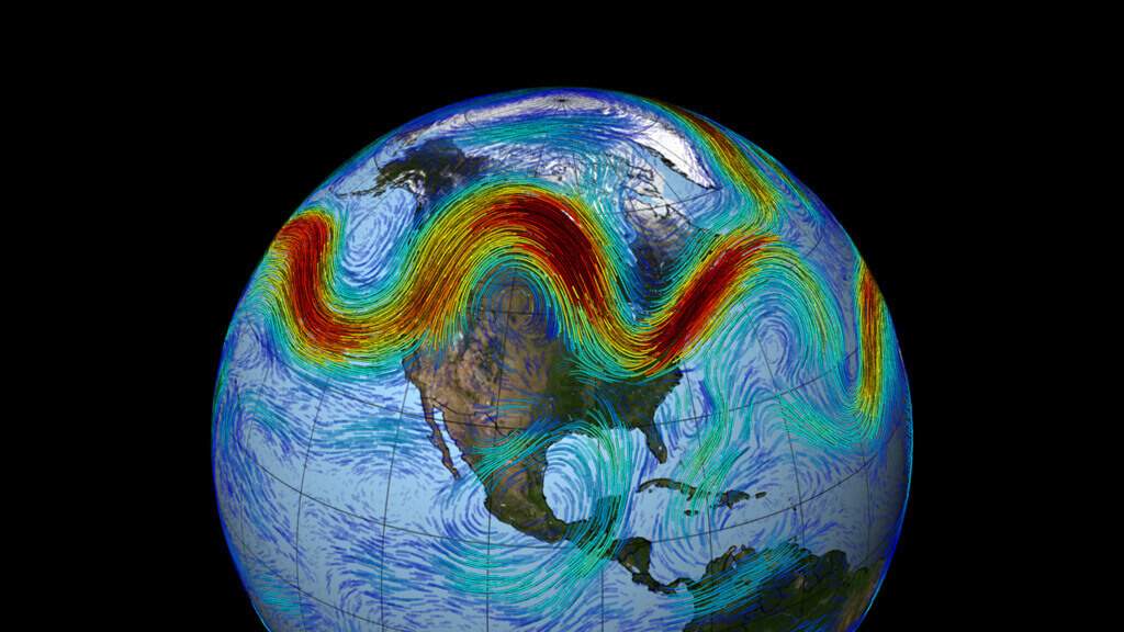
A visualization of the Northern Hemisphere's polar jet stream swirling weather patterns from west to east across North America. Visualization made with data from NASA's MERRA dataset. Credit: NASA’s Goddard Space Flight Center
The fast-moving air currents in a jet stream can transport weather systems across the United States, affecting temperature and precipitation. However, if a weather system is far away from a jet stream, it might stay in one place, causing heat waves or floods.
Earth’s four primary jet streams only travel from west to east. Jet streams typically move storms and other weather systems from west to east. However, jet streams can move in different ways, creating bulges of winds to the north and south.
Storms tend to follow the edge of the jet stream, where the difference between cool and warm air creates the turbulent conditions for storms. The farther south the jet stream is pushed, the warmer and wetter the air will be where the colder Arctic air meets up with it. That makes for more thunder and lightning, and more tornadoes.
El Niño is a weather pattern whose conditions push the jet stream south, at times as far as the Gulf of America. During El Niño conditions, the eastern Pacific Ocean near the equator warms up. When the water warms up, the air above it also warms, creating far-reaching weather changes.
El Niño conditions affect more than just clouds and rainfall in certain locations. Scientists have discovered that increased lightning and even increased tornado activity go along with El Niño.
So, we actually see increased lightning and tornado activity during El Niño as opposed to normal years!
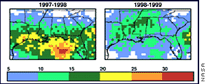
Number of winter days when lightning hit Earth’s surface during a strong El Niño period (left) and during La Niña (the opposite condition, in which the Pacific near the equator is colder than normal). Credit: Steven Goodman, Global Hydrology and Climate Center
Scientists have collected lightning data from existing instruments on two polar-orbiting satellites. The data definitely show increased lightning (which indicates storm characteristics) during El Niño years.
How Does the Jet Stream Help Us Predict the Weather?
Weather satellites, such as the Geostationary Operational Environmental Satellites-R Series (GOES-R), use infrared radiation to detect water vapor in the atmosphere. With this technology, meteorologists can detect the location of the jet streams.
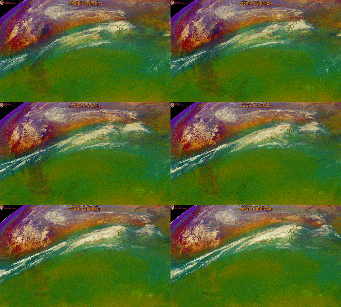
In this video from the GOES-16 (GOES East) satellite, the green area is warm, moist tropical air, while the orange and red areas are cold, dry polar air. The moving band of air between the two is the polar jet stream. Credit: NOAA/CIMMS/UW-Madison
Monitoring jet streams can help meteorologists determine where weather systems will move next. But jet streams are also a bit unpredictable. Their paths can change, taking storms in unexpected directions. So satellites like GOES-16 can give up-to-the-minute reports on where those jet streams are in the atmosphere — and where weather systems might be moving next.
