
Feature Story
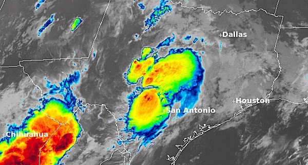
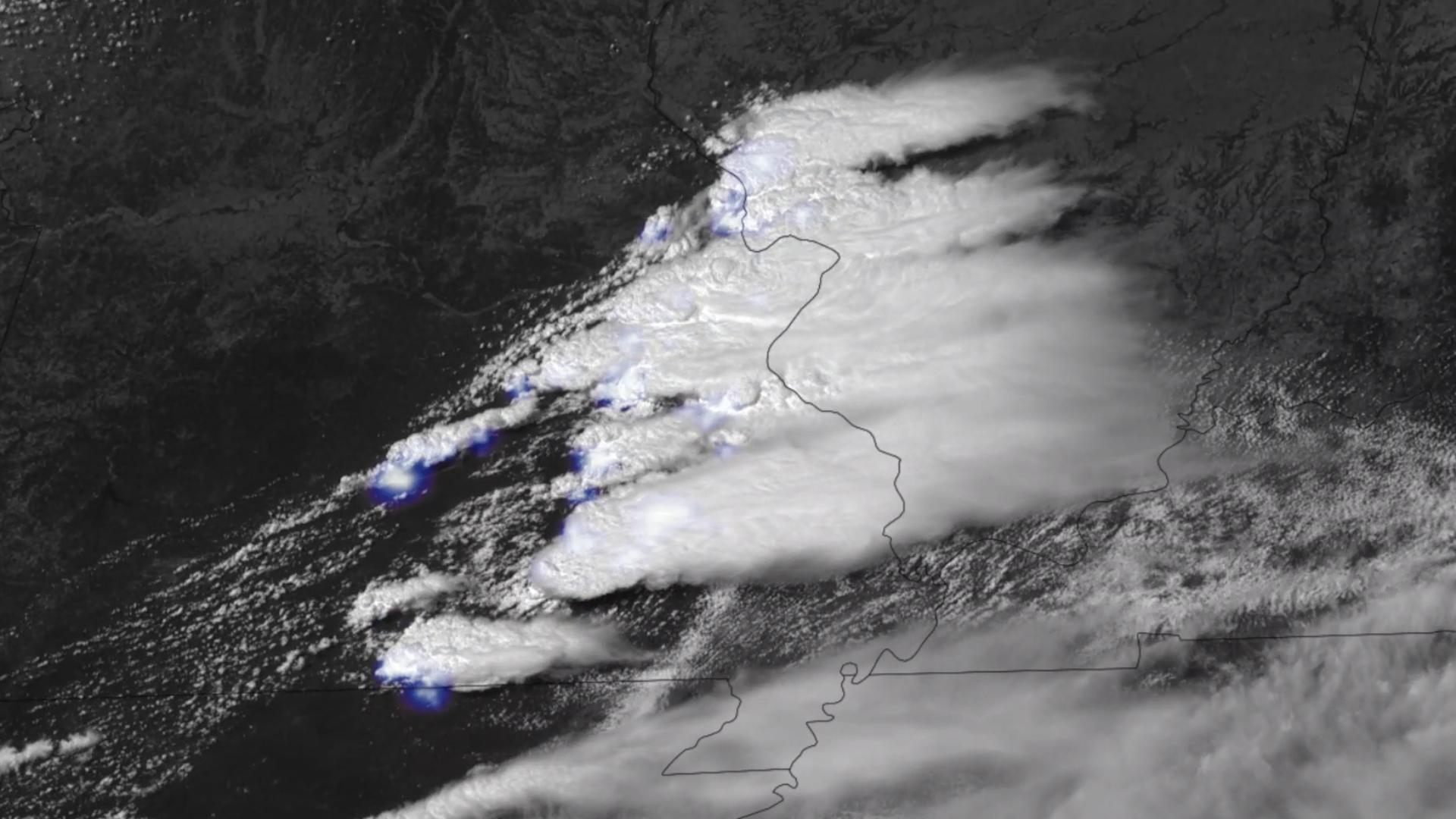
In the early hours of July 4, 2025 a devastating flash flood occurred in the Central Texas Hill Country. The Guadalupe River in Kerr County rose over twenty feet in just a few hours, and more than a hundred people lost their lives and thousands of…
Feature Story

The Shift Begins Before Sunrise and Continues After Sunset: How NOAA Satellite Operators and Engineers Keep America Safe, Every Day of the Year
Earth from Orbit
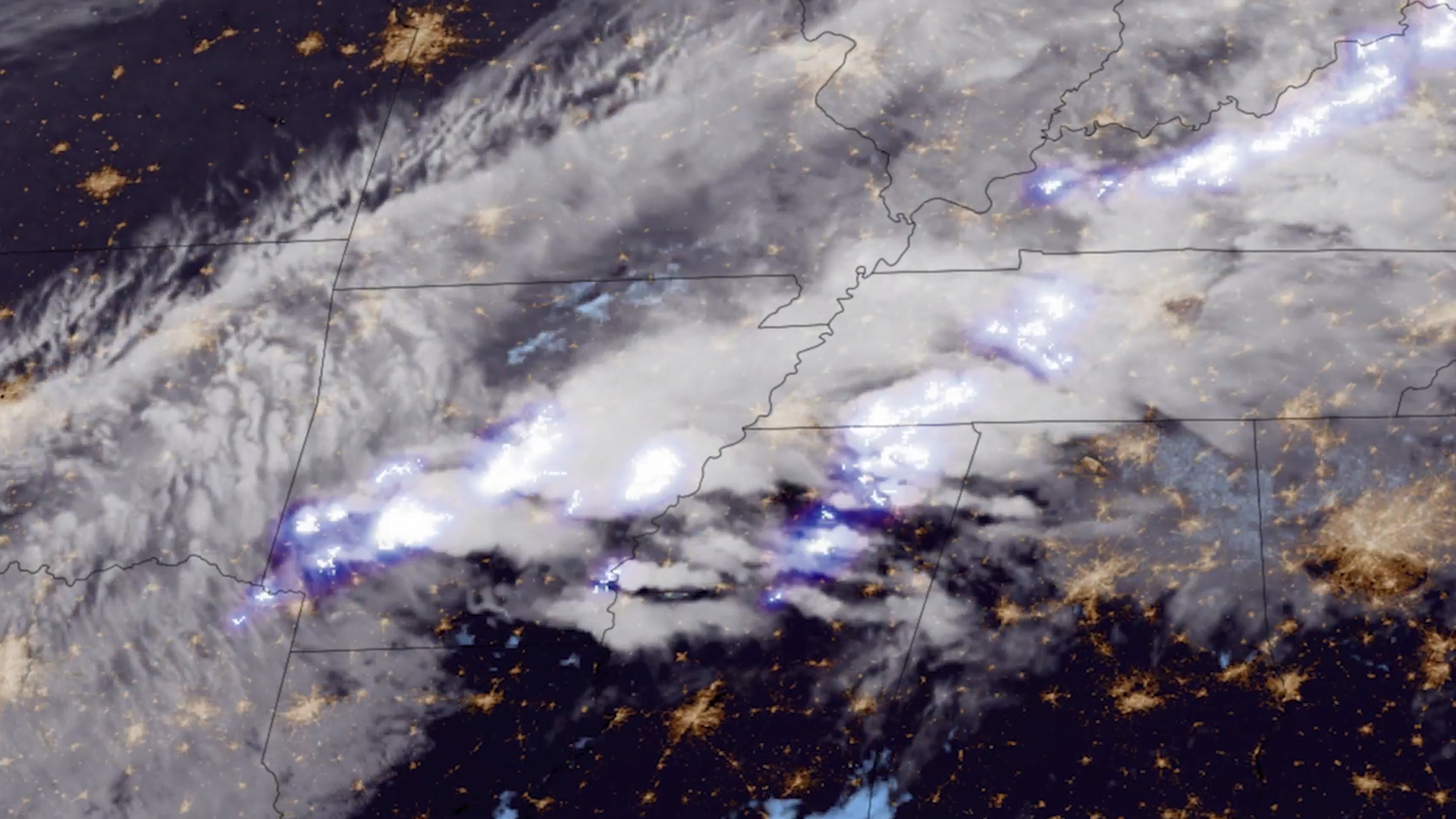
Lightning is a dangerous weather hazard that poses a significant threat to life and property. It can strike at any time, but is most common in the summer months.
Feature Story
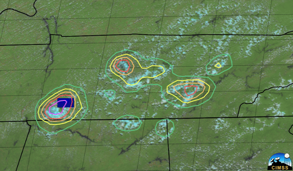
LightningCast uses artificial intelligence (AI) to predict general locations where lightning is most likely to occur.
Feature Story
On June 25, 2024, GOES-U, the final satellite in NOAA’s GOES-R Series, launched from NASA’s Kennedy Space Center in Florida.
Earth from Orbit
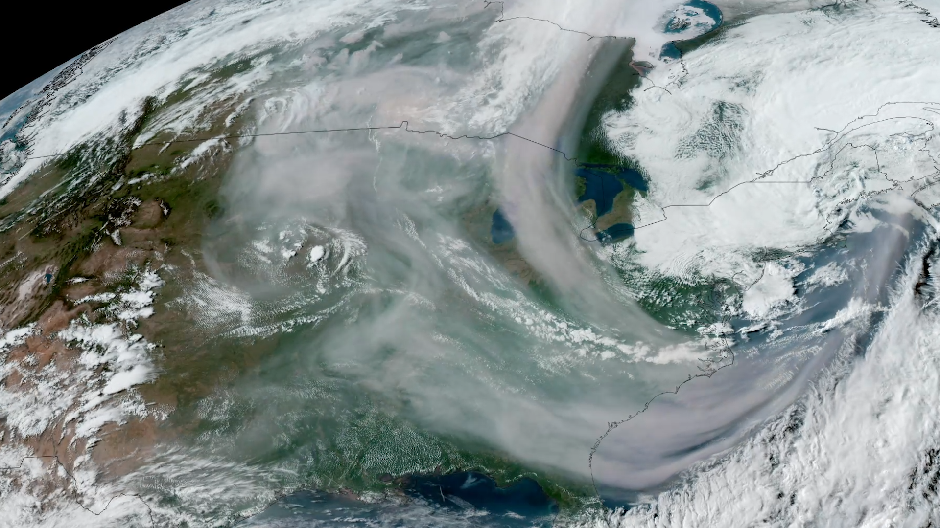
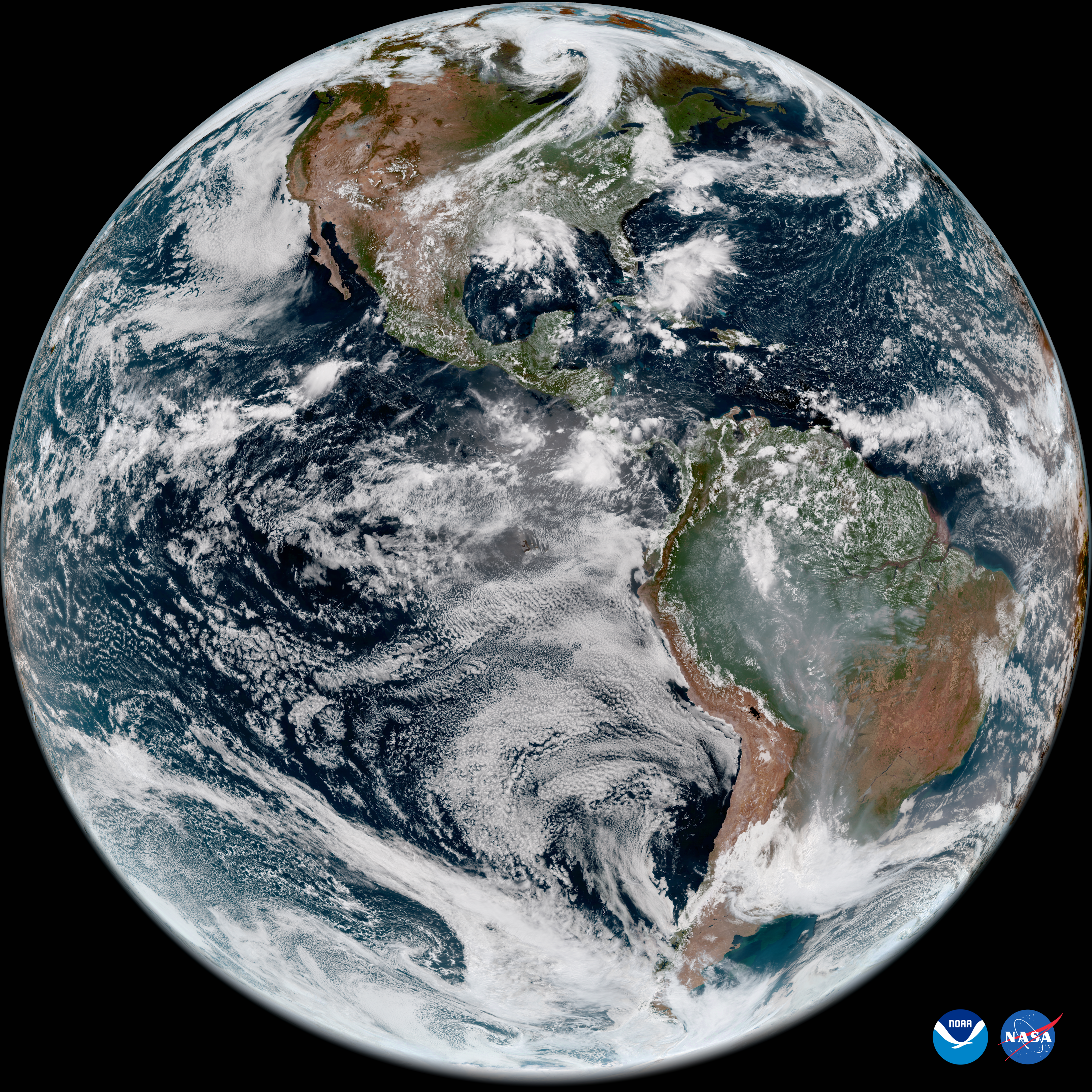
Since mid-May, NOAA satellites have been closely monitoring heat signatures and thick plumes of smoke (some stretching thousands of miles) from wildfires burning across Canada. Driven by heat, drought, and dry conditions, more than 160 fires kicked…
Feature Story
For 50 years , NOAA’s Geostationary Operational Environmental Satellites (GOES) have kept a constant vigil over the Western Hemisphere.
Earth from Orbit
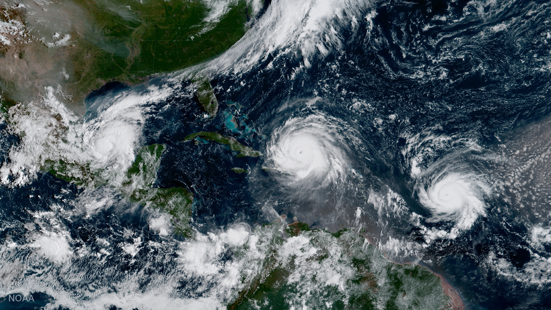
NOAA satellites have been monitoring a potent and complex spring weather pattern responsible for nearly a week-long stretch of severe weather, including two destructive tornado outbreaks across the central U.S. from May 15–16 and May 18–20, 2025.