
Satellite Snapshots
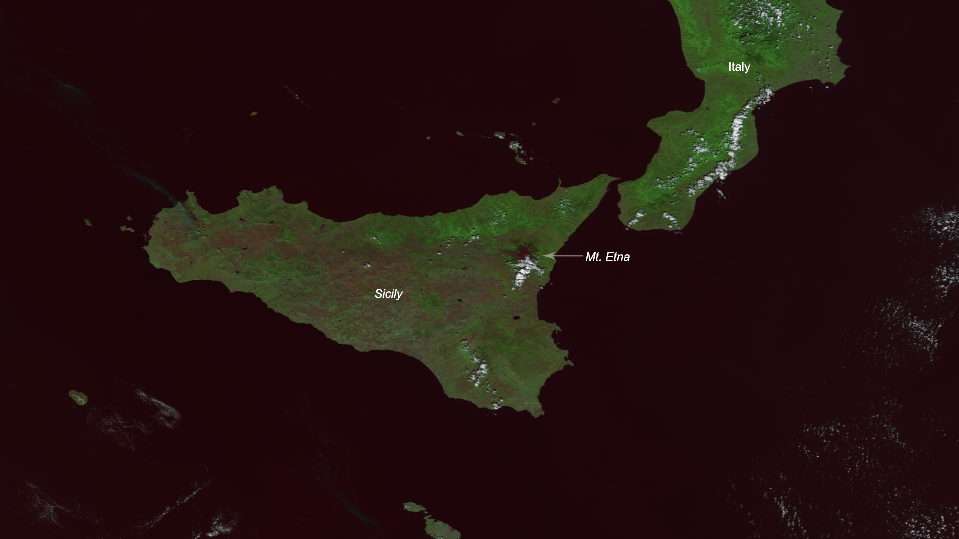
Mount Etna, the famous volcano on the Italian island of Sicily, has been spewing ash and red-hot chunks of lava known as “lava…
Satellite Snapshots
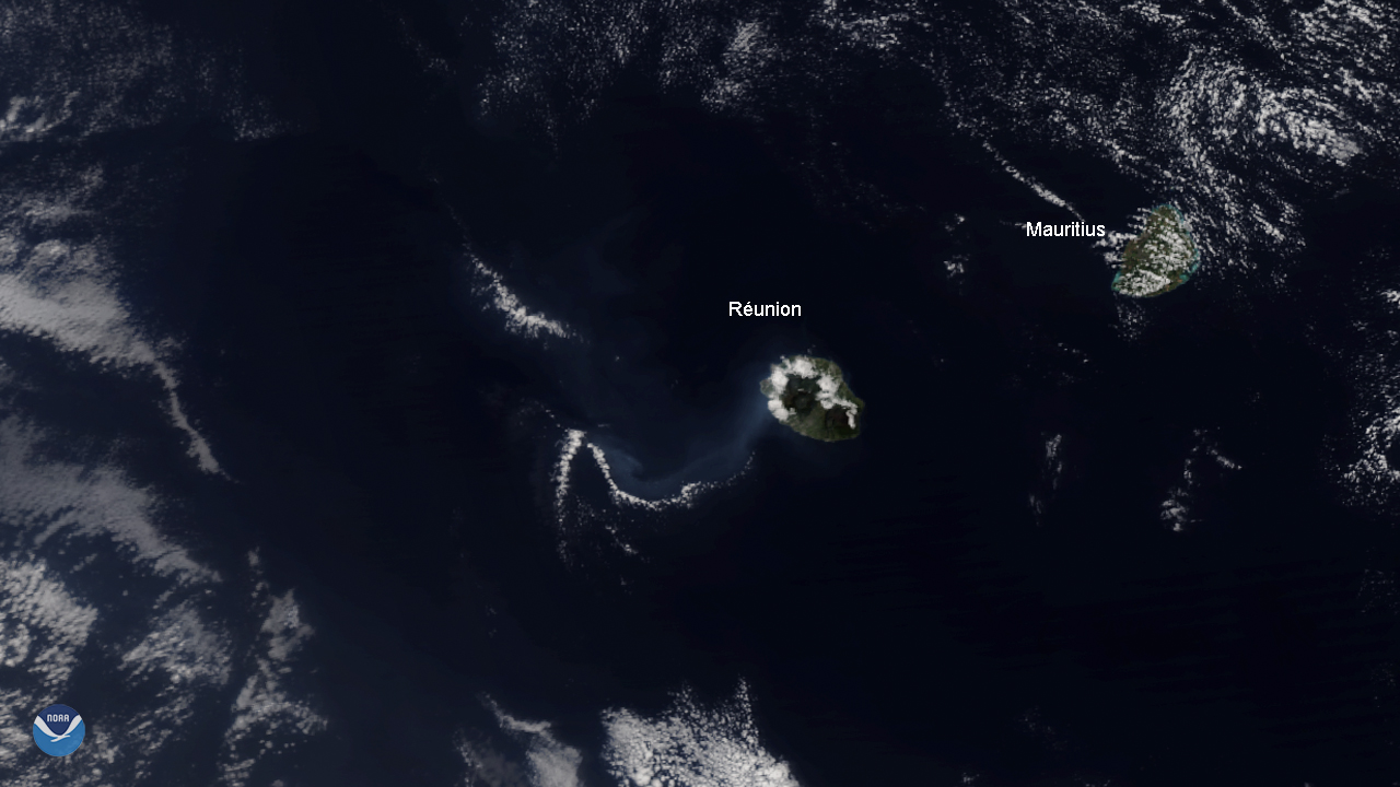
The NOAA-20 satellite spied the Piton de la Fournaise volcano on Réunion Island, off the Eastern coast of Madagascar, erupting for…
Satellite Snapshots
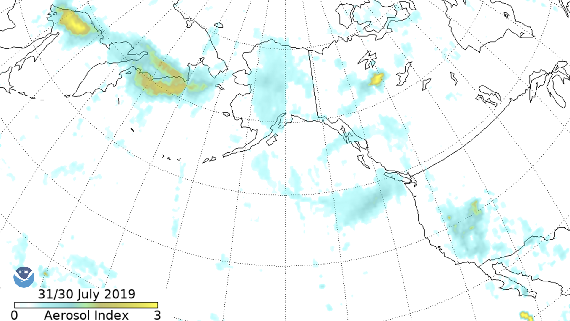
The Suomi-NPP Ozone Mapping and Profiler Suite (OMPS) aerosol index shows smoke moving across eastern Russia into Alaska, down the west…
Satellite Snapshots
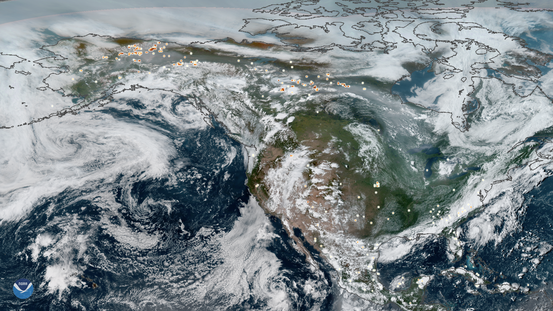
This true-color composite image of smoke from Arctic wildfires spreading across Alaska and Canada was captured by both GOES East and…
Satellite Snapshots
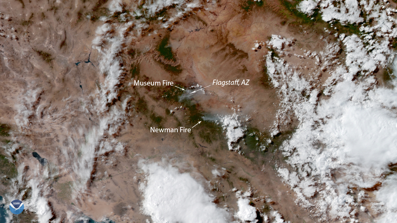
NOAA’s GOES West satellite zoomed in on two wildfires near Flagstaff, Ariz. on July 23, 2019. The Museum Fire , currently searing…
Satellite Snapshots
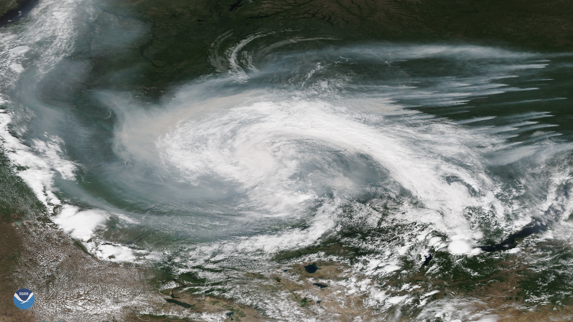
Smoke from active wildfires burning across northern Russia got caught in a low pressure system near the Verkhne-Tazovsky State Natural…
Satellite Snapshots

Clear skies over Australia on July 16, 2019, gave the NOAA-20 polar-orbiting satellite an unobstructed view of smoke plumes from…
Satellite Snapshots
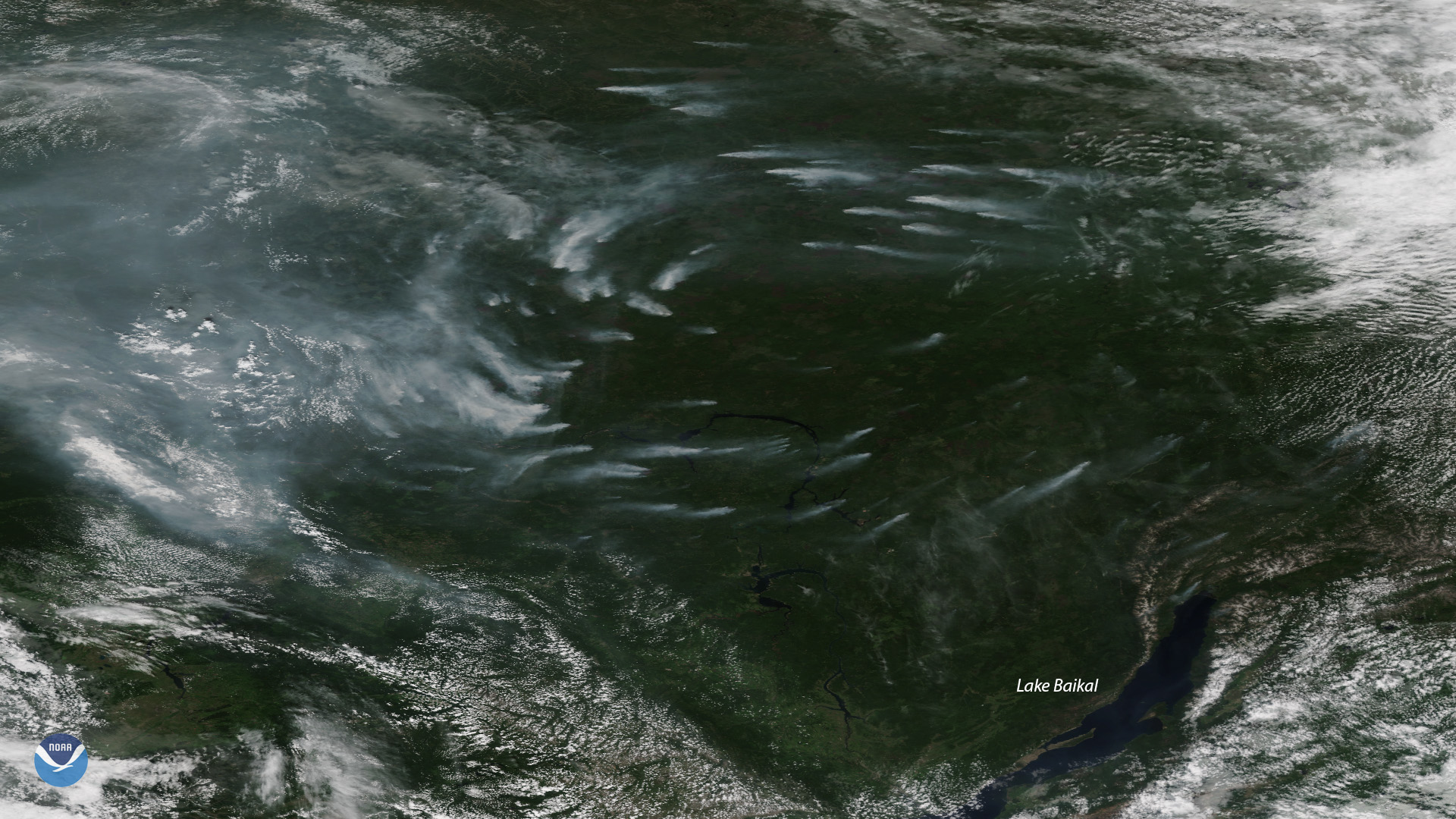
Plumes of smoke from more than a dozen large, active wildfires burning northwest of Russia’s Lake Baikal are seen in this NOAA-20…