
Earth from Orbit

From late Dec. 2022 into Jan. 2023, a series of nine “atmospheric rivers” dumped a record amount of rain and mountain snow across the western U.S.
Feature Story

The U.S. National Weather Service is using new fog detection software to assist with fog warnings.
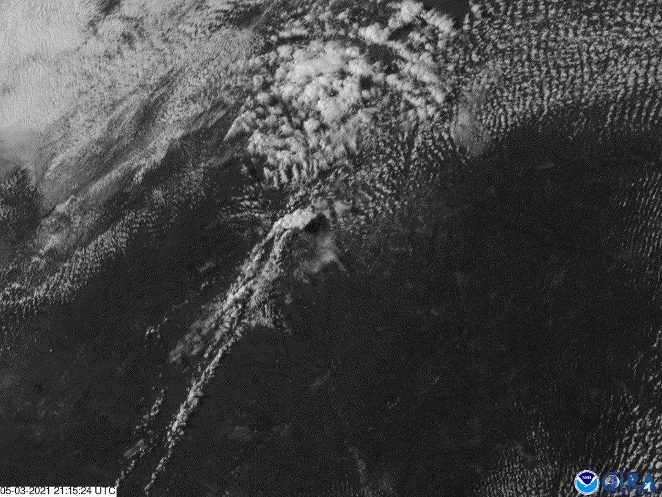
Earth from Orbit

NOAA satellites captured actinoform clouds over the eastern Pacific Ocean on June 3, 2021.
Satellite Snapshots
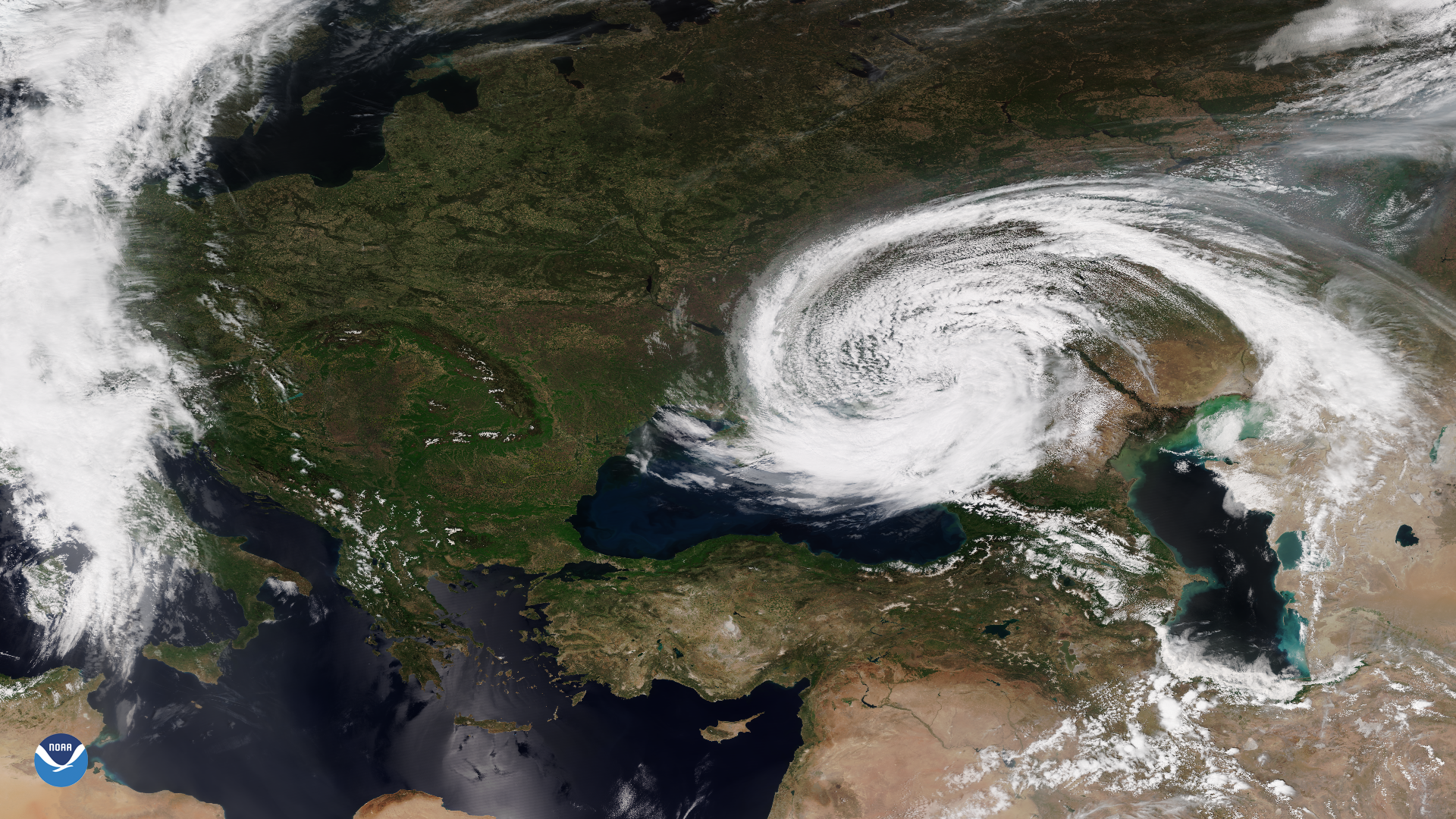
The VIIRS instrument onboard the NOAA-20 satellite captured this imagery of an unusual mid-latitude cyclone swirling around the Black Sea.
Earth from Orbit
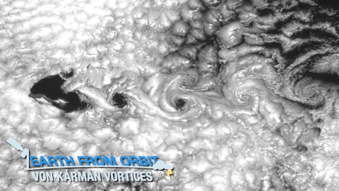
NOAA satellites captured von Kármán vortices streaming around Guadalupe Island. These are vortex patterns in stratocumulus clouds near islands.
Earth from Orbit
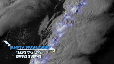
Severe thunderstorms struck Texas. The storms formed along a dry line—a boundary between moist and dry air. The storms caused hail and tornadoes.
Satellite Snapshots
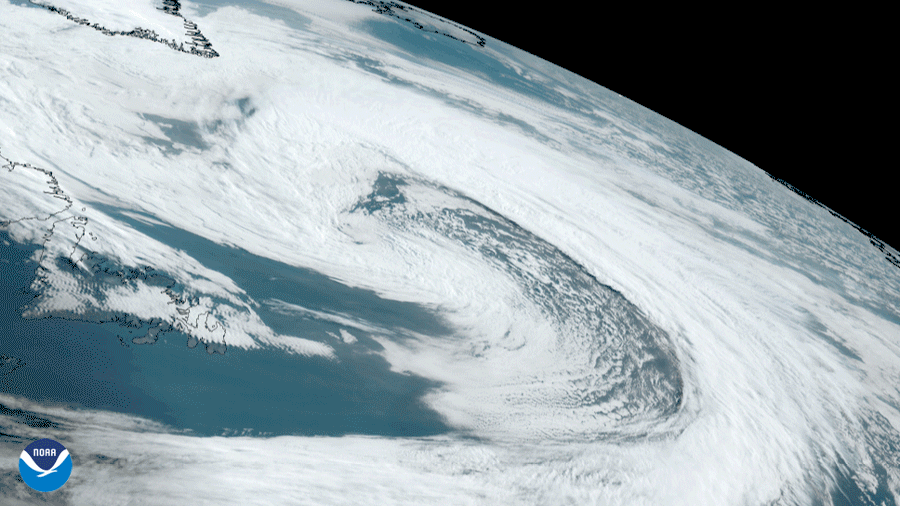
NOAA’s GOES East satellite saw a large occluded low pressure system (mid-latitude cyclone) swirl in the East Labrador Sea between Canada and Greenland
Satellite Snapshots
GOES East captured amazing visible imagery of large thunderstorms as they erupted over Texas. The Geostationary Lightning Mapper tracked lightning