
Feature Story
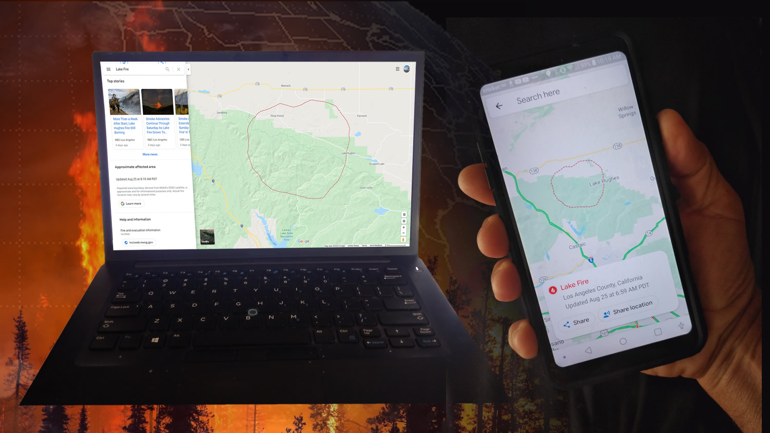
NOAA’s GOES-16 (GOES-East) and GOES-17 (GOES-West) satellites are helping the public see where active wildfires are and avoid dangerous situations.
Satellite Snapshots
On Aug. 19, 2020, NOAA’s GOES-West satellite captured the above GeoColor image loop of massive wildfire smoke plumes billowing from…
Satellite Snapshots
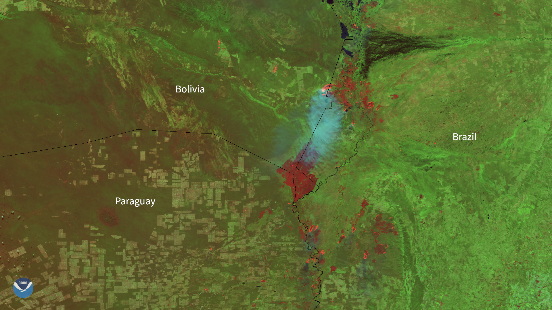
As NOAA’s satellites focused in on South America on Aug. 7, 2020, they could see smoke plumes from various fires across the continent…
Satellite Snapshots
In both visible and infrared imagery, dust can often be confused with clouds such as cirrus, since they are both considered optically thin.
Satellite Snapshots
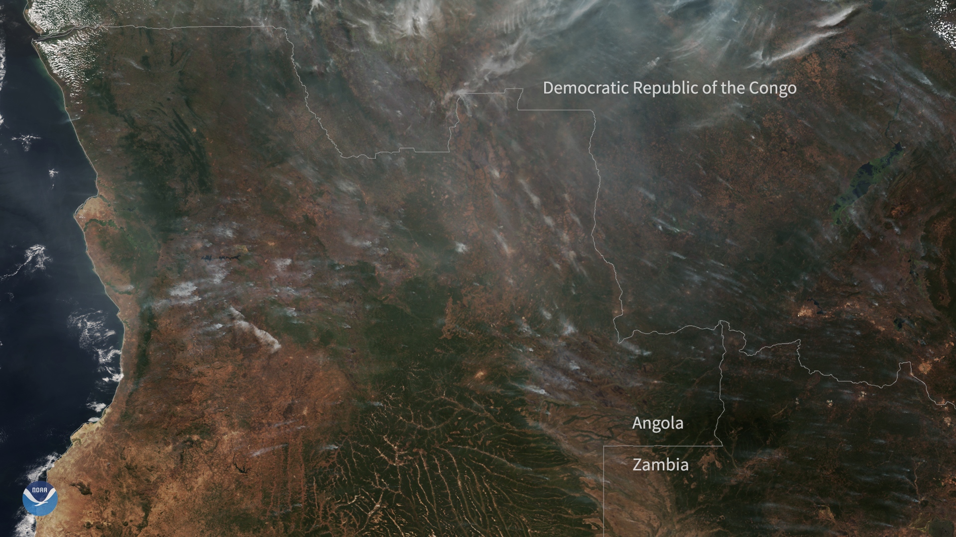
On July 5, 2020, the NOAA-20 satellite captured this True Color imagery of hazy smoke from fires burning across a large portion of central Africa.
Satellite Snapshots
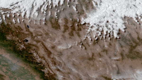
On June 28–29, 2020, NOAA’s GOES-West satellite watched a particularly intense dust cloud race across Nevada’s Mojave desert.
Satellite Snapshots
On June 28–29, 2020, NOAA’s GOES-West satellite watched a particularly intense dust cloud race across Nevada’s Mojave desert.
Satellite Snapshots
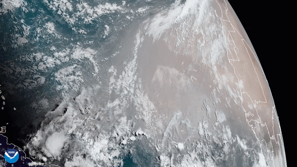
GOES-East satellite captured this GeoColor imagery of an expansive plume of dust from the Sahara Desert traveling westward.