
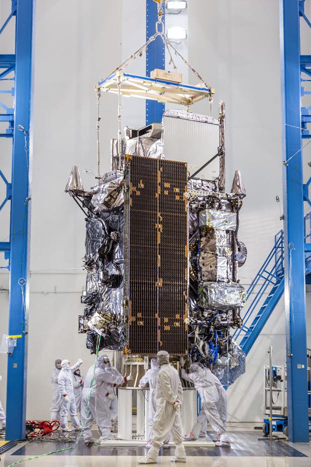
Feature Story
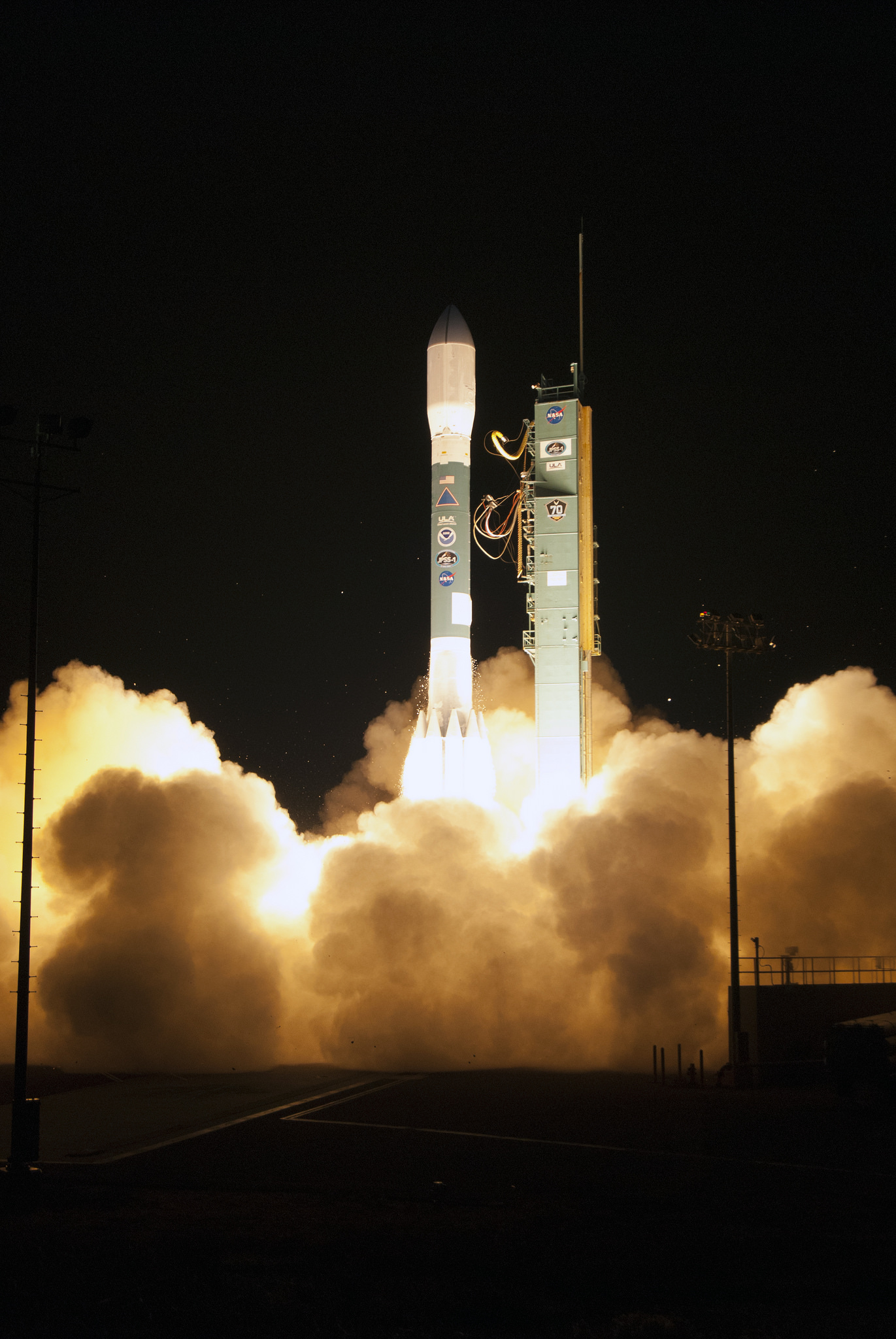
Approximately one hour after liftoff, when JPSS-1 separated from the upper stage of the Delta II launch vehicle and its solar array deployed, the laun
Announcement
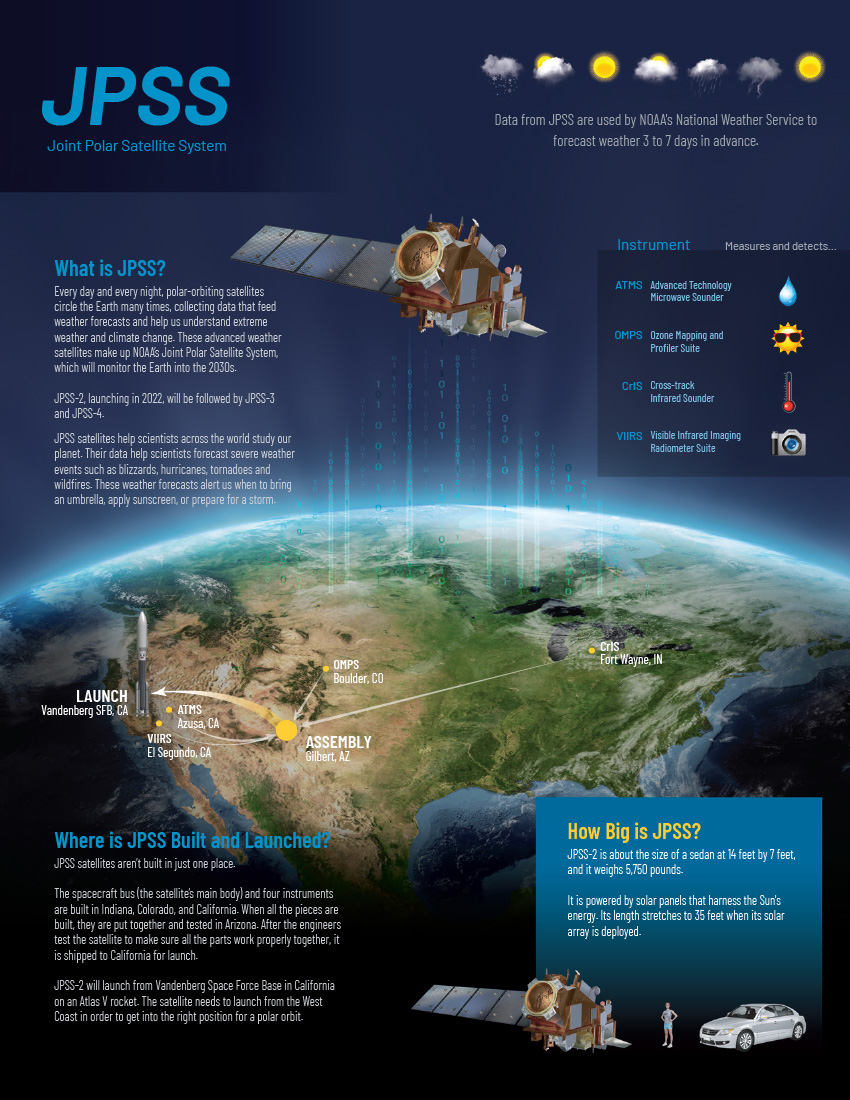
More detailed observations will improve marine, aviation forecasts and wildfire detection
Satellite Snapshots
This data visualization shows the maximum wind gusts from Hurricane Irma from September 7 to September 10, 2017. Note how the strongest wind gusts…
Feature Story

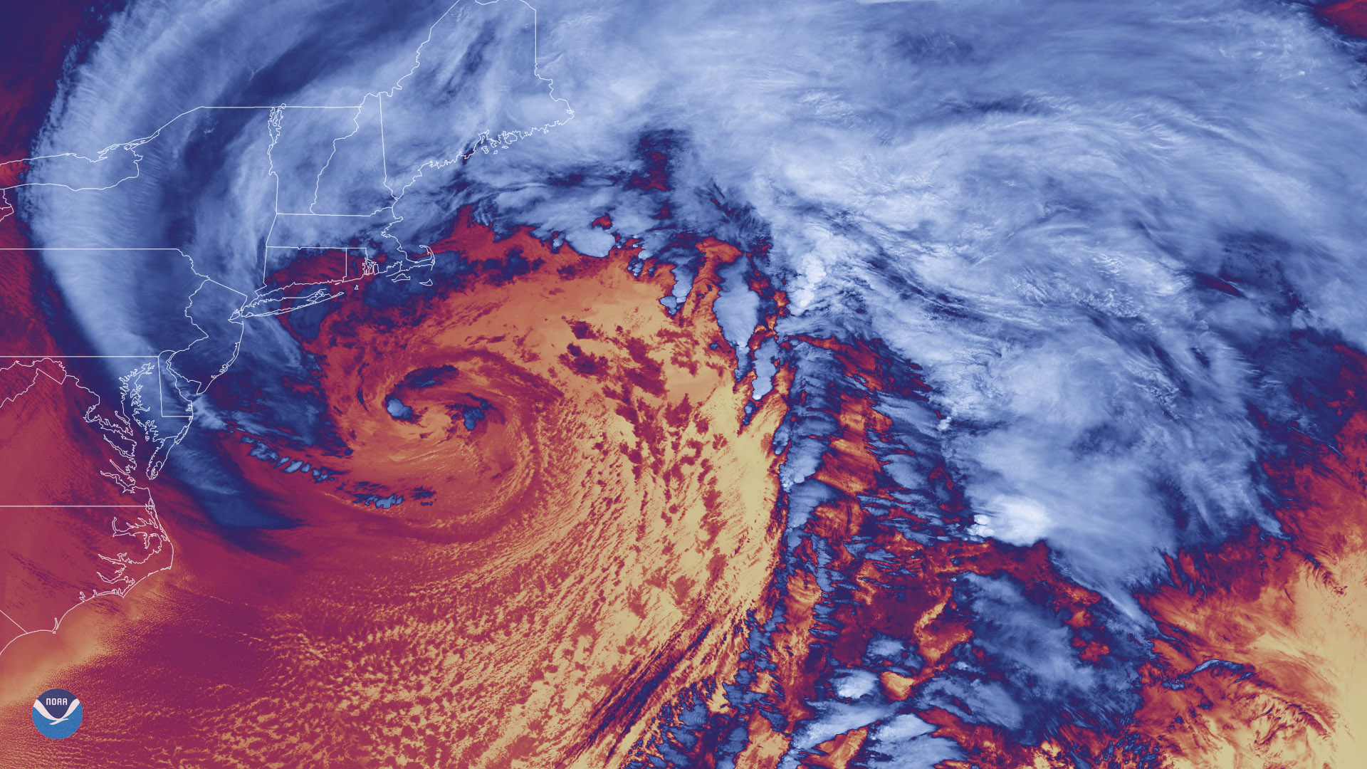
NOAA-20 captured these two images of North America five days apart (January 11, 2018 and January 16, 2018). Note the contrast in the surface temperatu
Satellite Snapshots
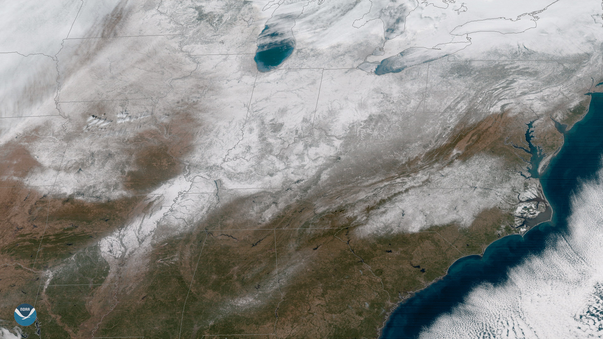
Clear skies enabled the GOES East satellite to capture this view of current snow cover over the eastern United States on January 18,…
Satellite Snapshots
Forty-seven days after it was first launched, the NOAA-20 polar-orbiting satellite sent back its first thermal infrared images on…
Feature Story
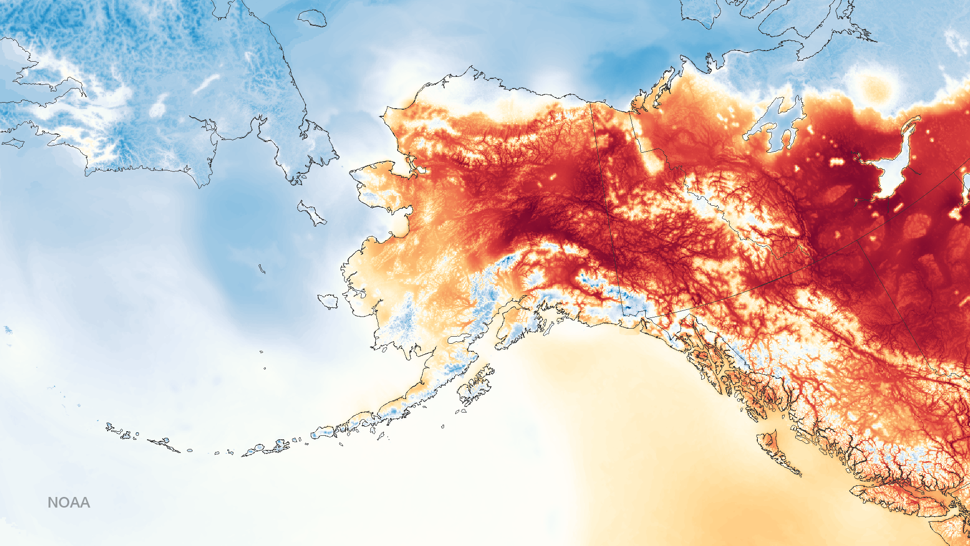
With a total area of more than 660,000 square miles, Alaska is not only the largest state in the U.S.; it's the largest state in the U.S. by far! Not
Feature Story
Every year at midnight on December 31st, the mathematical and mysterious converge as we witness a new year begin! It’s a…