
Feature Story

The Visible Infrared Imaging Radiometer Suite (VIIRS) instrument on board the Suomi National Polar-orbiting Partnership (Suomi NPP)
Feature Story
This is great in Alaska because the state has a lot of night in the winter.
Feature Story

now and ice cover has a profound impact on the overall health of the planet.
Feature Story

Forecaster Amy Huff describes how JPSS aerosol satellite products are improving air quality monitoring and forecasting by providing a way to track the
Feature Story

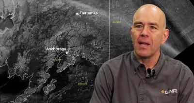
Meteorologist Dave Snider interviews Eric Stevens of The Geographic Information Network of Alaska.
Feature Story

A new ozone mapping instrument on the JPSS satellite -- the Ozone Mapping and Profiler Suite.
Feature Story
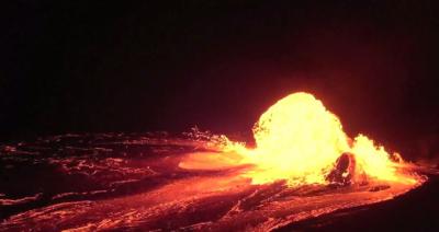
JPSS satellites will dramatically improve volcano monitoring worldwide, both in terms of monitoring volcano hot spots and tracking post-eruption.
Feature Story
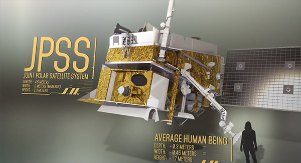
The satellites of the JPSS constellation host state-of-the-art instruments, including the Advanced Technology Microwave Sounder (ATMS).