
Feature Story

Predicting future weather requires timely and accurate data about present conditions.
Feature Story
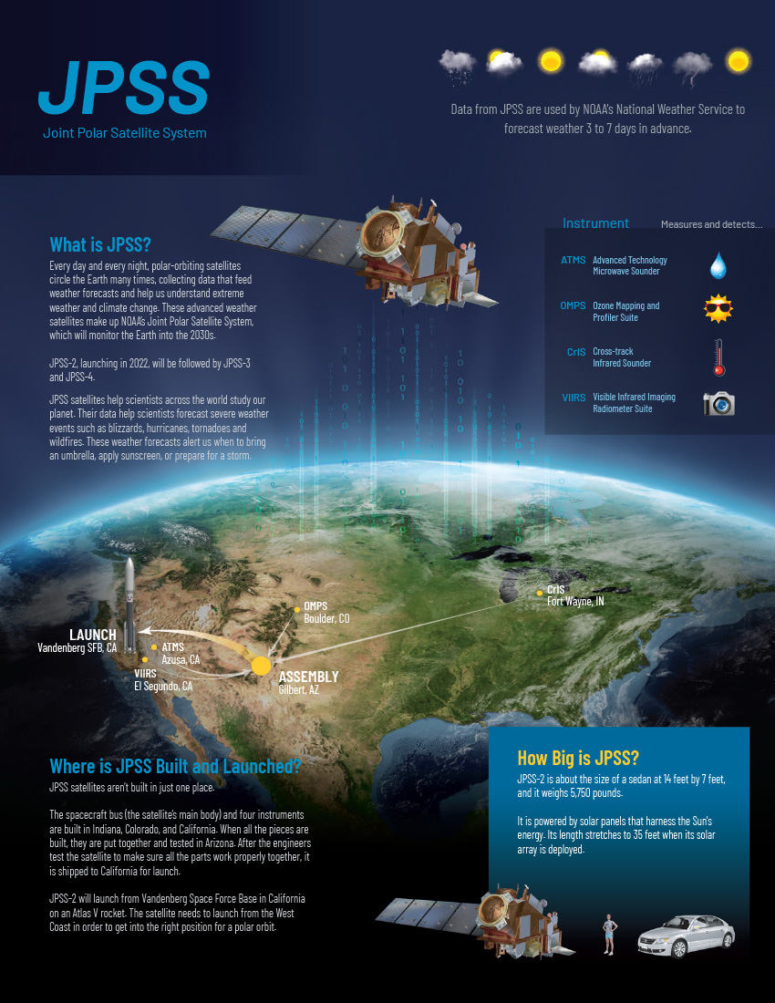
Orbiting around the planet from pole to pole 14 times per day JPSS keeps track of weather.
Feature Story
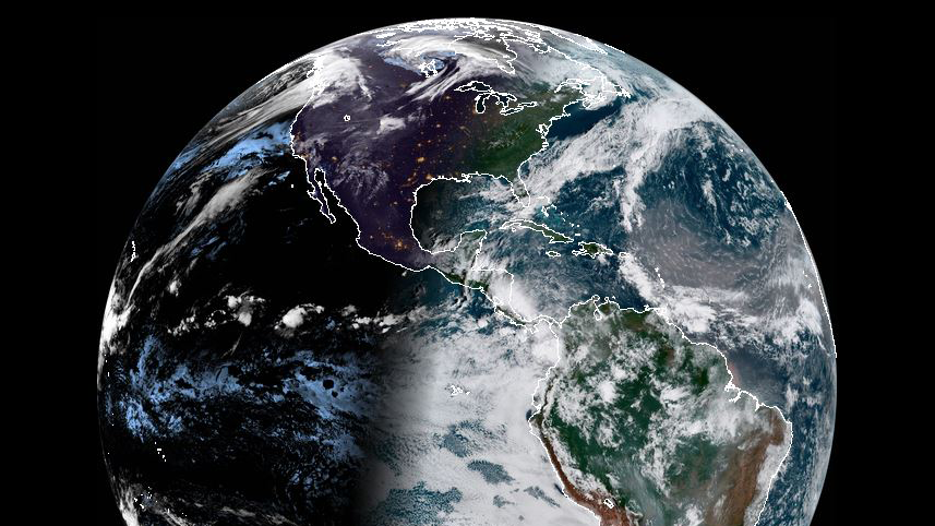
Every morning NOAA’s GOES-16 Satellite takes in an amazing view of Earth.
Feature Story
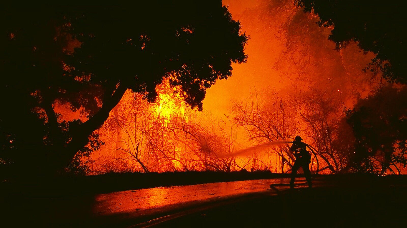
As news of the rising death toll from the California fires continues, NOAA satellites help capture the extent of the wildfires.
Satellite Snapshots
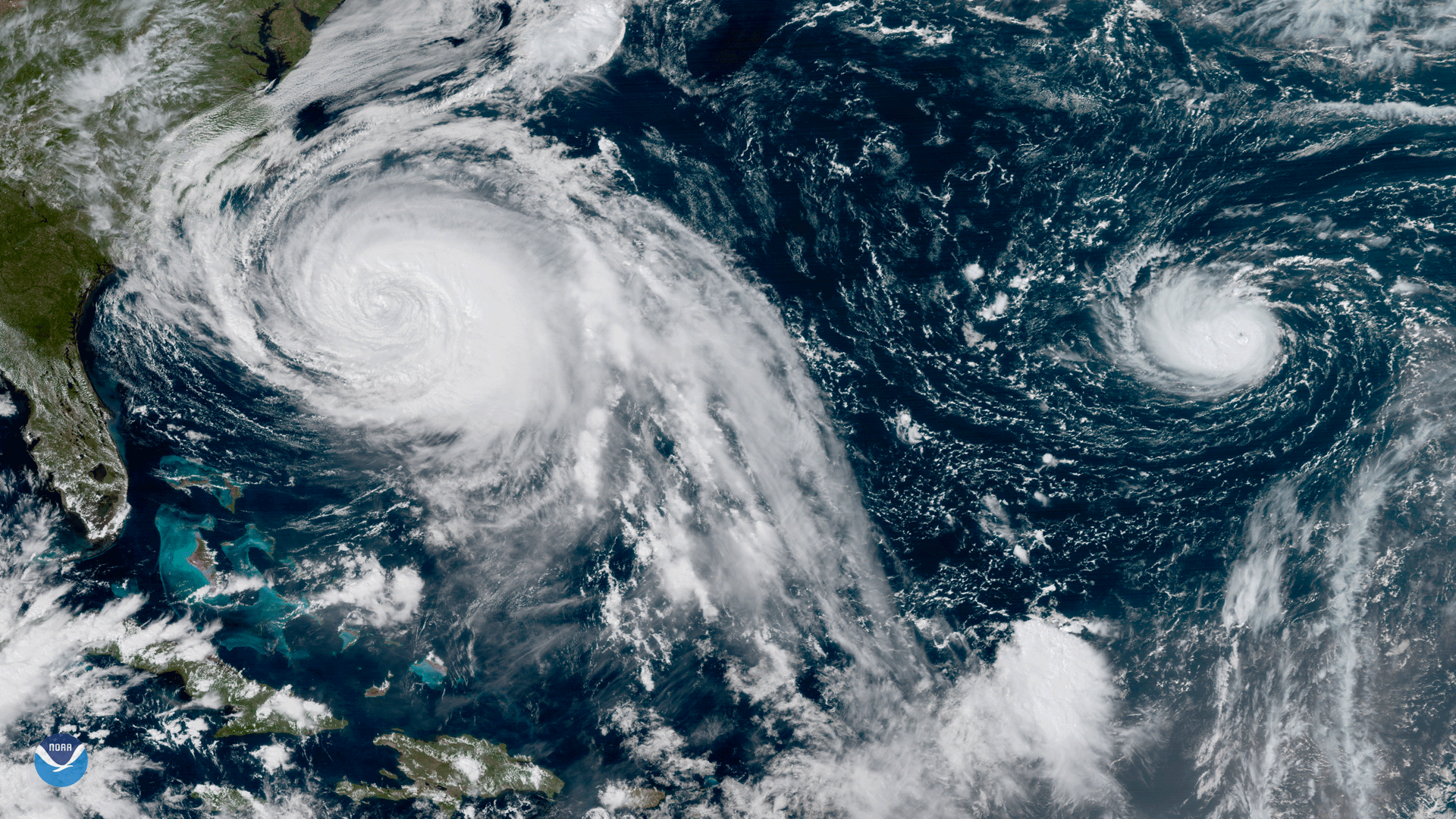
This GOES-16 geocolor image shows Hurricane Lee in the open Atlantic Ocean.
Feature Story
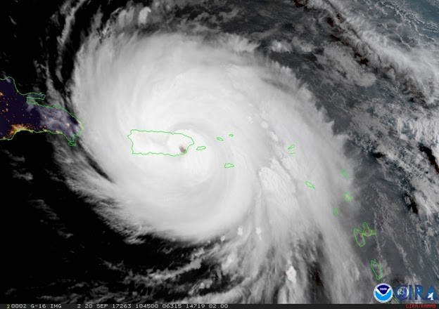
Although not yet operational, data from NOAA’s GOES-16 satellite proved vital in forecasting operations for Hurricane Maria as it neared Puerto Rico.
Satellite Snapshots
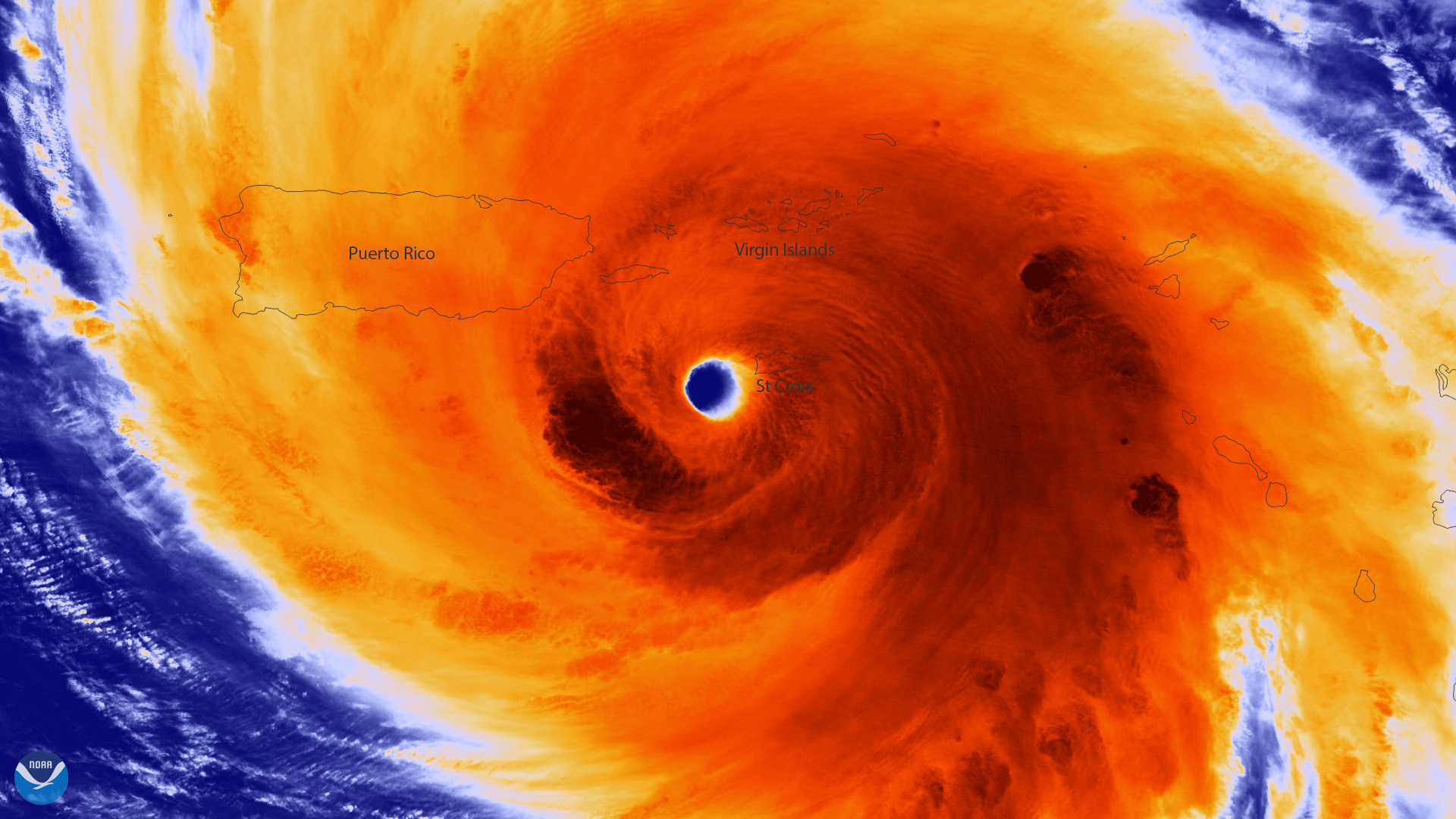
Colorized infrared image from Suomi NPP of the well-defined eye of Hurricane Maria
Satellite Snapshots
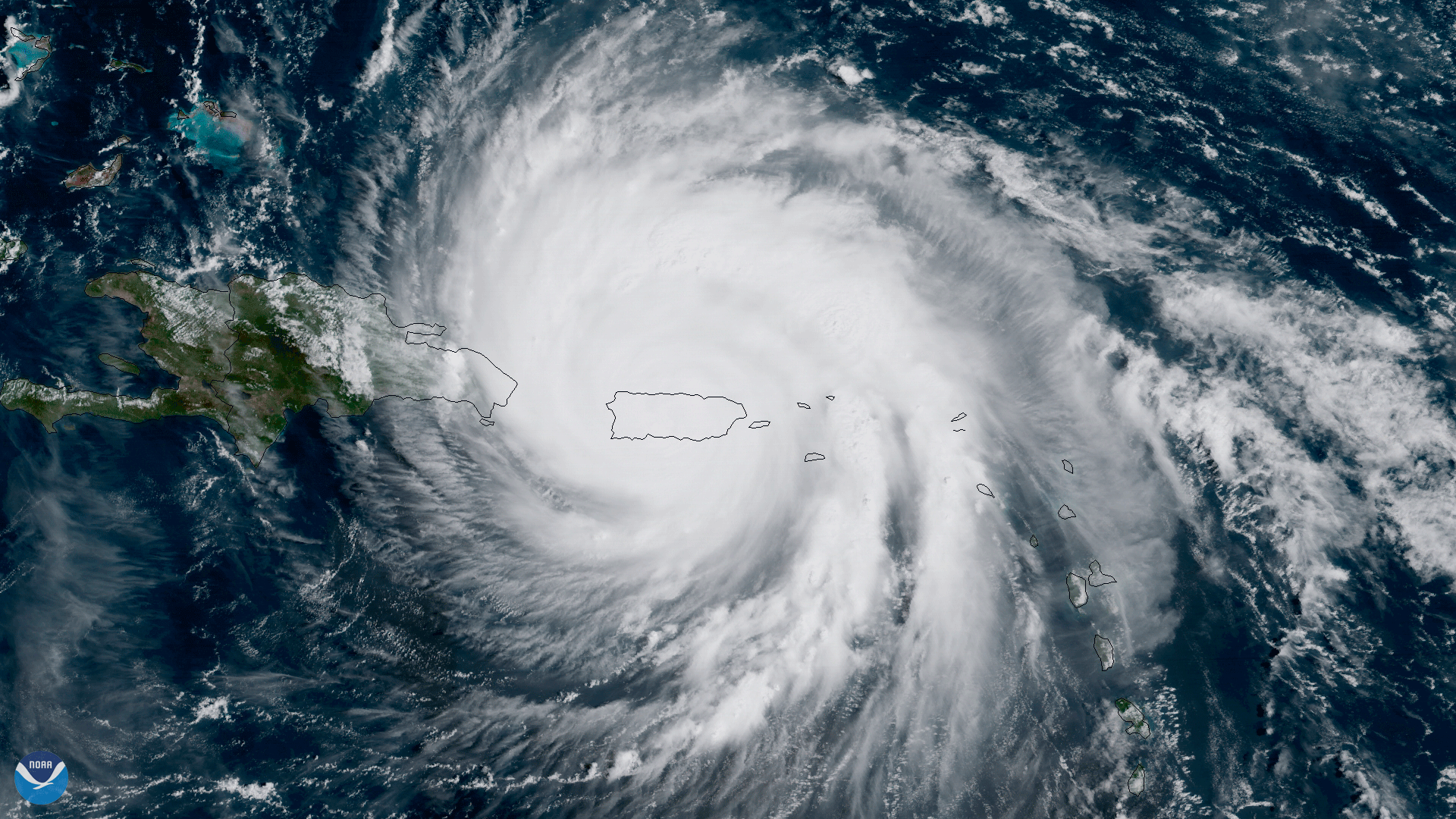
The center of Hurricane Maria approaches the northern coast of Puerto Rico in this geocolor image captured by NOAA's GOES-16.