
Satellite Snapshots
GOES-16 shows Hurricane Maria as it moves across the northeastern Caribbean toward the Virgin Islands.
Satellite Snapshots
GOES-16 satellite captured this image of Hurricane Maria approaching the Leeward Islands.
Satellite Snapshots
Data visualization shows the maximum wind gusts from Hurricane Irma from September 7 to September 10, 2017.
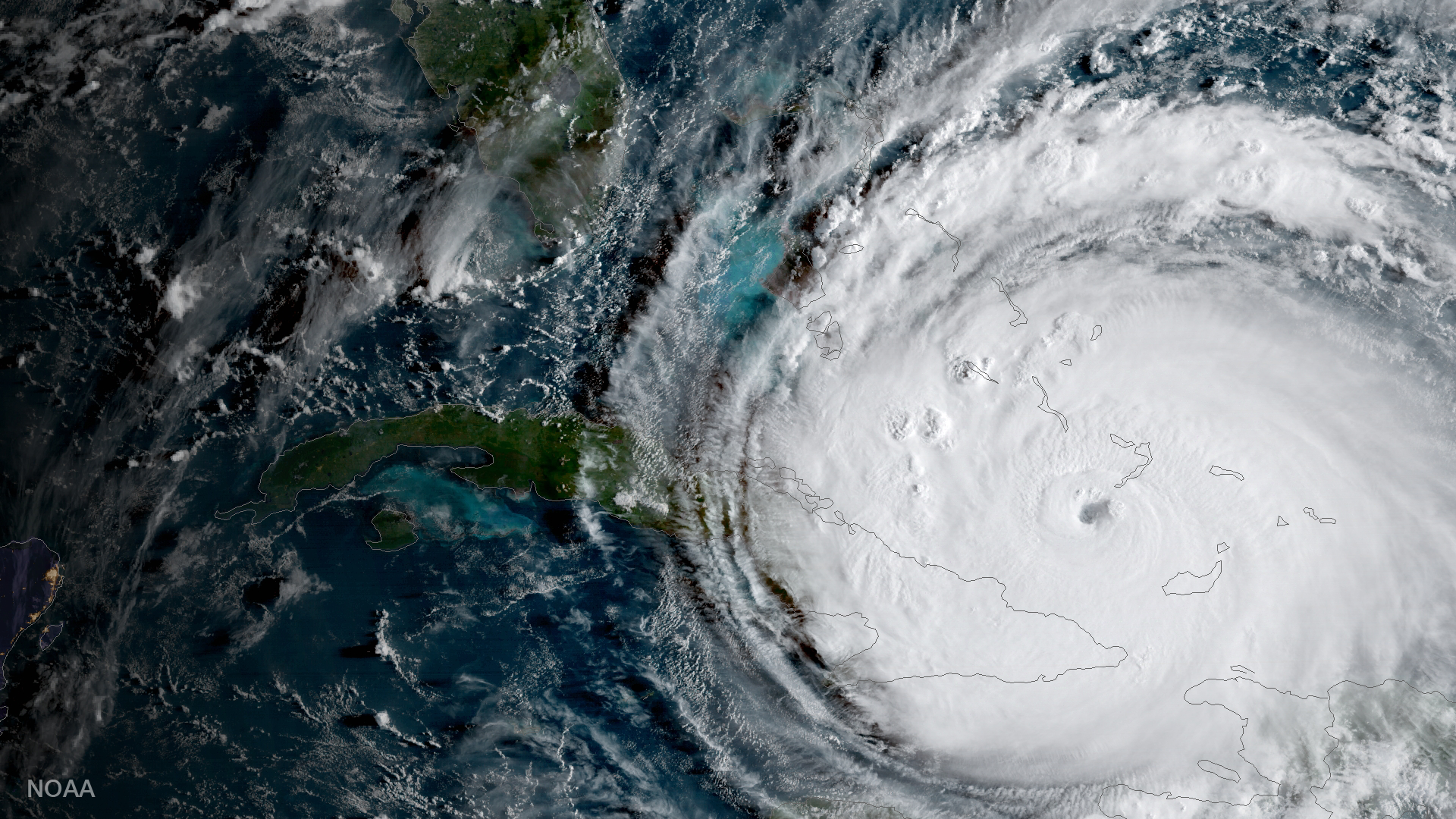
Satellite Snapshots

GOES-16 captured this geocolor image of Hurricane Irma making a second landfall near Marco Island, Florida.
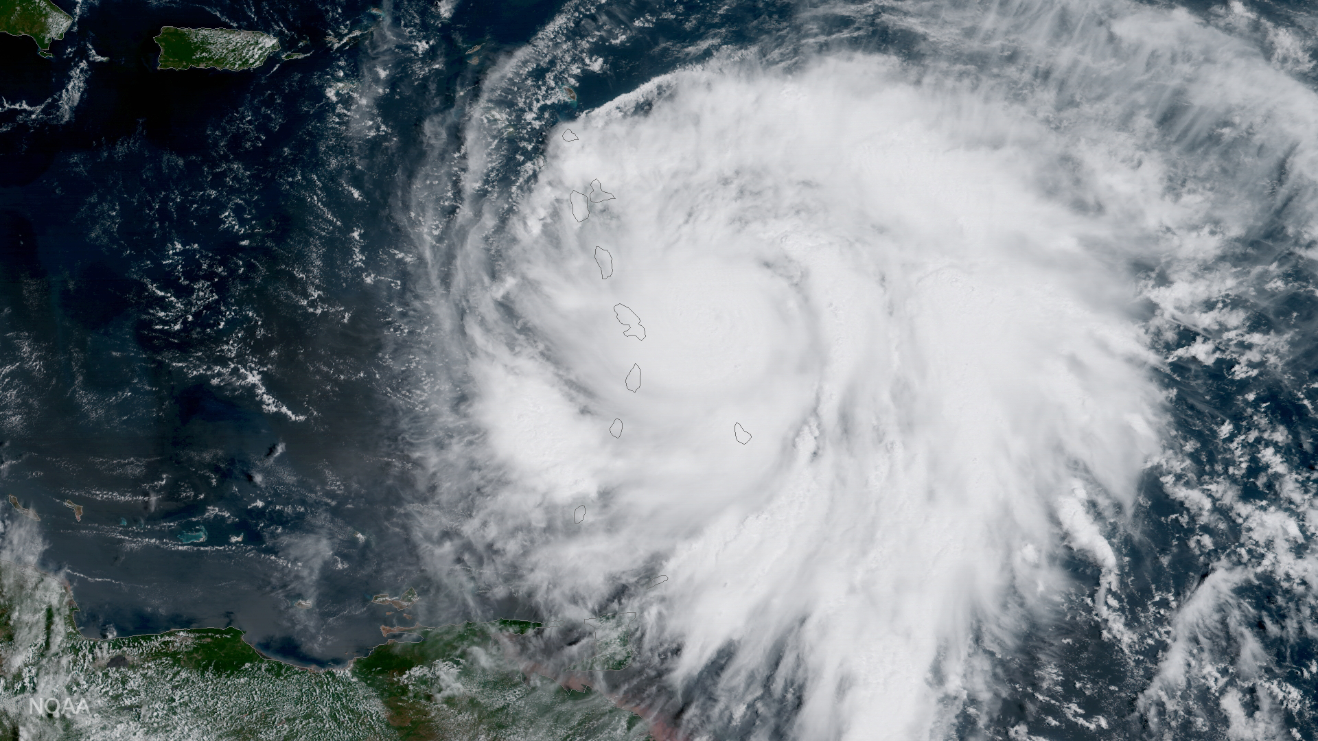
Satellite Snapshots
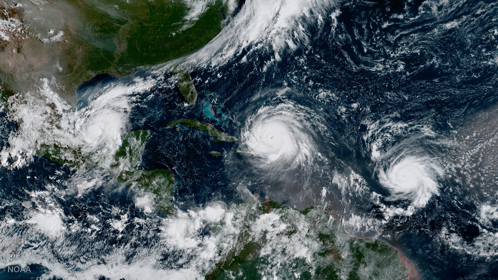
GOES-16 captured this geocolor image of Hurricane Irma passing the eastern end of Cuba.
Satellite Snapshots
This data visualization shows the maximum wind gusts from Hurricane Irma from September 7 to September 10, 2017.
Satellite Snapshots
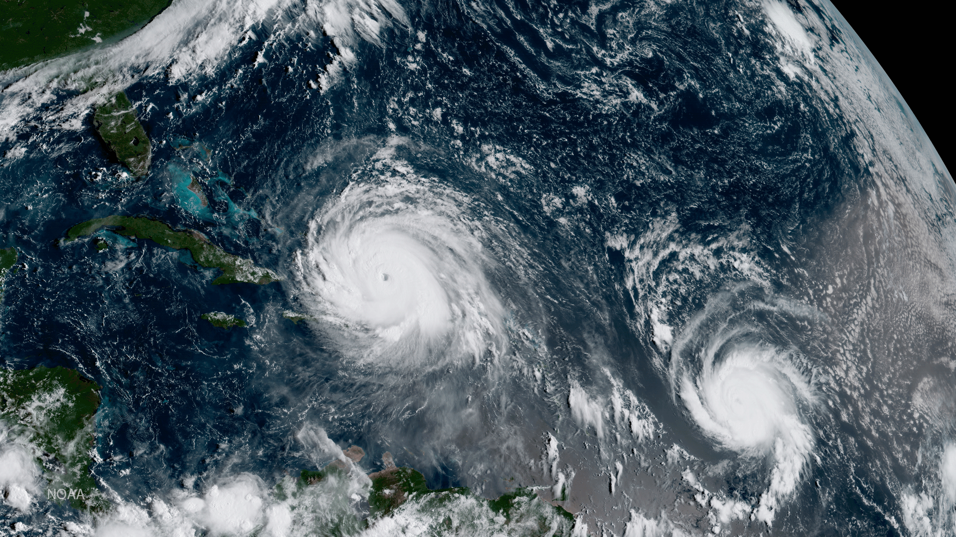
Geocolor image from GOES-16 shows Hurricanes Katia (l), Irma (m) and Jose (r) in the Atlantic Ocean.
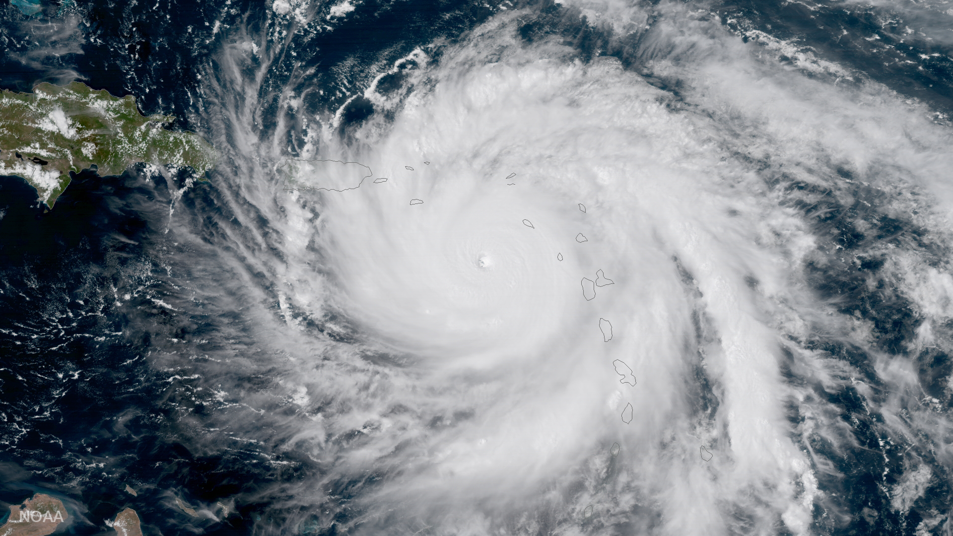
Satellite Snapshots
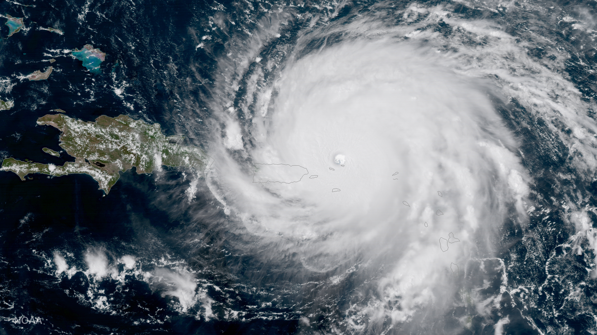
GOES-16 captured this geocolor image of Hurricane Irma -- a category 5 storm with winds as high as 185 miles per hour.