
Earth from Orbit

NOAA satellites monitored numerous fires over the Southern Plains, the majority of which were likely prescribed burns.
Earth from Orbit
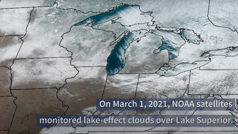
NOAA satellites monitored lake-effect clouds flowing over Lake Superior. Learn more about this phenomenon in this week's Earth from Orbit video.
Earth from Orbit

NOAA satellites monitored a large plume of dust from the Sahara Desert as it traveled off the west coast of North Africa, across the Atlantic Ocean.
Satellite Snapshots
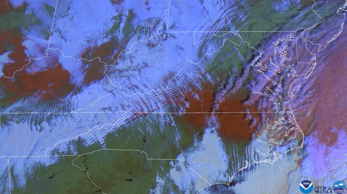
False color satellite imagery shows wave clouds and red snow on the ground.
Satellite Snapshots
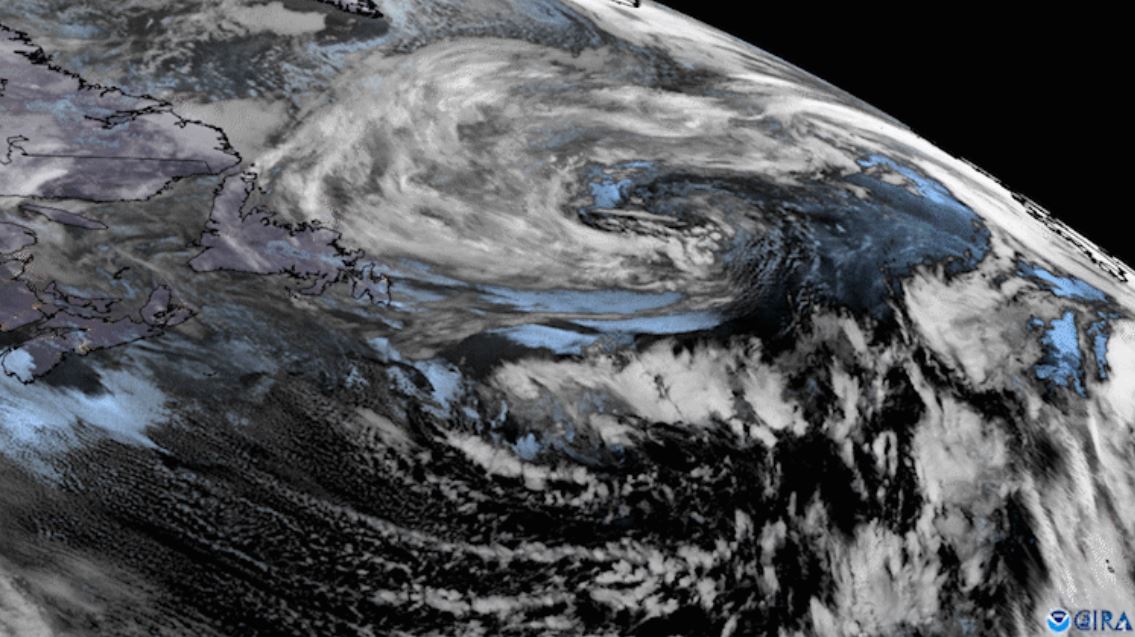
GOES East zoomed in on two low pressure systems swirling over the North Atlantic while cloud streets streamed off the North American coast.
Satellite Snapshots
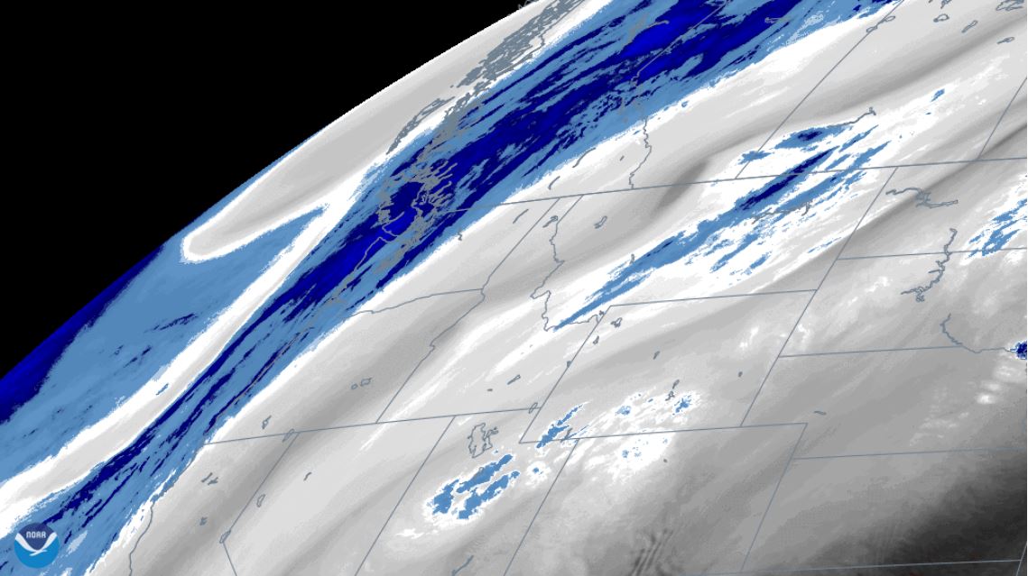
Water vapor imagery from NOAA’s GOES East satellite viewed an atmospheric wave pattern brought on by a digging trough the Pacific Northwest.
Feature Story

NOAA's GOES-T satellite is fully assembled and beginning a set of rigorous tests to ensure it can withstand launch and orbit conditions.
Feature Story
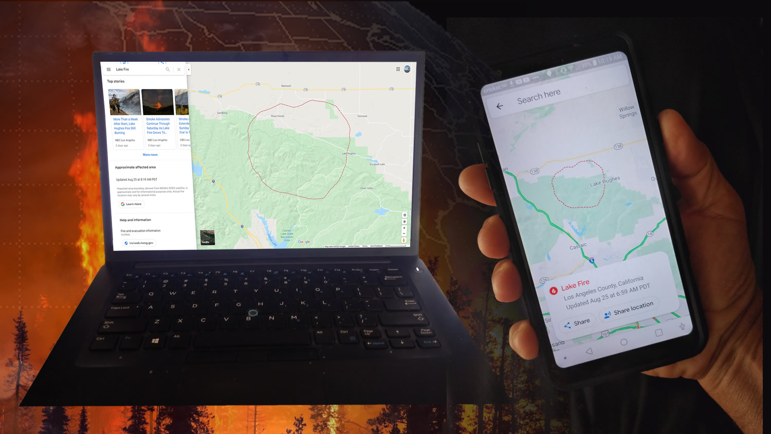
NOAA’s GOES-16 (GOES-East) and GOES-17 (GOES-West) satellites are helping the public see where active wildfires are and avoid dangerous situations.