
Satellite Snapshots
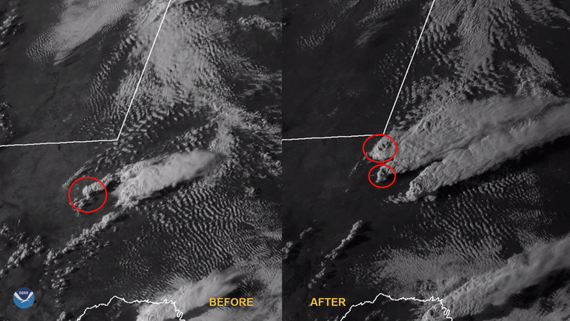
GOES-East satellite has been monitoring severe thunderstorms that brought torrential rain, destructive winds.
Satellite Snapshots
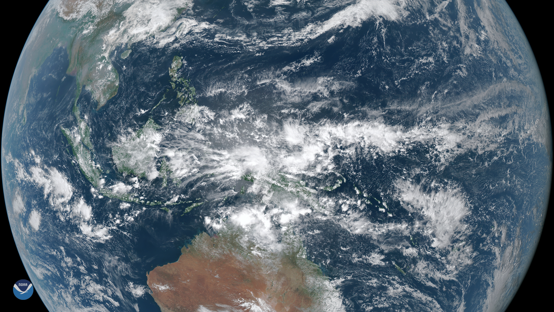
On March 23, 2020, the Himawari-8 satellite spied dense clouds producing heavy rain over Indonesia. Located between the Indian and…
Satellite Snapshots
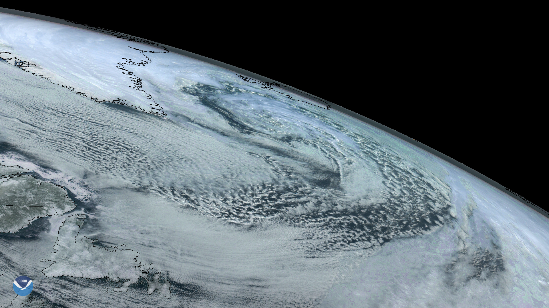
On Sunday, March 22, 2020, the GOES East satellite captured imagery of a large extratropical mid-latitude cyclone in the North…
Satellite Snapshots

Hurricane Dorian—shown here in an image created by the Visible Infrared Imaging Radiometer Suite (VIIRS) on September 1, 2019…
Satellite Snapshots
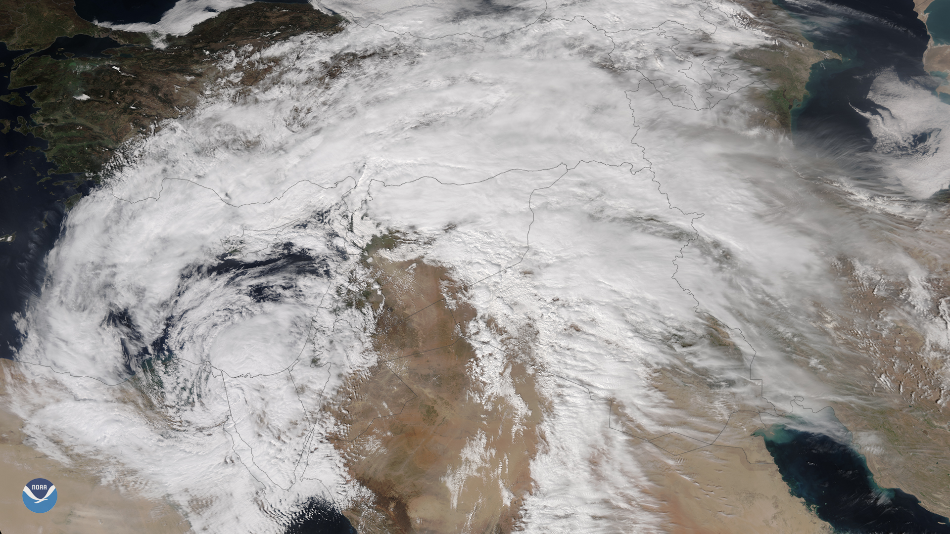
March 13, 2020 An unusually powerful mid-latitude cyclone that formed rapidly over Egypt on Thursday, March 12, 2020, is wreaking havoc in the Middle…
Satellite Snapshots
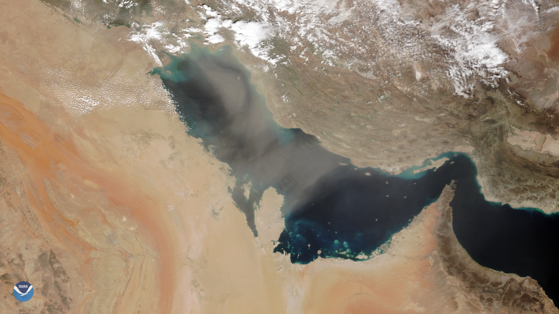
As NOAA-20 passed over the Middle East on March 8, 2020, it captured this image of dust blowing over the Persian Gulf. Dust storms are…
Satellite Snapshots
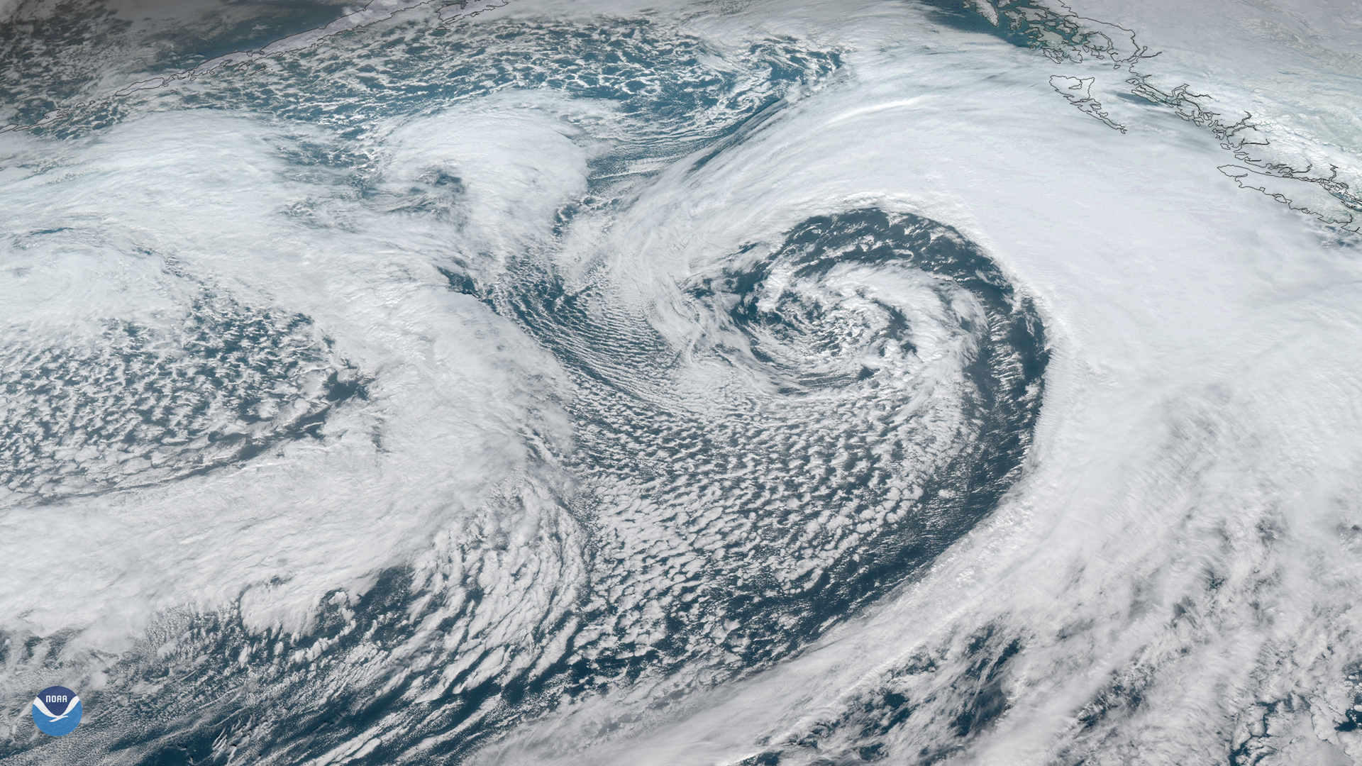
A strong area of low pressure is moving northward across Alaska’s eastern Aleutian Islands and western Peninsula. The system is…
Satellite Snapshots
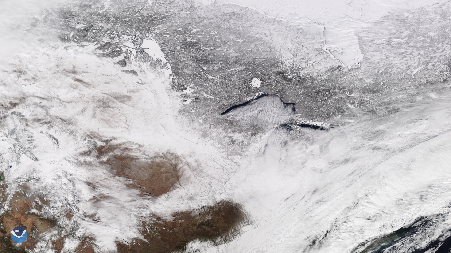
February 14, 2020 On Feb. 13, 2020, the NOAA-20 satellite viewed cloud streets over Lake Superior, signifying a cold air mass on the move. In fact,…