
Satellite Snapshots
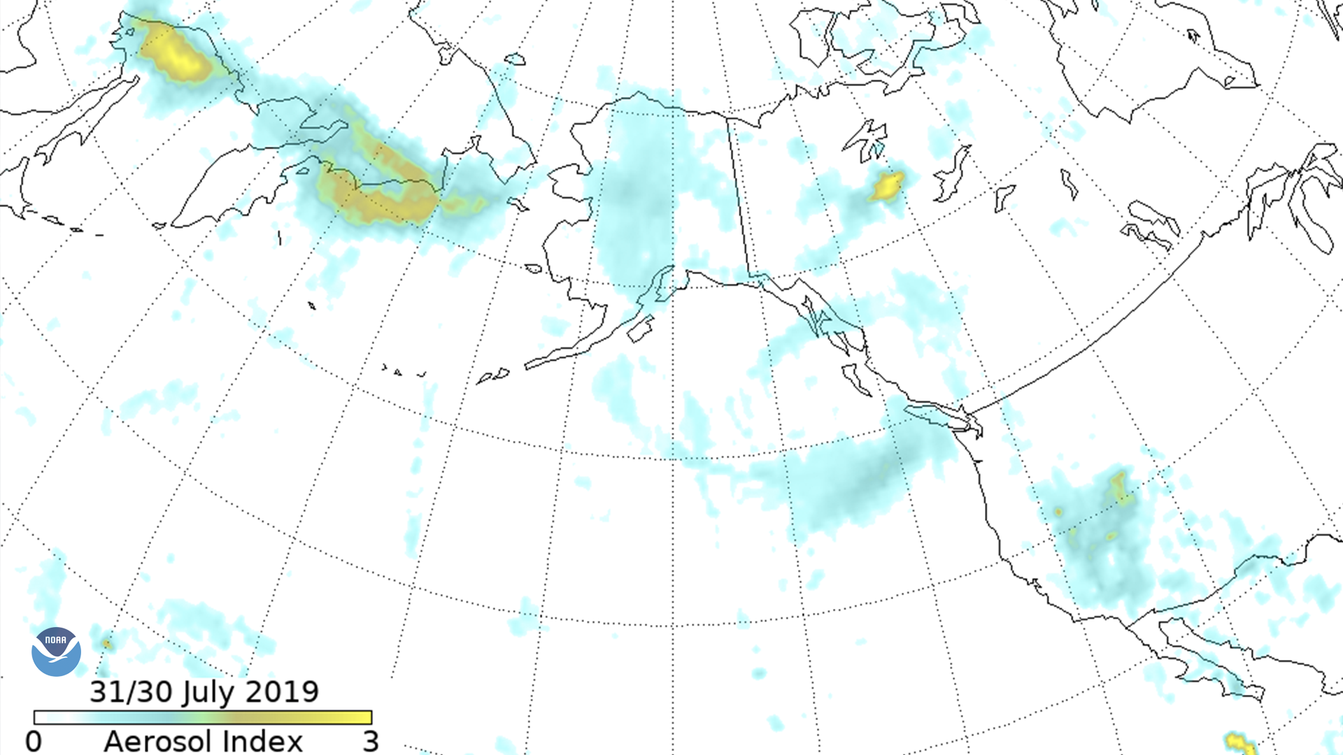
The Suomi-NPP Ozone Mapping and Profiler Suite (OMPS) aerosol index shows smoke moving across eastern Russia into Alaska, down the west…
Satellite Snapshots
The Suomi-NPP Ozone Mapping and Profiler Suite (OMPS) aerosol index shows smoke moving across eastern Russia into Alaska, down the west…
Feature Story
From 10,000 feet above ground, pilots can spot the glow of a fire. Data from satellites and aircraft help make firefighting decisions.
Satellite Snapshots
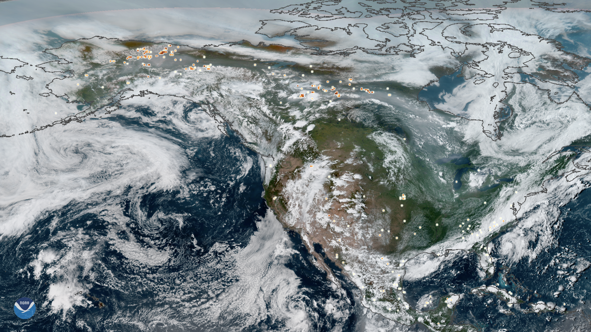
This true-color composite image of smoke from Arctic wildfires spreading across Alaska and Canada was captured by both GOES East and…
Satellite Snapshots
This true-color composite image of smoke from Arctic wildfires spreading across Alaska and Canada was captured by both GOES East and…
Satellite Snapshots
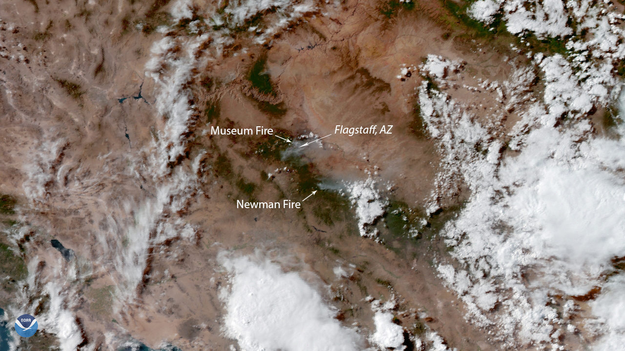
NOAA’s GOES West satellite zoomed in on two wildfires near Flagstaff, Ariz. on July 23, 2019. The Museum Fire , currently searing…
Satellite Snapshots
NOAA’s GOES West satellite zoomed in on two wildfires near Flagstaff, Ariz. on July 23, 2019. The Museum Fire , currently searing…
Satellite Snapshots
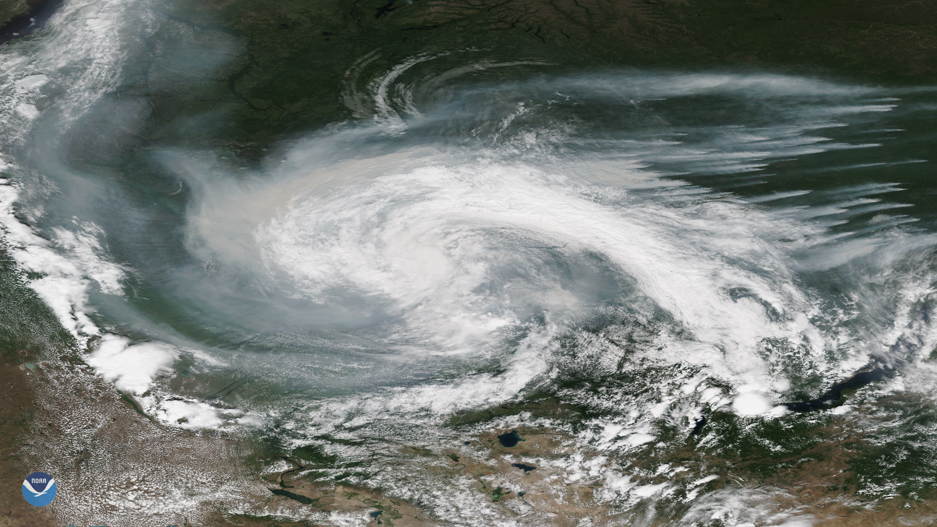
Smoke from active wildfires burning across northern Russia got caught in a low pressure system near the Verkhne-Tazovsky State Natural…