
Feature Story
The GOES-R series satellites will provide continuous weather monitoring. The new generation GOES-R satellites will carry significant improvements and technology innovation on board.
Feature Story

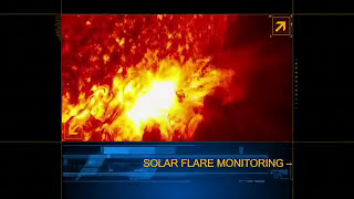
GOES-R will be a game changer for forecasting across the U.S., but did you know Earth’s weather is not the only weather the satellite will monitor?
Feature Story

The GOES-R satellite reached another major milestone on August 22, 2016, as it flew from Littleton, Colorado to Kennedy Space Center in Florida.
Satellite Snapshots
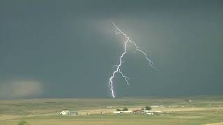
Where there's lightning, there's a strong chance of severe weather. The revolutionary Geostationary Lightning Mapper (GLM ) instrument on the new…
Satellite Snapshots

Weather generally blows in from over the horizon, and the GOES-R satellite will keep an eye on what's coming. But GOES-R will also monitor space…
Feature Story

2,300 miles is a long way, but locked in orbit above the equator, it's home sweet home for a weather satellite, the nation's newest, called GOES-R.
Satellite Snapshots

How will NOAA’s GOES-R satellite get from its current home in Colorado to Kennedy Space Center for launch in October 2016? Watch this fun video to…
Feature Story
How will NOAA’s GOES-R satellite get from its current home in Colorado to Kennedy Space Center for launch in October 2016? Watch this fun video.