
Satellite Snapshots
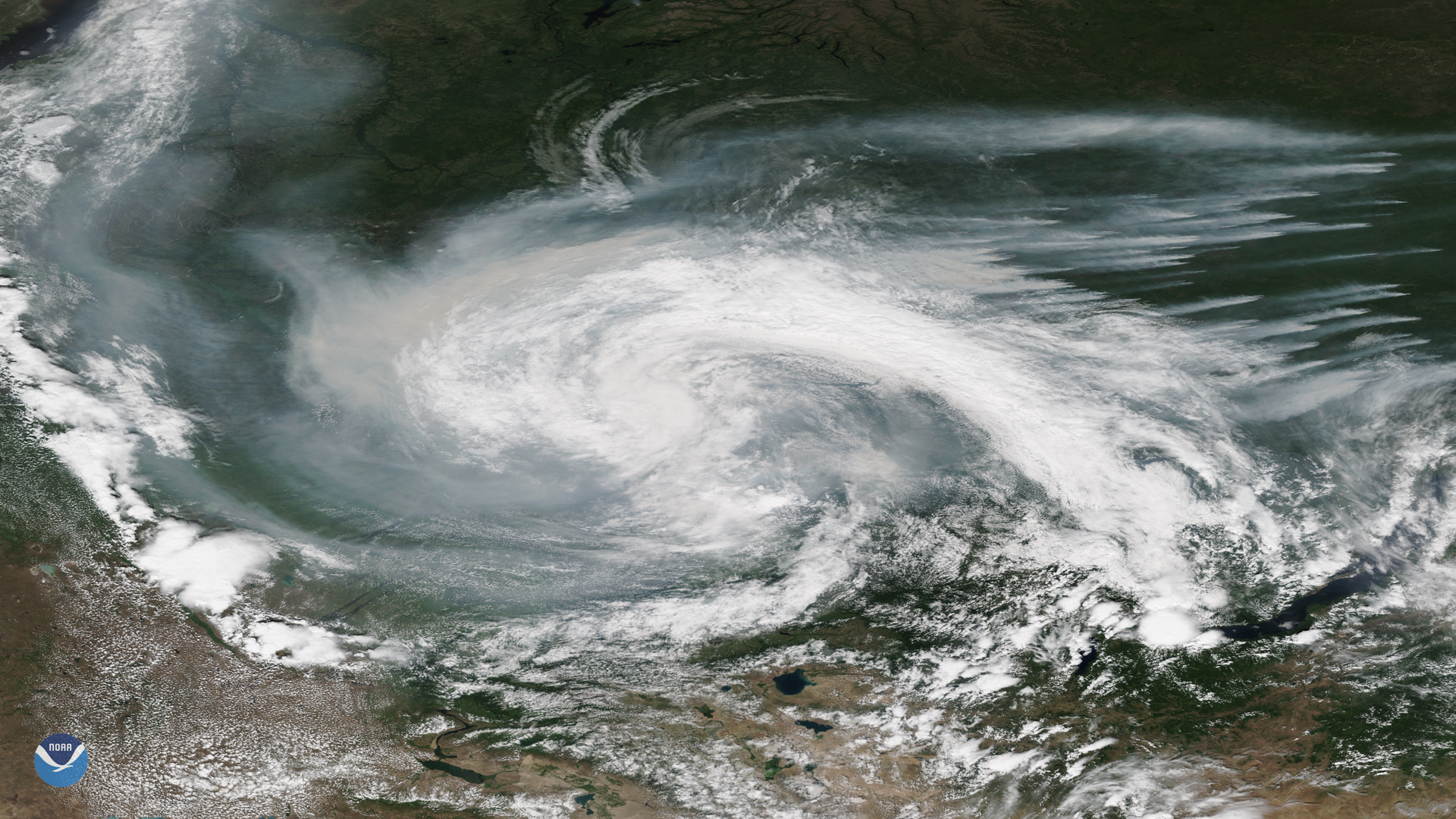
Smoke from active wildfires burning across northern Russia got caught in a low pressure system near the Verkhne-Tazovsky State Natural…
Satellite Snapshots
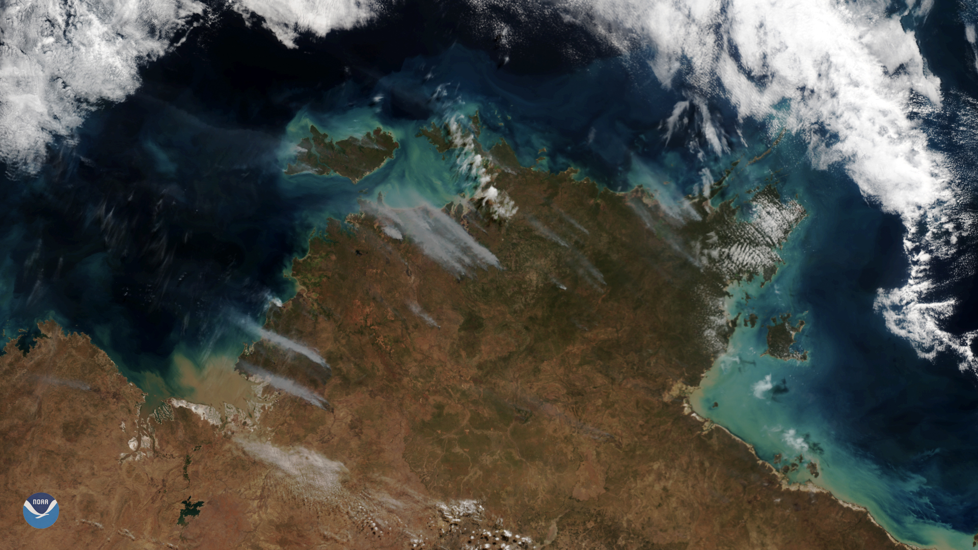
Clear skies over Australia on July 16, 2019, gave the NOAA-20 polar-orbiting satellite an unobstructed view of smoke plumes from…
Satellite Snapshots
Clear skies over Australia on July 16, 2019, gave the NOAA-20 polar-orbiting satellite an unobstructed view of smoke plumes from…
Satellite Snapshots
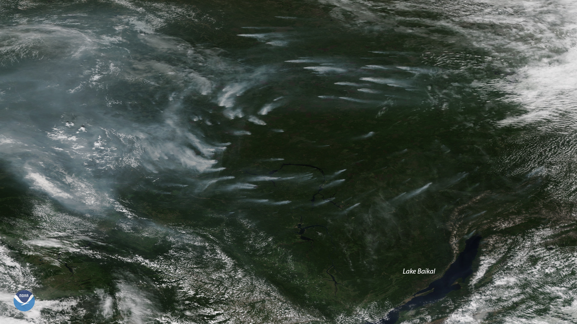
Plumes of smoke from more than a dozen large, active wildfires burning northwest of Russia’s Lake Baikal are seen in this NOAA-20…
Satellite Snapshots
Plumes of smoke from more than a dozen large, active wildfires burning northwest of Russia’s Lake Baikal are seen in this NOAA-20…
Satellite Snapshots
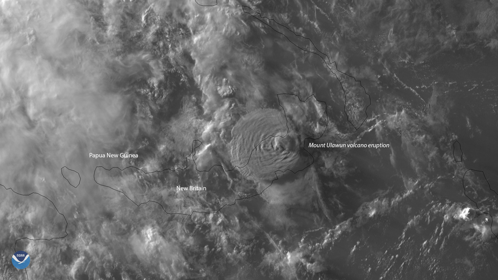
About 5,000 people were forced to flee their homes Wednesday, June 26, 2019, when Mount Ulawun on the island of New Britain in Papua…
Satellite Snapshots
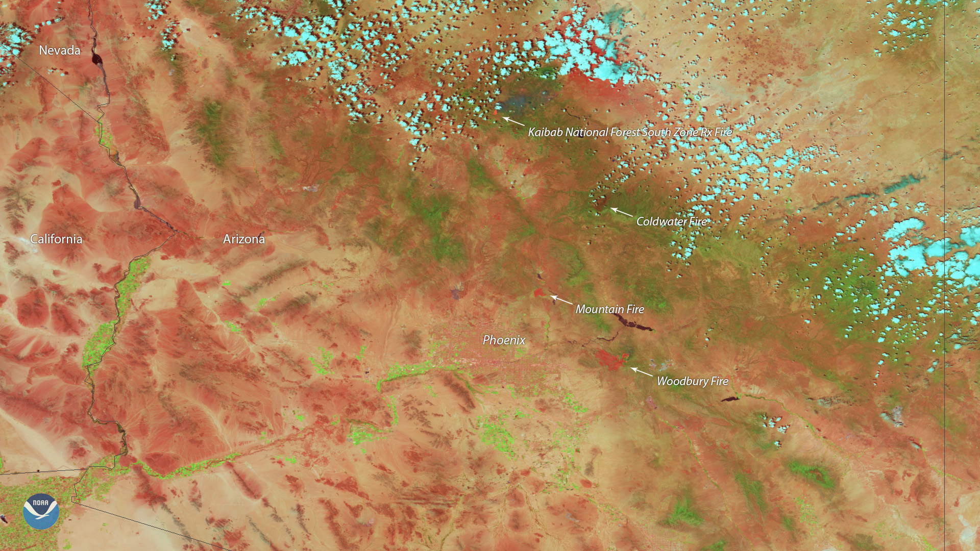
Heat from the Woodbury Fire, located east of Phoenix, is shown in red in this false-color imagery captured by the Suomi-NPP VIIRS instrument.
Satellite Snapshots
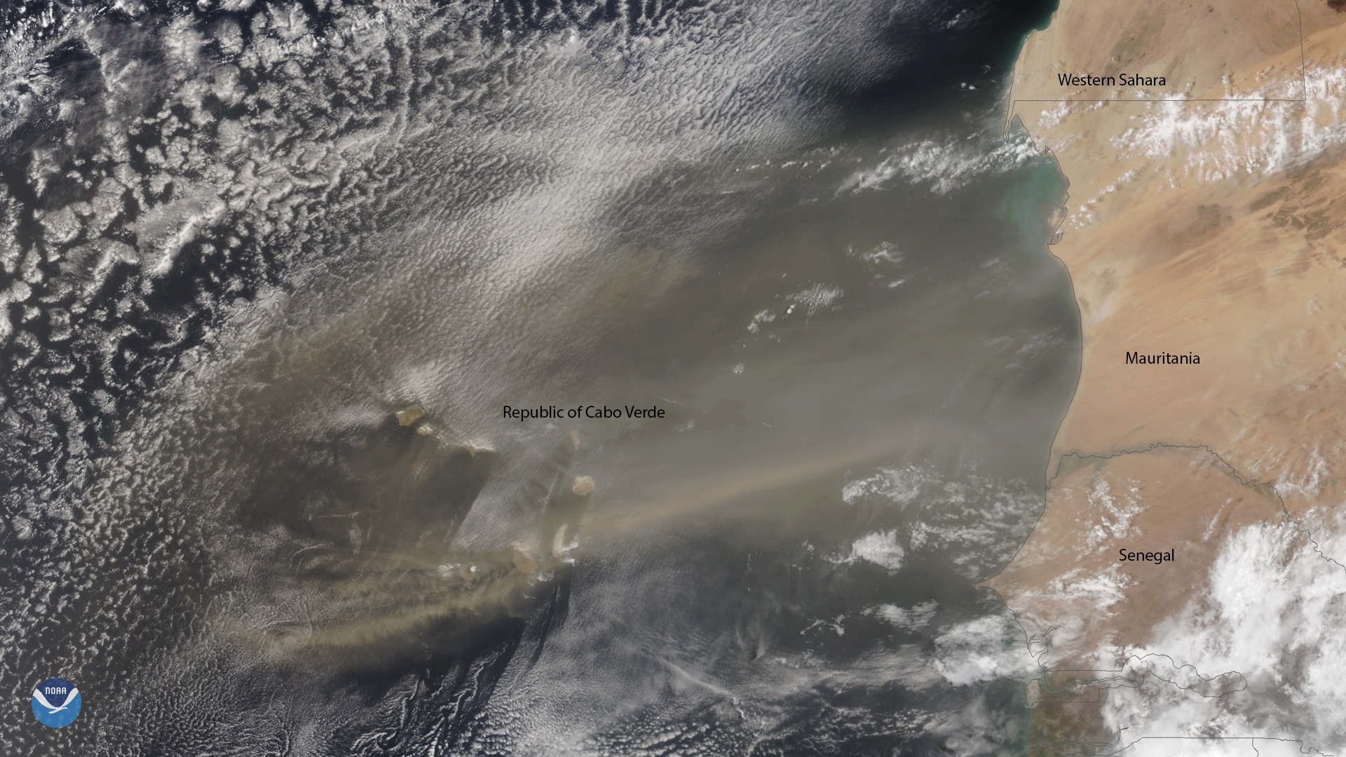
A plume of Saharan dust reaches beyond the Republic of Cabo Verde, which is located approximately 350 miles off the coast of northwest Africa.