
Satellite Snapshots
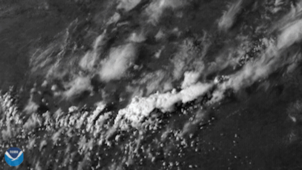
The GOES East satellite, on the evening of April 12, 2021, viewed a supercell thunderstorm bubble up in central Texas, part of several…
Satellite Snapshots
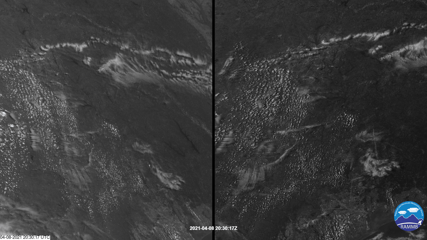
Both GOES West and GOES East saw an isolated, or discrete, supercell storm burst over East Texas.
Satellite Snapshots
The timelapse seen above in our Image of the Day captures the supercell thunderstorms that swept over parts of the landscape of the…
Earth from Orbit
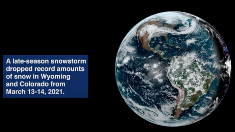
Satellite imagery shows a late-season snowstorm that dropped record-breaking amounts of snowfall in Cheyenne, Wyoming and Denver, Colorado.
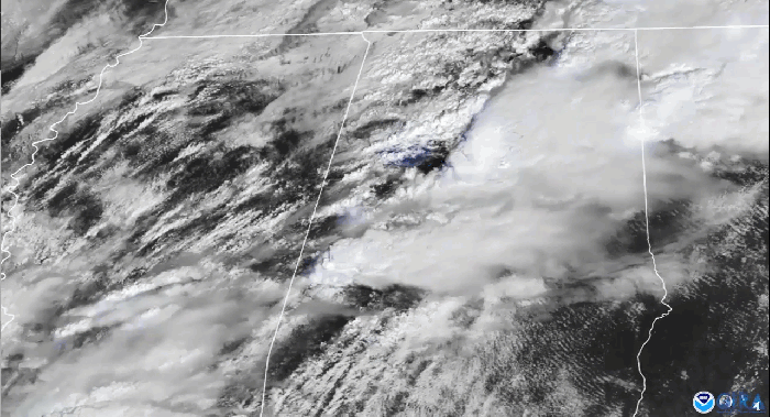
Satellite Snapshots
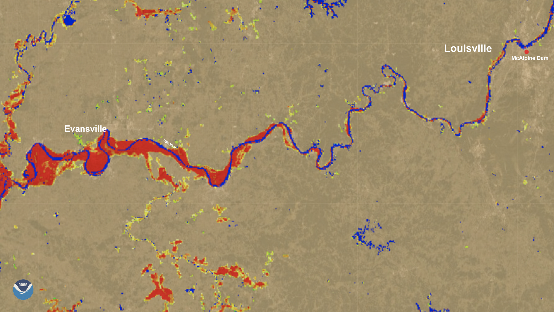
On March 6, the River Flood product showed flooding along the Ohio River on the Kentucky/Illinois/Indiana border.
Satellite Snapshots
Ten years ago today, a 9.1 magnitude earthquake struck off the northeastern coast of Honshu on the Japan Trench, a…
Satellite Snapshots
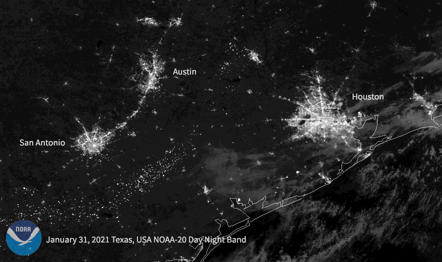
Following a historic winter storm across the central/southern U.S. this week, the NOAA-20 satellite caught the resulting power outages in Texas.
Satellite Snapshots
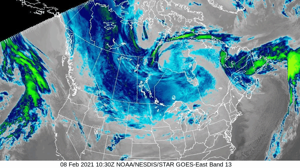
As a dip in the polar vortex continues to bring bitter temperatures to North America, the air over the northern reaches of the continent was so frigid on the morning of Monday, Feb. 8, 2021, that the GOES East satellite perceived the cold air along…