
Satellite Snapshots
As wildfires continue to rage across parts of Alberta, Canada, smoke from the blazes is reaching beyond North America.
Satellite Snapshots
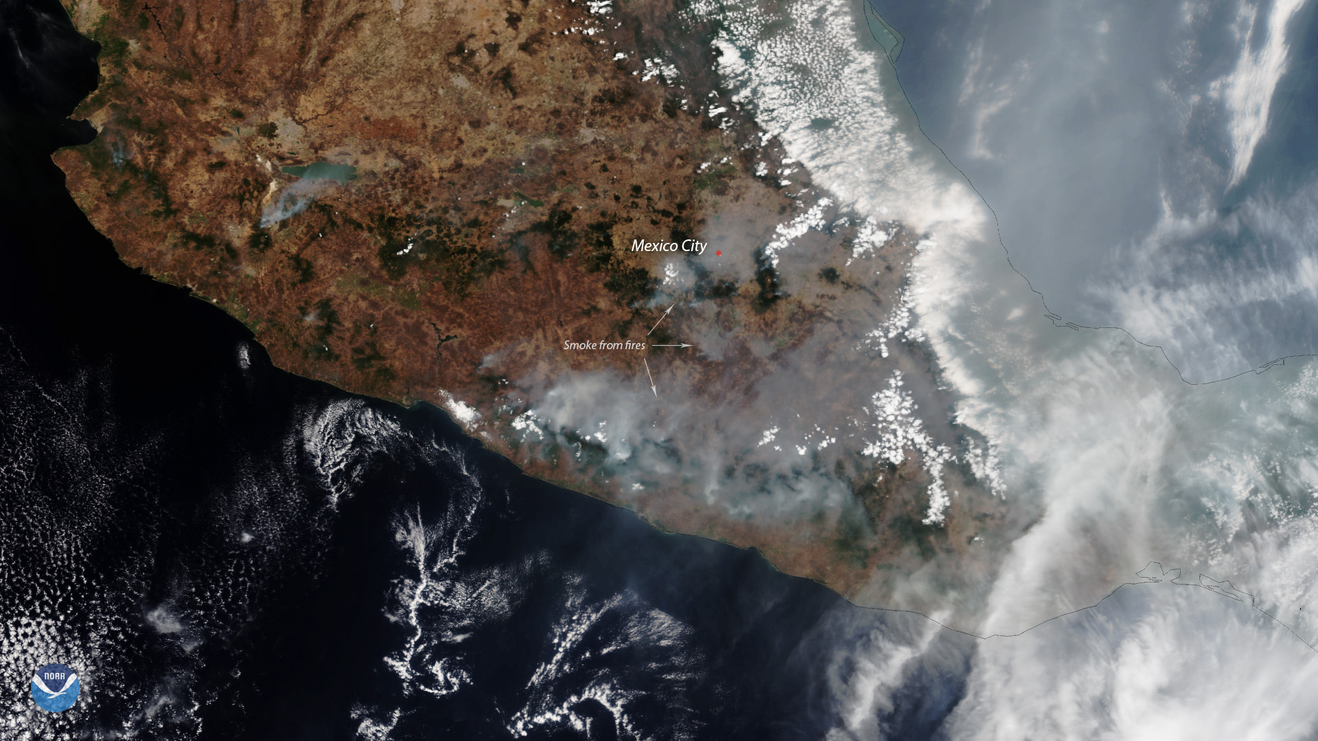
Mexico’s Megalópolis Environmental Commission urges residents to stay indoors as smoke inundates Mexico’s densely populated capital.
Satellite Snapshots
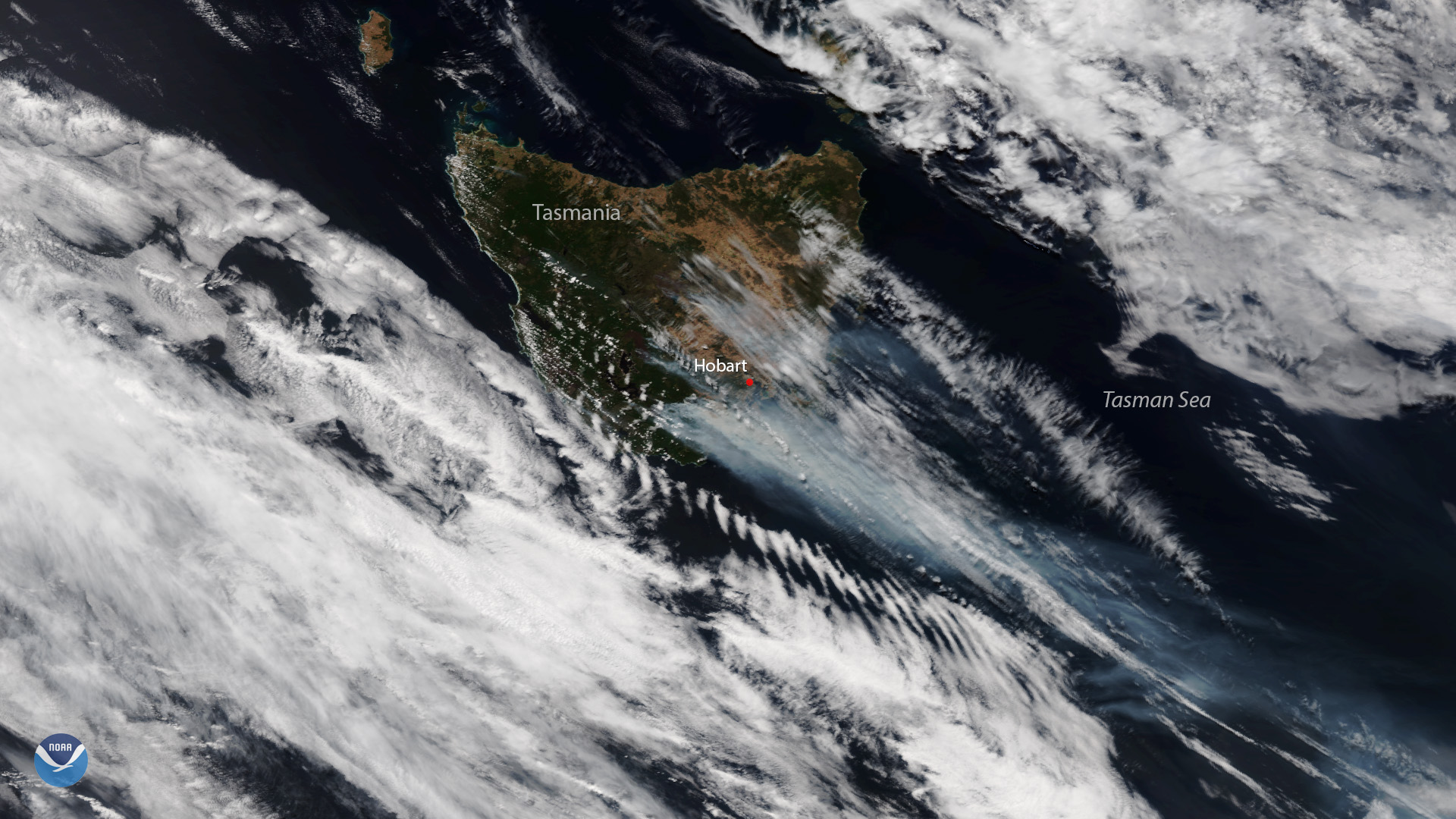
Plumes of smoke are seen over the bushfire-ravaged Australian island state of Tasmania in this Jan. 28, 2019 image from the NOAA-20…
Satellite Snapshots
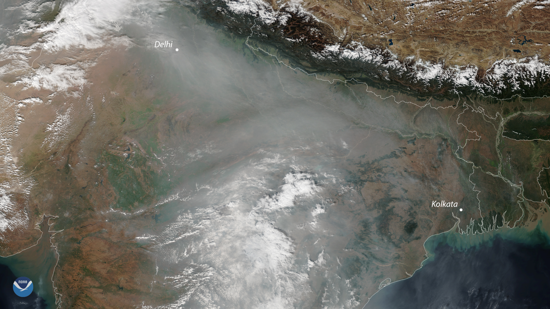
A cloud of unhealthy air pollution shrouded the skies of northern India again this week. It's a common sight in satellite images…
Satellite Snapshots
A cloud of unhealthy air pollution shrouded the skies of northern India again this week. It's a common sight in satellite images…
Satellite Snapshots
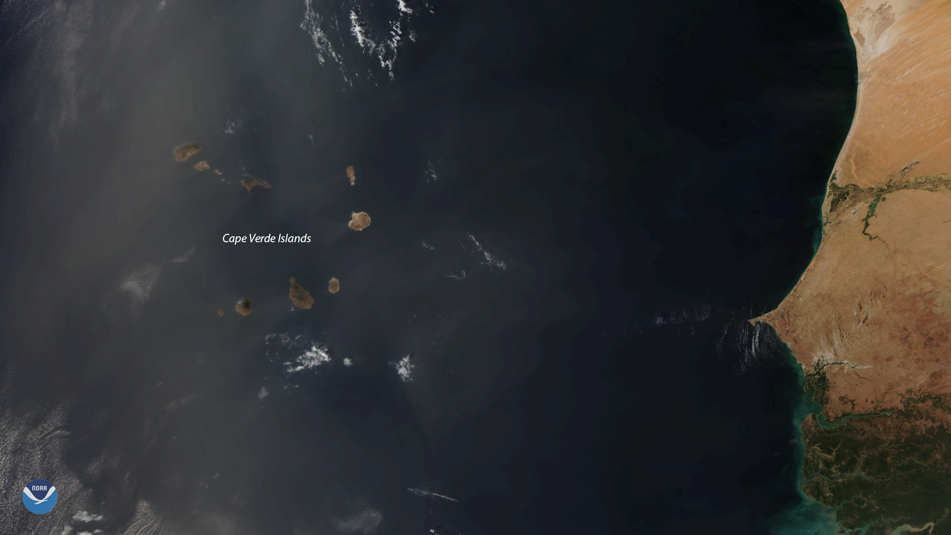
The NOAA-20 satellite viewed dust from the Sahara Desert be ingcarried by strong winds over the Cape Verde islands on Dec. 9, 2018.
Satellite Snapshots
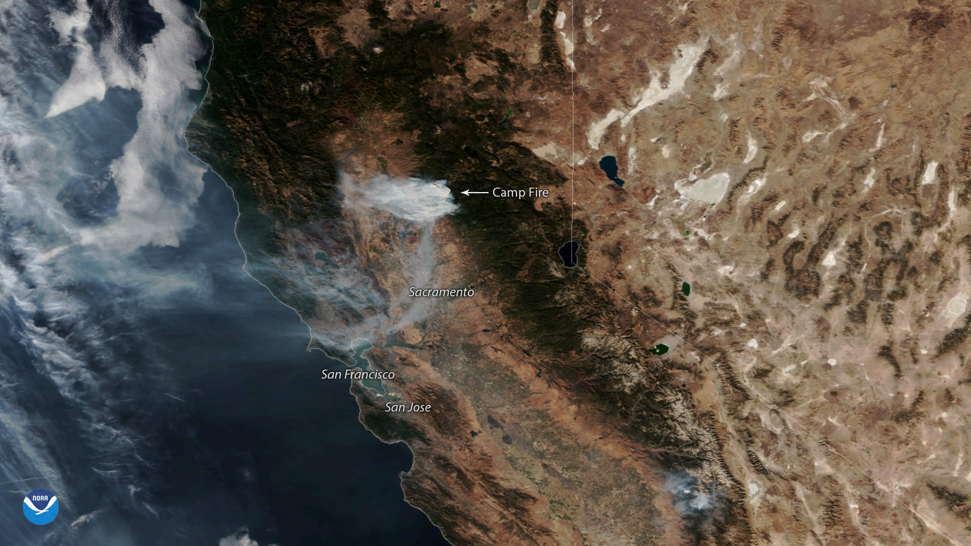
NOAA-20 captured this imagery of the fast-moving Camp Fire in Northern California on Nov. 12, 2018.
Satellite Snapshots

Plumes of smoke from California's Camp Fire are seen stretching across portions of the state in this NOAA-20 satellite image.