
Satellite Snapshots
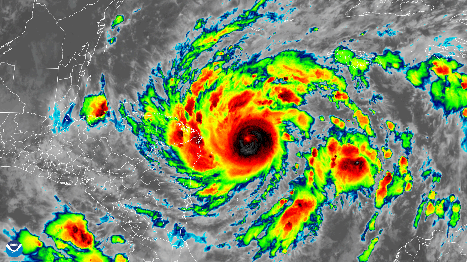
Early on November 2, 2020, the GOES-East satellite watched Tropical Storm Eta strengthen into a hurricane over the Caribbean Sea…
Satellite Snapshots
On October 28, 2020, NOAA’s GOES-East satellite viewed Hurricane Zeta make landfall at Cocodrie, Louisiana as a strong Category-2…
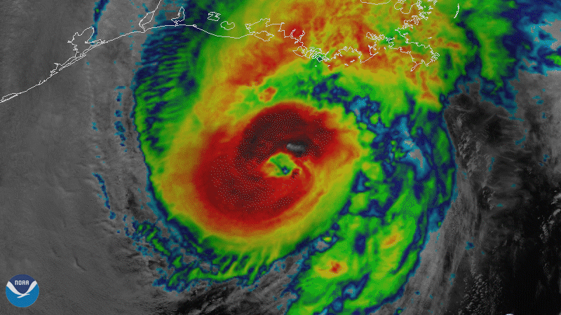
Satellite Snapshots
On October 28, 2020, NOAA’s GOES-East satellite viewed Hurricane Zeta make landfall at Cocodrie, Louisiana as a strong Category-2…
Satellite Snapshots
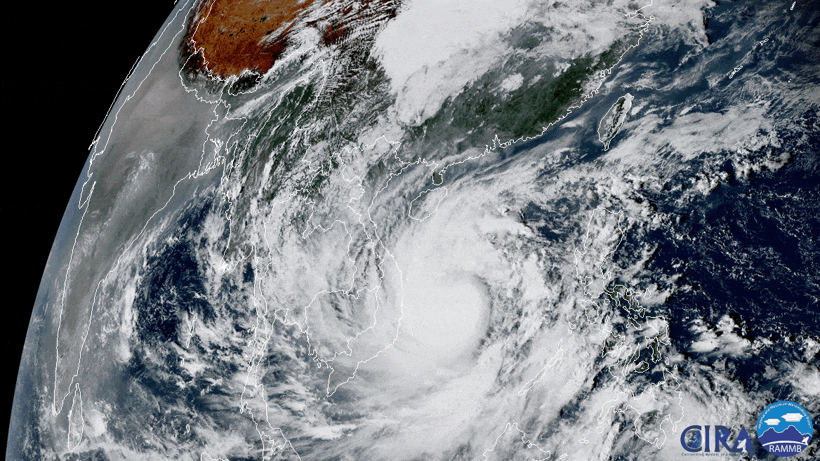
On Oct. 27, 2020, the Himawari-8 satellite, operated by our partners at the Japan Meteorological Agency , looked down from its…
Satellite Snapshots
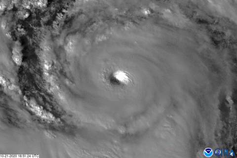
On Wednesday, Oct 21, 2020, The GOES-East satellite watched Hurricane Epsilon quickly intensify from a Category-1 storm to a major…
Satellite Snapshots
On Wednesday, Oct 21, 2020, The GOES-East satellite watched Hurricane Epsilon quickly intensify from a Category-1 storm to a major…
Satellite Snapshots
On Oct. 20, 2020, NOAA’s GOES-East satellite captured this four-hour GeoColor loop of Tropical Storm Epsilon, which strengthened…
Satellite Snapshots
On Oct. 20, 2020, NOAA’s GOES-East satellite captured this four-hour GeoColor loop of Tropical Storm Epsilon, which strengthened…