
Satellite Snapshots

About 5,000 people were forced to flee their homes Wednesday, June 26, 2019, when Mount Ulawun on the island of New Britain in Papua…
Satellite Snapshots
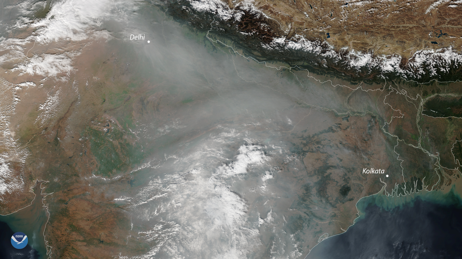
A cloud of unhealthy air pollution shrouded the skies of northern India again this week. It's a common sight in satellite images…
Feature Story
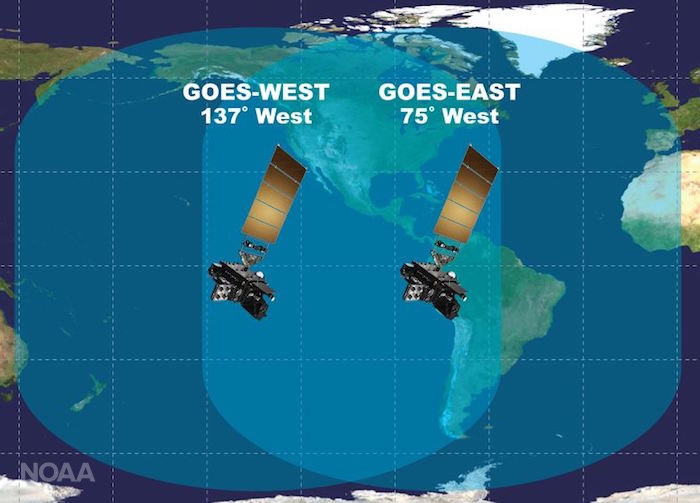
Excitement is building for the launch of GOES-S. On March 1, 2018, NOAA’s newest geostationary satellite will launch into…
Satellite Snapshots
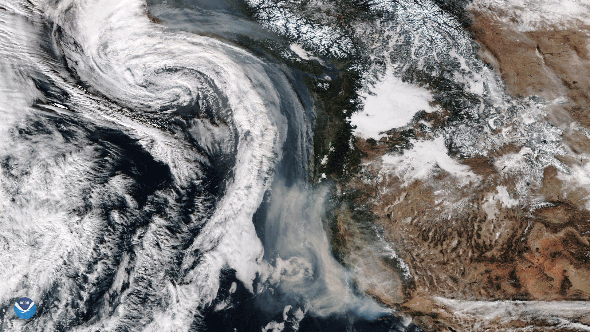
The Suomi-NPP satellite captured this image of smoke from California's wildfires being drawn northward into an approaching storm system.
Feature Story
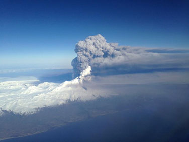
Data from polar-orbiting satellites provide forecasters with critical information on hazards like ash from volcanic eruptions.