
Satellite Snapshots
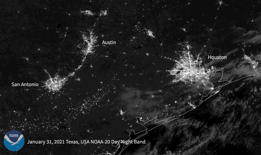
Following a historic winter storm across the central/southern U.S. this week, the NOAA-20 satellite caught the resulting power outages in Texas.
Satellite Snapshots
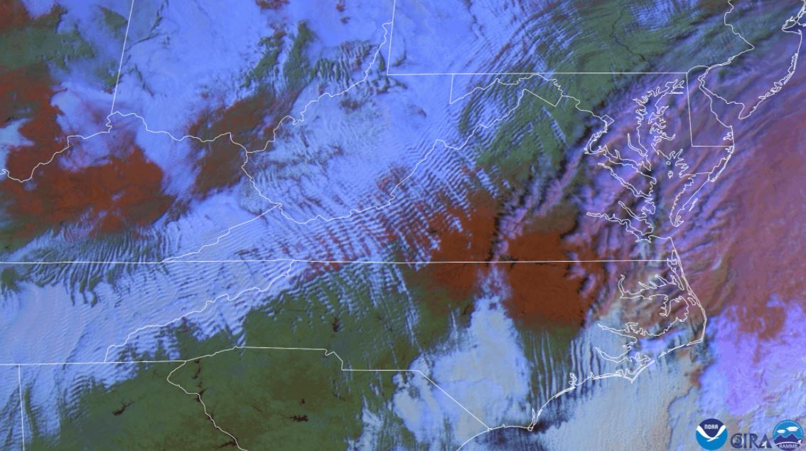
False color satellite imagery shows wave clouds and red snow on the ground.
Satellite Snapshots
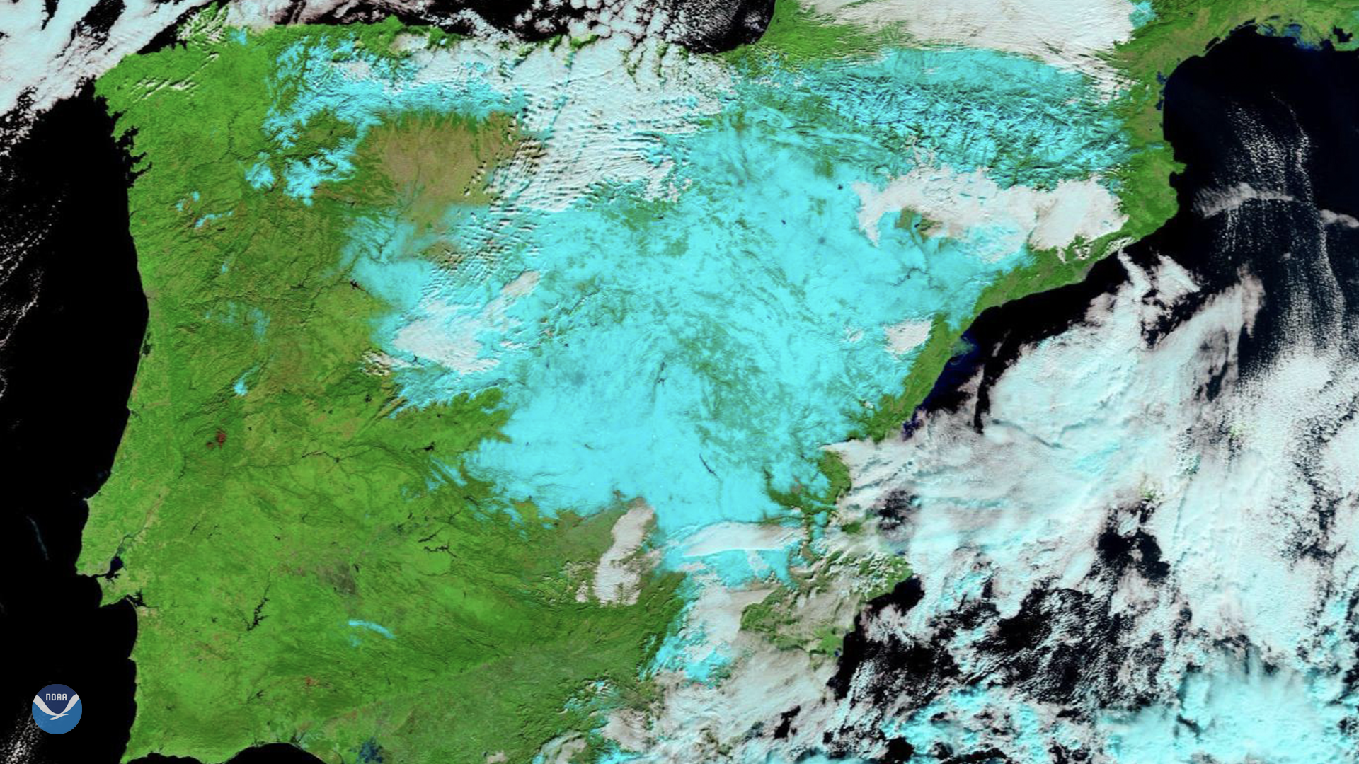
On Jan. 11, 2021, Europe’s Meteosat-11 satellite captured imagery of the aftermath of…
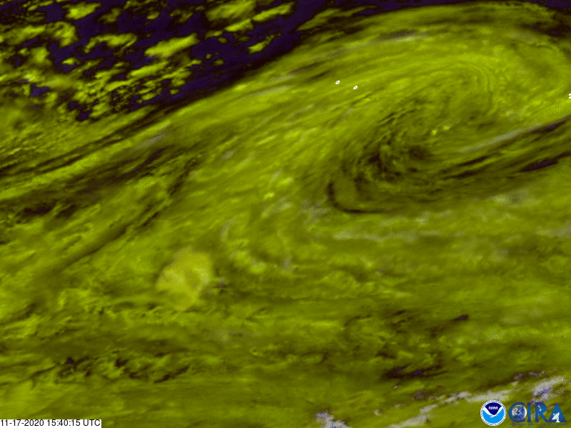
Satellite Snapshots
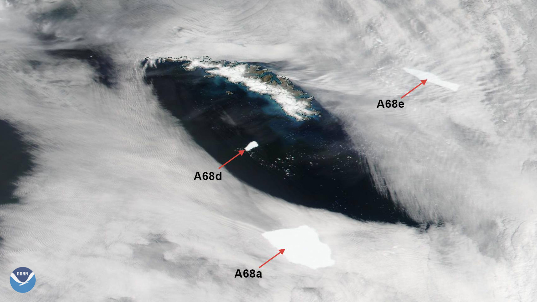
On Jan. 11, 2021, the NOAA-20 satellite viewed icebergs A-68A, A-68D, and A-68E move around South Georgia Island.
Satellite Snapshots
GOES East satellite captured this time-lapsed imagery of the massive ice block floating in the southern Atlantic Ocean
Satellite Snapshots
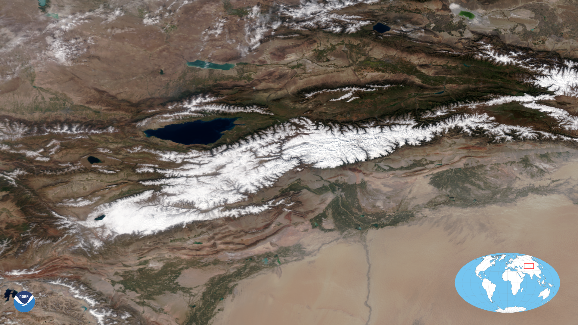
On Sept. 21, 2020, the NOAA-20 satellite was able to snap this cloudless True Color image of the snow-covered Tian Shan mountain…
Satellite Snapshots
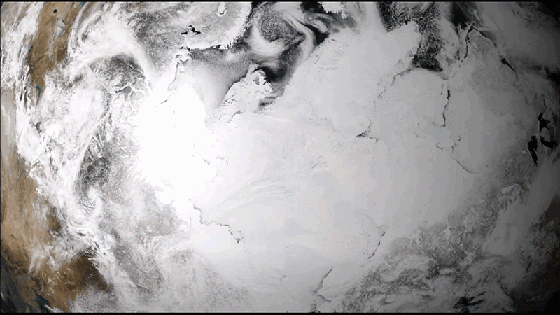
This animation shows the maximum-to-minimum melt cycle of Arctic sea ice for a single warm season spanning from April to September 2019.
Satellite Snapshots
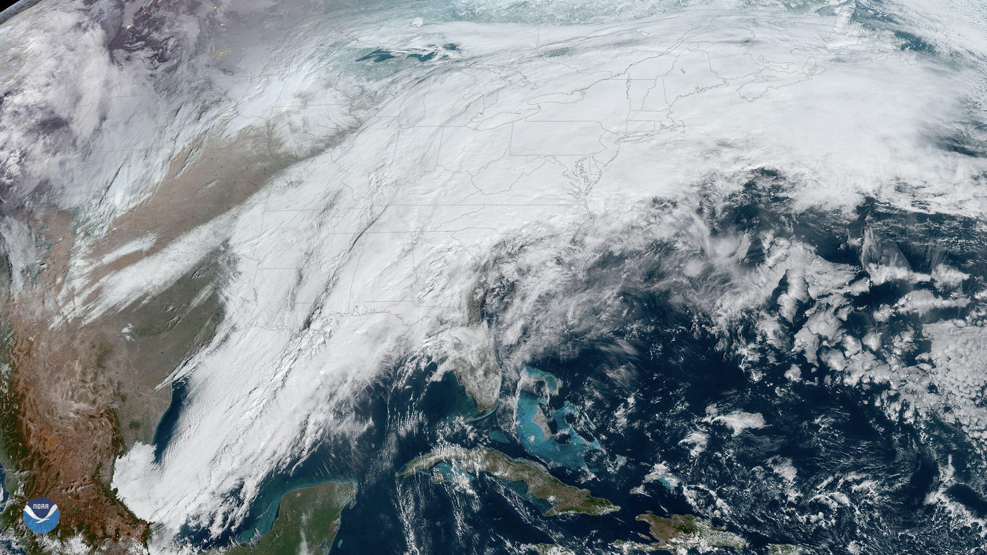
On Thursday, Feb. 6, 2020, the GOES-East satellite is watching a large winter storm stretching roughly 2,000 miles across the U.S.,…