
Satellite Snapshots
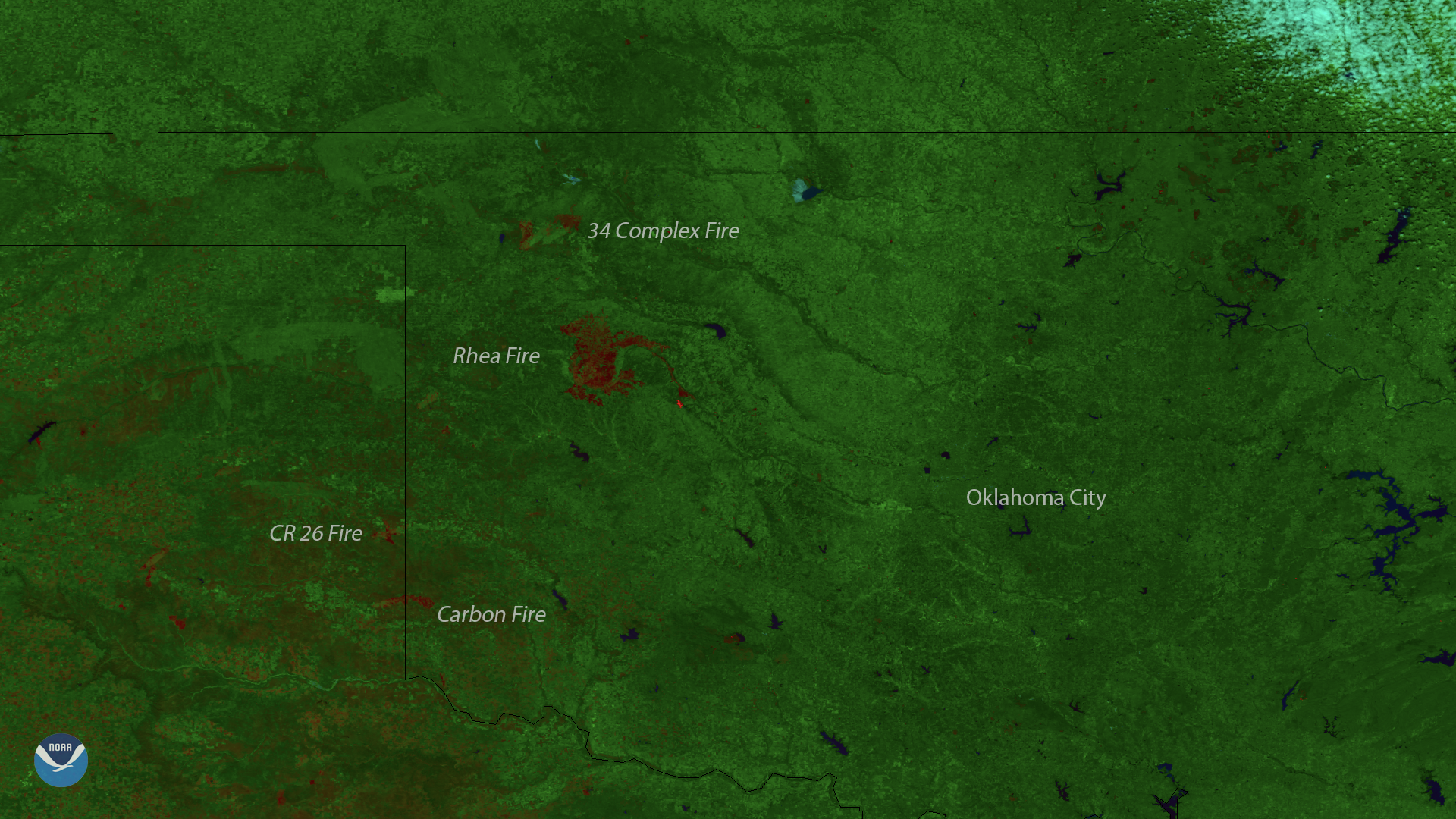
This image, captured by the Suomi NPP satellite's VIIRS instrument on April 15, 2018, shows locations of burn scars from the active…
Satellite Snapshots
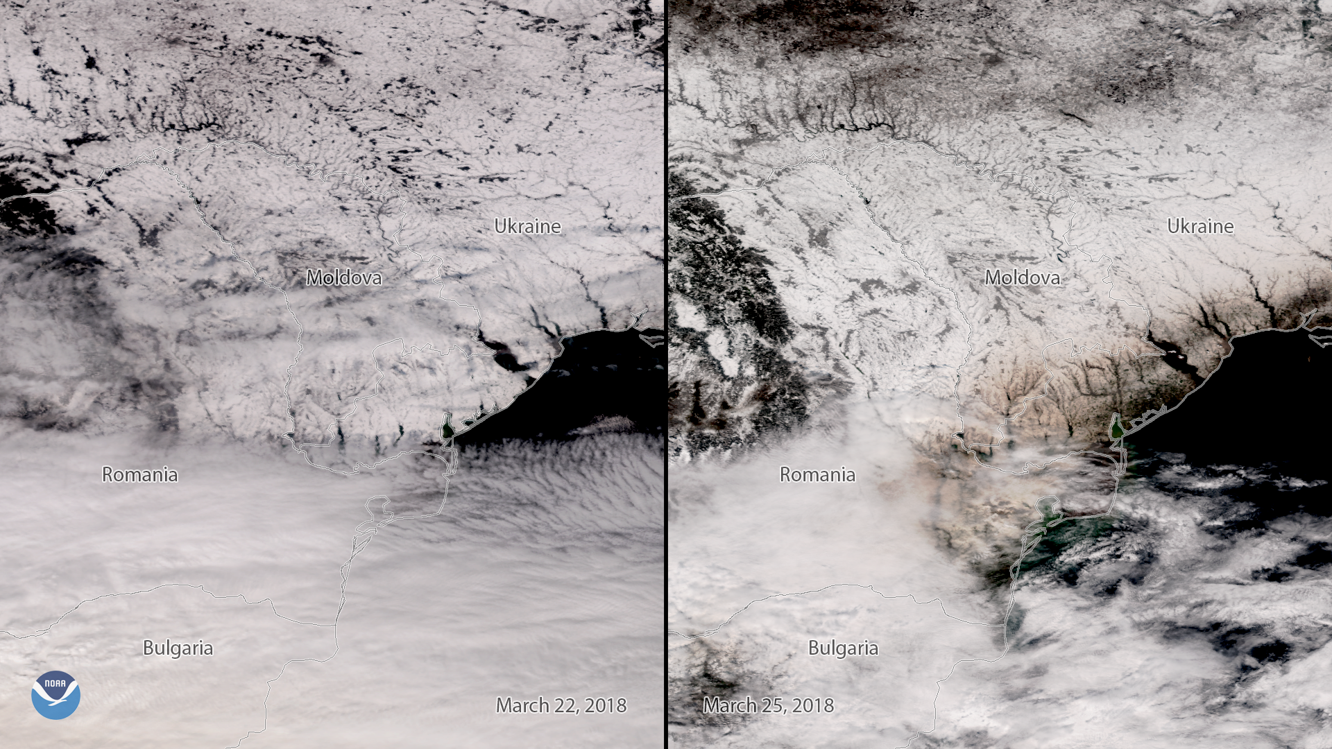
This side-by-side comparison from the Suomi NPP polar-orbiting satellite shows snow-covered Eastern Europe before and after a plume of…
Feature Story
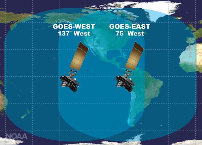
Excitement is building for the launch of GOES-S. On March 1, 2018, NOAA’s newest geostationary satellite will launch into…
Satellite Snapshots

NOAA's satellites have detected a plume of dust moving off the coast of Africa. Though quite common, this particular plume, also called the Saharan…
Satellite Snapshots
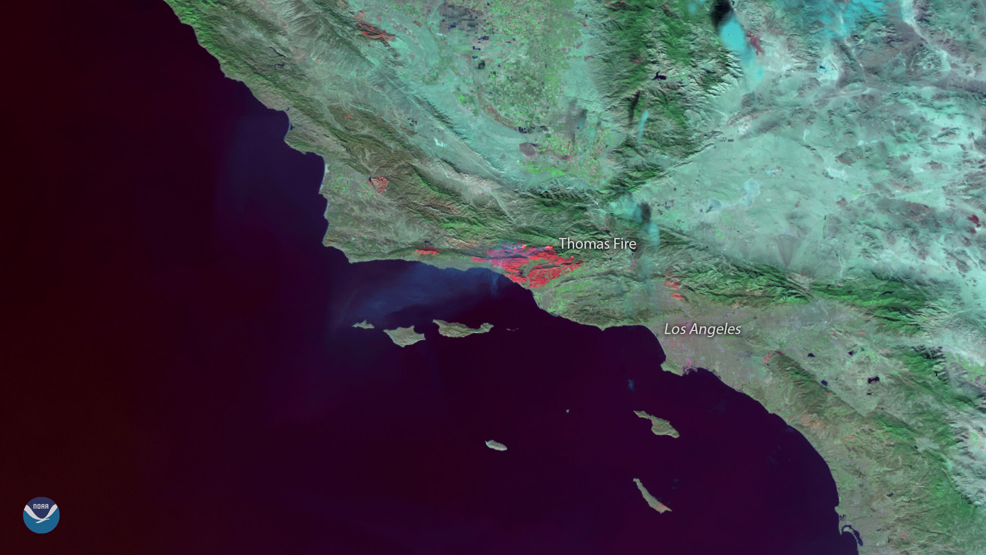
The Suomi NPP satellite's VIIRS instrument captured this image of burn scars from the massive Thomas Fire that has been raging in…
Satellite Snapshots
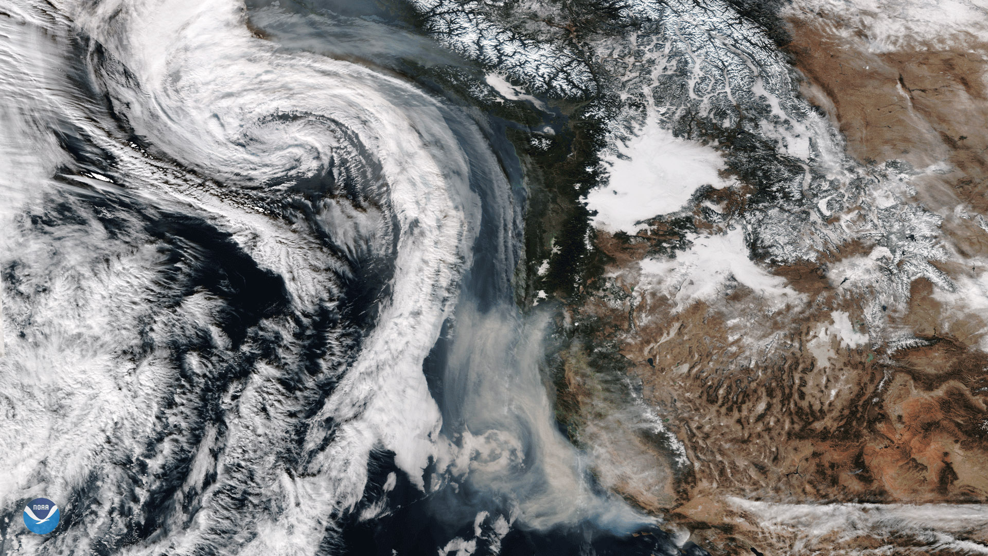
The Suomi-NPP satellite captured this image of smoke from California's wildfires being drawn northward into an approaching storm system.
Satellite Snapshots
The Suomi-NPP satellite captured this image of smoke from California's wildfires being drawn northward into an approaching storm system.
Satellite Snapshots
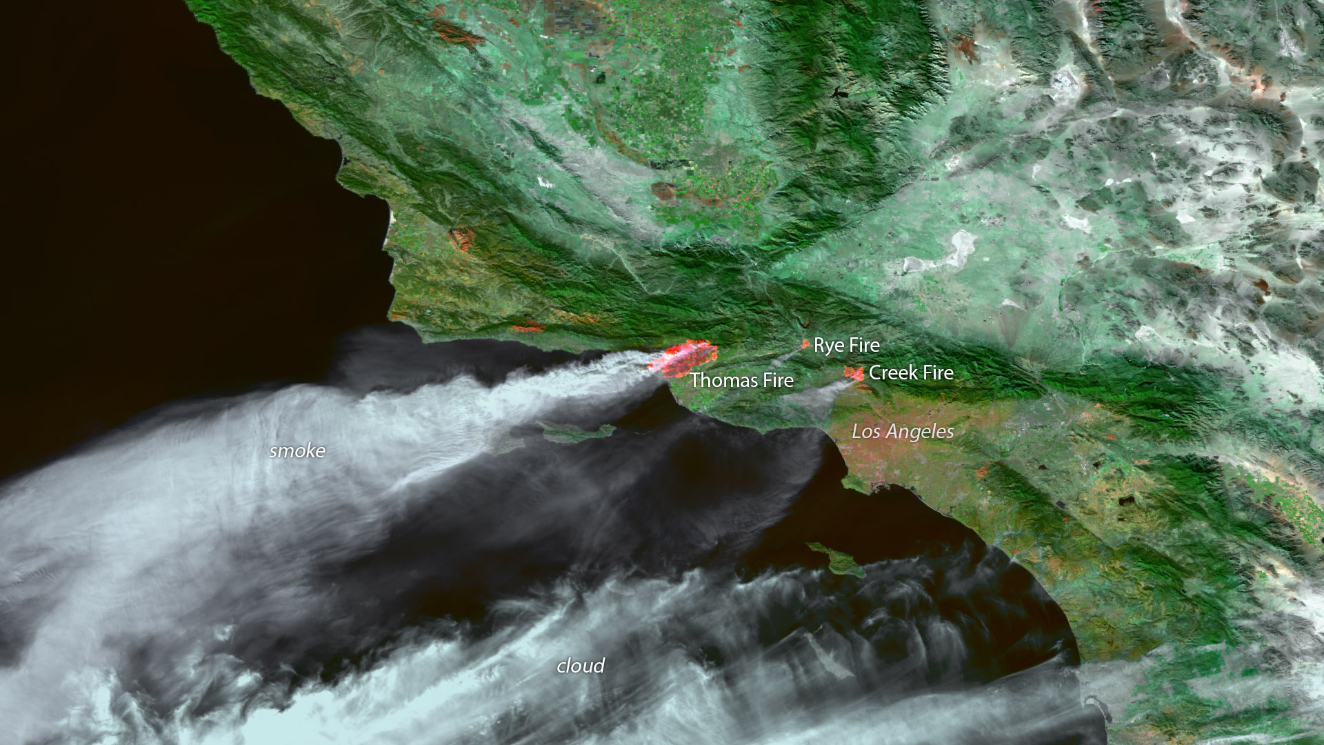
Fast-moving fires ignited this week in parts of Ventura, Oxnard, Santa Barbara and Los Angeles, California.