
Satellite Snapshots
The Visible Infrared Imaging Radiometer Suite (VIIRS) aboard the NOAA/NASA Suomi NPP satellite captured this color-enhanced infrared…
Feature Story
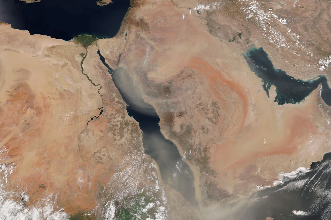
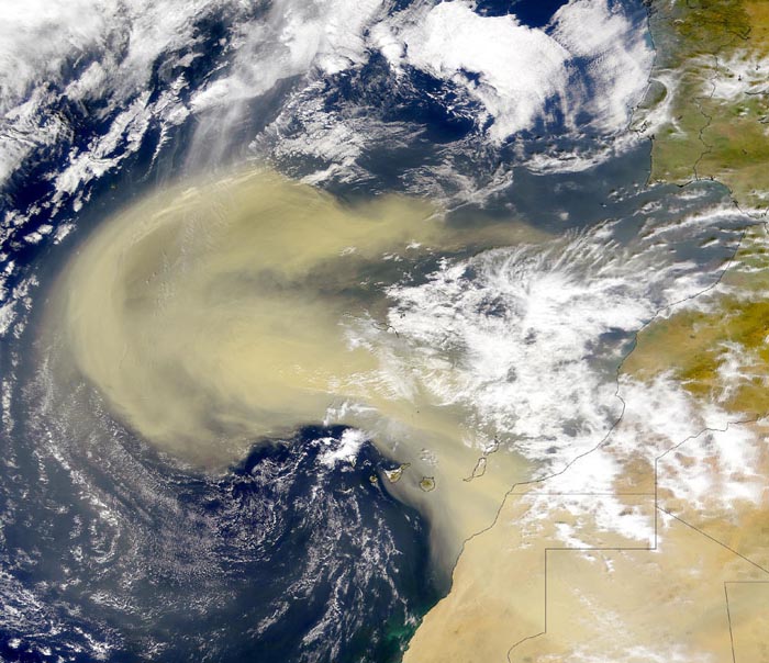
It's dusty out there. Beyond the research indicating the frequency of dust storms is on the rise around the world, scientists…
Feature Story
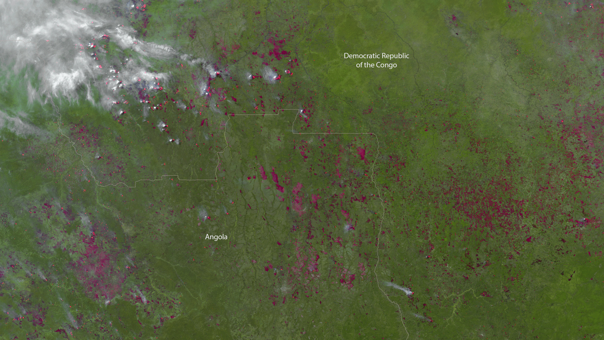
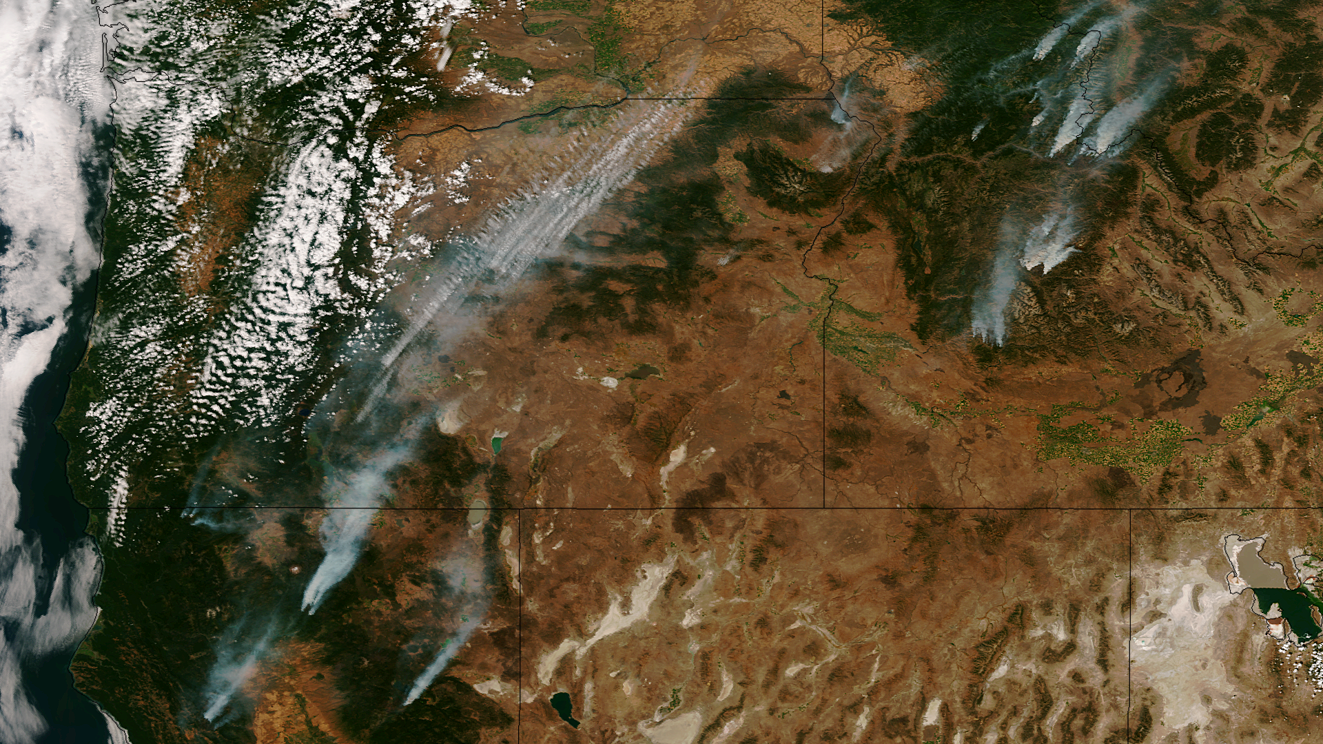
Fires, whether naturally occurring or man-made, have substantial impacts on both the landscape and air quality. Fortunately,…
Feature Story
Even though satellites can detect dust in the atmosphere, that does not mean it's easy for scientists to detect it in satellite imagery.
Feature Story
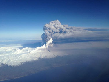
Data from polar-orbiting satellites provide forecasters with critical information on hazards like ash from volcanic eruptions.
Satellite Snapshots

Taken on August 10th, 2013 by the Landsat-8 satellite, this image shows the active fire areas along with burn scars for the McCan and…
Satellite Snapshots
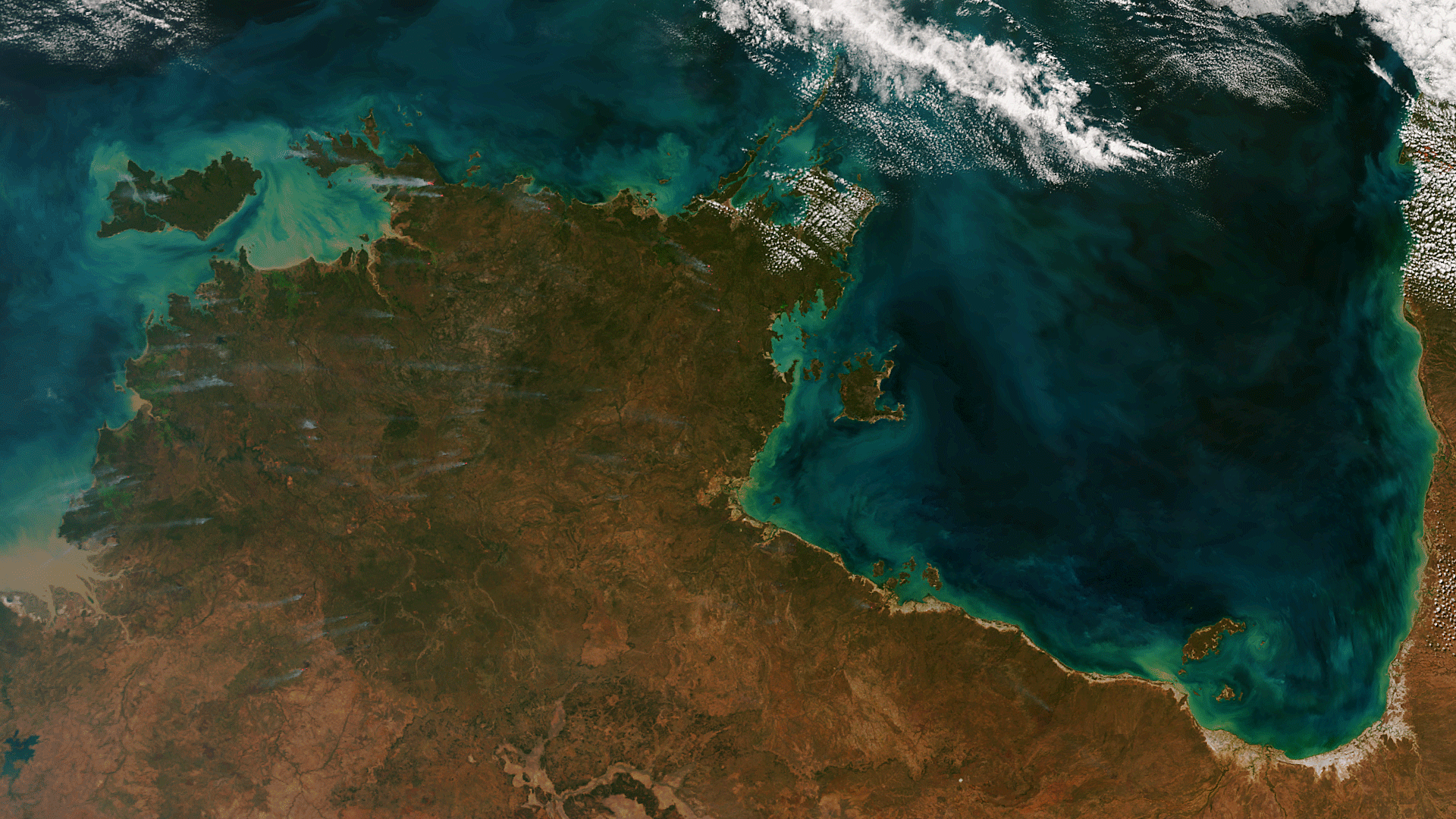
The Suomi NPP satellite captured an amazing image of northern Australia on June 25, 2013. Dozens of wildfires release wisps of smoke…
Satellite Snapshots
One orbit, or about 90 minutes, after passing over Hurricane Isaac in the Gulf of Mexico on August 28th, the Suomi NPP satellite…