
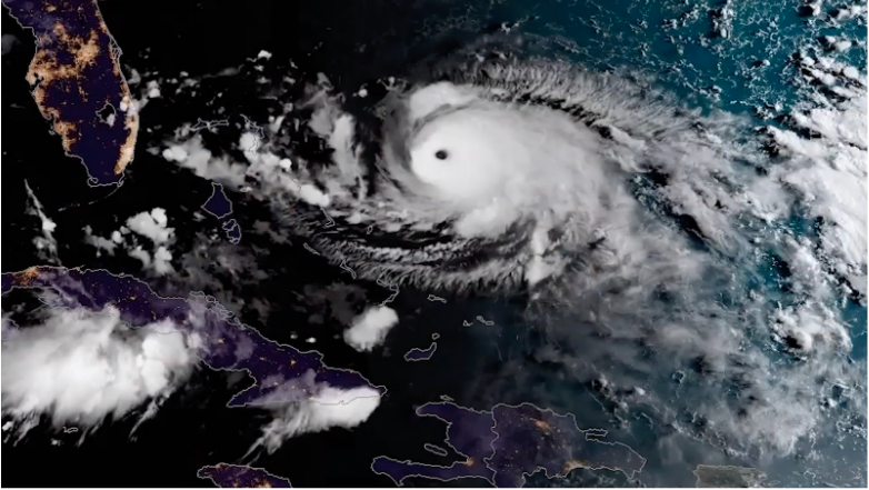
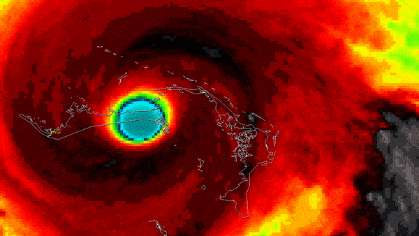
Satellite Snapshots

GOES-West captured this impressive view of the eye of Hurricane Douglas as it spun over the Pacific.
Satellite Snapshots
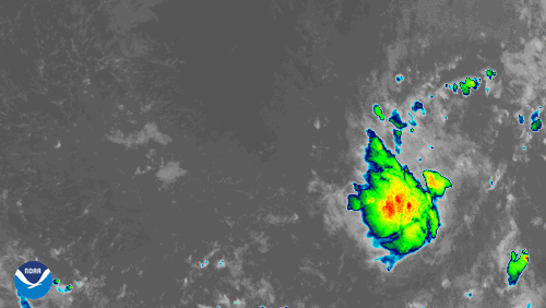
GOES-East zoomed in on newly-formed Tropical Storm Gonzalo.
Satellite Snapshots
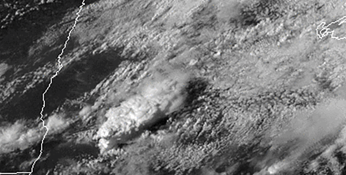
At least two tornadoes touched down across parts of west-central and north-central Minnesota on Wednesday, July 8, 2020.
Feature Story
The powerful hurricane that struck Galveston, Texas on September 8, 1900, killing an estimated 8,000 people and destroying more…
Feature Story
The powerful hurricane that struck Galveston, Texas on September 8, 1900, killing an estimated 8,000 people and destroying more…
Feature Story
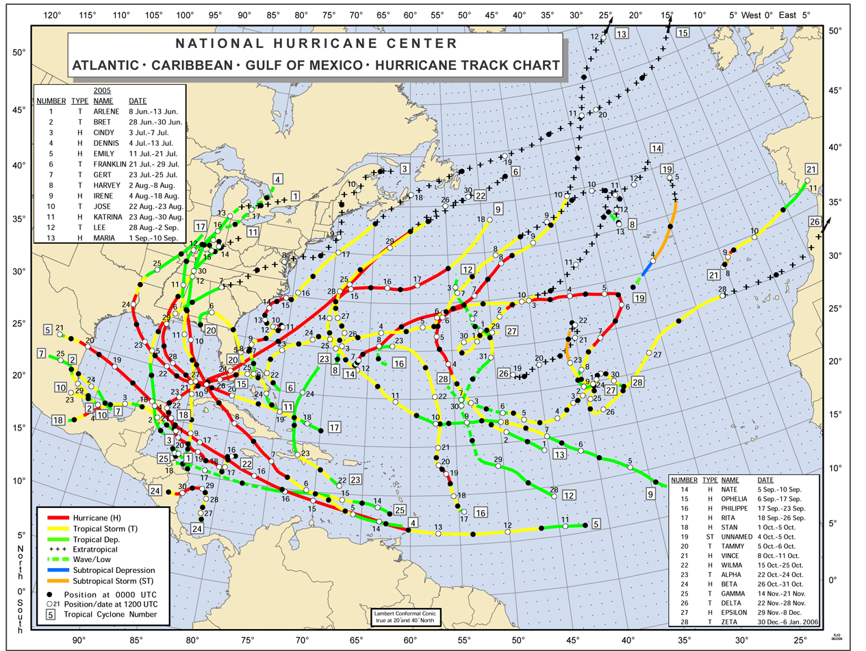
The incredible 2005 Atlantic hurricane season smashed many long-standing records. Some of the words used to describe it included,…
Satellite Snapshots
NOAA has released its Atlantic Hurricane Outlook for 2020. NOAA’s National Weather Service Climate Prediction Center.
Satellite Snapshots
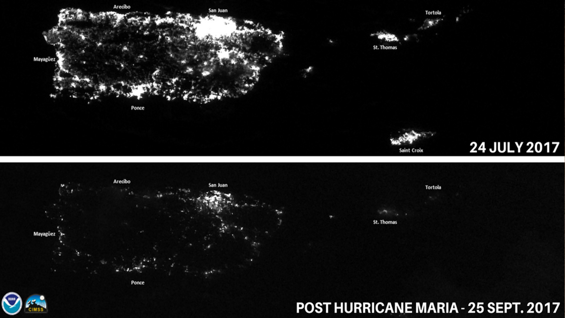
Some hurricane damage can’t be captured by photographs; these storms can inflict profound harm to the mental health of people.