
Earth from Orbit
Sept. 10 marked the peak of the Atlantic hurricane season, which officially runs from June 1 through Nov. 30.
Earth from Orbit
Sept. 10 marked the peak of the Atlantic hurricane season, which officially runs from June 1 through Nov. 30.
Earth from Orbit
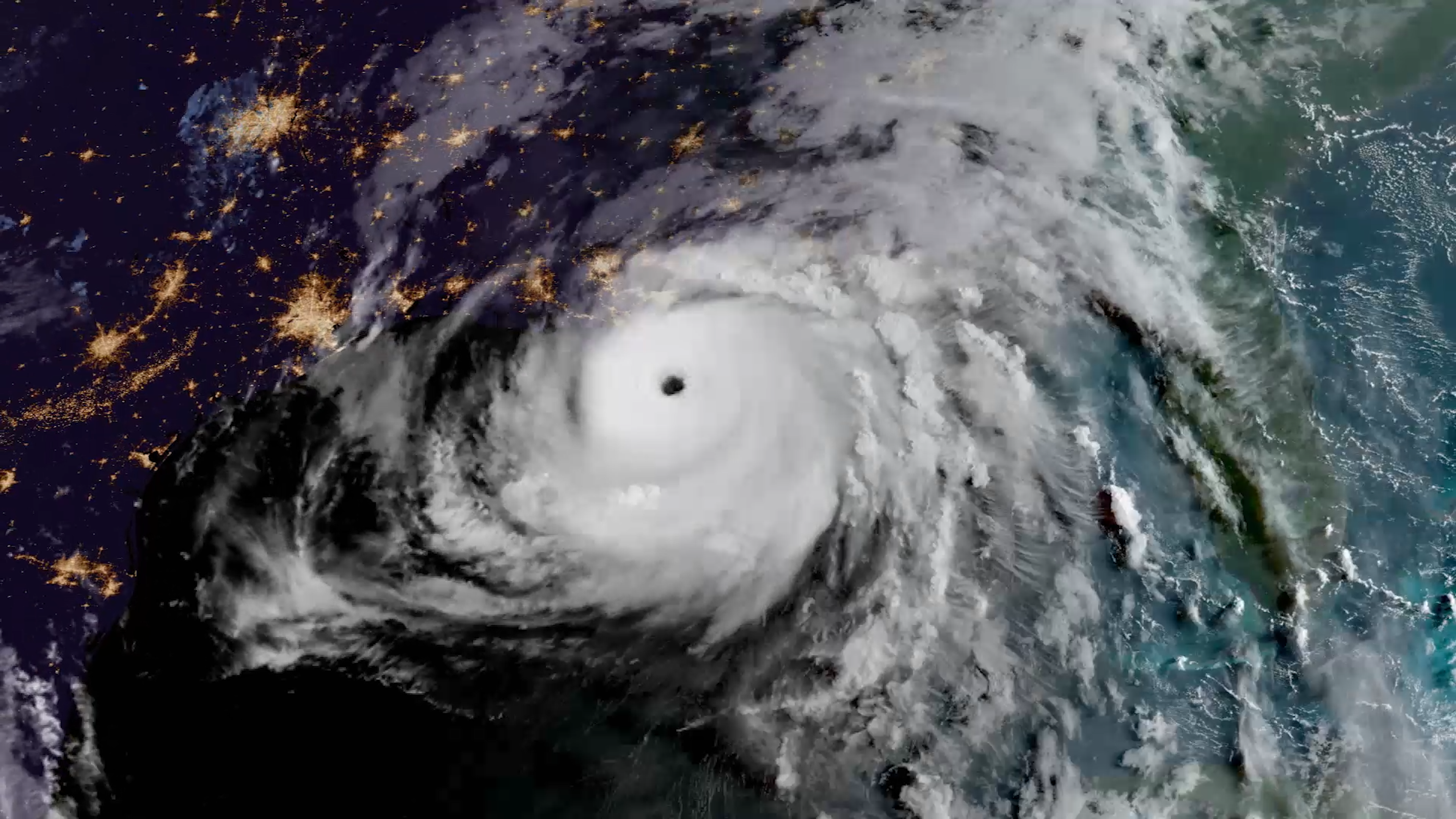
At least nine people died from torrential rains in New York and New Jersey as Hurricane Ida moved North.
Earth from Orbit
At least nine people died from torrential rains in New York and New Jersey as Hurricane Ida moved North.
Satellite Snapshots
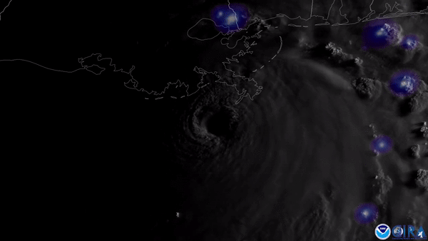
NOAA’s GOES East satellite was closely watching the swirling clouds and flashing lightning associated with major Hurricane Ida on August 29, 2021.
Satellite Snapshots
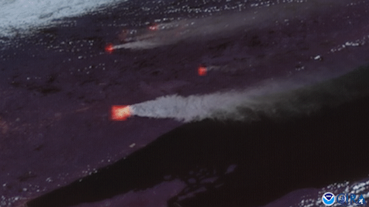
NOAA’s GOES East satellite had its eye on Minnesota’s Greenwood Fire on August 23, as the wildfire nearly doubled in size.
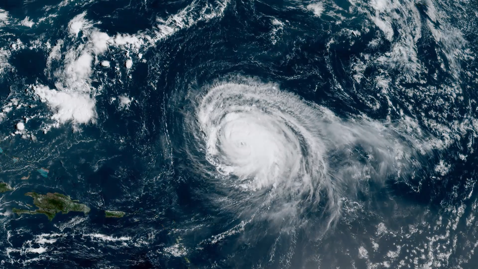
Earth from Orbit

As we approach the peak of Atlantic hurricane season, activity in the tropics has ramped up.
Earth from Orbit

As wildfires continue to rage in North America, the Dixie Fire became the second largest fire in California history.