
Satellite Snapshots
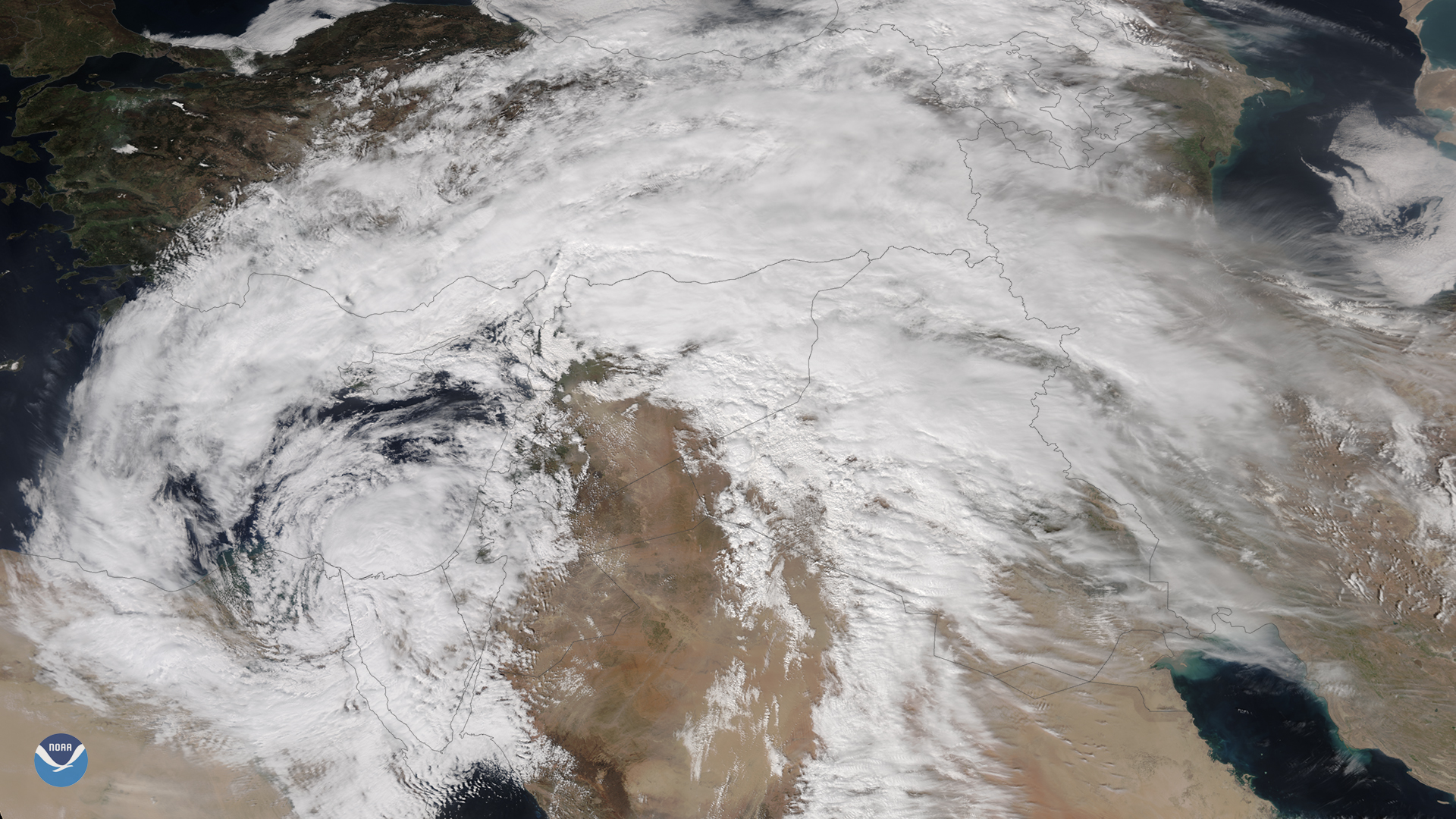
March 13, 2020 An unusually powerful mid-latitude cyclone that formed rapidly over Egypt on Thursday, March 12, 2020, is wreaking havoc in the Middle…
Satellite Snapshots
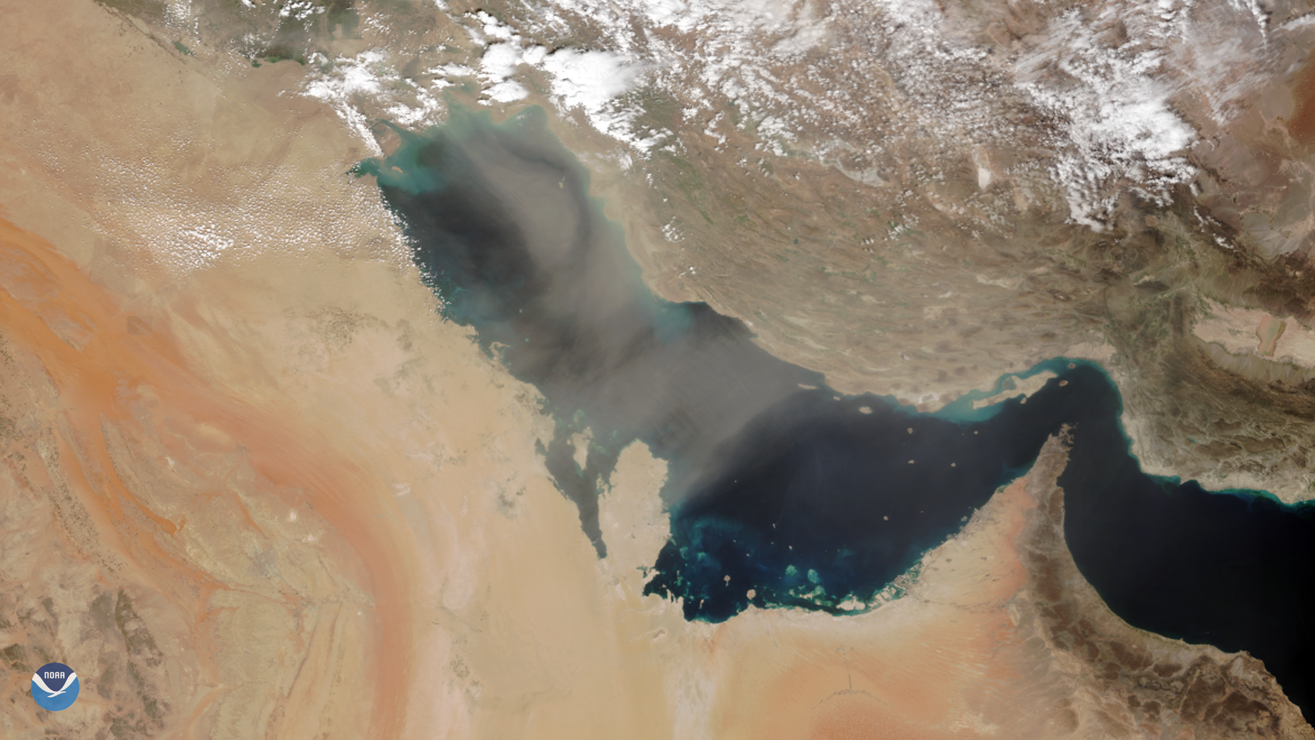
As NOAA-20 passed over the Middle East on March 8, 2020, it captured this image of dust blowing over the Persian Gulf. Dust storms are…
Satellite Snapshots
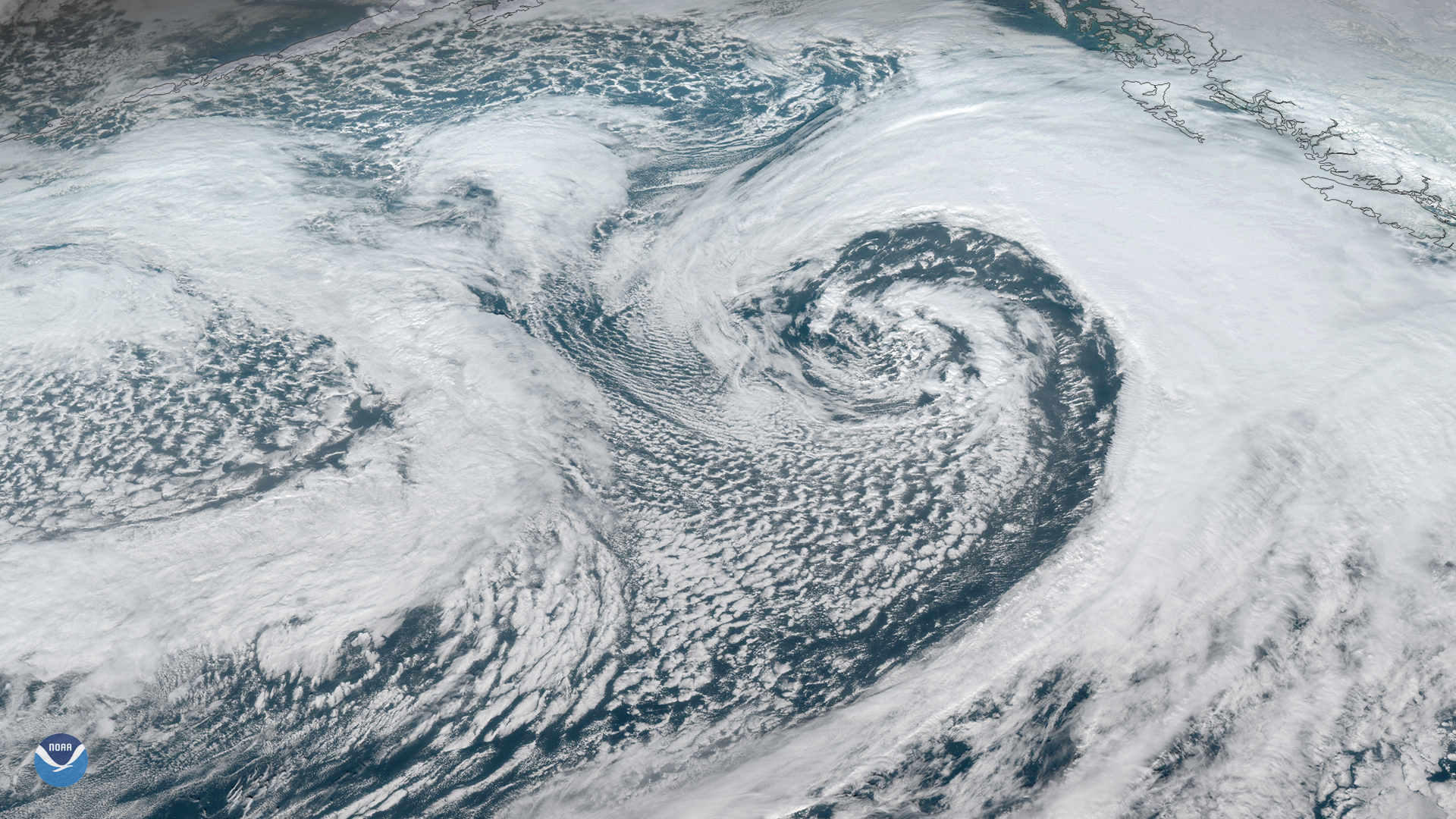
A strong area of low pressure is moving northward across Alaska’s eastern Aleutian Islands and western Peninsula. The system is…
Satellite Snapshots
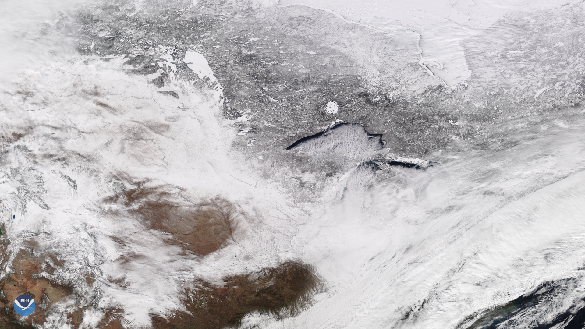
February 14, 2020 On Feb. 13, 2020, the NOAA-20 satellite viewed cloud streets over Lake Superior, signifying a cold air mass on the move. In fact,…
Feature Story

NOAA’s satellite imagery and data were the foundation of 2019’s life-saving forecasts throughout the 14 billion-dollar disasters.
Satellite Snapshots
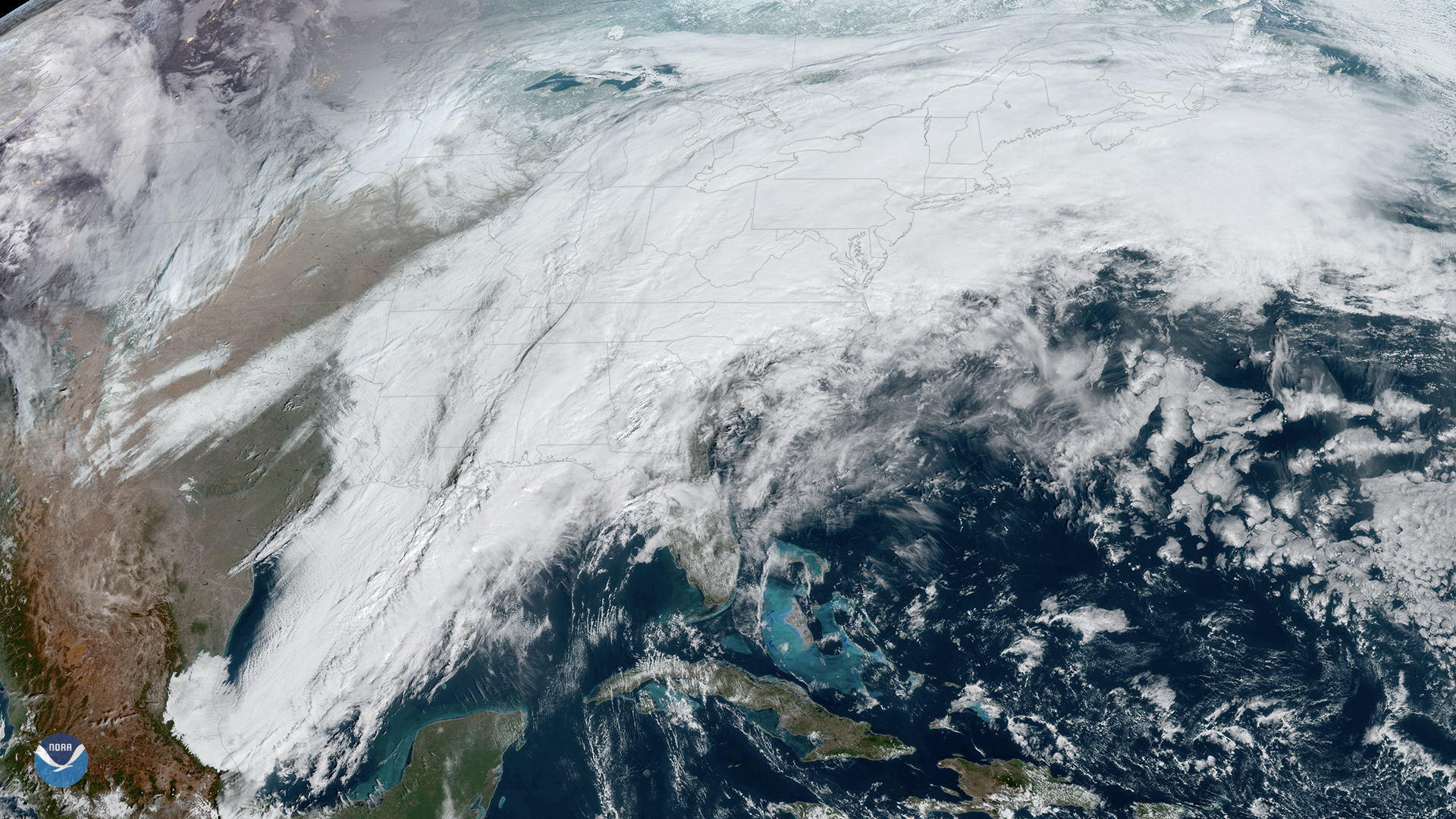
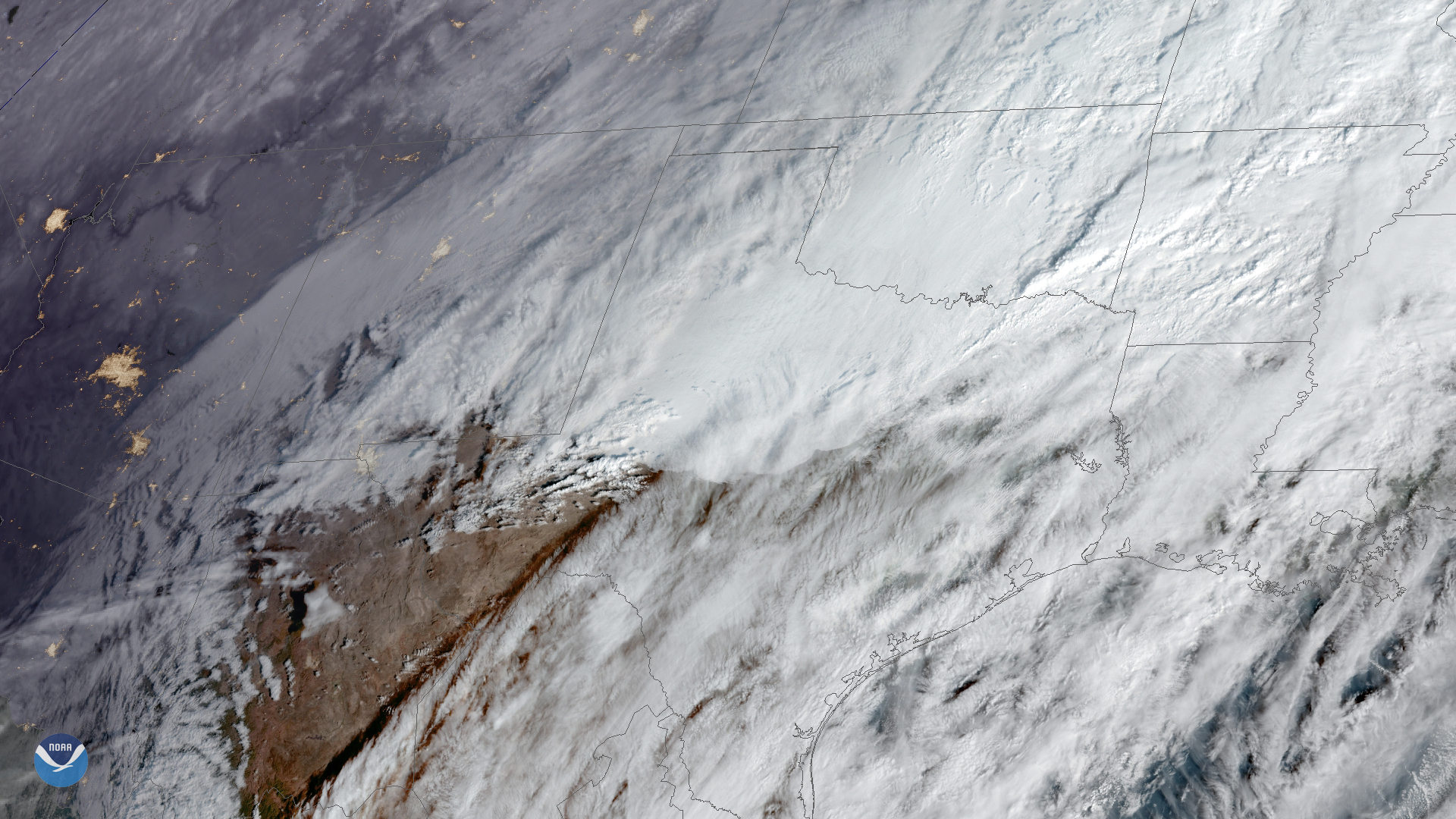
On Thursday, Feb. 6, 2020, the GOES-East satellite is watching a large winter storm stretching roughly 2,000 miles across the U.S.,…
Satellite Snapshots
On Thursday, Feb. 6, 2020, the GOES-East satellite is watching a large winter storm stretching roughly 2,000 miles across the U.S.,…
Satellite Snapshots
February 04, 2020 On Feb. 4, 2020, GOES-East captured this imagery of low-level stratus clouds as they moved across Texas behind a cold front, while…