
Satellite Snapshots
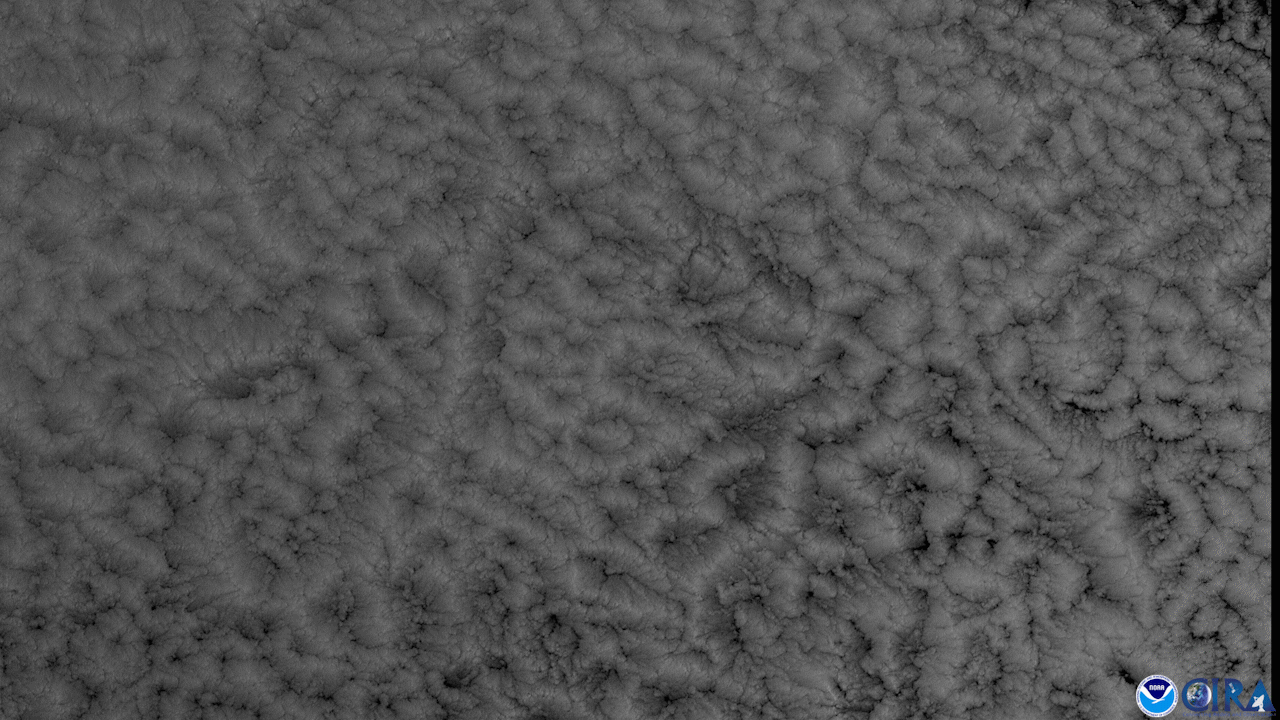
GOES East, using Band 2 of the ABI instrument , viewed percolating clouds approximately 3,000 miles off of the coast of Chile.
Satellite Snapshots
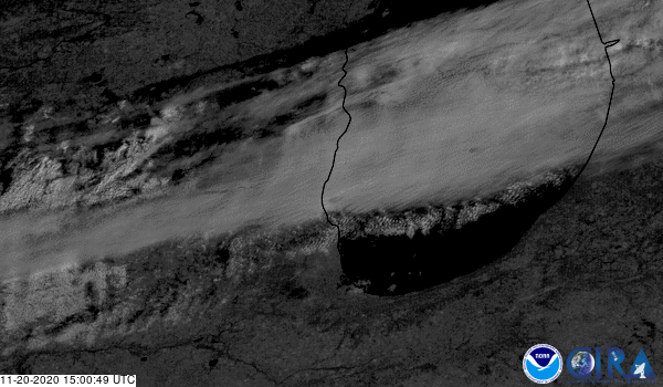
GOES East satellite captured a “supercool” phenomenon occurring within the clouds over Michigan.
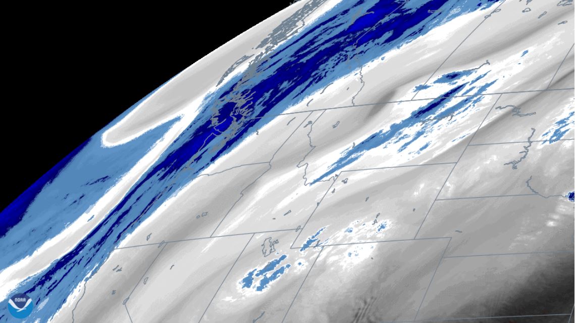
Satellite Snapshots

GOES-East viewed cloud streets that were generated by a northwesterly wind over the Great Lakes and Northeast
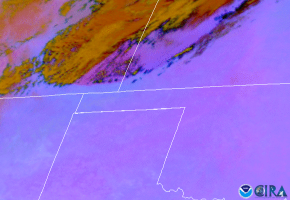
Satellite Snapshots
Water vapor imagery from NOAA’s GOES East satellite viewed an atmospheric wave pattern brought on by a digging trough the Pacific Northwest.
Satellite Snapshots
On Oct. 11, 2020, NOAA’s GOES-East satellite watched a huge wall of dust blow more than 300 miles from eastern Colorado to Nebraska,…
Satellite Snapshots
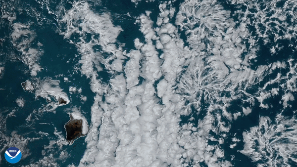
From June 30–July 1, 2020, the GOES-West satellite captured a cluster of actinoform clouds drifting toward the Hawaiian islands.
Satellite Snapshots
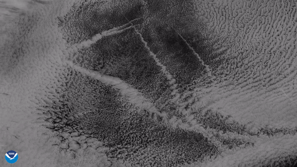
From its vantage point nearly 22,300 miles up, the GOES West satellite captured this imagery of ship tracks embedded in stratocumulus clouds.
Satellite Snapshots
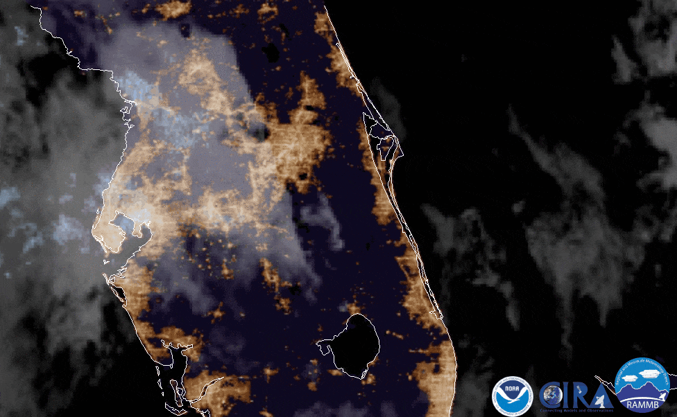
On June 9, 2020, the GOES East satellite captured imagery of fallstreak holes (AKA: hole punch clouds) over Florida.