
Earth from Orbit
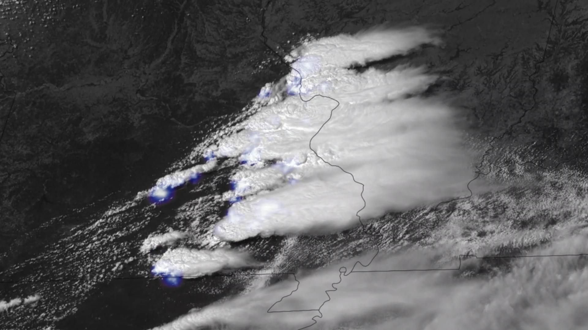
NOAA satellites have been monitoring a potent and complex spring weather pattern responsible for nearly a week-long stretch of severe weather, including two destructive tornado outbreaks across the central U.S. from May 15–16 and May 18–20, 2025.
Feature Story
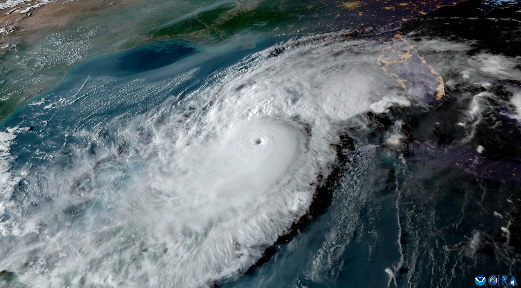
The 2025 Atlantic Hurricane Season officially begins June 1, and NOAA’s eyes in the sky are ready for whatever the season may bring.
Satellite Snapshots
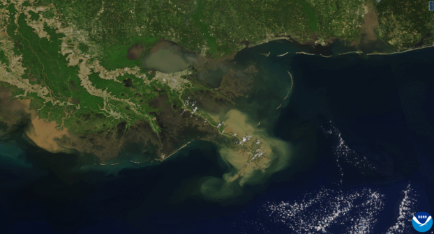
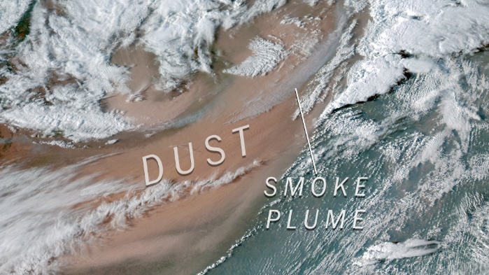
NOAA’s Joint Polar Satellite System (JPSS) satellites captured striking imagery of sediment runoff due to flooding in the Mississippi River delta from April 8–13, 2025.
Satellite Snapshots
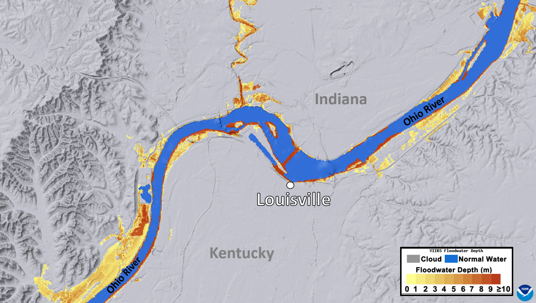
NOAA's JPSS Program satellites captured flooding along the Ohio River on April 7, 2025.
Satellite Snapshots
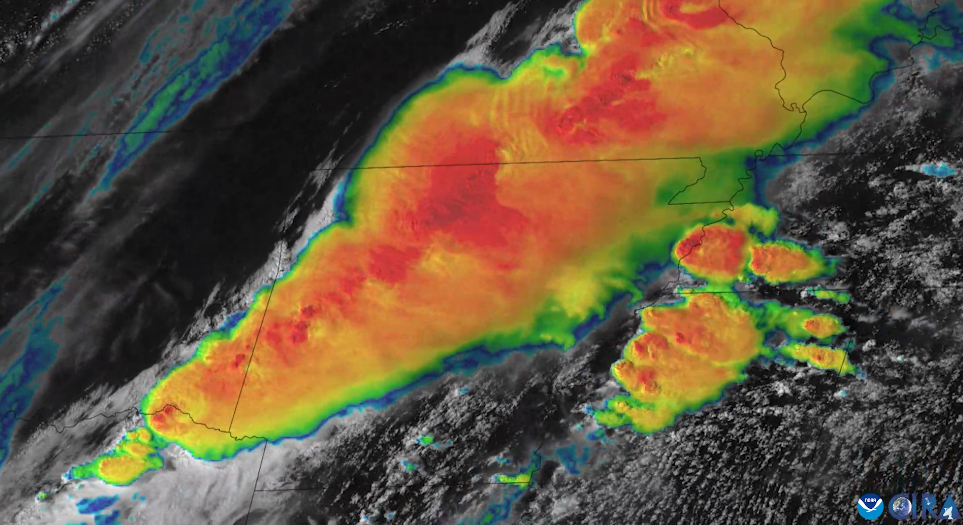
On April 2, 2025, NOAA’s GOES East (GOES-16) satellite captured imagery of numerous severe thunderstorms erupting across the Mississippi and Ohio river valleys.
Feature Story
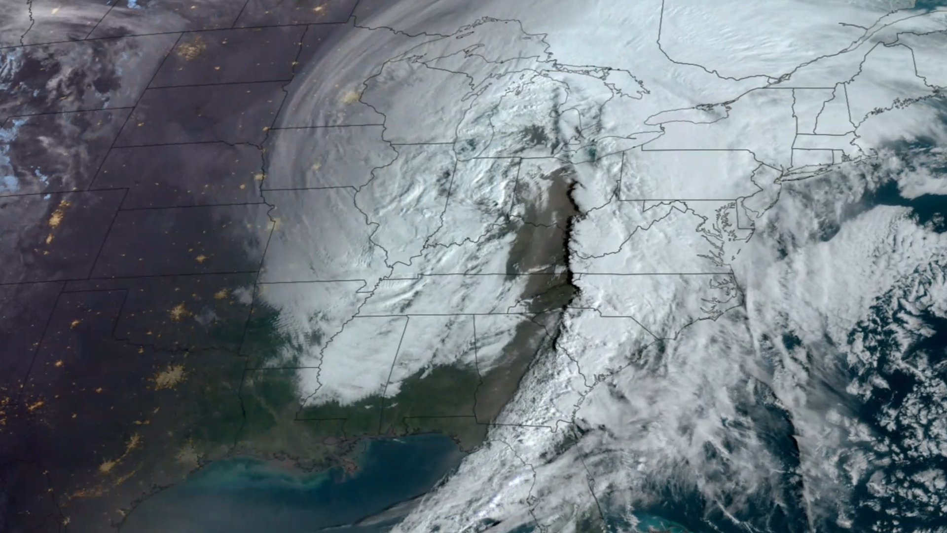
NOAA satellites closely monitored a powerful and devastating storm system that tore through the central and eastern United States from March 14-16, 2025.
Feature Story
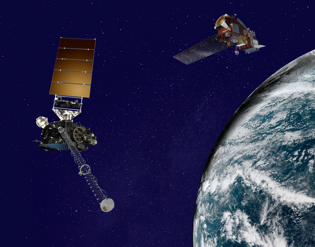
From their orbits, NOAA satellites can play a vital role in detecting and tracking severe weather, providing forecasters with critical data to predict and monitor life-threatening conditions.
Earth from Orbit
NOAA satellites have been tracking a major spring storm system pushing across the central United States this week. The system has prompted NOAA’s National Weather Service (NWS) to issue widespread weather alerts for everything from blizzard warnings…