
Satellite Snapshots
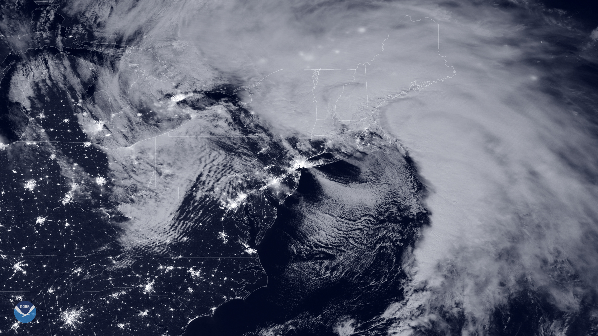
A dangerous nor’easter parked over New England delivered a powerful punch to the region this week. A nor’easter is essentially a…
Feature Story
The stunning, colorful imagery you see from GOES-16 and GOES-17 isn’t just beautiful to look at, it also provides critical information to forecasters
Satellite Snapshots
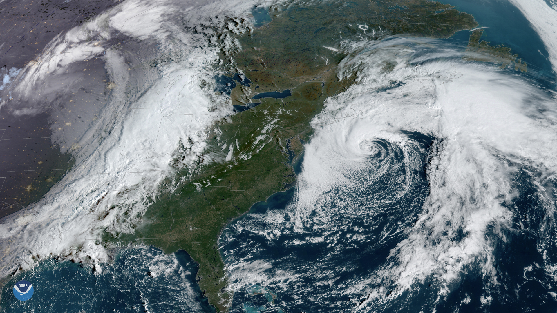
GOES East captured this awe-inspiring view of two large storm systems over North America on Friday, Oct. 11, 2019. To the west, a…
Feature Story
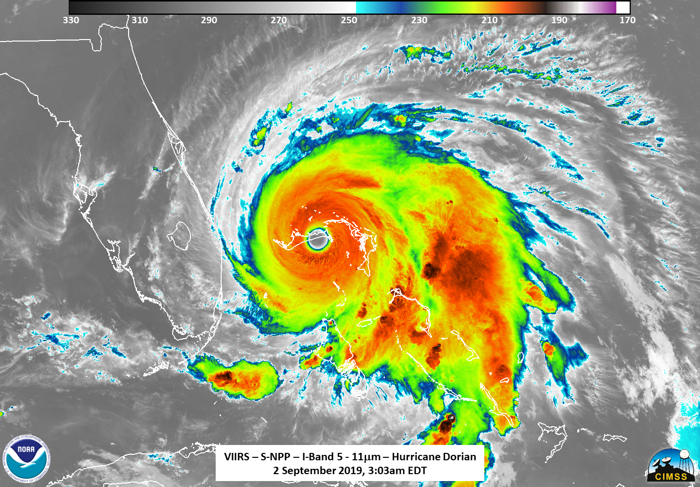
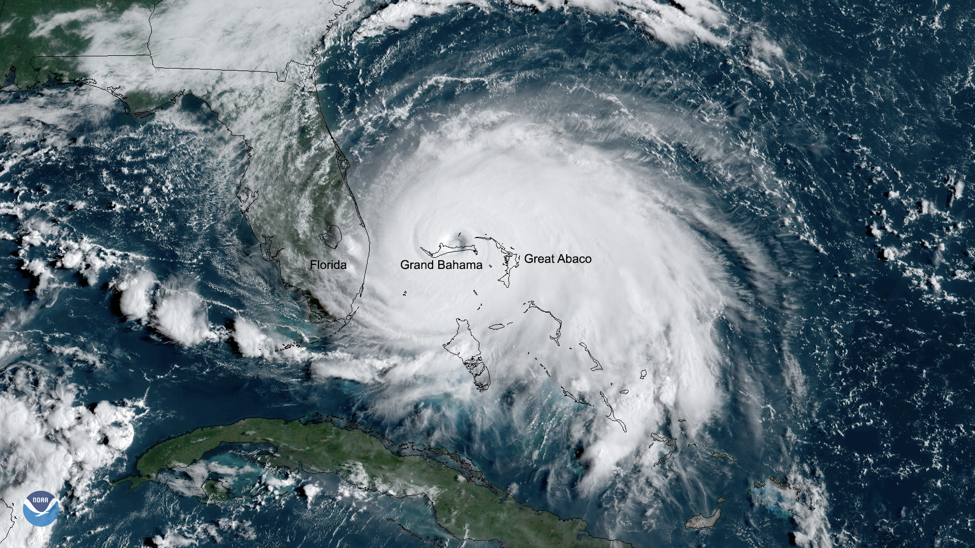
As Hurricane Dorian made landfall over two islands in the Bahamas, NOAA's Joint Polar Satellite System satellites captured these infrared images.
Satellite Snapshots
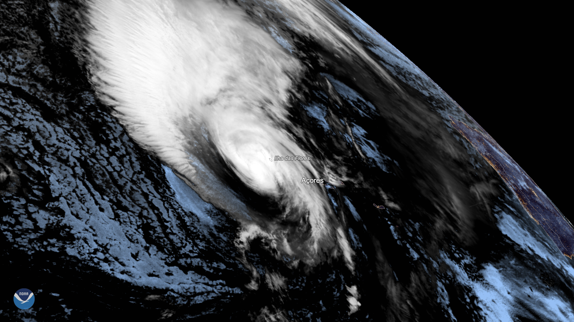
Hurricane Lorenzo lashed Portugal’s Azores Islands early Wednesday morning, toppling trees and downing power lines as the then…
Satellite Snapshots
NOAA’s GOES East satellite zoomed in on Category 1 Hurricane Dorian on Thursday, Aug. 29, 2019 over the open waters of the Atlantic Ocean
Satellite Snapshots
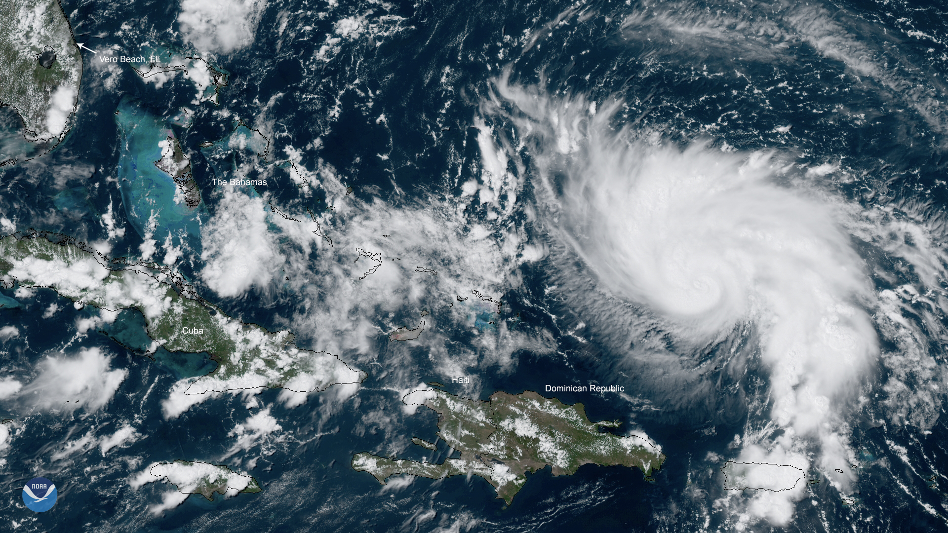
GOES East has been watching a tropical system just east of the Lesser Antilles, which became Tropical Storm Dorian
Satellite Snapshots
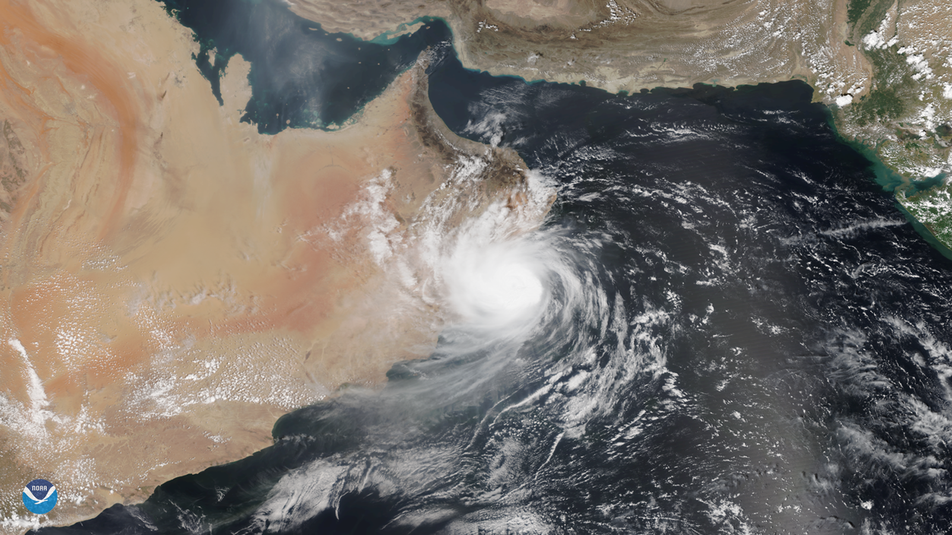
While we typically think of tropical cyclones as storms that form in the Atlantic and Pacific oceans, they do occasionally appear…