
Feature Story

The U.S. Drought Monitor and NOAA support a $100 billion U.S. industry: livestock. In this video, learn about how cattle ranchers use environmental…
Satellite Snapshots
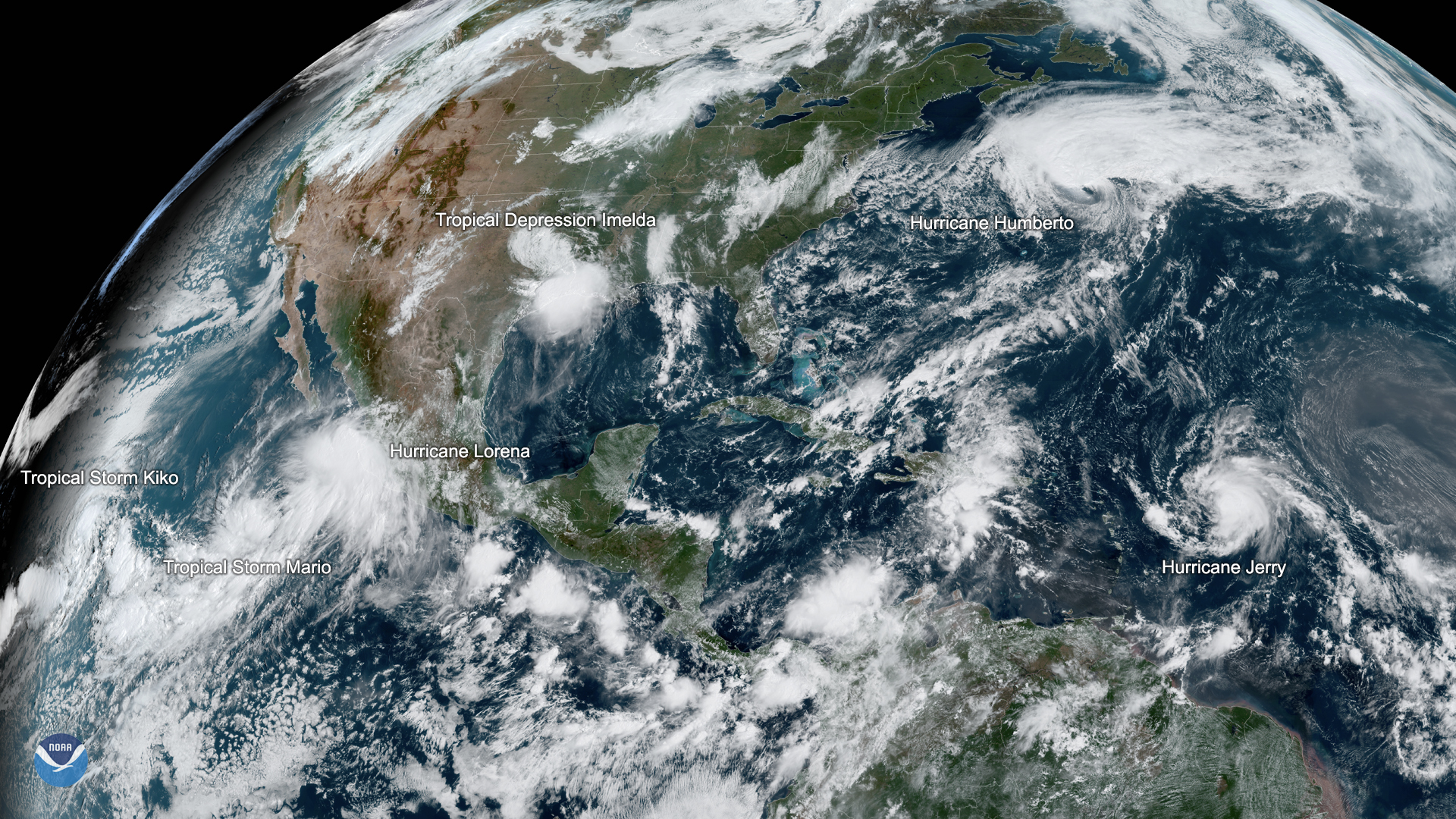
GOES East imagery shows five active named storms across the Atlantic and Eastern Pacific basins.
Satellite Snapshots
GOES East imagery shows five active named storms across the Atlantic and Eastern Pacific basins.
Feature Story
This season’s Humberto isn’t the first tropical cyclone in the Atlantic Basin to be given the name. In fact, it’s the…
Satellite Snapshots
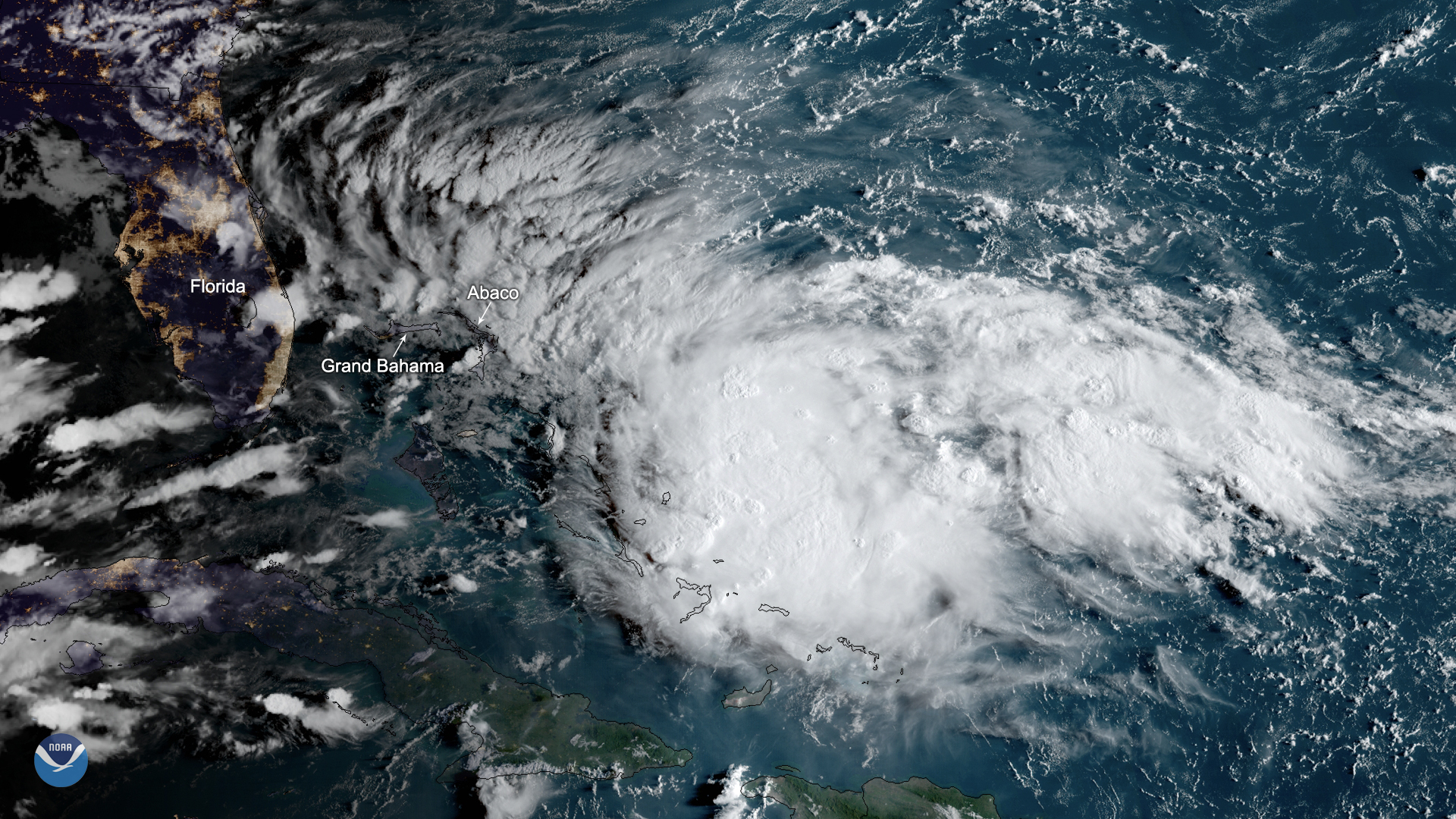
Potential Tropical Cyclone Nine is expected to become a tropical depression or a tropical storm as it moves northwestward over the…
Satellite Snapshots
Potential Tropical Cyclone Nine is expected to become a tropical depression or a tropical storm as it moves northwestward over the…
Satellite Snapshots
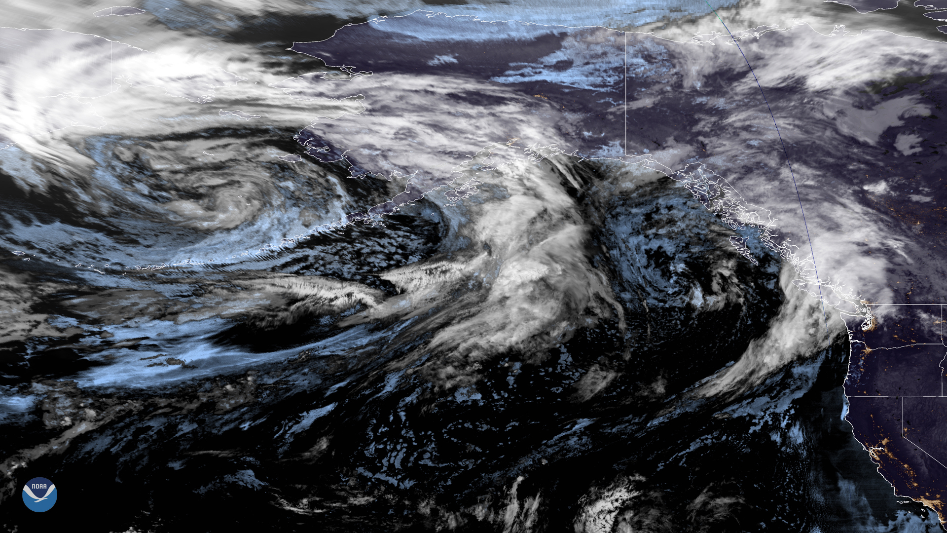
A large low-pressure system over the northern Pacific is making its way to the West Coast in this merged imagery captured by NOAA…
Feature Story
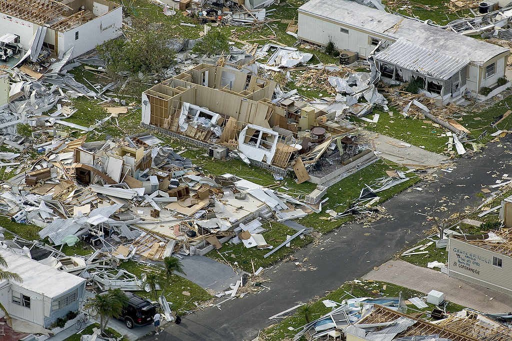
In 2004, the Atlantic had one of its most active and destructive hurricane seasons on record. These storms produced more than $61 billion in damages