
Feature Story
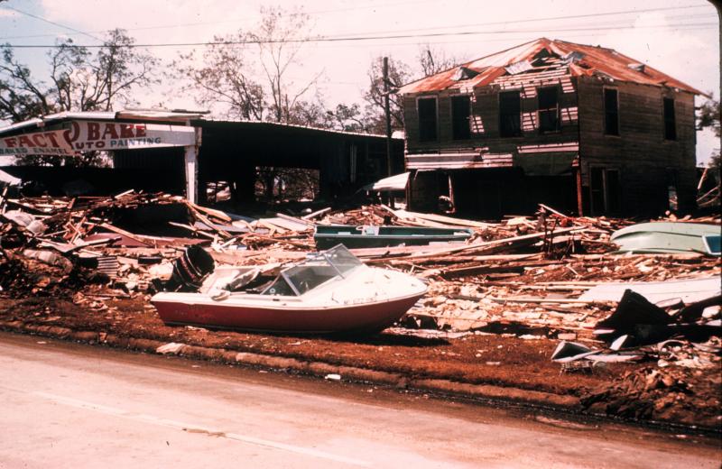
In the late evening hours of August 17, 1969, a catastrophic storm named Hurricane Camille slammed into the Gulf Coast. A…
Satellite Snapshots
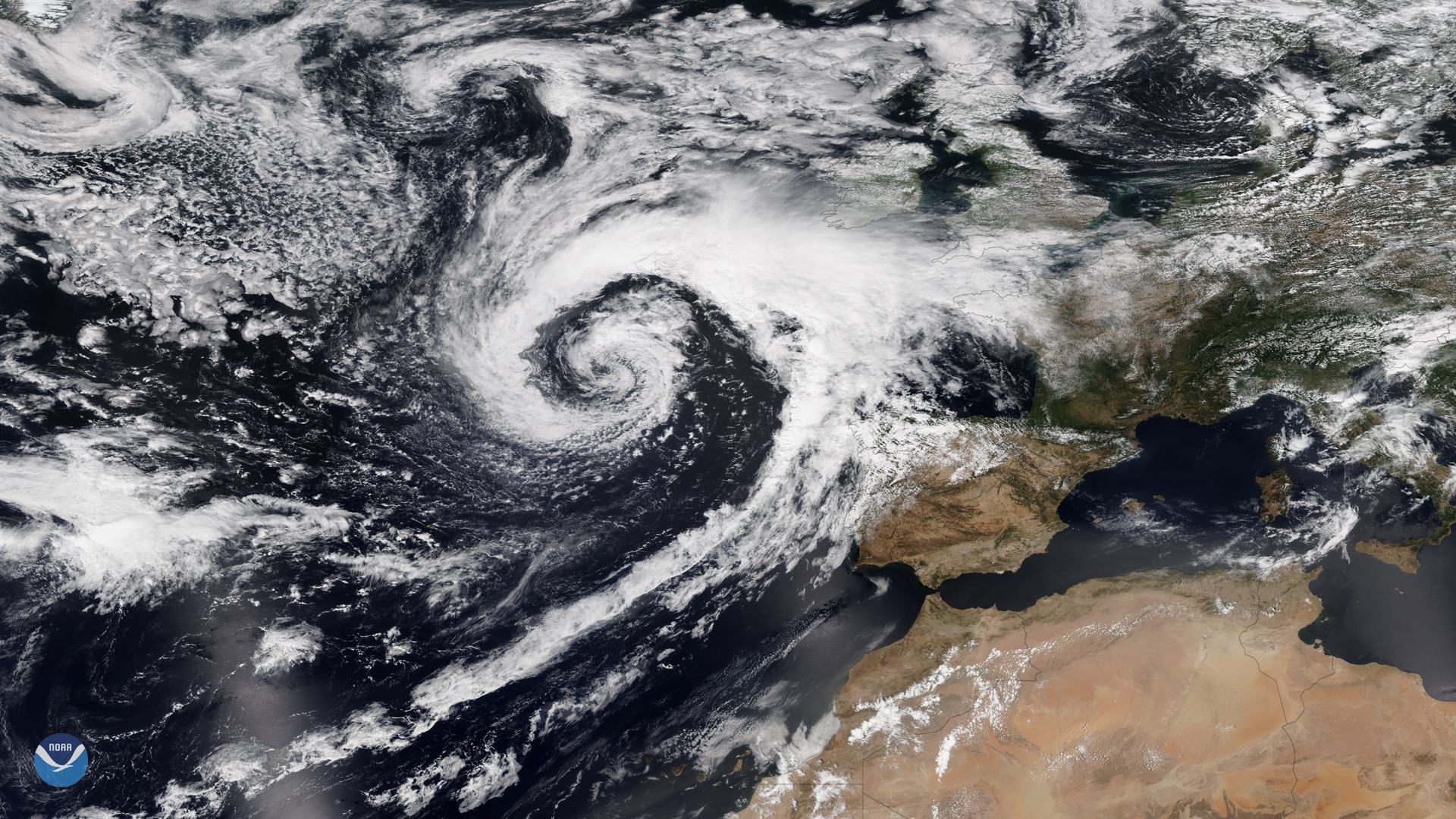
This past week the United Kingdom (UK) has experienced nasty weather and torrential rains, which brought flooding, power outages, and…
Satellite Snapshots

A triangle of tropical storm systems in the Western Pacific Ocean was seen by Japan’s Himawari-8 satellite on Tuesday, August 6, 2019…
Satellite Snapshots

Hazy smoke from agricultural fires in central to southern Africa can be clearly seen in this VIIRS true-color image taken by NOAA-20…
Satellite Snapshots
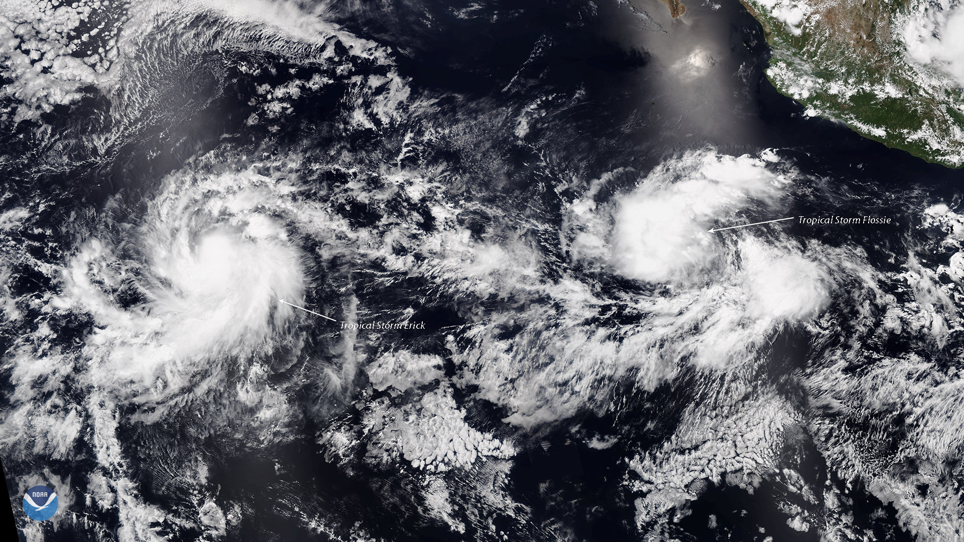
Tropical Storms Erick and Flossie, seen together in this July 28, 2019 view from the NOAA-20 satellite, are strengthening in the…
Satellite Snapshots
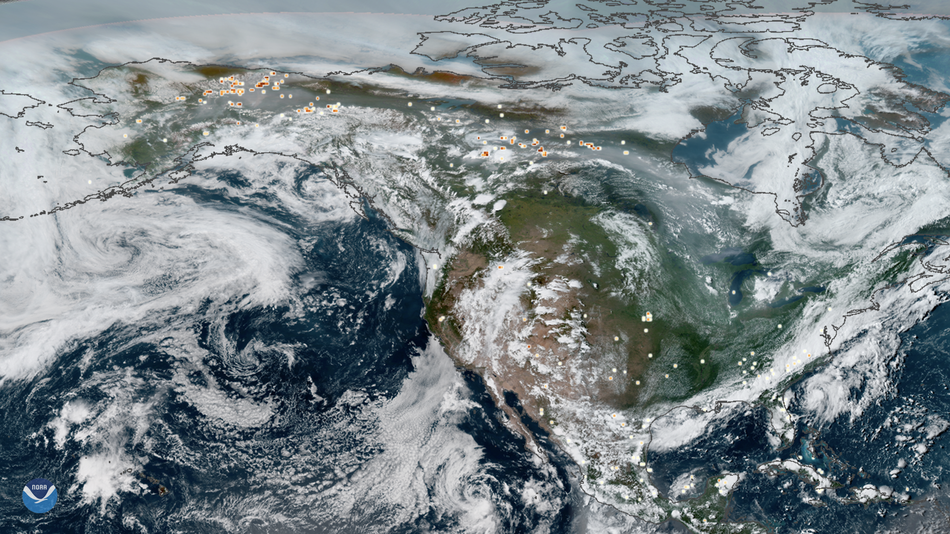
This true-color composite image of smoke from Arctic wildfires spreading across Alaska and Canada was captured by both GOES East and…
Satellite Snapshots
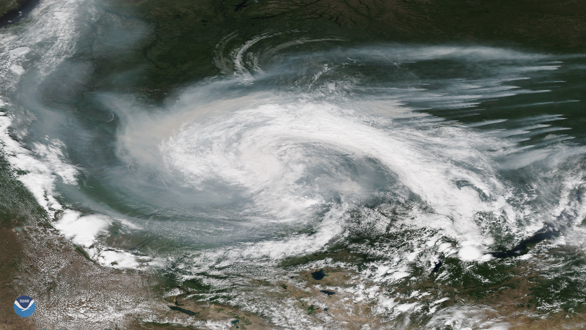
Smoke from active wildfires burning across northern Russia got caught in a low pressure system near the Verkhne-Tazovsky State Natural…
Satellite Snapshots
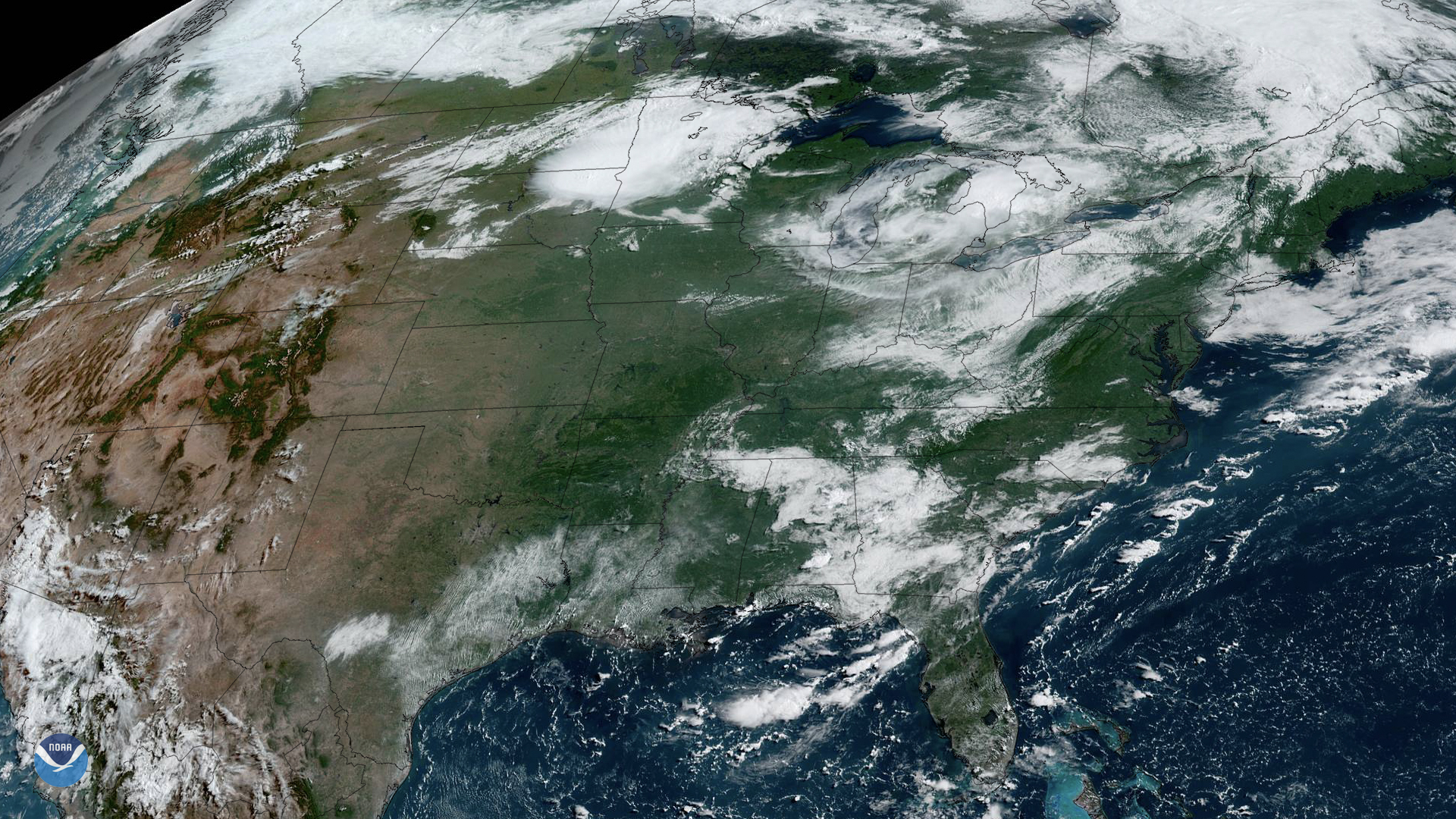
NOAA’s GOES East satellite watched as storms began firing up over the Upper Midwest on Friday, July 19, 2019. While there’s a cluster…