
Earth from Orbit

NOAA satellites monitored a large plume of dust from the Sahara Desert as it traveled off the west coast of North Africa, across the Atlantic Ocean.
Satellite Snapshots
On Feb. 19, 2021, GOES East zoomed in on the Great Lakes, capturing beautiful imagery of ice drifting across the southern tip of Lake Michigan.
Satellite Snapshots
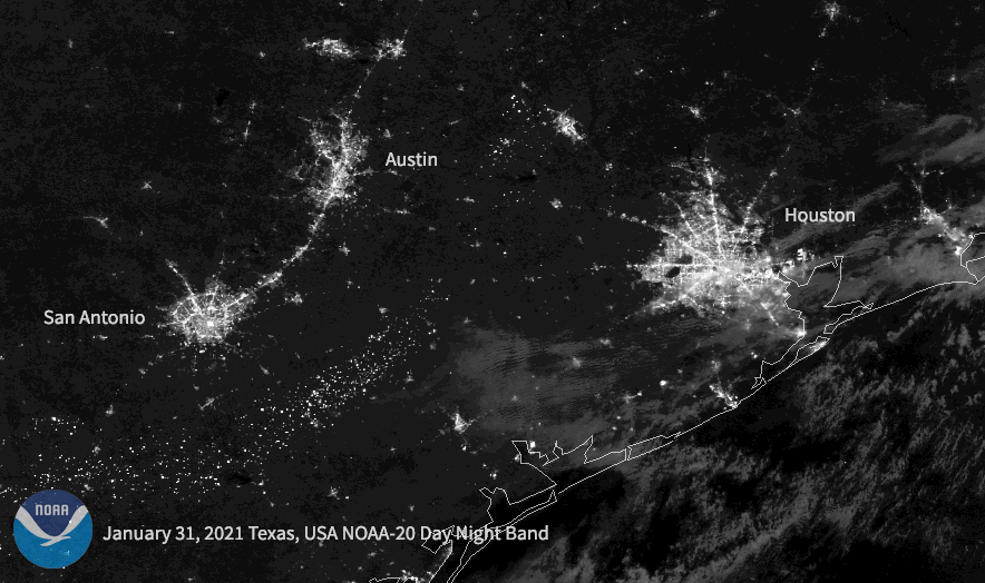
Following a historic winter storm across the central/southern U.S. this week, the NOAA-20 satellite caught the resulting power outages in Texas.
Satellite Snapshots
NOAA’s GOES East satellite captured dust from the Saharan Air Layer (SAL) as it wafted its way over the Atlantic Ocean and Canary…
Satellite Snapshots
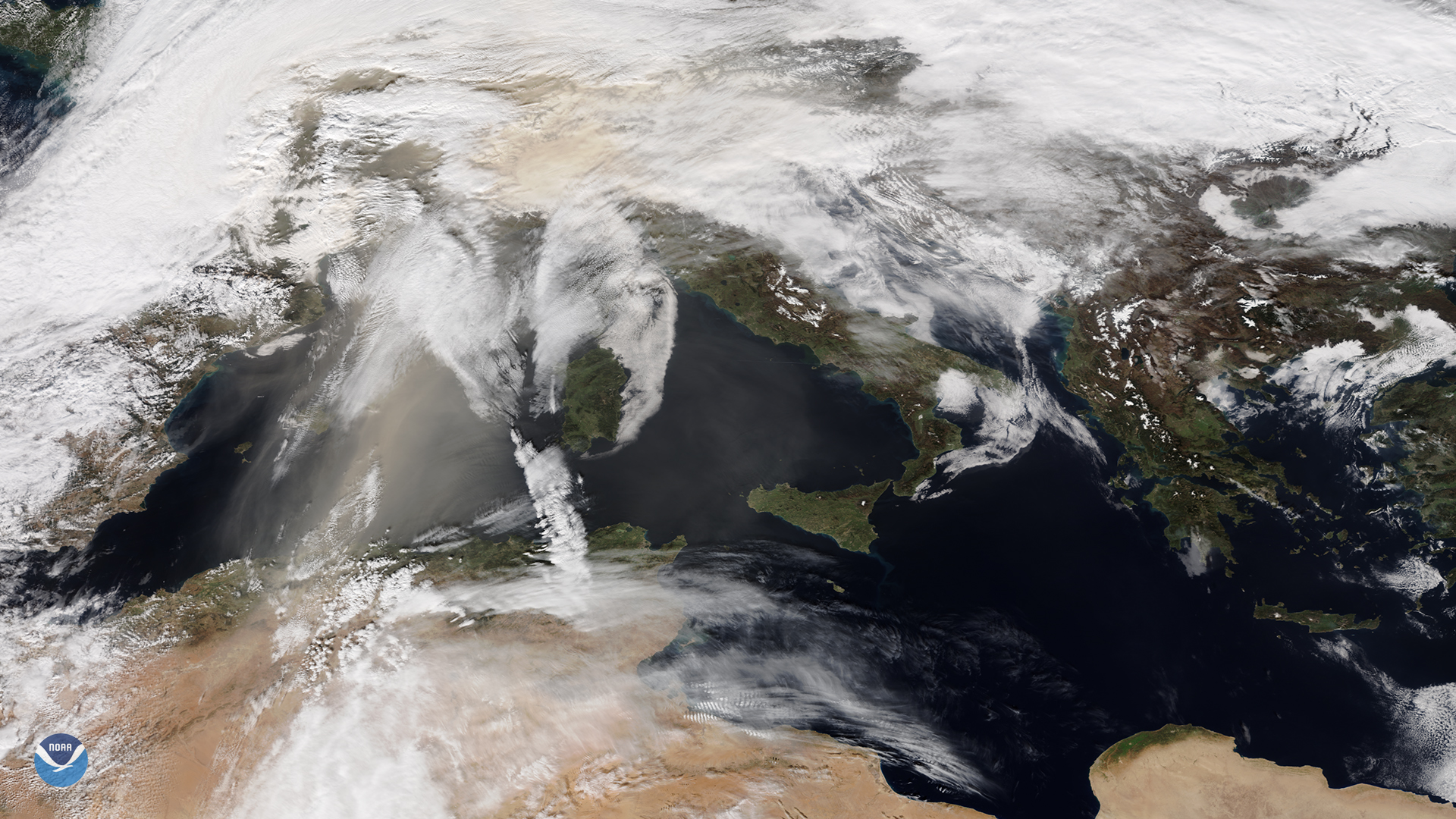
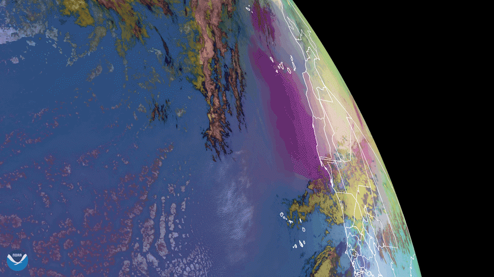
NOAA-20 catches orange skies and dusty ski slopes plagued Europe during the first weekend of February
Satellite Snapshots
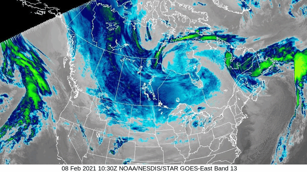
As a dip in the polar vortex continues to bring bitter temperatures to North America, the air over the northern reaches of the continent was so frigid on the morning of Monday, Feb. 8, 2021, that the GOES East satellite perceived the cold air along…
Satellite Snapshots
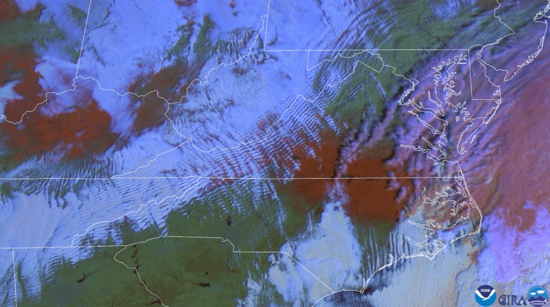
False color satellite imagery shows wave clouds and red snow on the ground.
Satellite Snapshots
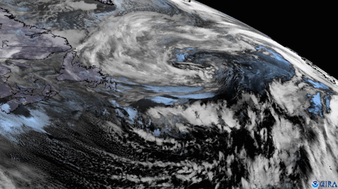
GOES East zoomed in on two low pressure systems swirling over the North Atlantic while cloud streets streamed off the North American coast.