
Satellite Snapshots

Clear skies over Australia on July 16, 2019, gave the NOAA-20 polar-orbiting satellite an unobstructed view of smoke plumes from…
Satellite Snapshots
A nearly full moon made it possible for the day-night band of NOAA-20 's Visible Infrared Imaging Radiometer Suite (VIIRS) to capture…
Satellite Snapshots
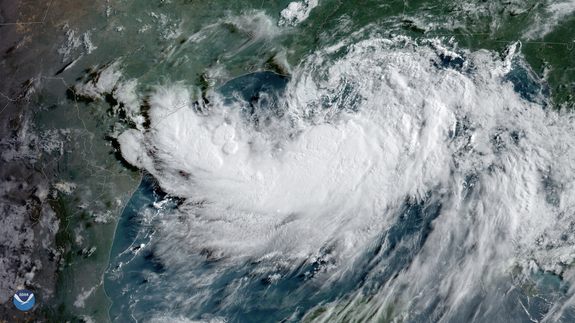
Tropical Storm Barry, seen here by GOES East on July 12, 2019, at 9 a.m. ET is strengthening over the warm waters of the northern Gulf…
Satellite Snapshots
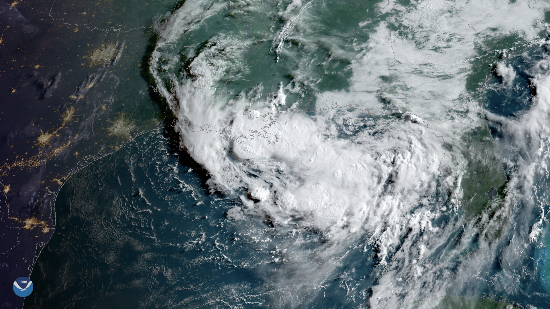
Clouds associated with a tropical disturbance bubbled up over the Gulf Coast on Wednesday, July 10, 2019.
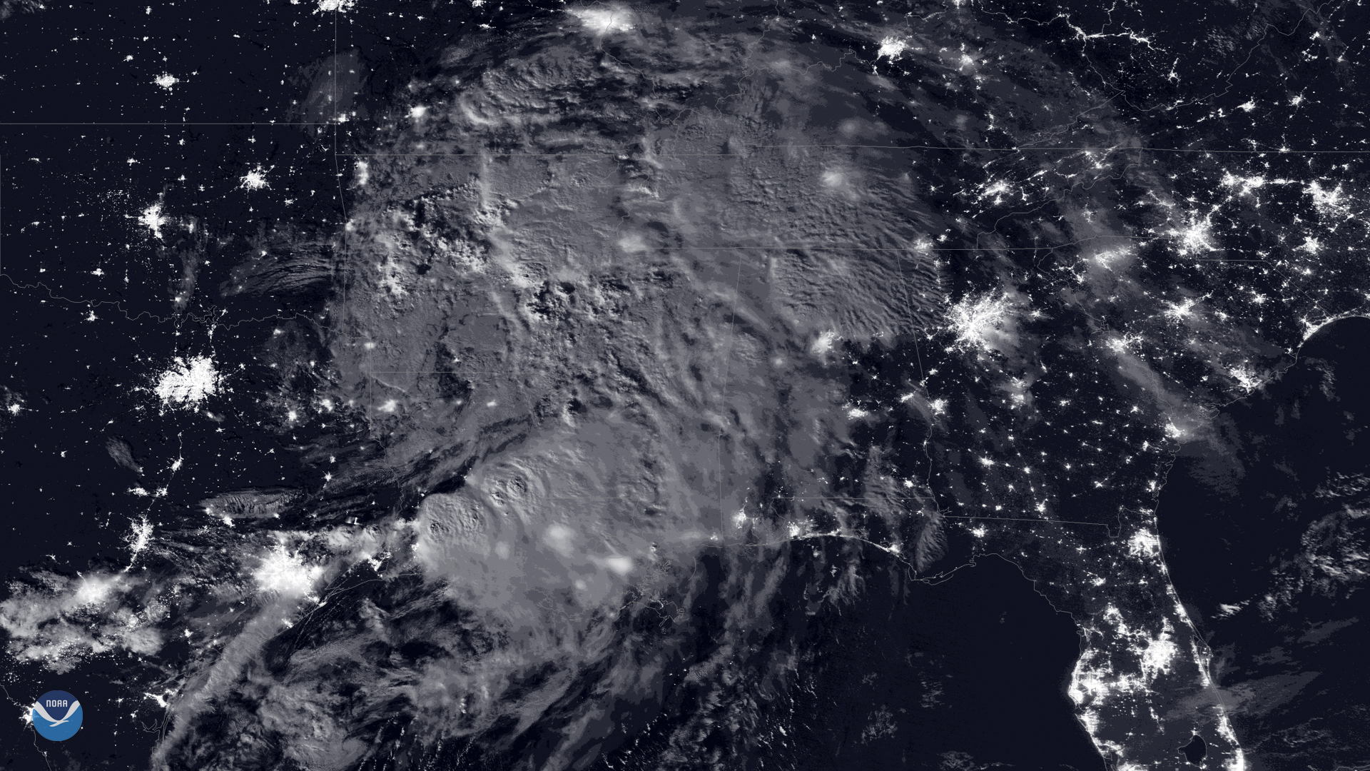
Satellite Snapshots
A storm is brewing in the northern Gulf of Mexico. A broad area of low pressure, located just south of the eastern Florida Panhandle,…
Satellite Snapshots
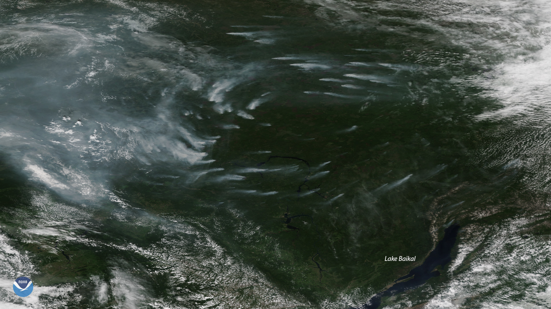
Plumes of smoke from more than a dozen large, active wildfires burning northwest of Russia’s Lake Baikal are seen in this NOAA-20…
Satellite Snapshots
Tropical Storm Barbara, seen on July 1,2019, at 9:20 a.m. ETin this sunrise view from GOES West, is steadily strengthening in the…
Satellite Snapshots

About 5,000 people were forced to flee their homes Wednesday, June 26, 2019, when Mount Ulawun on the island of New Britain in Papua…