
Satellite Snapshots
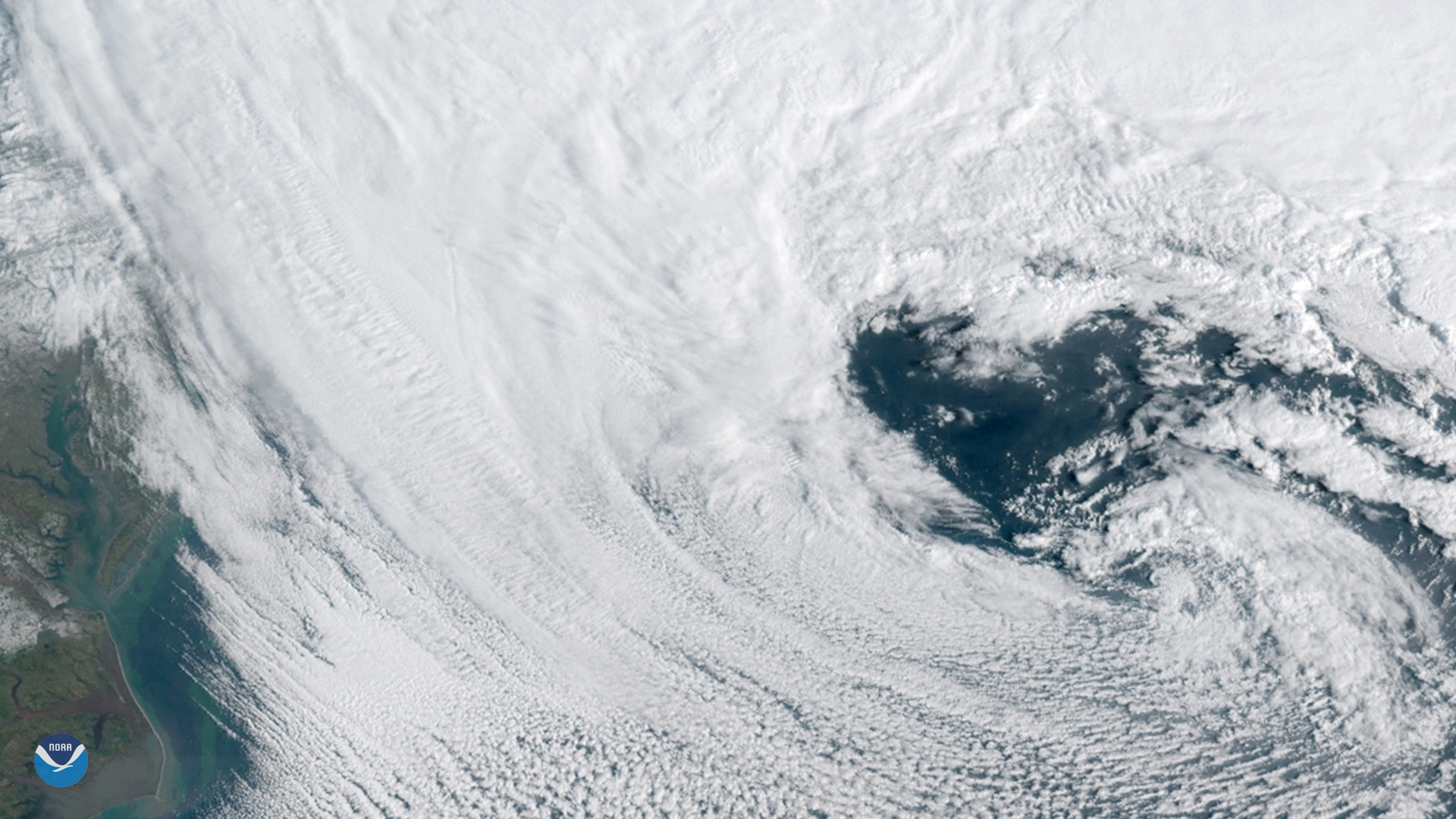
GOES East spied this heart-shaped cloud pattern within a powerful nor'easter that barreled up the U.S. East Coast on March 13, 2018.
Satellite Snapshots
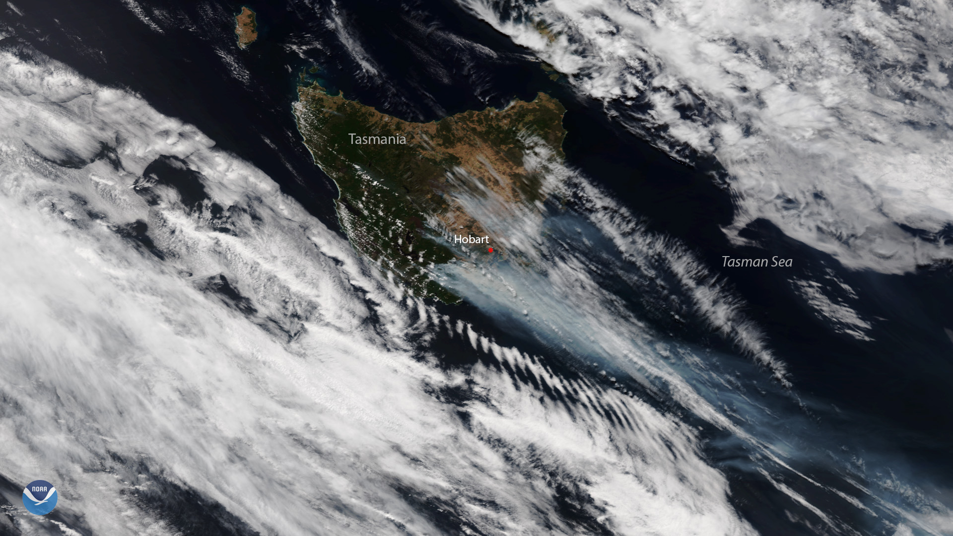
Plumes of smoke are seen over the bushfire-ravaged Australian island state of Tasmania in this Jan. 28, 2019 image from the NOAA-20…
Satellite Snapshots
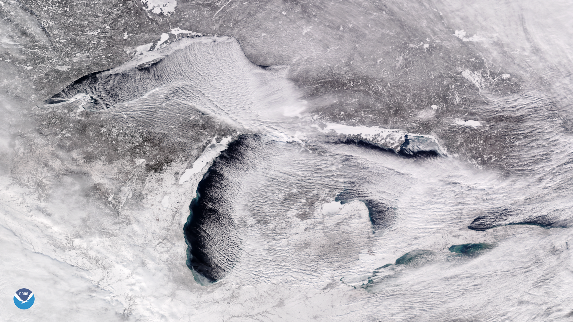
Bitter cold, arctic air is pouring into the Midwest and Great Lakes this week, and is expected to bring a prolonged period of…
Satellite Snapshots
For much of 2018, satellite images have shown the Eastern U.S. covered in a thick blanket of clouds – and for good reason: Time and…
Satellite Snapshots
For much of 2018, satellite images have shown the Eastern U.S. covered in a thick blanket of clouds – and for good reason: Time and…
Feature Story
The Polar-orbiting Operational Environmental Satellite (POES) project can claim a number of firsts in its 40-year history…
Satellite Snapshots

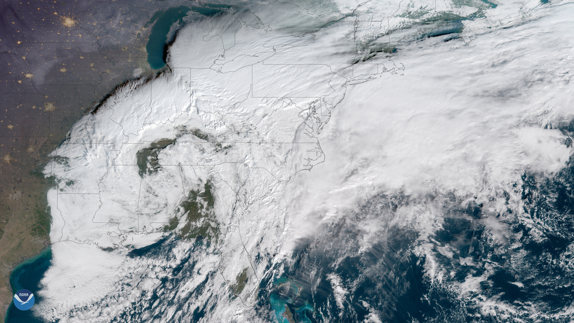
This GOES East image shows a sprawling storm system across large portions of the Midwest, South, and Eastern U.S.
Satellite Snapshots
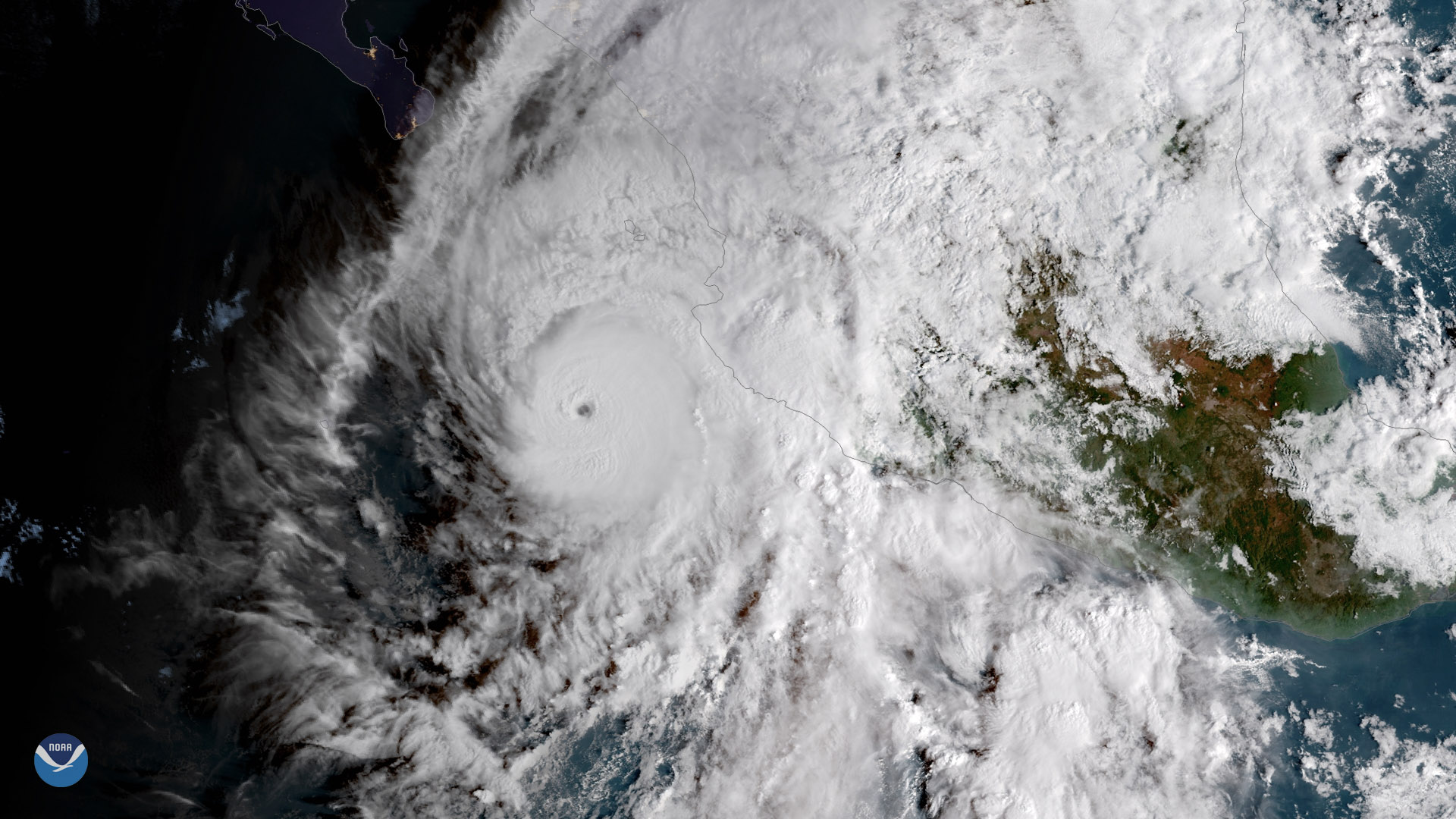
Willa was the tenth major hurricane (defined as a Category 3 storm or higher) to form in the eastern Pacific basin in 2018.