
Satellite Snapshots
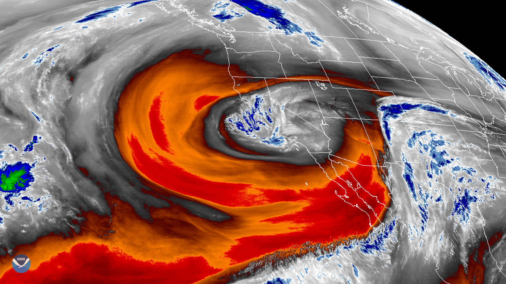
GOES West's water vapor band shows a low-pressure area off California that has become isolated or “cut off” from the main westerly air current.
Satellite Snapshots
April 01, 2020 On April 1, 1960, 10 years before NOAA was established, NASA launched the Television Infrared Observation Satellite (TIROS-1), which…
Satellite Snapshots
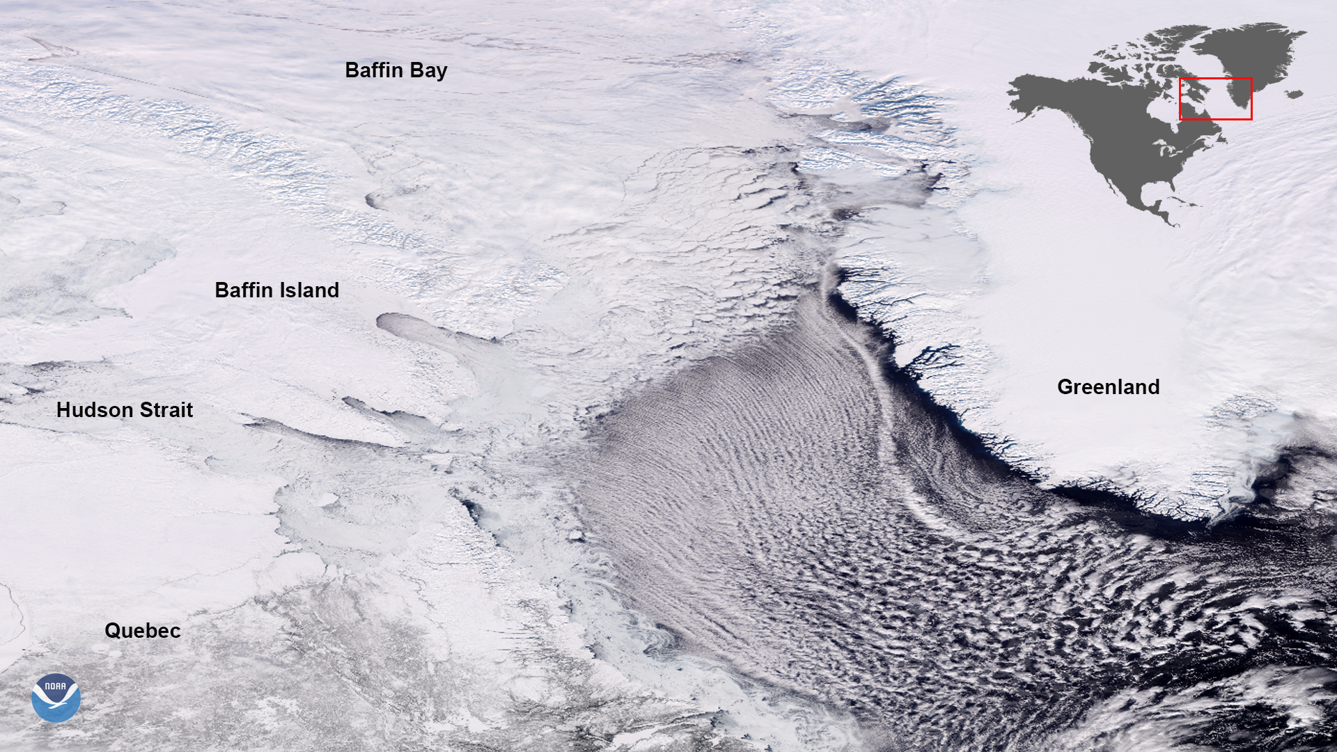
NOAA-20 satellite snapped this dynamic image of ribbon-shaped cloud streets streaming over the Labrador Sea.
Satellite Snapshots
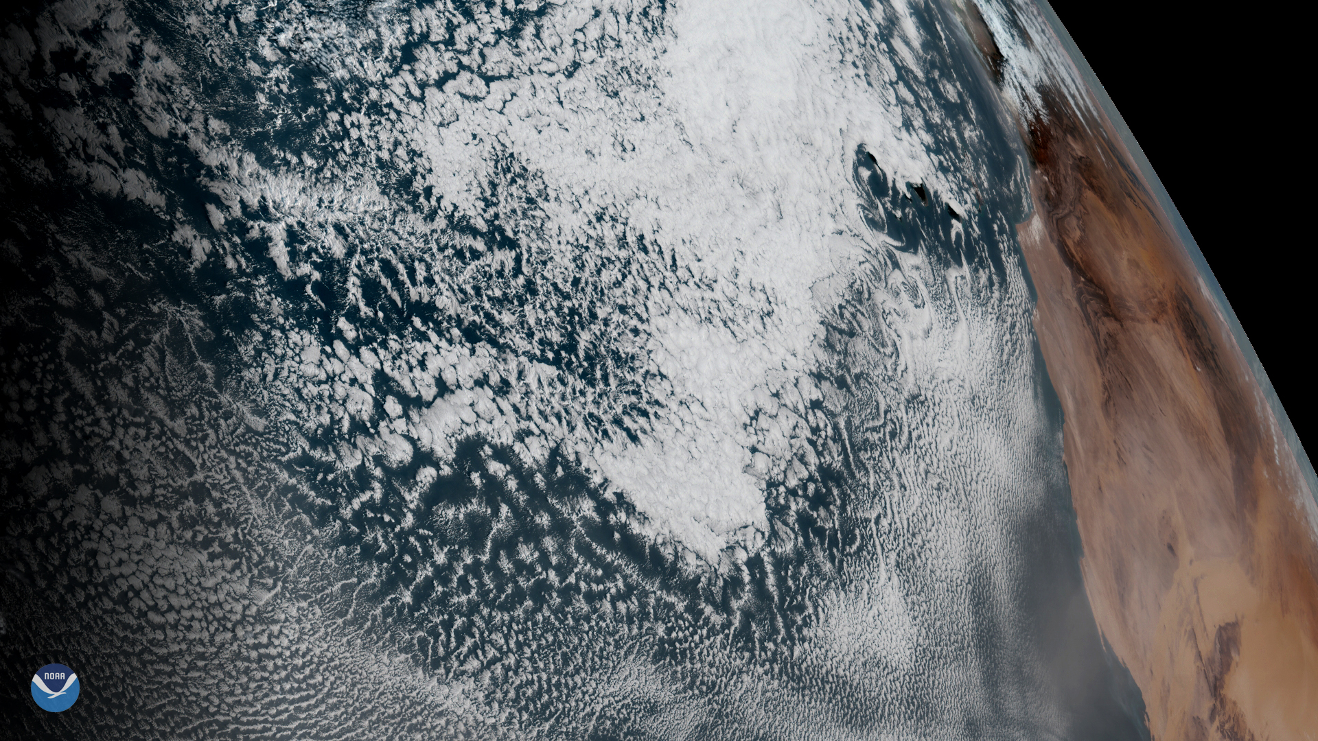
GOES East spied spiral cloud eddies called von Kármán vortices off the Canary Islands on Feb. 20, 2020.
Satellite Snapshots
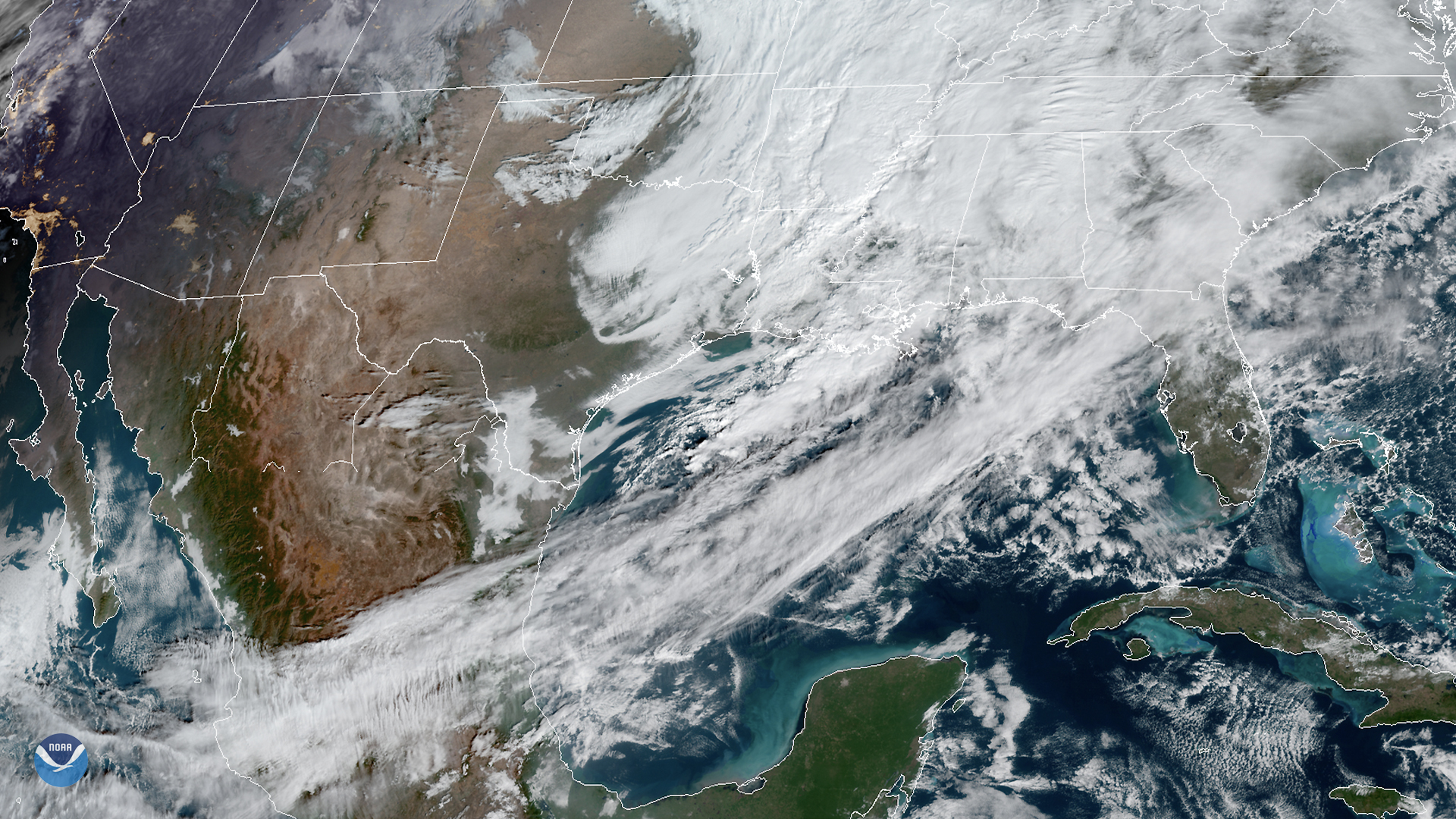
The GOES East satellite viewed strong southwesterly winds ahead of a cold front traversing the Gulf of Mexico. The…
Satellite Snapshots
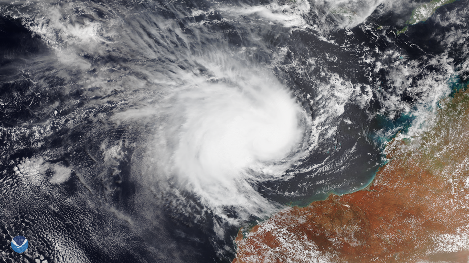
The NOAA-20 satellite captured this image of Tropical Cyclone Claudia off the northwestern coast of Australia on Jan. 13, 2020. The…
Satellite Snapshots
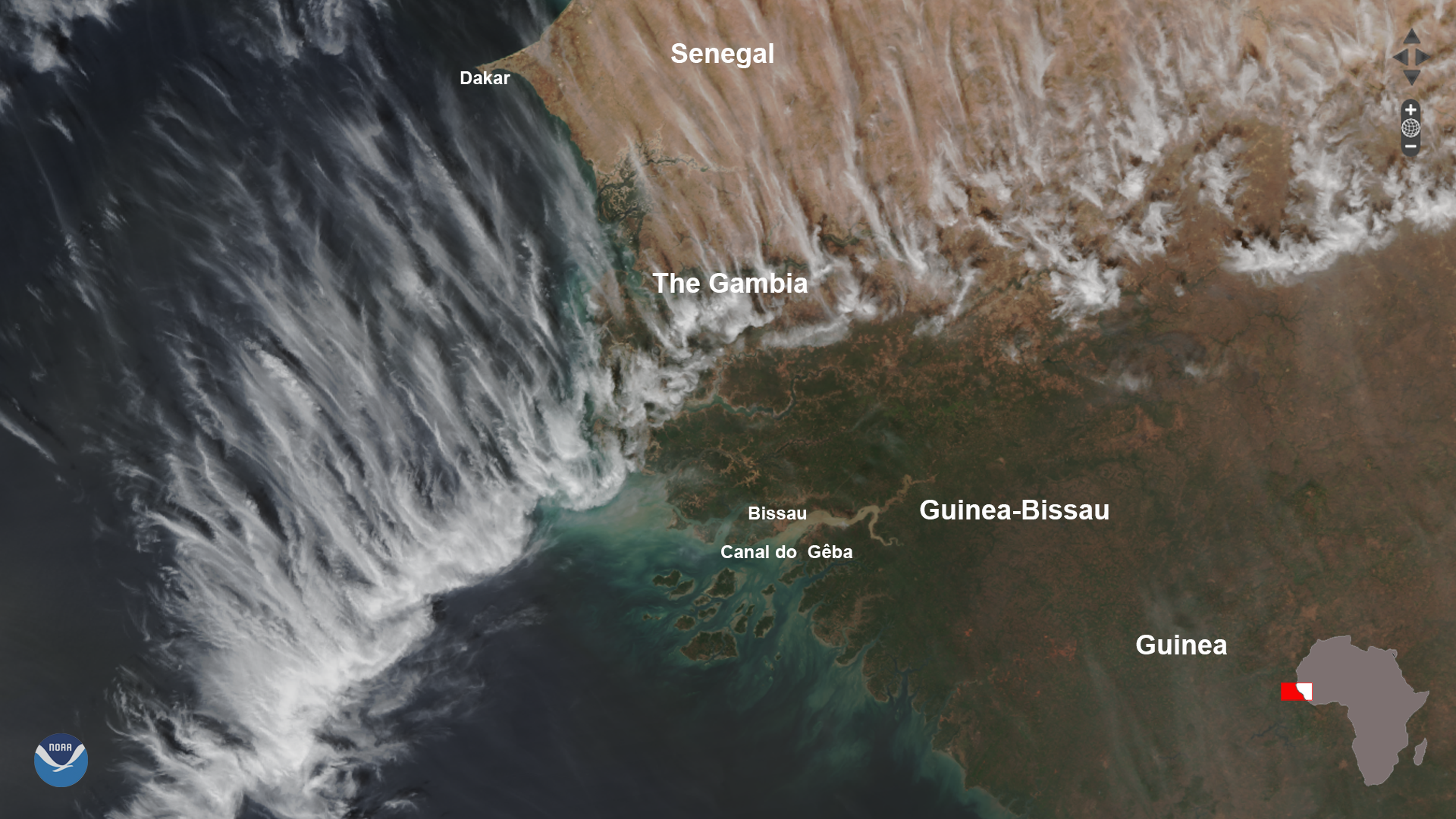
On Jan. 7, 2020, the NOAA-20 satellite snapped this dynamic shot of the West African coast. The beautiful feathery clouds are a…
Satellite Snapshots
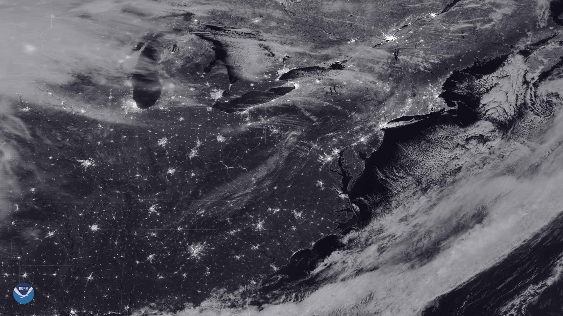
As the NOAA-20 satellite passed over the eastern United States on the night of the last full moon of the year, the sky was mostly…