
Satellite Snapshots

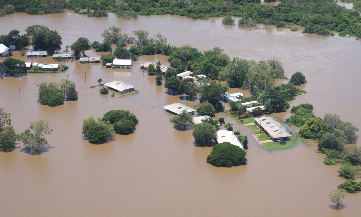
This before-and-after imagery of the Lower Mississippi River Valley shows the impact of heavy rainfall and flooding that struck the region in mid-February 2025.
Feature Story

As a winter storm brought its fury to Washington, D.C. and the Mid-Atlantic region on January 6, 2025, NOAA’s National Environmental Satellite, Data, and Information Service played a pivotal role in monitoring and supporting the nation’s response to…
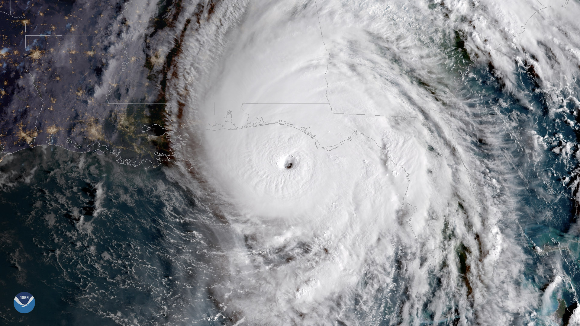
Earth from Orbit
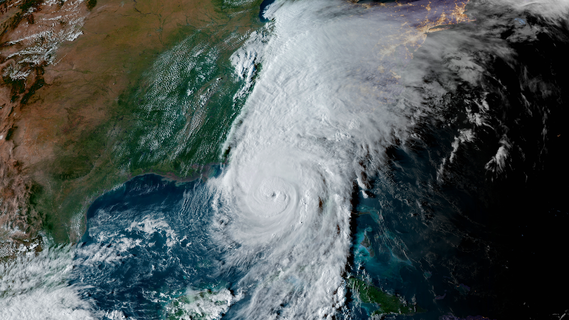
NOAA satellites constantly monitor the ocean for tropical activity. As the 2024 Atlantic hurricane season comes to a close on Nov. 30, we’re looking back at its above-average activity, with a record breaking ramp up following a peak-season lull.
Satellite Snapshots
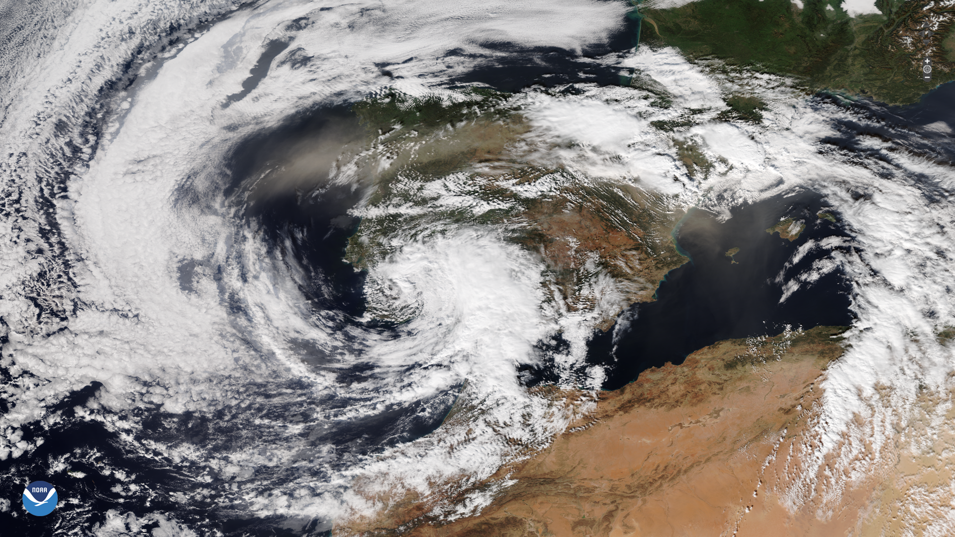
A powerful storm struck parts of Spain on Tuesday, Oct. 29, 2024, which brought severe flooding.
Satellite Snapshots
A powerful storm struck parts of Spain on Tuesday, Oct. 29, 2024, which brought severe flooding.
Feature Story
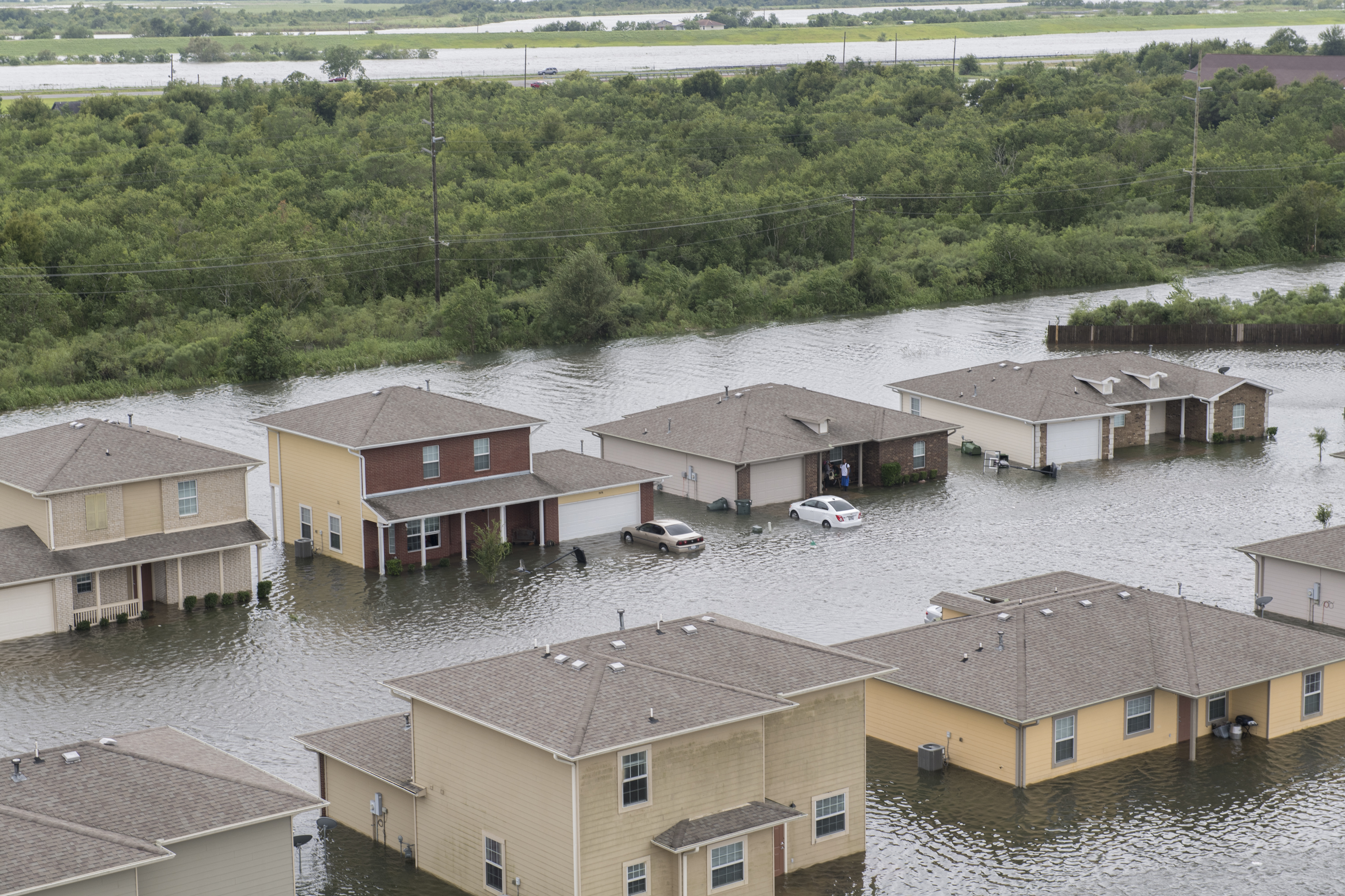
As climate change increases flood risks, accurate forecasting and resilience tools are more essential than ever.
Feature Story
As climate-driven floods intensify, VIIRS provides near real-time data to bolster global preparedness and protect vulnerable communities.
Feature Story
Late October has occasionally produced devastating hurricanes that have hit the United States and elsewhere.