
Satellite Snapshots
The NOAA-20 satellite captured this imagery of a nor’easter off the mid-Atlantic coast and a low-pressure system off of Florida’s…
Satellite Snapshots
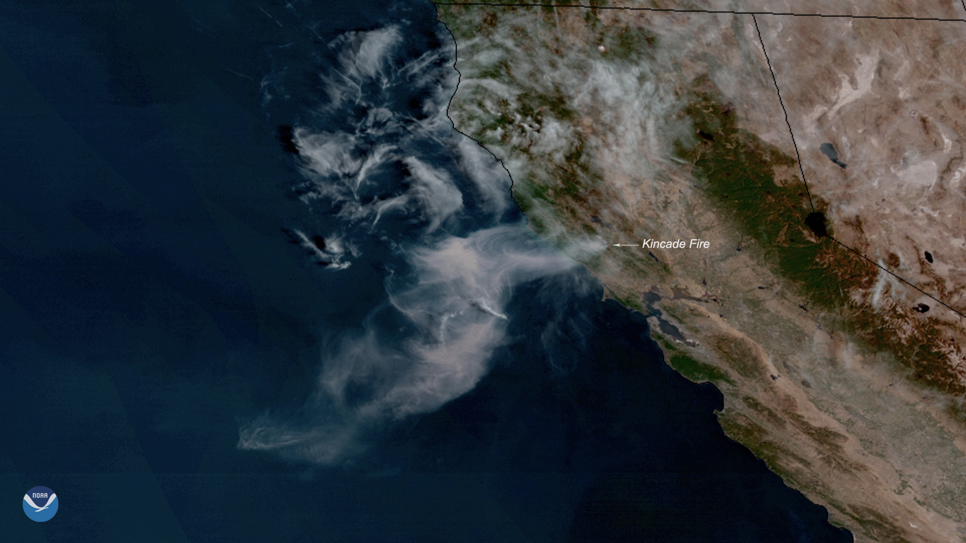
Neighborhoods across parts of Sonoma County, California, are under evacuation orders, and more are expected as the Kincade Fire…
Feature Story
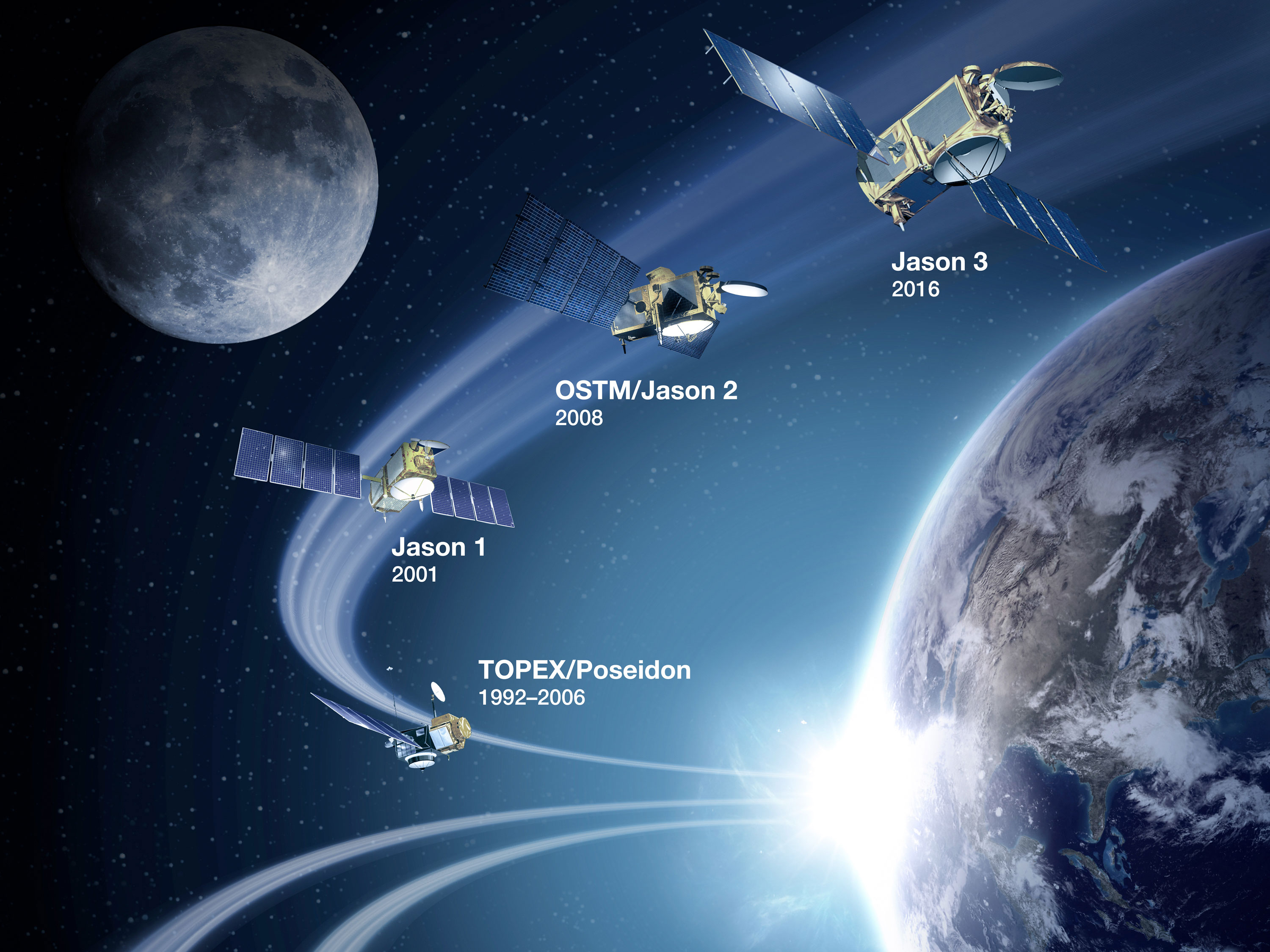
Jason-2, the oceanography satellite that has helped us map the ocean floor and measure global sea level rise, marks its tenth year in orbit.
Feature Story
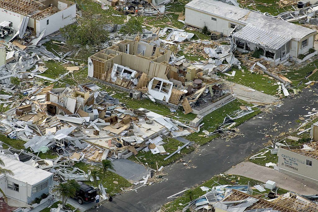
In 2004, the Atlantic had one of its most active and destructive hurricane seasons on record. These storms produced more than $61 billion in damages
Satellite Snapshots
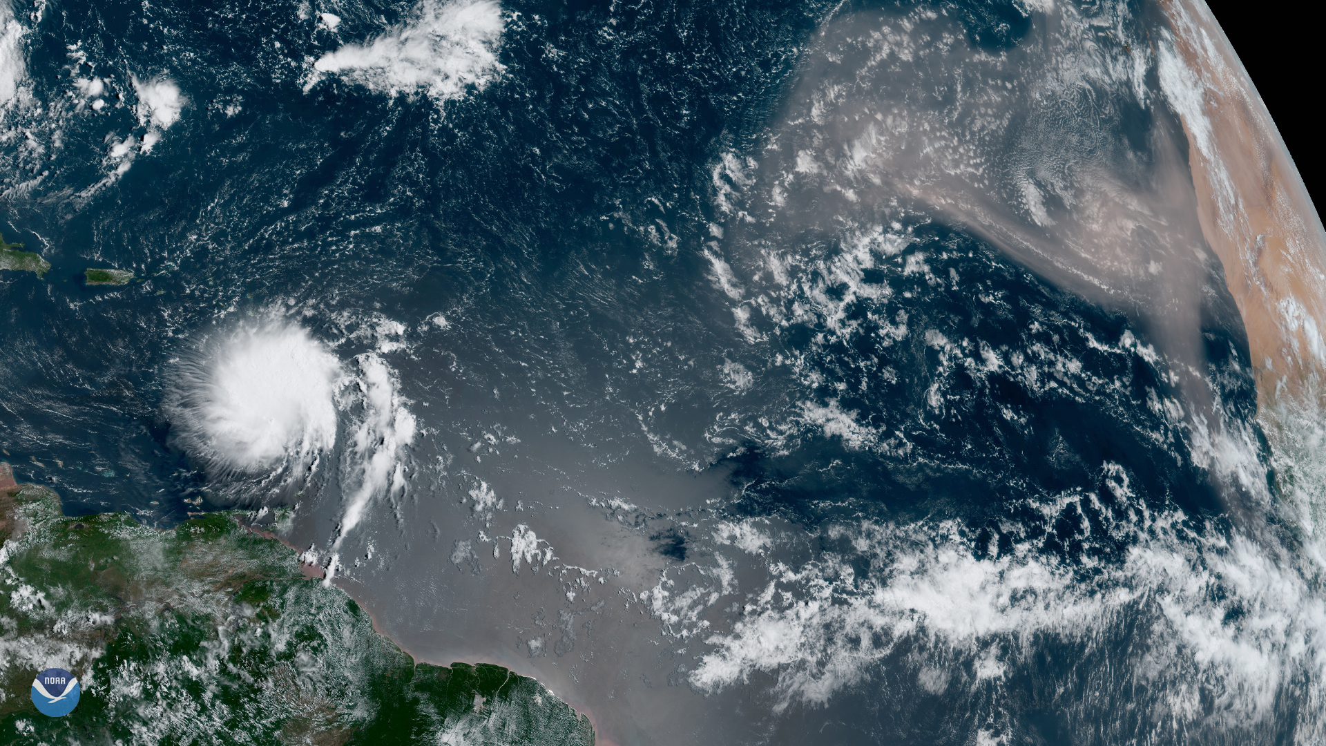
Although we’re inching closer to the peak of hurricane season — which typically occurs in early September — GOES East spotted one of…
Satellite Snapshots
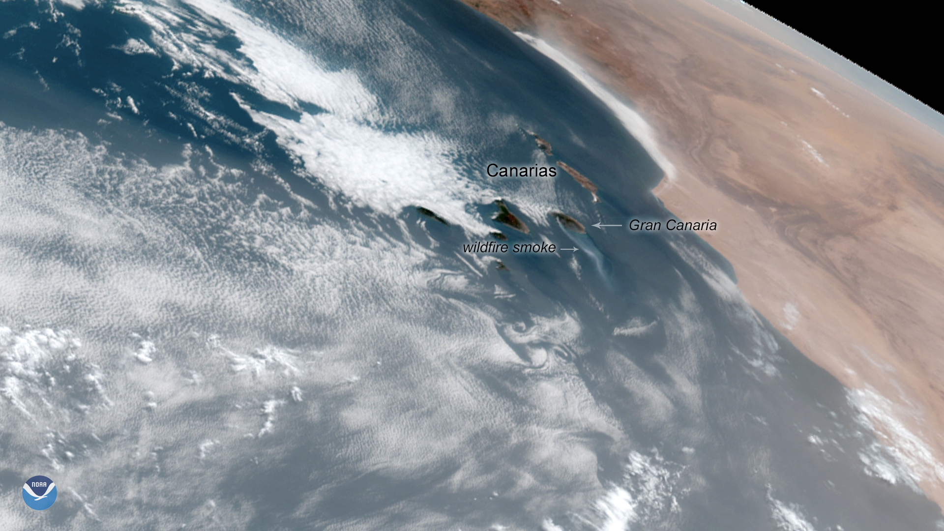
A wildfire burning on the Island of Gran Canaria in Spain’s Canary Islands is the worst in six years, authorities say. Originating…
Feature Story

On February 4, 1979, an iceberg slightly larger in area than the city of Indianapolis was first spotted in the Wilkesland Sea…
Satellite Snapshots
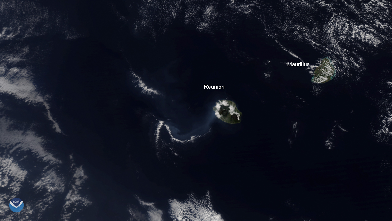
The NOAA-20 satellite spied the Piton de la Fournaise volcano on Réunion Island, off the Eastern coast of Madagascar, erupting for…