
Feature Story
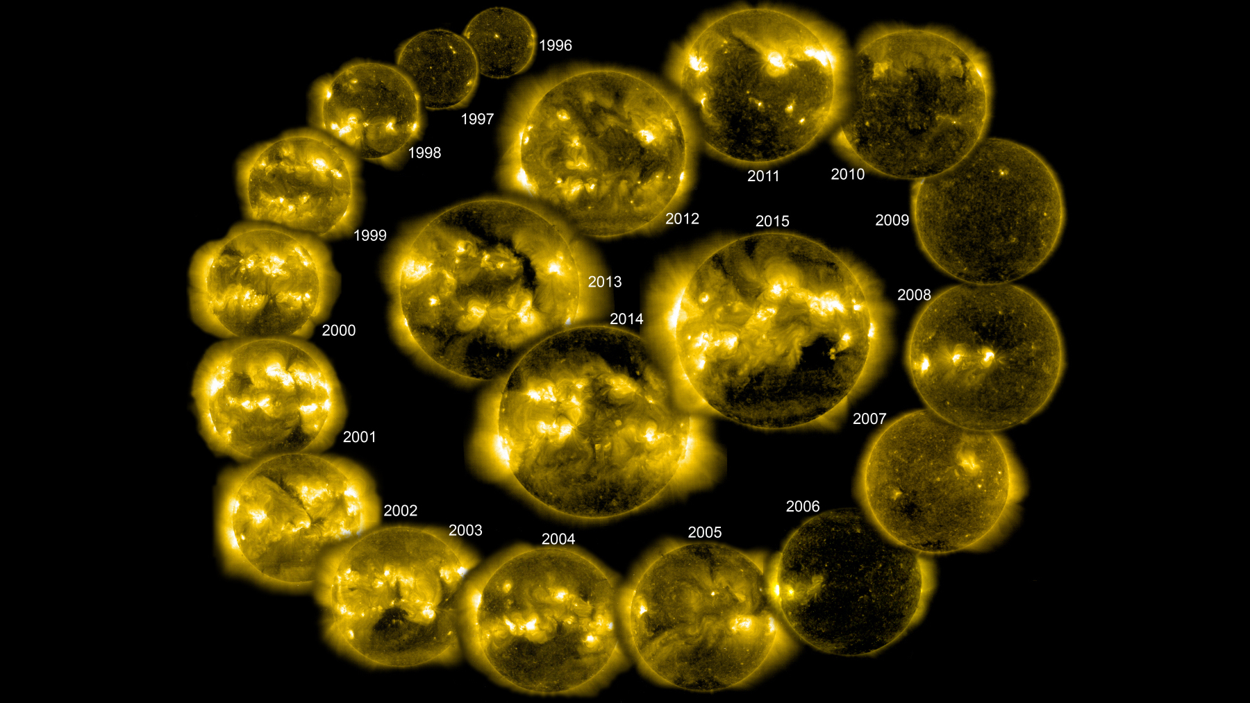
As an agency, NOAA’s science isn’t just limited to Earth and its atmosphere. NOAA’s reach goes…
Satellite Snapshots
September 14, 2020 On the morning of September 14, 2020, NOAA’s GOES-East satellite spied six active tropical systems spanning the Atlantic and…
Satellite Snapshots
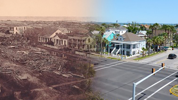
This Image of the Day shows before-and-after imagery from the Great Galveston hurricane of 1900.
Feature Story
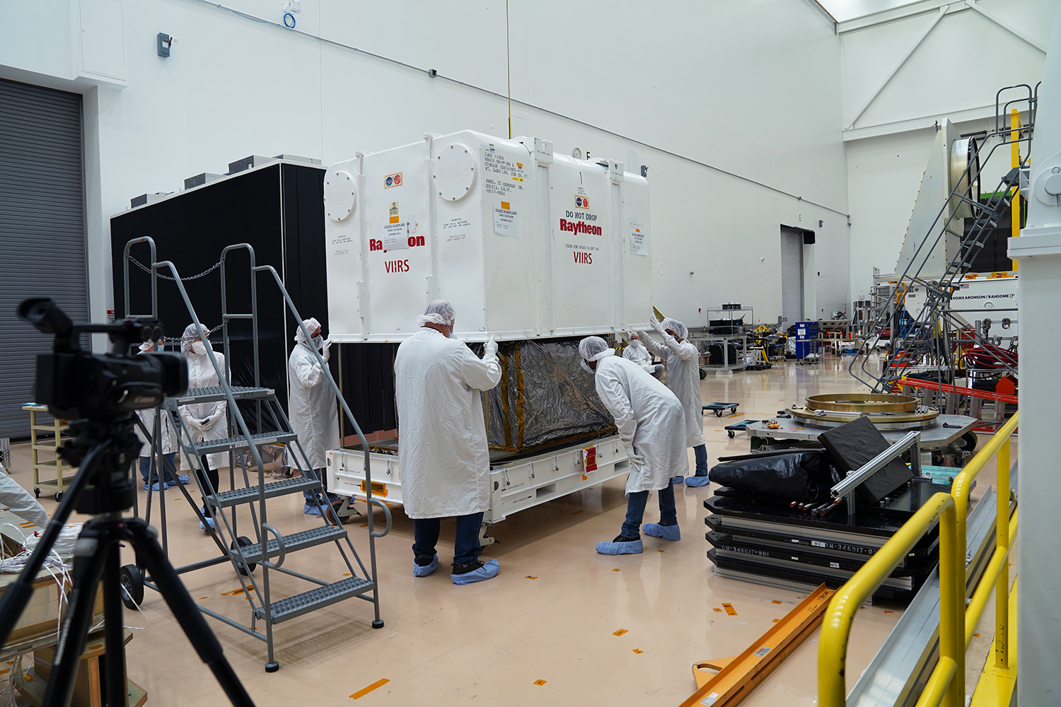
The Visible Infrared Imaging Radiometer Suite (VIIRS), the first instrument for NOAA’s next polar-orbiting weather satellite, arrived at Northrop Grum
Satellite Snapshots
August 14, 2020 During the early morning hours of August 13, 2020, NOAA’s GOES-West satellite viewed the rapid growth of the Lake Hughes Fire in…
Satellite Snapshots
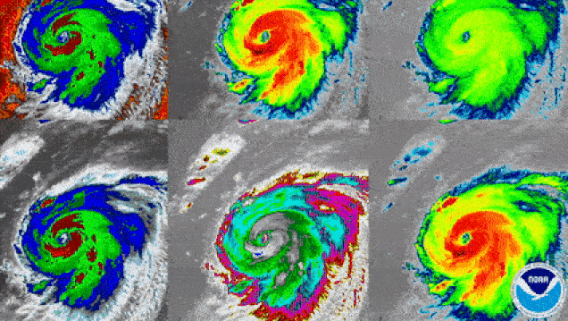
GOES-East satellite watched Hurricane Laura this week, this is how the storm looked via the different spectral bands...
Satellite Snapshots
GOES-East satellite watched Hurricane Laura this week, this is how the storm looked via the different spectral bands...
Feature Story
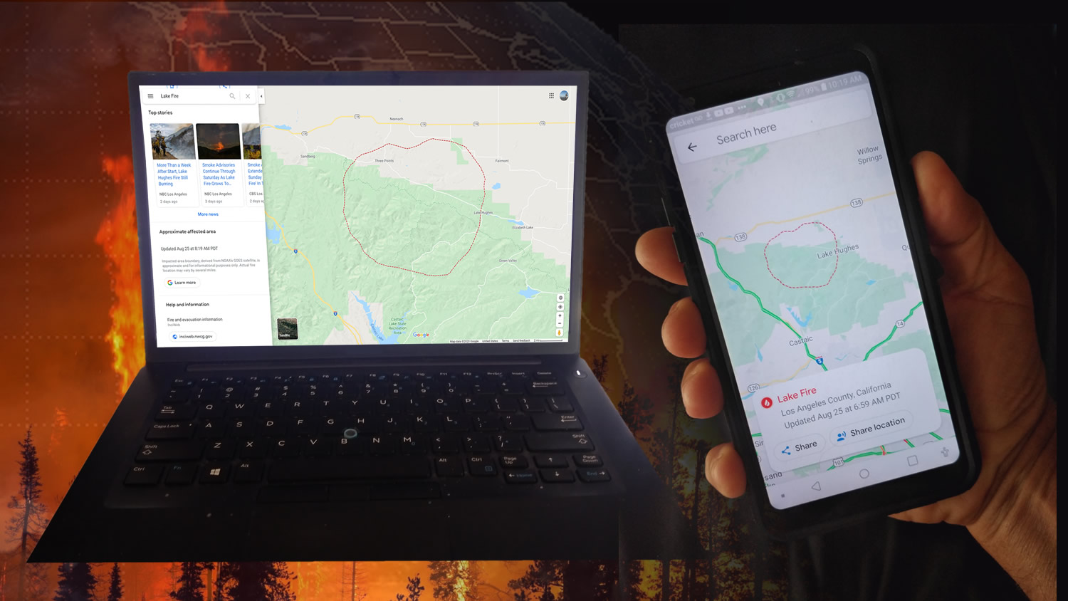
NOAA’s GOES-16 (GOES-East) and GOES-17 (GOES-West) satellites are helping the public see where active wildfires are and avoid dangerous situations.