
Satellite Snapshots
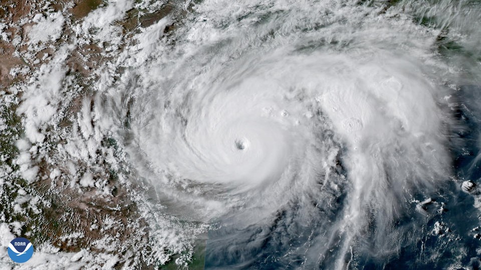
Hurricane Harvey became the first Category-4 hurricane to make landfall along the coast of Texas since Carla in 1961.
Satellite Snapshots
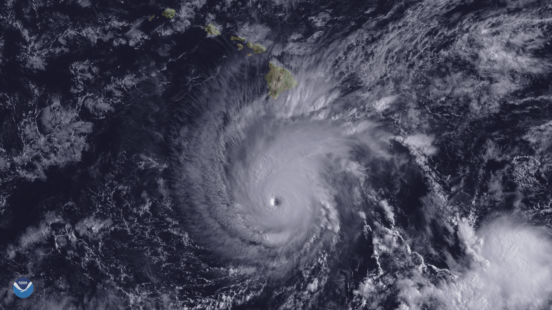
The state of Hawaii faces a significant threat from powerful Hurricane Lane, which is expected to track northward toward the islands.
Satellite Snapshots

Historic heat has baked much of Europe this summer, turning the landscape from green to brown in little over a month. These two…
Satellite Snapshots

GOES East captured imagery of Hurricane Hector and two new tropical storms, John and Ileana, in the East Pacific on Aug. 6, 2018.
Satellite Snapshots
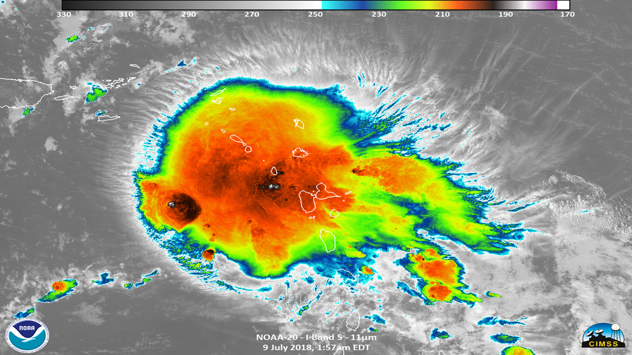
Hurricane Beryl seen by NOAA-20 July 9, 2018 in the Caribbean Sea
Satellite Snapshots
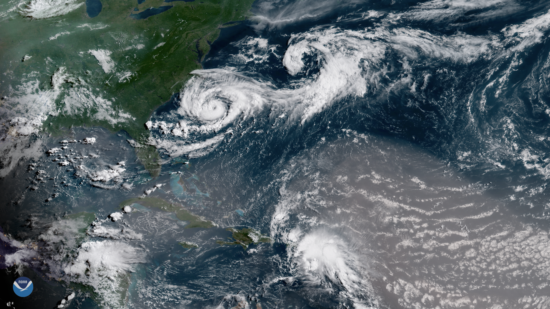
Several interesting atmospheric features appear in this GOES East satellite image of the western Atlantic Ocean, captured July 9, 2018…
Satellite Snapshots
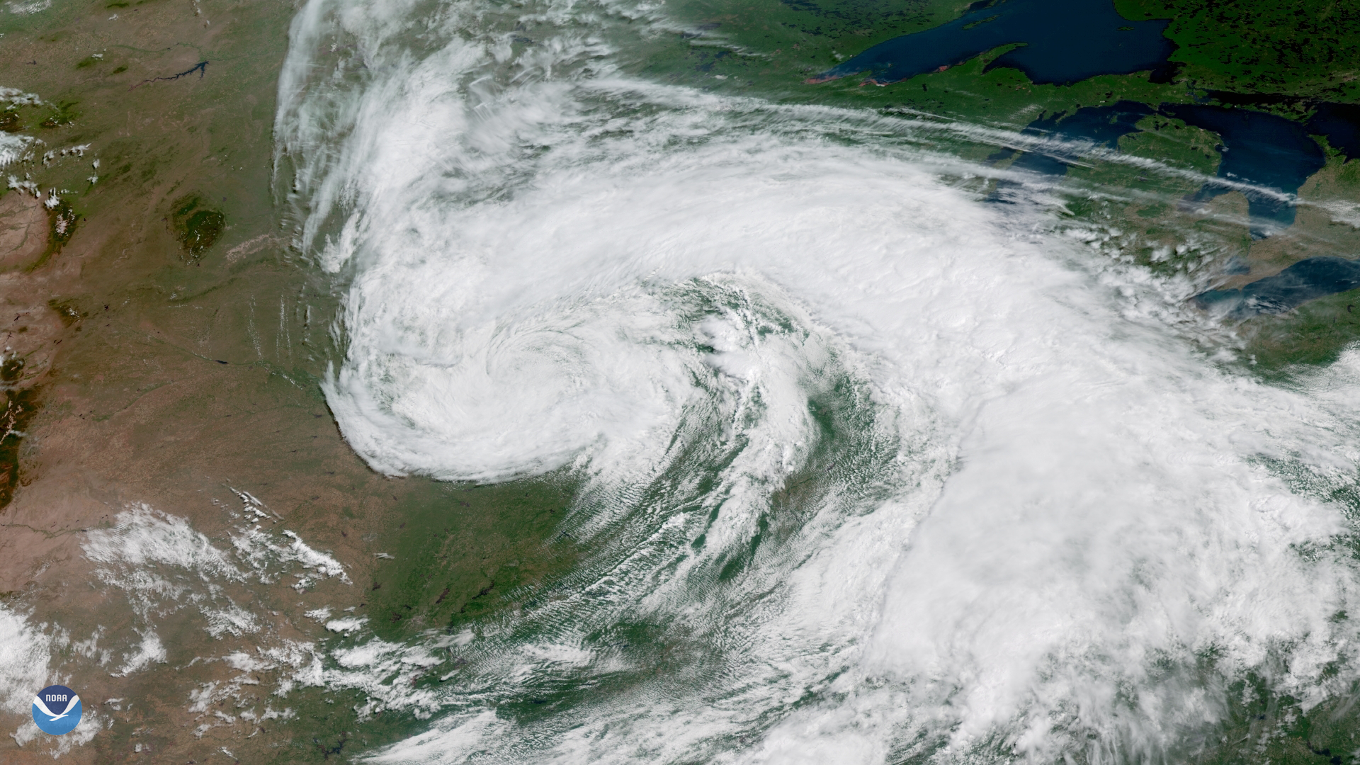
On the first day of astronomical summer , the GOES East satellite captured this image of a large storm system moving across the central…
Satellite Snapshots

Hurricane Isaac made landfall in Louisiana in the evening of August 28, 2012.