
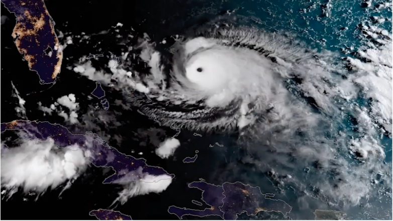
Satellite Snapshots
June 25, 2020 On June 23, 2020, the GOES-East satellite viewed the Saharan Air Layer (or SAL) over Cuba, while a storm erupted through its dusty haze…
Feature Story
The powerful hurricane that struck Galveston, Texas on September 8, 1900, killing an estimated 8,000 people and destroying more…
Feature Story

House Science, Space, and Technology Committee Ranking Member Frank Lucas released a statement praising the National Oceanic…
Satellite Snapshots
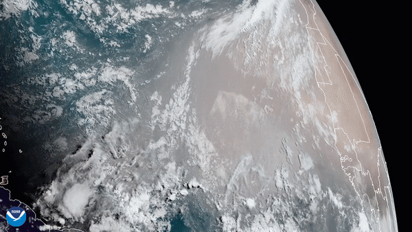
GOES-East satellite captured this GeoColor imagery of an expansive plume of dust from the Sahara Desert traveling westward.
Satellite Snapshots
GOES-East satellite captured this GeoColor imagery of an expansive plume of dust from the Sahara Desert traveling westward.
Satellite Snapshots
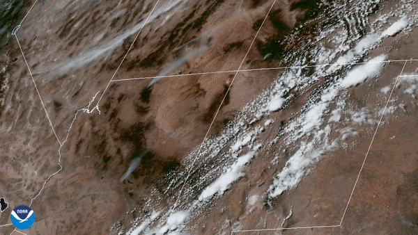
GOES-East satellite focused its Advanced Baseline Imager on wildfires in the four corners region of the western United States.
Satellite Snapshots
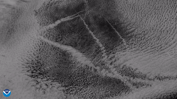
From its vantage point nearly 22,300 miles up, the GOES West satellite captured this imagery of ship tracks embedded in stratocumulus clouds.
Satellite Snapshots
June 12, 2020 On June 9, 2020, NOAA’s GOES-East satellite viewed as a large dust cloud blew over the landscape of Oklahoma (pink shading). According…