
Satellite Snapshots
VIIRS instrument aboard NOAA/NASA Suomi NPP Satellite captured this image of Super Typhoon Lan.
Satellite Snapshots
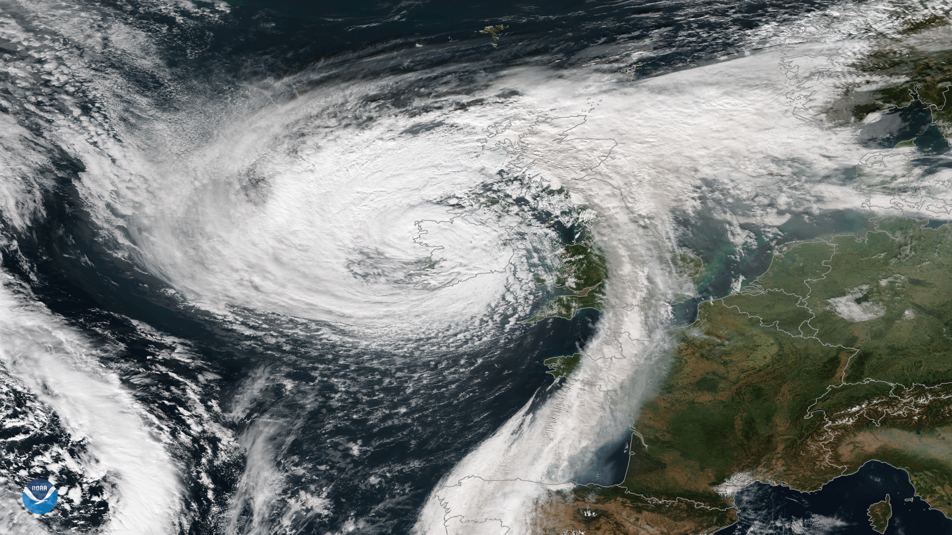
The Visible Infrared Imaging Radiometer Suite instrument aboard the NOAA/NASA Suomi NPP satellite captured this image.
Feature Story
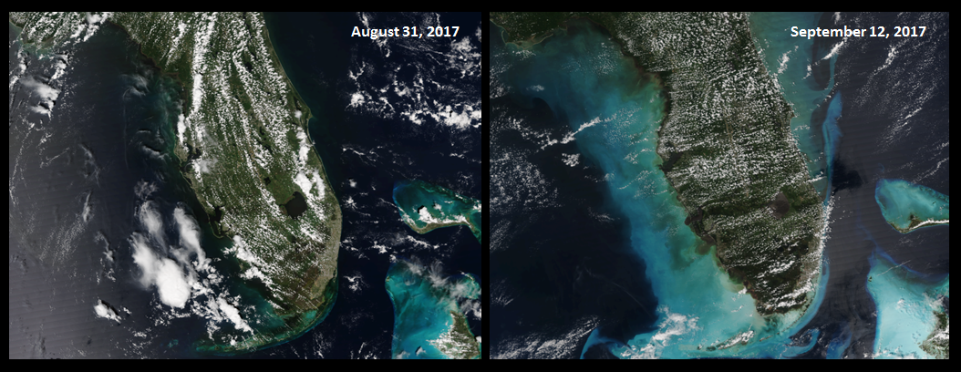
Hurricane Irma didn't just impact land. As seen in these before-and-after true-color images captured by the VIIRS…
Satellite Snapshots
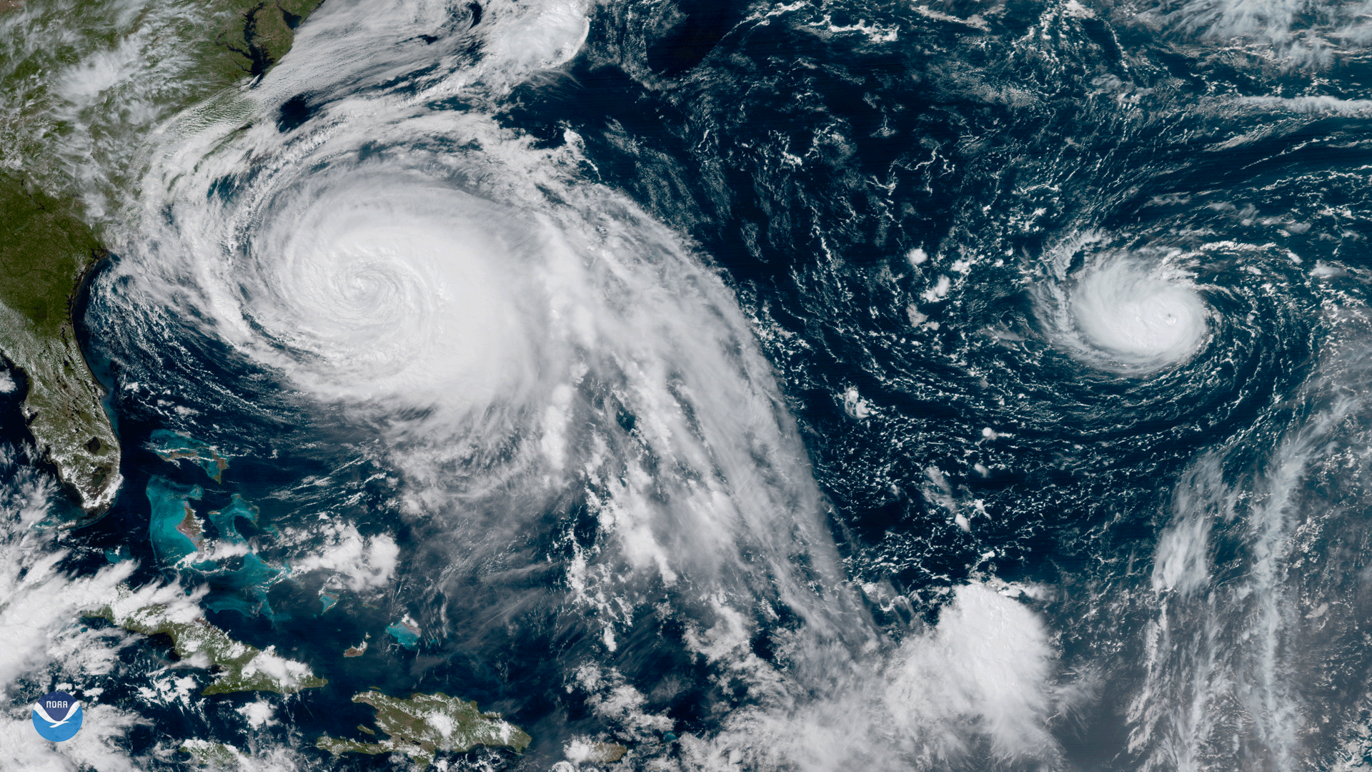
This GOES-16 geocolor image shows Hurricane Lee in the open Atlantic Ocean.
Feature Story
Although not yet operational, data from NOAA’s GOES-16 satellite proved vital in forecasting operations for Hurricane Maria as it neared Puerto Rico.
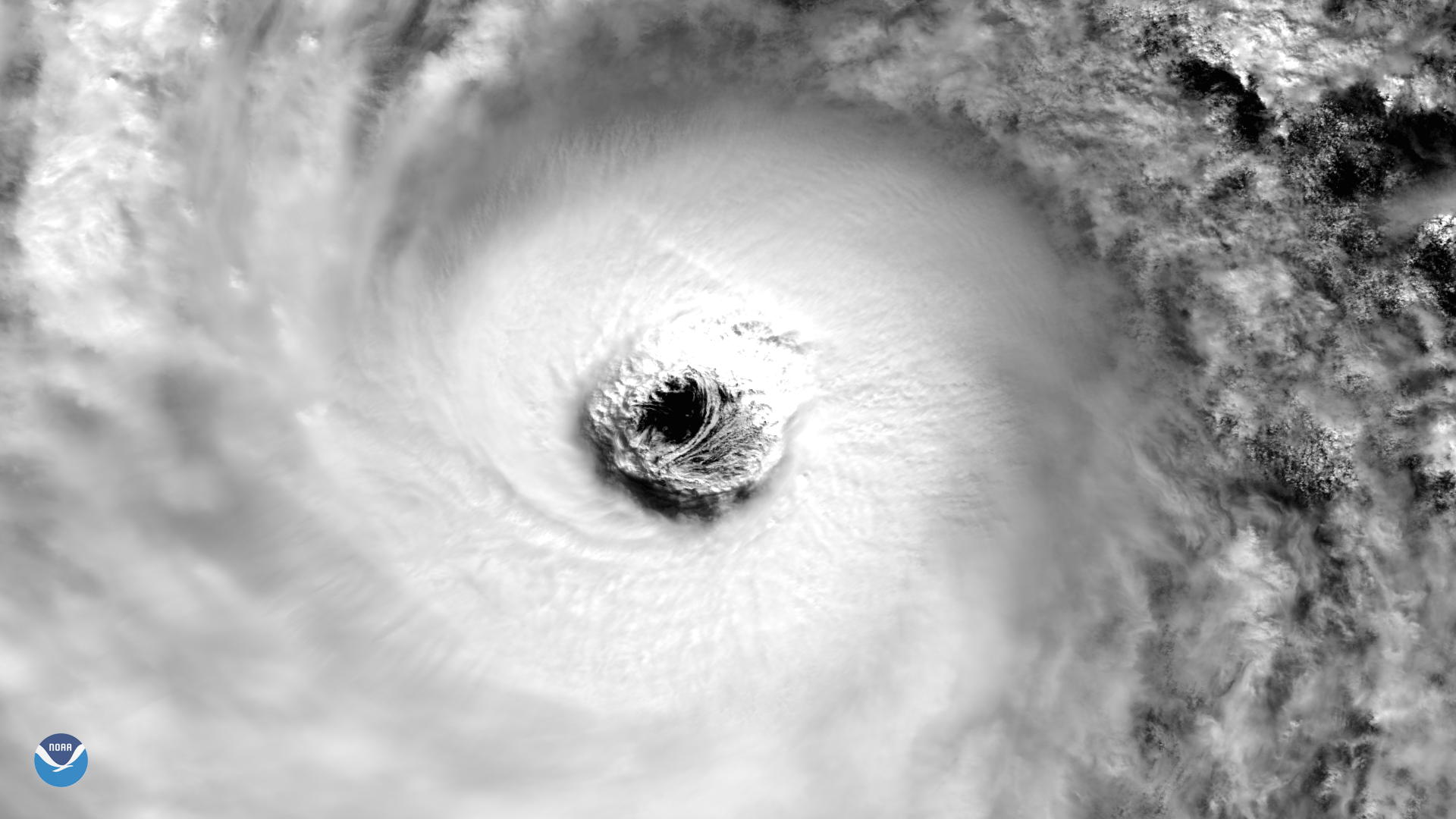
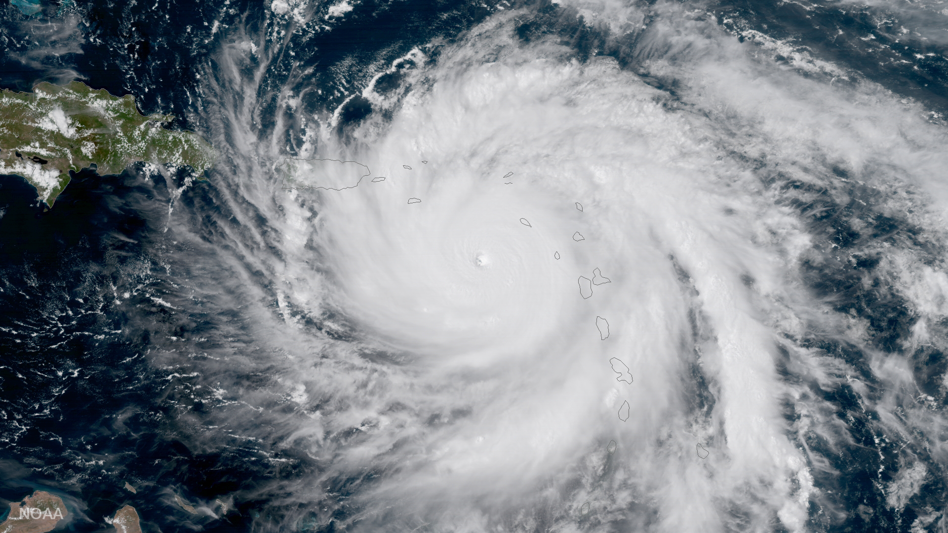
Satellite Snapshots
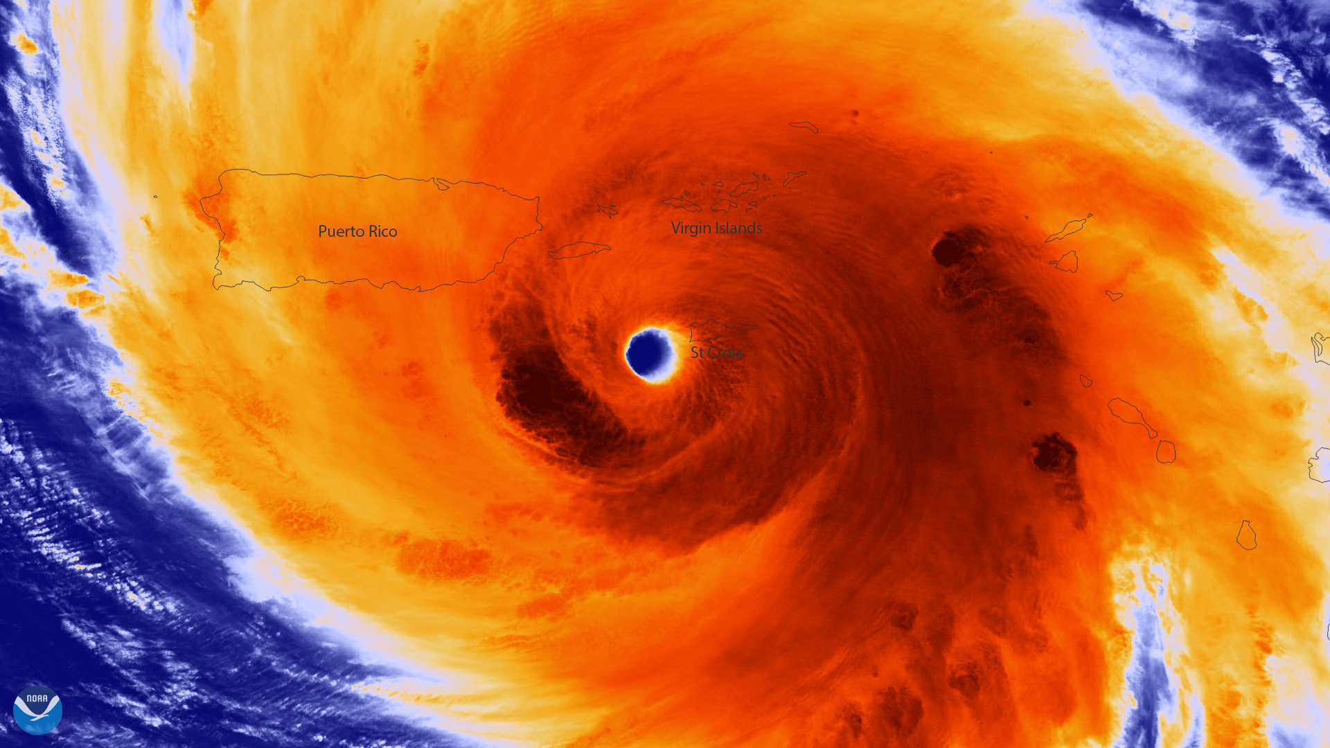
Colorized infrared image from Suomi NPP of the well-defined eye of Hurricane Maria
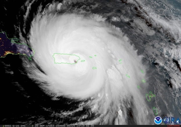
Satellite Snapshots
The center of Hurricane Maria approaches the northern coast of Puerto Rico in this geocolor image captured by NOAA's GOES-16.
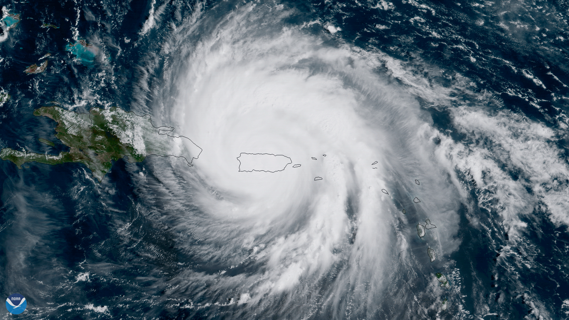
Satellite Snapshots
GOES-16 shows Hurricane Maria as it moves across the northeastern Caribbean toward the Virgin Islands.