
Satellite Snapshots
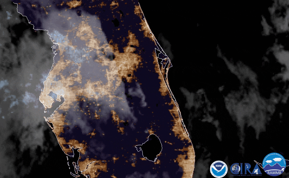
On June 9, 2020, the GOES East satellite captured imagery of fallstreak holes (AKA: hole punch clouds) over Florida.
Satellite Snapshots
June 09, 2020 From June 1–9, 2020, NOAA’s GOES-East satellite viewed the formation, development, and dissipation of two tropical cyclones, Amanda and…
Satellite Snapshots
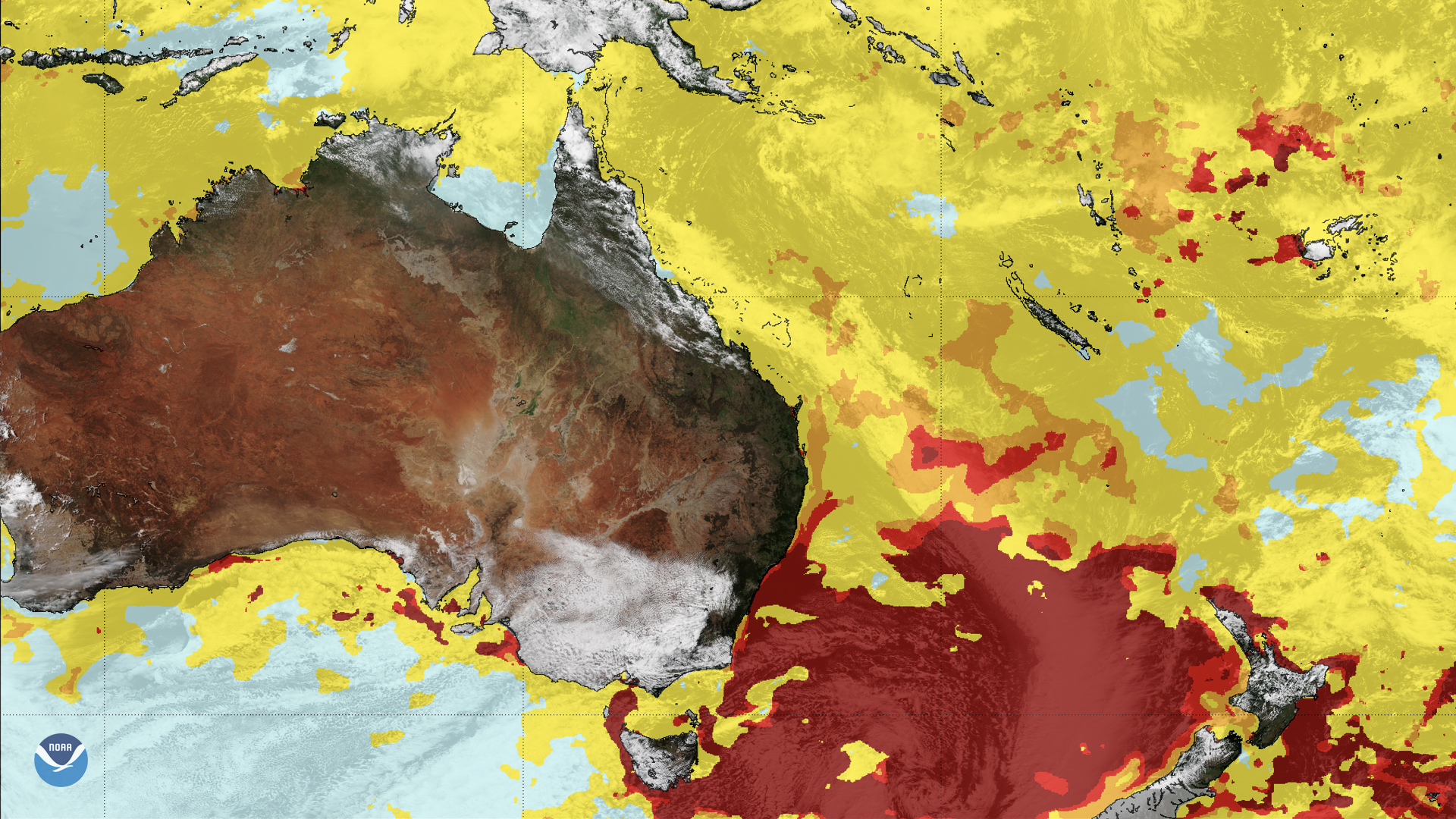
The GOES-R series and NOAA-20 satellites help play a pivotal role in monitoring the health of coral reefs around the world.
Satellite Snapshots
The GOES-R series and NOAA-20 satellites help play a pivotal role in monitoring the health of coral reefs around the world.
Satellite Snapshots
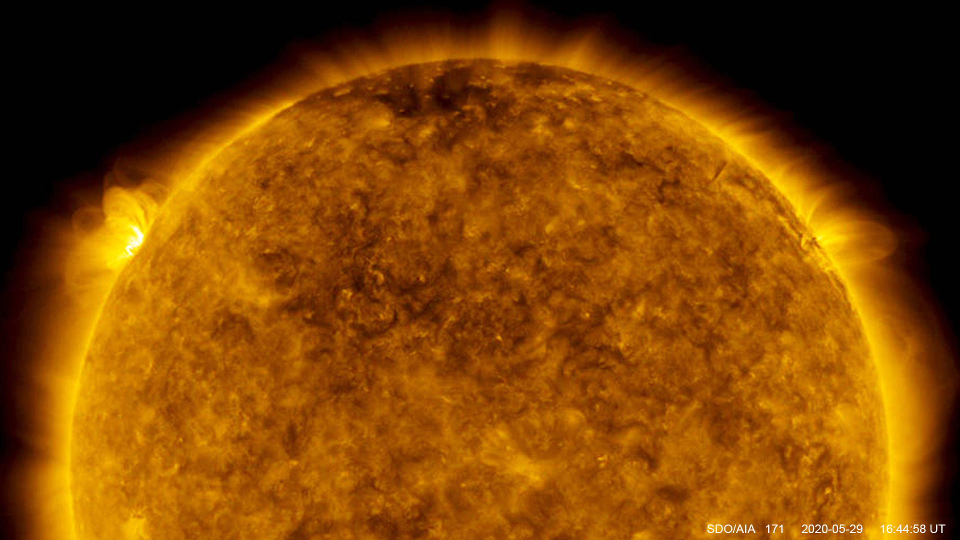
On May 29, 2020, NASA's Solar Dynamics Observatory captured the largest solar flare since October 2017.
Satellite Snapshots
Two years ago today, NOAA announced that its JPSS satellite, NOAA-20, was fully operational.
Satellite Snapshots
May 27, 2020 On May 27, 2020, NOAA’s GOES-West satellite used its water vapor imagery to spy this donut-shaped low-pressure system spinning off of…
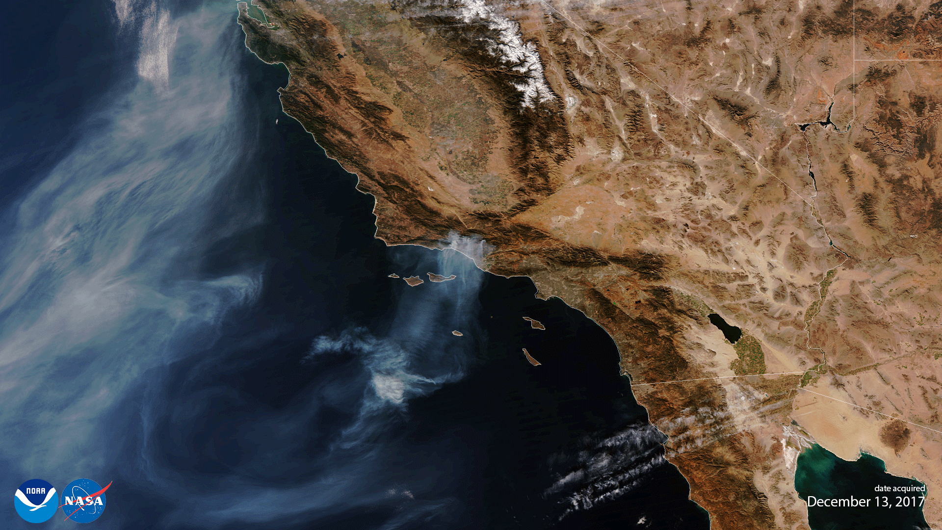
Satellite Snapshots
May 08, 2020 From their first spark to their dying embers, many wildfires can be seen and monitored from space by NOAA’s satellites... and sometimes…