
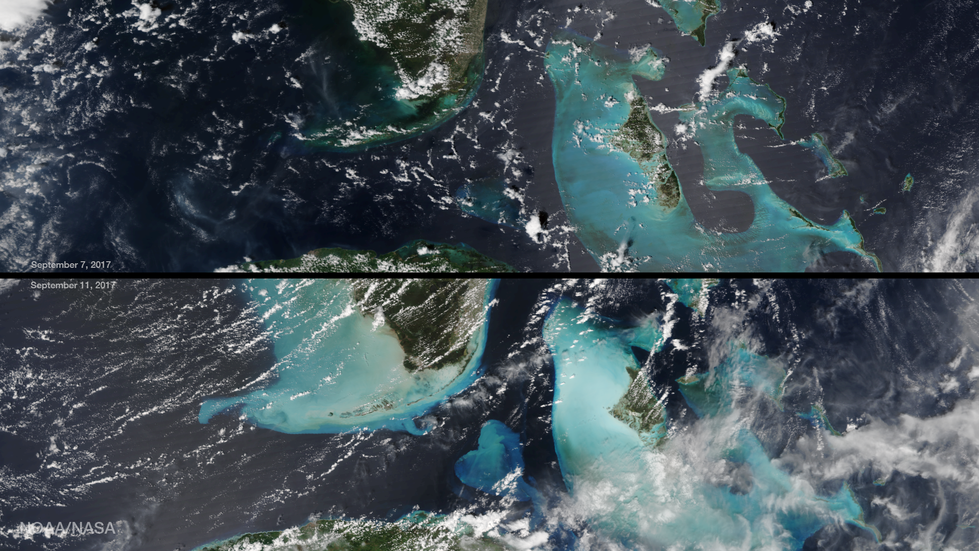
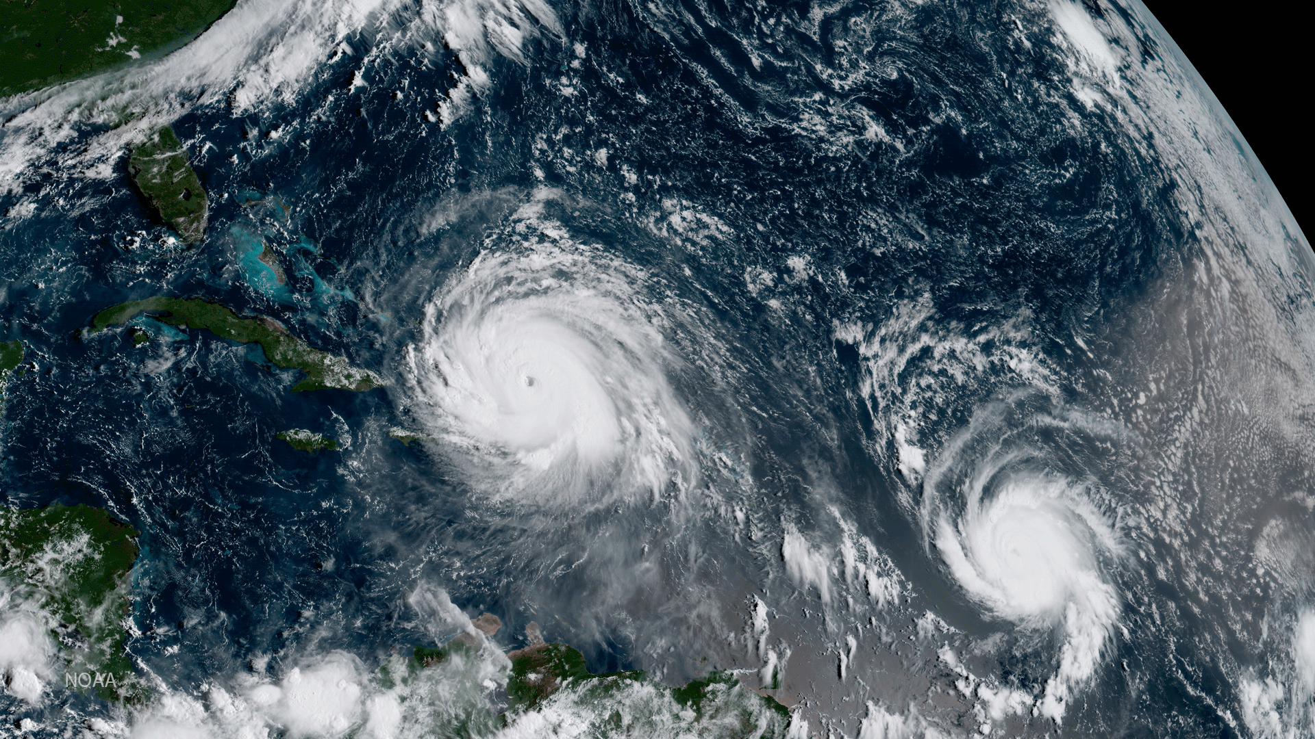
Satellite Snapshots
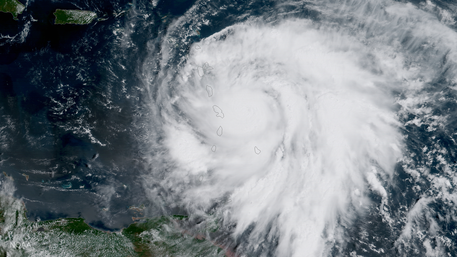
GOES-16 satellite captured this image of Hurricane Maria approaching the Leeward Islands.
Satellite Snapshots
This data visualization shows the maximum wind gusts from Hurricane Irma from September 7 to September 10, 2017. Note how the…
Feature Story
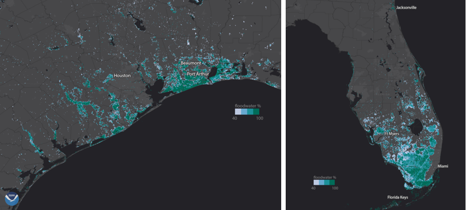
NOAA’s GOES-16 and NOAA-NASA Suomi NPP provide FEMA with the first comprehensive view of flood zones, and aircraft see the human impact
Satellite Snapshots
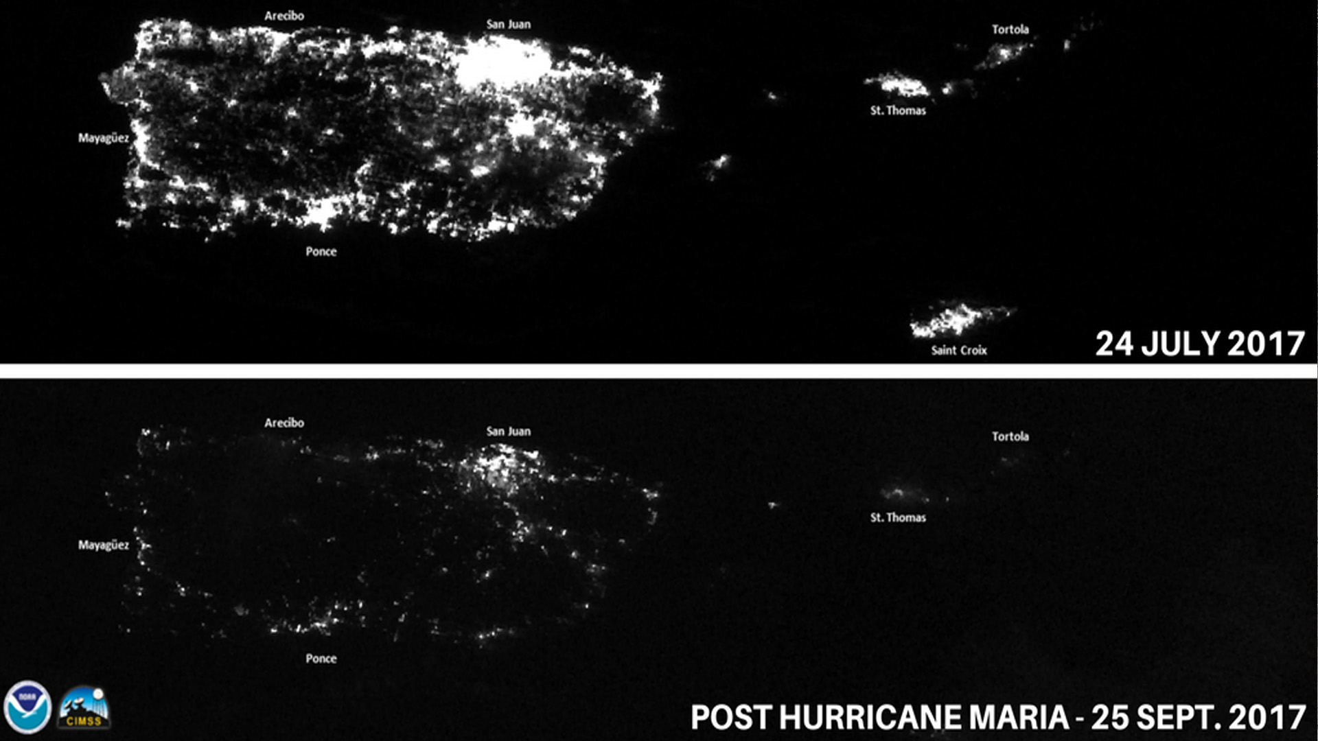
NOAA Satellites captured images of Puerto Rico after Hurricane Maria knocked out the power grid and left millions without…
Satellite Snapshots
Data visualization shows the maximum wind gusts from Hurricane Irma from September 7 to September 10, 2017.
Satellite Snapshots
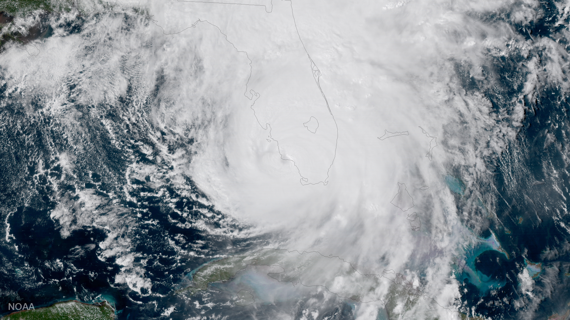
GOES-16 captured this geocolor image of Hurricane Irma making a second landfall near Marco Island, Florida.
Satellite Snapshots
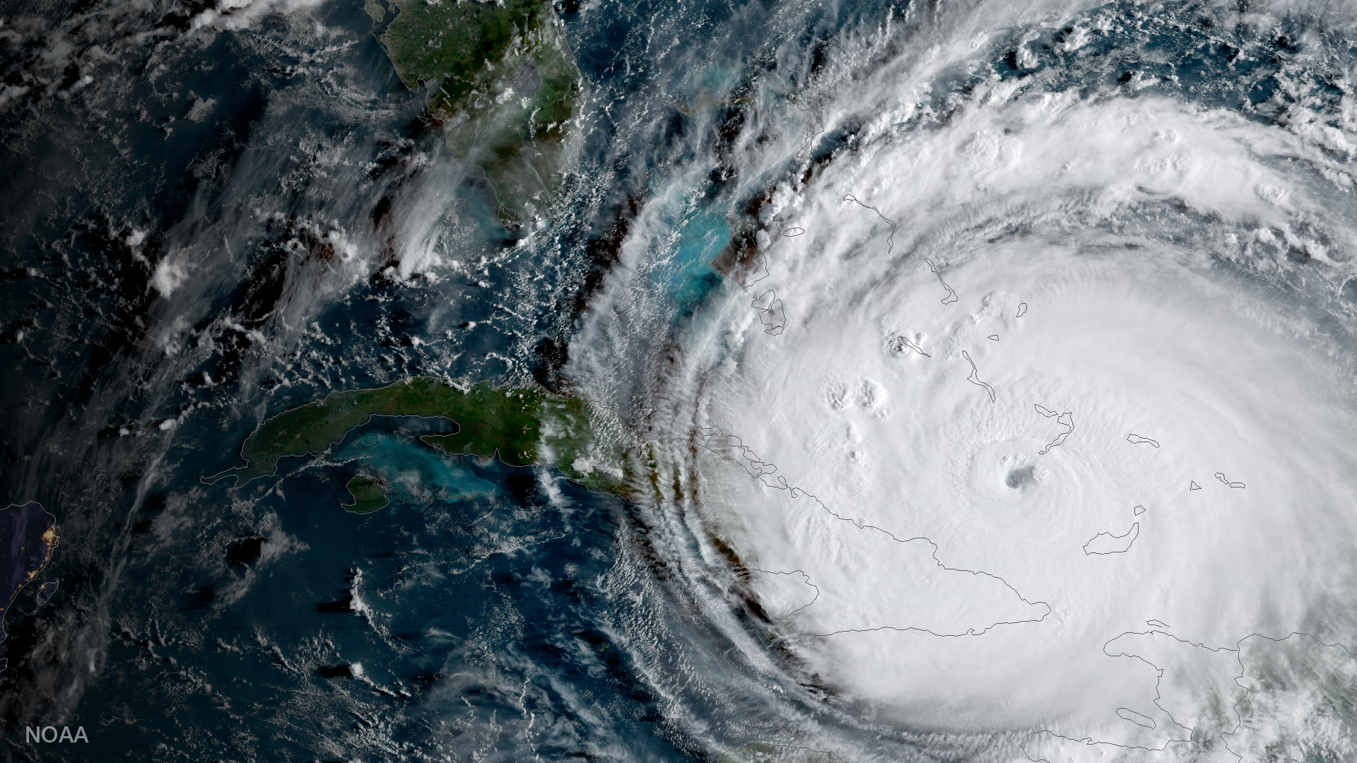
GOES-16 captured this geocolor image of Hurricane Irma passing the eastern end of Cuba.
Satellite Snapshots
This data visualization shows the maximum wind gusts from Hurricane Irma from September 7 to September 10, 2017.